Directions to Roxy's Bakery & Cafe (Everett) with public transportation
The following transit lines have routes that pass near Roxy's Bakery & Cafe
 Bus: 104, 109, 97, 110.
- Train: NEWBURYPORT/ROCKPORT, HAVERHILL.
- Subway: ORANGE LINE.
How to get to Roxy's Bakery & Cafe by bus?
Click on the bus route to see step by step directions with maps, line arrival times and updated time schedules.
From Sonia, Boston
66 minFrom Hilton Garden Inn, Brookline
84 minFrom Royal Sonesta Hotel, Cambridge
43 minFrom 240 Mount Vernon Street, Boston
103 minFrom Element Boston Seaport, Boston
52 minFrom Beth Israel Deaconess Medical Center, Brookline
84 minFrom Holiday Inn Express-Saugus, Saugus
59 minFrom New England Baptist Hospital, Boston
82 minFrom Intercontinental-Boston (Intercontinental Hotel), Boston
39 minFrom Massport Security Badge Office, Boston
29 min
How to get to Roxy's Bakery & Cafe by train?
Click on the train route to see step by step directions with maps, line arrival times and updated time schedules.
How to get to Roxy's Bakery & Cafe by subway?
Click on the subway route to see step by step directions with maps, line arrival times and updated time schedules.
From Sonia, Boston
104 minFrom Hilton Garden Inn, Brookline
84 minFrom Royal Sonesta Hotel, Cambridge
57 minFrom 240 Mount Vernon Street, Boston
70 minFrom Element Boston Seaport, Boston
77 minFrom Beth Israel Deaconess Medical Center, Brookline
82 minFrom New England Baptist Hospital, Boston
78 minFrom Intercontinental-Boston (Intercontinental Hotel), Boston
57 minFrom Massport Security Badge Office, Boston
66 min
Bus stops near Roxy's Bakery & Cafe in Everett
Train stations near Roxy's Bakery & Cafe in Everett
Subway station near Roxy's Bakery & Cafe in Everett
- Assembly, 31 min walk,VIEW
Bus lines to Roxy's Bakery & Cafe in Everett
What are the closest stations to Roxy's Bakery & Cafe?
The closest stations to Roxy's Bakery & Cafe are:
- Broadway @ Maple Ave is 229 yards away, 3 min walk.
- Ferry St @ Clarence St is 469 yards away, 6 min walk.
- Chelsea is 1421 yards away, 20 min walk.
- Assembly is 2635 yards away, 31 min walk.
- Oak Grove is 4342 yards away, 51 min walk.
Which bus lines stop near Roxy's Bakery & Cafe?
These bus lines stop near Roxy's Bakery & Cafe: 104, 109.
Which train line stops near Roxy's Bakery & Cafe?
NEWBURYPORT/ROCKPORT (#125 | Newburyport)
Which subway line stops near Roxy's Bakery & Cafe?
ORANGE LINE (Oak Grove)
What’s the nearest train station to Roxy's Bakery & Cafe in Everett?
The nearest train station to Roxy's Bakery & Cafe in Everett is Chelsea. It’s a 20 min walk away.
What’s the nearest bus station to Roxy's Bakery & Cafe in Everett?
The nearest bus station to Roxy's Bakery & Cafe in Everett is Broadway @ Maple Ave. It’s a 3 min walk away.
What time is the first subway to Roxy's Bakery & Cafe in Everett?
The ORANGE LINE is the first subway that goes to Roxy's Bakery & Cafe in Everett. It stops nearby at 5:15 AM.
What time is the last subway to Roxy's Bakery & Cafe in Everett?
The ORANGE LINE is the last subway that goes to Roxy's Bakery & Cafe in Everett. It stops nearby at 1:59 AM.
What time is the first train to Roxy's Bakery & Cafe in Everett?
The HAVERHILL is the first train that goes to Roxy's Bakery & Cafe in Everett. It stops nearby at 5:35 AM.
What time is the last train to Roxy's Bakery & Cafe in Everett?
The NEWBURYPORT/ROCKPORT is the last train that goes to Roxy's Bakery & Cafe in Everett. It stops nearby at 12:06 AM.
What time is the first bus to Roxy's Bakery & Cafe in Everett?
The 104 is the first bus that goes to Roxy's Bakery & Cafe in Everett. It stops nearby at 4:32 AM.
What time is the last bus to Roxy's Bakery & Cafe in Everett?
The 110 is the last bus that goes to Roxy's Bakery & Cafe in Everett. It stops nearby at 2:11 AM.
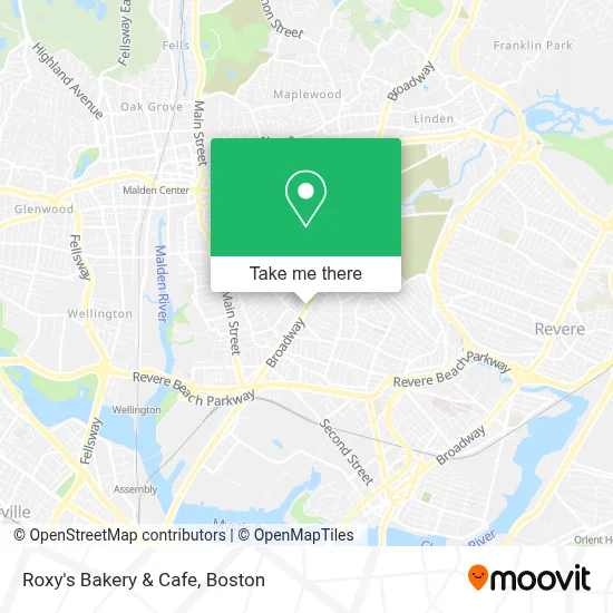
See Roxy's Bakery & Cafe, Everett, on the map
Public Transit to Roxy's Bakery & Cafe in Everett
Wondering how to get to Roxy's Bakery & Cafe in Everett? Moovit helps you find the best way to get to Roxy's Bakery & Cafe with step-by-step directions from the nearest public transit station.
Moovit provides free maps and live directions to help you navigate through your city. View schedules, routes, timetables, and find out how long does it take to get to Roxy's Bakery & Cafe in real time.
Looking for the nearest stop or station to Roxy's Bakery & Cafe? Check out this list of stops closest to your destination: Broadway @ Maple Ave; Ferry St @ Clarence St; Chelsea; Assembly; Oak Grove.
Bus: 104, 109, 97, 110.Train: NEWBURYPORT/ROCKPORT, HAVERHILL.Subway: ORANGE LINE.
Want to see if there’s another route that gets you there at an earlier time? Moovit helps you find alternative routes or times. Get directions from and directions to Roxy's Bakery & Cafe easily from the Moovit App or Website.
We make riding to Roxy's Bakery & Cafe easy, which is why over 1.7 million users, including users in Everett, trust Moovit as the best app for public transit. You don’t need to download an individual bus app or train app, Moovit is your all-in-one transit app that helps you find the best bus time or train time available.
For information on prices of bus, subway and train, costs and ride fares to Roxy's Bakery & Cafe, please check the Moovit app.
Use the app to navigate to popular places including to the airport, hospital, stadium, grocery store, mall, coffee shop, school, college, and university.
Roxy's Bakery & Cafe Address: 614 Broadway street in Everett
- Alex Krisak,
- Credit Union 1,
- Phoenix Barbershop,
- David McKinnon Park,
- Century 21,
- Mauro Silva of MG Group Everett Ma Real Estate Agent,
- Sandra Enterprise Serv,
- Keller Williams Realty,
- Progressive Insurance,
- Brazilian House Cleaning,
- K-Chivo Market,
- Bloom Cleaners,
- Sky Hookah Lounge,
- PSPS Legal Support Services,
- Executive Protection Training Institute,
- El Valle De La Sultana Market,
- Glendale Park (Glendale Laundromat),
- The Park Thats Not A Park,
- Ferry St (broadway ferry),
- Iglesia Adventista de Everett
Places Near Roxy's Bakery & Cafe (Everett)
- Castle Island, Boston,
- Wang Theater, Boston,
- Museum Of Science, Boston,
- Massachusetts General Hospital, Boston,
- Leader Bank Pavilion (Leader Bank Pavillion), Boston,
- Boston Children's Hospital, Boston,
- Cheers, Boston,
- Boston Convention & Exhibition Center, Boston,
- Td Garden, Boston,
- Boston Medical Center, Boston,
- North End, Boston,
- Faneuil Hall, Boston,
- House Of Blues, Boston,
- Boston Common, Boston,
- Mgm Music Hall, Boston,
- Wilbur Theatre, Boston,
- Quincy Market, Boston,
- Seaport District, Boston,
- Isabella Stewart Gardner Museum, Boston,
- Prudential Center, Boston
How to get to popular places in Boston with public transit
Get around Everett by public transit!
Traveling around Everett has never been so easy. See step by step directions as you travel to any attraction, street or major public transit station. View bus and train schedules, arrival times, service alerts and detailed routes on a map, so you know exactly how to get to anywhere in Everett.
When traveling to any destination around Everett use Moovit's Live Directions with Get Off Notifications to know exactly where and how far to walk, how long to wait for your line, and how many stops are left. Moovit will alert you when it's time to get off — no need to constantly re-check whether yours is the next stop.
Wondering how to use public transit in Everett or how to pay for public transit in Everett? Moovit public transit app can help you navigate your way with public transit easily, and at minimum cost. It includes public transit fees, ticket prices, and costs. Looking for a map of Everett public transit lines? Moovit public transit app shows all public transit maps in Everett with all Bus, Train, Subway and Ferry routes and stops on an interactive map.
Boston has 4 transit type(s), including: Bus, Train, Subway and Ferry, operated by several transit agencies, including MBTA, Southeastern Regional Transit Authority, MetroWest Regional Transit Authority, Rhode Island Public Transit Authority, WRTA, Lowell Regional Transit Authority, Merrimack Valley Transit, Montachusett Regional Transit Authority, Cape Cod Regional Transit Authority, Brockton Area Transit Authority, Martha's Vineyard Transit Authority, the WAVE - Nantucket Regional Transit Authority, GATRA, Cape Ann Transportation Authority and Massport