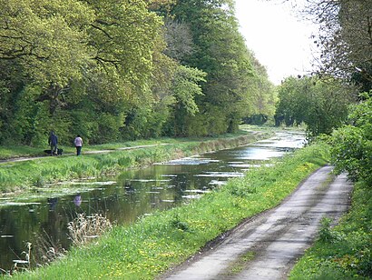
See Royal Canal, Dublin, on the map
Directions to Royal Canal (Dublin) with public transportation
The following transit lines have routes that pass near Royal Canal
 Bus:
Bus: - Train:
- Light Rail:
How to get to Royal Canal by bus?
Click on the bus route to see step by step directions with maps, line arrival times and updated time schedules.
How to get to Royal Canal by train?
Click on the train route to see step by step directions with maps, line arrival times and updated time schedules.
Bus stations near Royal Canal in Dublin
- East Wall, St Mary's Road North,6 min walk,
- East Wall, Caledon Road,7 min walk,
Bus lines to Royal Canal in Dublin
- 53,Dublin Ferryport,
- N4,Point Village,
- 151,Foxborough,
What are the closest stations to Royal Canal?
The closest stations to Royal Canal are:
- East Wall, St Mary's Road North is 424 meters away, 6 min walk.
- East Wall, Caledon Road is 492 meters away, 7 min walk.
Which bus lines stop near Royal Canal?
These bus lines stop near Royal Canal: 15, 151, 42, 500.
Which train lines stop near Royal Canal?
These train lines stop near Royal Canal: DART, DROGHEDA/DUNDALK SERVICE, MAYNOOTH SERVICE.
Which light rail line stops near Royal Canal?
RED
What’s the nearest bus stop to Royal Canal in Dublin?
The nearest bus stop to Royal Canal in Dublin is East Wall, St Mary's Road North. It’s a 6 min walk away.
See Royal Canal, Dublin, on the map
Public Transit to Royal Canal in Dublin
Wondering how to get to Royal Canal in Dublin, Ireland? Moovit helps you find the best way to get to Royal Canal with step-by-step directions from the nearest public transit station.
Moovit provides free maps and live directions to help you navigate through your city. View schedules, routes, timetables, and find out how long does it take to get to Royal Canal in real time.
Looking for the nearest stop or station to Royal Canal? Check out this list of stops closest to your destination: East Wall; East Wall.
Bus:Train:Light Rail:
Want to see if there’s another route that gets you there at an earlier time? Moovit helps you find alternative routes or times. Get directions from and directions to Royal Canal easily from the Moovit App or Website.
We make riding to Royal Canal easy, which is why over 1.5 million users, including users in Dublin, trust Moovit as the best app for public transit. You don’t need to download an individual bus app or train app, Moovit is your all-in-one transit app that helps you find the best bus time or train time available.
For information on prices of bus, light rail and train, costs and ride fares to Royal Canal, please check the Moovit app.
Use the app to navigate to popular places including to the airport, hospital, stadium, grocery store, mall, coffee shop, school, college, and university.
Location: Dublin, Ireland
Attractions near Royal Canal
An Chanáil Ríoga,Ringsend Gut,ராயல் வாய்க்கால்,Sheriff Street Upper,Q Tech Bar Services,1 Castleforbes Road,Unit C104,16 Church Street East,9 Irvine Terrace,Spar,Dublin 1,6 Church Avenue,Castleforbes Business Park,Castleforbes House,1 Church Place,Block A,4 Fm / Nova 100,Castleforbes Square Blocks A-E,Apartment 35 Block A,DublinHow to get to popular attractions in Dublin with public transit
The Brazen Head, Dublin,Navan / an Uaimh, Navan,Stephen's Green Shopping Centre, Dublin,Republic of Ireland, Dublin,The Dean Hotel, Dublin,Royal Dublin Society (Rds), Dublin,Rathmines / Ráth Maonais, Dublin,Apple,Rotunda Hospital, Dublin,Ikea, Dubber,The Square Shopping Centre, Tallaght,Bray, Bray,Clayton Hotel Leopardstown, Glencullen,Microsoft Ireland, Dundrum,Gate Theatre, Dublin,Dún Laoghaire Mallin Railway Station, Dún Laoghaire,IKEA, Dubber,Phibsborough Shopping Centre, Dublin,The Oliver Plunkett,Aviva Stadium, DublinGet around Dublin by public transit!
Traveling around Dublin has never been so easy. See step by step directions as you travel to any attraction, street or major public transit station. View bus and train schedules, arrival times, service alerts and detailed routes on a map, so you know exactly how to get to anywhere in Dublin.
When traveling to any destination around Dublin use Moovit's Live Directions with Get Off Notifications to know exactly where and how far to walk, how long to wait for your line, and how many stops are left. Moovit will alert you when it's time to get off — no need to constantly re-check whether yours is the next stop.
Wondering how to use public transit in Dublin or how to pay for public transit in Dublin? Moovit public transit app can help you navigate your way with public transit easily, and at minimum cost. It includes public transit fees, ticket prices, and costs. Looking for a map of Dublin public transit lines? Moovit public transit app shows all public transit maps in Dublin with all bus, light rail or train routes and stops on an interactive map.
Dublin has 3 transit type(s), including: bus, light rail or train, operated by several transit agencies, including Luas, Bus Átha Cliath – Dublin Bus, Bus Éireann, Go-Ahead Ireland, Nitelink, Dublin Bus, Citylink, Kenneally's Bus Service, Aircoach, TFI Local Link Mayo, Irish Rail, Express Bus, JJ/Bernard Kavanagh, Dublin Coach, Kearns Transport and Matthews Coach Hire