Directions to Royal Family Restaurant & Pizza (Dennis Port) with public transportation
The following transit lines have routes that pass near Royal Family Restaurant & Pizza
 Bus: H2O HYANNIS-ORLEANS.
How to get to Royal Family Restaurant & Pizza by bus?
Click on the bus route to see step by step directions with maps, line arrival times and updated time schedules.
Bus stop near Royal Family Restaurant & Pizza in Dennis Port
- Municipal Lot A, Dennis Port, 17 min walk,VIEW
Bus lines to Royal Family Restaurant & Pizza in Dennis Port
- H2O HYANNIS-ORLEANS, Stop & Shop, Orleans,VIEW
What are the closest stations to Royal Family Restaurant & Pizza?
The closest stations to Royal Family Restaurant & Pizza are:
- Municipal Lot A, Dennis Port is 1435 yards away, 17 min walk.
Which bus line stops near Royal Family Restaurant & Pizza?
H2O HYANNIS-ORLEANS (Hyannis Transportation Center (Htc)→Stop & Shop, Orleans)
What time is the first bus to Royal Family Restaurant & Pizza in Dennis Port?
The H2O HYANNIS-ORLEANS is the first bus that goes to Royal Family Restaurant & Pizza in Dennis Port. It stops nearby at 6:16 AM.
What time is the last bus to Royal Family Restaurant & Pizza in Dennis Port?
The H2O HYANNIS-ORLEANS is the last bus that goes to Royal Family Restaurant & Pizza in Dennis Port. It stops nearby at 8:26 PM.
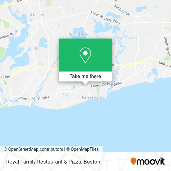
See Royal Family Restaurant & Pizza, Dennis Port, on the map
Public Transit to Royal Family Restaurant & Pizza in Dennis Port
Wondering how to get to Royal Family Restaurant & Pizza in Dennis Port? Moovit helps you find the best way to get to Royal Family Restaurant & Pizza with step-by-step directions from the nearest public transit station.
Moovit provides free maps and live directions to help you navigate through your city. View schedules, routes, timetables, and find out how long does it take to get to Royal Family Restaurant & Pizza in real time.
Looking for the nearest stop or station to Royal Family Restaurant & Pizza? Check out this list of stops closest to your destination: Municipal Lot A.
Bus: H2O HYANNIS-ORLEANS.
Want to see if there’s another route that gets you there at an earlier time? Moovit helps you find alternative routes or times. Get directions from and directions to Royal Family Restaurant & Pizza easily from the Moovit App or Website.
We make riding to Royal Family Restaurant & Pizza easy, which is why over 1.7 million users, including users in Dennis Port, trust Moovit as the best app for public transit. You don’t need to download an individual bus app or train app, Moovit is your all-in-one transit app that helps you find the best bus time or train time available.
For information on prices of bus, costs and ride fares to Royal Family Restaurant & Pizza, please check the Moovit app.
Use the app to navigate to popular places including to the airport, hospital, stadium, grocery store, mall, coffee shop, school, college, and university.
Royal Family Restaurant & Pizza Address: 374 Lower County Rd street in Dennis Port
- Wooden Shoe,
- Cape Cod Vacation Rental Dennis Port, Massachusetts,
- Cape Cottages Condo,
- Robert Paul Vacations,
- The Little Tea Pot Family Child Care,
- Dennis Port, Massachusetts,
- Original Seafood Restaurant,
- Aluminum Products of Cape Cod,
- Lune,
- The Restaurant and Pub next Door,
- Dennisport Coin-OP Laundry,
- ADT A T Alarm & Home Security,
- Arts & Carafes,
- Webcasts USA,
- Mike Stacy Memorial Playground,
- Star Laundromat,
- Hydrangea House Gift Shop & Art Gallery,
- Rory's Market,
- Designs by Diane,
- Medical Alarms USA
Places Near Royal Family Restaurant & Pizza (Dennis Port)
- Prudential Center, Boston,
- Td Garden, Boston,
- Boston Medical Center, Boston,
- House Of Blues, Boston,
- North End, Boston,
- Mgm Music Hall, Boston,
- Wang Theater, Boston,
- Boston Common, Boston,
- Boston Convention & Exhibition Center, Boston,
- Quincy Market, Boston,
- Cheers, Boston,
- Castle Island, Boston,
- Wilbur Theatre, Boston,
- Isabella Stewart Gardner Museum, Boston,
- Leader Bank Pavilion (Leader Bank Pavillion), Boston,
- Museum Of Science, Boston,
- Faneuil Hall, Boston,
- Seaport District, Boston,
- Boston Children's Hospital, Boston,
- Massachusetts General Hospital, Boston
How to get to popular places in Boston with public transit
Get around Dennis Port by public transit!
Traveling around Dennis Port has never been so easy. See step by step directions as you travel to any attraction, street or major public transit station. View bus and train schedules, arrival times, service alerts and detailed routes on a map, so you know exactly how to get to anywhere in Dennis Port.
When traveling to any destination around Dennis Port use Moovit's Live Directions with Get Off Notifications to know exactly where and how far to walk, how long to wait for your line, and how many stops are left. Moovit will alert you when it's time to get off — no need to constantly re-check whether yours is the next stop.
Wondering how to use public transit in Dennis Port or how to pay for public transit in Dennis Port? Moovit public transit app can help you navigate your way with public transit easily, and at minimum cost. It includes public transit fees, ticket prices, and costs. Looking for a map of Dennis Port public transit lines? Moovit public transit app shows all public transit maps in Dennis Port with all Bus, Train, Subway and Ferry routes and stops on an interactive map.
Boston has 4 transit type(s), including: Bus, Train, Subway and Ferry, operated by several transit agencies, including MBTA, Southeastern Regional Transit Authority, MetroWest Regional Transit Authority, Rhode Island Public Transit Authority, WRTA, Lowell Regional Transit Authority, Merrimack Valley Transit, Montachusett Regional Transit Authority, Cape Cod Regional Transit Authority, Brockton Area Transit Authority, Martha's Vineyard Transit Authority, the WAVE - Nantucket Regional Transit Authority, GATRA, Cape Ann Transportation Authority and Massport