Directions to Rpc Social Impact Center (Boston) with public transportation
The following transit lines have routes that pass near Rpc Social Impact Center
 Bus: 14, 19, 23, 28, SL5.
- Train: FAIRMOUNT, FRANKLIN/FOXBORO, PROVIDENCE/STOUGHTON.
- Subway: ORANGE LINE, RED LINE.
How to get to Rpc Social Impact Center by bus?
Click on the bus route to see step by step directions with maps, line arrival times and updated time schedules.
From Boston North Station, Boston
65 minFrom Tufts University, Medford
81 minFrom Everett, MA, Everett
92 minFrom Charles W. Eliot Bridge, Boston
74 minFrom Boston College (BC), Boston
73 minFrom Belle Isle Lobster & Seafood, Winthrop Town
100 minFrom Terrace Room, Paige Hall, Medford
81 minFrom Quincy Market, Quincy
80 minFrom Quincy Market, Boston
40 minFrom Harvard University, Cambridge
53 min
How to get to Rpc Social Impact Center by train?
Click on the train route to see step by step directions with maps, line arrival times and updated time schedules.
How to get to Rpc Social Impact Center by subway?
Click on the subway route to see step by step directions with maps, line arrival times and updated time schedules.
From Boston North Station, Boston
46 minFrom Tufts University, Medford
64 minFrom Charles W. Eliot Bridge, Boston
74 minFrom Boston College (BC), Boston
92 minFrom Belle Isle Lobster & Seafood, Winthrop Town
70 minFrom Terrace Room, Paige Hall, Medford
65 minFrom Quincy Market, Quincy
56 minFrom Quincy Market, Boston
43 minFrom Harvard University, Cambridge
54 min
Bus stops near Rpc Social Impact Center in Boston
Train station near Rpc Social Impact Center in Boston
- Four Corners/Geneva, 9 min walk,VIEW
Subway station near Rpc Social Impact Center in Boston
- Jackson Square, 16 min walk,VIEW
Bus lines to Rpc Social Impact Center in Boston
What are the closest stations to Rpc Social Impact Center?
The closest stations to Rpc Social Impact Center are:
- Humboldt Ave @ Ml King Blvd is 207 yards away, 4 min walk.
- Warren St @ Waverly St is 325 yards away, 4 min walk.
- Blue Hill Ave @ Clifford St is 471 yards away, 6 min walk.
- Four Corners/Geneva is 739 yards away, 9 min walk.
- Jackson Square is 1375 yards away, 16 min walk.
Which bus lines stop near Rpc Social Impact Center?
These bus lines stop near Rpc Social Impact Center: 14, 19, 23, 28, SL5.
Which train line stops near Rpc Social Impact Center?
FAIRMOUNT (#1619 | Fairmount)
Which subway lines stop near Rpc Social Impact Center?
These subway lines stop near Rpc Social Impact Center: ORANGE LINE, RED LINE.
What’s the nearest subway station to Rpc Social Impact Center in Boston?
The nearest subway station to Rpc Social Impact Center in Boston is Jackson Square. It’s a 16 min walk away.
What’s the nearest train station to Rpc Social Impact Center in Boston?
The nearest train station to Rpc Social Impact Center in Boston is Four Corners/Geneva. It’s a 9 min walk away.
What’s the nearest bus station to Rpc Social Impact Center in Boston?
The nearest bus stations to Rpc Social Impact Center in Boston are Humboldt Ave @ Ml King Blvd and Warren St @ Waverly St. The closest one is a 4 min walk away.
What time is the first subway to Rpc Social Impact Center in Boston?
The ORANGE LINE is the first subway that goes to Rpc Social Impact Center in Boston. It stops nearby at 5:20 AM.
What time is the last subway to Rpc Social Impact Center in Boston?
The ORANGE LINE is the last subway that goes to Rpc Social Impact Center in Boston. It stops nearby at 1:52 AM.
What time is the first train to Rpc Social Impact Center in Boston?
The FAIRMOUNT is the first train that goes to Rpc Social Impact Center in Boston. It stops nearby at 4:47 AM.
What time is the last train to Rpc Social Impact Center in Boston?
The FAIRMOUNT is the last train that goes to Rpc Social Impact Center in Boston. It stops nearby at 12:00 AM.
What time is the first bus to Rpc Social Impact Center in Boston?
The 28 is the first bus that goes to Rpc Social Impact Center in Boston. It stops nearby at 3:18 AM.
What time is the last bus to Rpc Social Impact Center in Boston?
The 23 is the last bus that goes to Rpc Social Impact Center in Boston. It stops nearby at 2:31 AM.
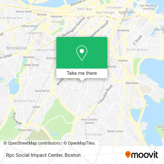
See Rpc Social Impact Center, Boston, on the map
Public Transit to Rpc Social Impact Center in Boston
Wondering how to get to Rpc Social Impact Center in Boston? Moovit helps you find the best way to get to Rpc Social Impact Center with step-by-step directions from the nearest public transit station.
Moovit provides free maps and live directions to help you navigate through your city. View schedules, routes, timetables, and find out how long does it take to get to Rpc Social Impact Center in real time.
Looking for the nearest stop or station to Rpc Social Impact Center? Check out this list of stops closest to your destination: Humboldt Ave @ Ml King Blvd; Warren St @ Waverly St; Blue Hill Ave @ Clifford St; Four Corners/Geneva; Jackson Square.
Bus: 14, 19, 23, 28, SL5, 44, 10, 45.Train: FAIRMOUNT, FRANKLIN/FOXBORO, PROVIDENCE/STOUGHTON.Subway: ORANGE LINE, RED LINE.
Want to see if there’s another route that gets you there at an earlier time? Moovit helps you find alternative routes or times. Get directions from and directions to Rpc Social Impact Center easily from the Moovit App or Website.
We make riding to Rpc Social Impact Center easy, which is why over 1.7 million users, including users in Boston, trust Moovit as the best app for public transit. You don’t need to download an individual bus app or train app, Moovit is your all-in-one transit app that helps you find the best bus time or train time available.
For information on prices of bus, subway and train, costs and ride fares to Rpc Social Impact Center, please check the Moovit app.
Use the app to navigate to popular places including to the airport, hospital, stadium, grocery store, mall, coffee shop, school, college, and university.
Rpc Social Impact Center Address: 328 Warren St street in Boston
- Washington Park Mall,
- D'Laly's Beauty Salon,
- Exp/Snipes 3027,
- Popeyes LOUISIANA KITCHEN,
- Naacp Boston Branch,
- Dollar Max Store,
- Popeyes @ Washington Park Mall,
- Boston Locksmith PRO,
- District 7 Tavern,
- Lopes and Associates,
- Apartments,
- Xposure by Noel,
- Dr Lue Dee Jackson, DMD, MD,
- Quincy Geneva Housing Office,
- Greater Boston,
- Roxbury Ymca,
- Authentic Diva,
- Jaezoe Studio,
- JD Romero Home Cleaning,
- Makings of Mo
Places Near Rpc Social Impact Center (Boston)
- Boston Convention & Exhibition Center, Boston,
- Castle Island, Boston,
- Museum Of Science, Boston,
- Wilbur Theatre, Boston,
- Seaport District, Boston,
- Quincy Market, Boston,
- House Of Blues, Boston,
- Cheers, Boston,
- Prudential Center, Boston,
- Massachusetts General Hospital, Boston,
- Isabella Stewart Gardner Museum, Boston,
- Boston Common, Boston,
- Boston Children's Hospital, Boston,
- North End, Boston,
- Td Garden, Boston,
- Wang Theater, Boston,
- Faneuil Hall, Boston,
- Mgm Music Hall, Boston,
- Boston Medical Center, Boston,
- Leader Bank Pavilion (Leader Bank Pavillion), Boston
How to get to popular places in Boston with public transit
Get around Boston by public transit!
Traveling around Boston has never been so easy. See step by step directions as you travel to any attraction, street or major public transit station. View bus and train schedules, arrival times, service alerts and detailed routes on a map, so you know exactly how to get to anywhere in Boston.
When traveling to any destination around Boston use Moovit's Live Directions with Get Off Notifications to know exactly where and how far to walk, how long to wait for your line, and how many stops are left. Moovit will alert you when it's time to get off — no need to constantly re-check whether yours is the next stop.
Wondering how to use public transit in Boston or how to pay for public transit in Boston? Moovit public transit app can help you navigate your way with public transit easily, and at minimum cost. It includes public transit fees, ticket prices, and costs. Looking for a map of Boston public transit lines? Moovit public transit app shows all public transit maps in Boston with all Bus, Train, Subway and Ferry routes and stops on an interactive map.
Boston has 4 transit type(s), including: Bus, Train, Subway and Ferry, operated by several transit agencies, including MBTA, Southeastern Regional Transit Authority, MetroWest Regional Transit Authority, Rhode Island Public Transit Authority, WRTA, Lowell Regional Transit Authority, Merrimack Valley Transit, Montachusett Regional Transit Authority, Cape Cod Regional Transit Authority, Brockton Area Transit Authority, Martha's Vineyard Transit Authority, the WAVE - Nantucket Regional Transit Authority, GATRA, Cape Ann Transportation Authority and Massport