How to get to Rrg_Multiservices by bus?
Click on the bus route to see step by step directions with maps, line arrival times and updated time schedules.
From E 77th St / Lexington Ave, Manhattan
34 minFrom Parkchester, Bronx
55 minFrom Cross County Shopping Center, Yonkers
65 minFrom 31st St (astoria blvd & 31st street), Queens
84 minFrom Astoria, NY, Queens
84 minFrom Beacon Theater, Manhattan
56 minFrom Throgs Neck, Bronx
67 minFrom Astoria, Queens
85 minFrom MTA - 81st Street - Museum of Natural History, Manhattan
50 minFrom Mitsuwa Marketplace, Edgewater
57 min
How to get to Rrg_Multiservices by train?
Click on the train route to see step by step directions with maps, line arrival times and updated time schedules.
How to get to Rrg_Multiservices by subway?
Click on the subway route to see step by step directions with maps, line arrival times and updated time schedules.
Subway stations near Rrg_Multiservices in Manhattan
- Dyckman St, 2 min walk,VIEW
Bus stops near Rrg_Multiservices in Manhattan
Bus lines to Rrg_Multiservices in Manhattan
What are the closest stations to Rrg_Multiservices?
The closest stations to Rrg_Multiservices are:
- Dyckman St is 142 yards away, 2 min walk.
- Dyckman St/Nagle Av is 159 yards away, 3 min walk.
- Dyckman St/Sherman Av is 369 yards away, 5 min walk.
- Broadway/W 196 St is 518 yards away, 7 min walk.
- Fort George Av/66 Fort George Av is 991 yards away, 12 min walk.
Which bus lines stop near Rrg_Multiservices?
These bus lines stop near Rrg_Multiservices: BX12-SBS, BXM1, M100, M98.
Which train line stops near Rrg_Multiservices?
1 (717#| Croton-Harmon)
Which subway line stops near Rrg_Multiservices?
1 (Downtown & Brooklyn)
What’s the nearest subway station to Rrg_Multiservices in Manhattan?
The nearest subway station to Rrg_Multiservices in Manhattan is Dyckman St. It’s a 2 min walk away.
What’s the nearest bus station to Rrg_Multiservices in Manhattan?
The nearest bus station to Rrg_Multiservices in Manhattan is Dyckman St/Nagle Av. It’s a 3 min walk away.
What time is the first subway to Rrg_Multiservices in Manhattan?
The 1 is the first subway that goes to Rrg_Multiservices in Manhattan. It stops nearby at 3:00 AM.
What time is the last subway to Rrg_Multiservices in Manhattan?
The A is the last subway that goes to Rrg_Multiservices in Manhattan. It stops nearby at 4:33 AM.
What time is the first bus to Rrg_Multiservices in Manhattan?
The M101 is the first bus that goes to Rrg_Multiservices in Manhattan. It stops nearby at 3:27 AM.
What time is the last bus to Rrg_Multiservices in Manhattan?
The M101 is the last bus that goes to Rrg_Multiservices in Manhattan. It stops nearby at 3:27 AM.
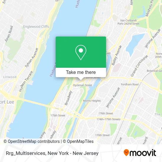
See Rrg_Multiservices, Manhattan, on the map
Public Transit to Rrg_Multiservices in Manhattan
Wondering how to get to Rrg_Multiservices in Manhattan? Moovit helps you find the best way to get to Rrg_Multiservices with step-by-step directions from the nearest public transit station.
Moovit provides free maps and live directions to help you navigate through your city. View schedules, routes, timetables, and find out how long does it take to get to Rrg_Multiservices in real time.
Looking for the nearest stop or station to Rrg_Multiservices? Check out this list of stops closest to your destination: Dyckman St; Dyckman St/Nagle Av; Dyckman St/Sherman Av; Broadway/W 196 St; Fort George Av/66 Fort George Av.
Bus: BX12-SBS, BXM1, M100, M98, BX7, M3.Train: 1.Subway: 1, A.
Want to see if there’s another route that gets you there at an earlier time? Moovit helps you find alternative routes or times. Get directions from and directions to Rrg_Multiservices easily from the Moovit App or Website.
We make riding to Rrg_Multiservices easy, which is why over 1.5 million users, including users in Manhattan, trust Moovit as the best app for public transit. You don’t need to download an individual bus app or train app, Moovit is your all-in-one transit app that helps you find the best bus time or train time available.
For information on prices of bus, subway and train, costs and ride fares to Rrg_Multiservices, please check the Moovit app.
Use the app to navigate to popular places including to the airport, hospital, stadium, grocery store, mall, coffee shop, school, college, and university.
Rrg_Multiservices Address: 35 Sherman Ave street in Manhattan
- Mi Lupita Grocery,
- Thania Salazar: Allstate Insurance,
- Platano Celular,
- Allstate Insurance,
- Sofia Studio Salon Unisex,
- Dryclean Nyc,
- Champions Martial Arts Dyckman,
- joselito travel,
- Community Family Health Center,
- Legacy Restoration Metal Stone Wood, Llc,
- Navarrete Travel and Tours,
- Afanador,
- Nebula Bar & Restaurant,
- Nagle Ave / Thayer,
- Lily Nails,
- La Ruleta Meat Market (Laruleta Meat Mkt),
- Ups Access Point Location,
- Ez Short Sales,
- 165 Nagle Wireless Inc,
- Uptown Print and Frame
Places Near Rrg_Multiservices (Manhattan)
- Wall Street, Manhattan,
- Pier 83, Manhattan,
- 1 Police Plaza, Manhattan,
- Hudson Yards, Manhattan,
- Rockefeller Center, Manhattan,
- Katz's Deli, Manhattan,
- Mountainside Hospital, Glen Ridge,
- 66 John Street, Manhattan,
- qqqq, Manhattan,
- 111 Centre New York City Supreme Court, Manhattan,
- Bellevue Hospital, Manhattan,
- SoHo, Manhattan,
- 3 Stone St, Manhattan,
- 911 Memorial, Manhattan,
- Chinatown, Manhattan,
- 376 Hudson Street, Manhattan,
- San Gennaro Feast, Manhattan,
- Queens Center Mall, Queens,
- Times Square, Manhattan,
- 26 Federal Plaza, Manhattan
How to get to popular places in New York - New Jersey with public transit
Get around Manhattan by public transit!
Traveling around Manhattan has never been so easy. See step by step directions as you travel to any attraction, street or major public transit station. View bus and train schedules, arrival times, service alerts and detailed routes on a map, so you know exactly how to get to anywhere in Manhattan.
When traveling to any destination around Manhattan use Moovit's Live Directions with Get Off Notifications to know exactly where and how far to walk, how long to wait for your line, and how many stops are left. Moovit will alert you when it's time to get off — no need to constantly re-check whether yours is the next stop.
Wondering how to use public transit in Manhattan or how to pay for public transit in Manhattan? Moovit public transit app can help you navigate your way with public transit easily, and at minimum cost. It includes public transit fees, ticket prices, and costs. Looking for a map of Manhattan public transit lines? Moovit public transit app shows all public transit maps in Manhattan with all Bus, Train, Subway, Light Rail, Ferry and Cable Car routes and stops on an interactive map.
New York - New Jersey has 6 transit type(s), including: Bus, Train, Subway, Light Rail, Ferry and Cable Car, operated by several transit agencies, including MTA Subway, Metro-North Railroad, LIRR, PATH, MTA New York City Transit - Express routes, MTA Bus, NJ Transit, NYC Ferry, NICE bus, Bee-Line Bus, NJ Transit Rail, Norwalk Transit District, Hartford Line, River Valley Transit and HART