Directions to Rua Aracaçu 45 (Uberaba) with public transportation
The following transit lines have routes that pass near Rua Aracaçu 45
How to get to Rua Aracaçu 45 by bus?
Click on the bus route to see step by step directions with maps, line arrival times and updated time schedules.
From Rua Senador Accioly Filho, 298 - Cidade Industrial, Cic
65 minFrom Estação Tubo Prefeitura, Centro Cívico
42 minFrom Capão Raso, Capão Raso
64 minFrom Hospital Da Cruz Vermelha, Batel
53 minFrom Estação Tubo Brigadeiro Franco, Centro
50 minFrom RH Hospital Evangelico, Bigorrilho
55 minFrom Linha C42 Pinhais/Bairro Alto, Bairro Alto
71 minFrom Rua José Loureiro, Centro
40 minFrom Shopping Palladium, Portão
61 minFrom Hospital Erasto Gaertner, Jardim Das Américas
27 min
Bus stops near Rua Aracaçu 45 in Uberaba
Bus lines to Rua Aracaçu 45 in Uberaba
- 468 JARDIM CENTAURO, Jardim Centauro → Praça Rui Barbosa,VIEW
- 474 JARDIM ITIBERÊ, Jardim Itiberê → Praça Rui Barbosa,VIEW
- E01 URANO / GUADALUPE, Terminal Afonso Pena → Terminal Guadalupe,VIEW
- E67 BRAGA / CURITIBA (VIA OURO FINO), Terminal Guadalupe ↺ Braga / Ouro Fino (Circular),VIEW
- E68 QUISSISSANA / GUADALUPE, Quississana → Terminal Guadalupe,VIEW
- E99 SÃO JOSÉ / GUADALUPE (VIA T. CENTRAL), Terminal Guadalupe → Praça Pedro Moro,VIEW
- 335 CENTENÁRIO / BOQUEIRÃO, Terminal Boqueirão → Terminal Centenário,VIEW
- X14 REFORÇO HAUER, Marumbi → Terminal Hauer,VIEW
- 188 MAD. PILARZINHO / UBERABA, Praça Rui Barbosa ↺ Uberaba (Circular),VIEW
- 338 CENTENÁRIO / HAUER, Terminal Centenário → Terminal Hauer,VIEW
What are the closest stations to Rua Aracaçu 45?
The closest stations to Rua Aracaçu 45 are:
- R. Aracaçu, 132 is 99 meters away, 2 min walk.
- R. Aviador Armin Buhrer, 335 is 307 meters away, 5 min walk.
- Av. Comendador Franco, 7479 is 454 meters away, 7 min walk.
- R. Augusto Zibarth, 765 is 497 meters away, 7 min walk.
- R. Zacarias Gomes De Souza, 600 is 524 meters away, 7 min walk.
Which bus lines stop near Rua Aracaçu 45?
These bus lines stop near Rua Aracaçu 45: 335 CENTENÁRIO / BOQUEIRÃO, 338 CENTENÁRIO / HAUER, 468 JARDIM CENTAURO, E68 QUISSISSANA / GUADALUPE.
What’s the nearest bus station to Rua Aracaçu 45 in Uberaba?
The nearest bus station to Rua Aracaçu 45 in Uberaba is R. Aracaçu, 132. It’s a 2 min walk away.
What time is the first bus to Rua Aracaçu 45 in Uberaba?
The 188 MAD. PILARZINHO / UBERABA is the first bus that goes to Rua Aracaçu 45 in Uberaba. It stops nearby at 3:25 AM.
What time is the last bus to Rua Aracaçu 45 in Uberaba?
The 188 MAD. PILARZINHO / UBERABA is the last bus that goes to Rua Aracaçu 45 in Uberaba. It stops nearby at 2:25 AM.
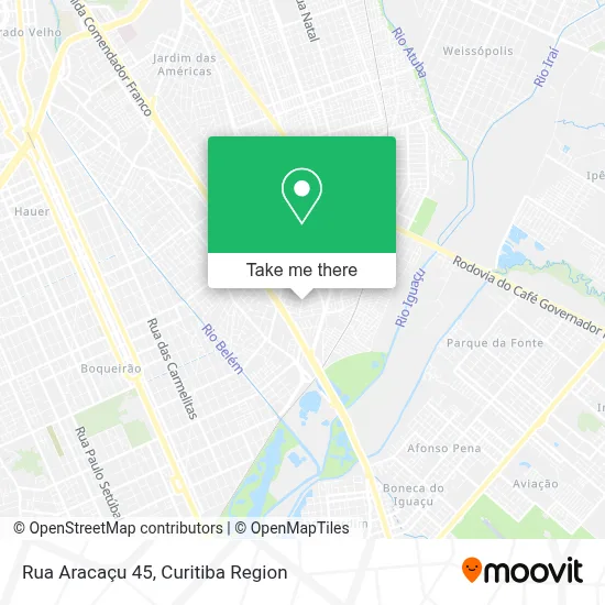
See Rua Aracaçu 45, Uberaba, on the map
Public Transit to Rua Aracaçu 45 in Uberaba
Wondering how to get to Rua Aracaçu 45 in Uberaba? Moovit helps you find the best way to get to Rua Aracaçu 45 with step-by-step directions from the nearest public transit station.
Moovit provides free maps and live directions to help you navigate through your city. View schedules, routes, timetables, and find out how long does it take to get to Rua Aracaçu 45 in real time.
Looking for the nearest stop or station to Rua Aracaçu 45? Check out this list of stops closest to your destination: R. Aracaçu; R. Aviador Armin Buhrer; Av. Comendador Franco; R. Augusto Zibarth; R. Zacarias Gomes De Souza.
Bus: 335 CENTENÁRIO / BOQUEIRÃO, 338 CENTENÁRIO / HAUER, 468 JARDIM CENTAURO, E68 QUISSISSANA / GUADALUPE, 474 JARDIM ITIBERÊ, E01 URANO / GUADALUPE, E67 BRAGA / CURITIBA (VIA OURO FINO), E99 SÃO JOSÉ / GUADALUPE (VIA T. CENTRAL), X14 REFORÇO HAUER, 188 MAD. PILARZINHO / UBERABA.
Want to see if there’s another route that gets you there at an earlier time? Moovit helps you find alternative routes or times. Get directions from and directions to Rua Aracaçu 45 easily from the Moovit App or Website.
We make riding to Rua Aracaçu 45 easy, which is why over 1.5 million users, including users in Uberaba, trust Moovit as the best app for public transit. You don’t need to download an individual bus app or train app, Moovit is your all-in-one transit app that helps you find the best bus time or train time available.
For information on prices of bus, costs and ride fares to Rua Aracaçu 45, please check the Moovit app.
Use the app to navigate to popular places including to the airport, hospital, stadium, grocery store, mall, coffee shop, school, college, and university.
Rua Aracaçu 45 Address: Rua Aracaçu, 45 - Uberaba, Curitiba - PR, 81560-500, Brasil street in Uberaba
- Avaliare Avaliação Médica E Psicológica,
- Rua Sargento Luiz Gonzaga Martins Ribas,
- Rua Aviador Armin Buhrer, 335 - Uberaba,
- Rua Aviador Armin Buhrer 357,
- Rua Maurício Thá 140,
- Majin Boo,
- Colégio Estadual Alfredo Parodi,
- Rua Eurídes Maciel de Almeida 44,
- APCEF/PR,
- 70 Igreja do Evangelio Quadrangular - Jardim Centauro,
- Jardim Centauro, Uberaba,
- Avenida Com. Franco 7273,
- Rua Zacarias Gomes de Souza 1550,
- Digao Dj Curitiba,
- Igreja Universal Uberaba,
- Centro de Formacao de Condutores Centauro,
- Mini Preço Av. das Torres,
- Academia de Judô Kaminari,
- Rua Aviador Armin Buhrer,
- Lanchonete the Brothers. Av.Das Torres
Places Near Rua Aracaçu 45 (Uberaba)
- Hospital Nossa Senhora Das Graças, Mercês,
- Parque Barigui, Mercês,
- Hospital de Clínicas (HC - UFPR), Centro,
- Rua Martim Afonso 558, Mercês,
- Hospital Da Cruz Vermelha, Batel,
- Hospital Angelina Caron, Campina Grande Do Sul,
- Shopping Estação, Rebouças,
- Hospital Erasto Gaertner, Jardim Das Américas,
- Arena Da Baixada - Curitiba,
- Campo Largo, Campo,
- Pontifícia Universidade Católica do Paraná (PUCPR), Prado Velho,
- Hospital Madalena Sofia, Bairro Alto,
- Rua General Mário Tourinho, Campina Do Siqueira,
- Jockey Plaza Shopping Center, Tarumã,
- Hospital Universitário Evangélico de Curitiba, Bigorrilho,
- Hhhhh, Fazendinha,
- Jardim Botânico de Curitiba PR, Centro,
- Shopping Palladium, Portão,
- Park Shopping Barigüi, Mossunguê,
- Hospital do Rocio, Campo
How to get to popular places in Curitiba Region with public transit
Get around Uberaba by public transit!
Traveling around Uberaba has never been so easy. See step by step directions as you travel to any attraction, street or major public transit station. View bus and train schedules, arrival times, service alerts and detailed routes on a map, so you know exactly how to get to anywhere in Uberaba.
When traveling to any destination around Uberaba use Moovit's Live Directions with Get Off Notifications to know exactly where and how far to walk, how long to wait for your line, and how many stops are left. Moovit will alert you when it's time to get off — no need to constantly re-check whether yours is the next stop.
Wondering how to use public transit in Uberaba or how to pay for public transit in Uberaba? Moovit public transit app can help you navigate your way with public transit easily, and at minimum cost. It includes public transit fees, ticket prices, and costs. Looking for a map of Uberaba public transit lines? Moovit public transit app shows all public transit maps in Uberaba with all Bus and Cable Car routes and stops on an interactive map.
Curitiba Region has 2 transit type(s), including: Bus and Cable Car, operated by several transit agencies, including Sistema Integrado de Mobilidade (URBS), Sistema Integrado de Mobilidade (AMEP), URBS (Cartões bancários e Dinheiro), URBS (Cartões bancários / Cartão URBS), AMEP (Cartões bancários / Cartão MetroCard), AMEP (Cartões bancários / Cartão MetroCard / Dinheiro), Viação Colombo (Dinheiro), TRIAR (Cartão TRIAR / Dinheiro), Empresa Curitiba Cerro Azul (Dinheiro), Expresso Nossa Senhora da Penha (Dinheiro), Empresa Campo Alto Tijucas (Dinheiro), Auto Viação São José (Cartão VEM / Dinheiro), BRT S/A (Cartão VEM / Dinheiro), TransPiedade (Cartão Cidadão / Dinheiro) and Oceânica Sul (Cartão Transporte / Dinheiro)