How to get to Rua Coronel Soares by bus?
Click on the bus route to see step by step directions with maps, line arrival times and updated time schedules.
From Hospital Central do Exército (HCE), Benfica
57 minFrom TRE 179ª Zona Eleitoral, Freguesia (Jacarepaguá)
48 minFrom Hospital Universitário Clementino Fraga Filho (HUCFF), Cidade Universitária (Fundão)
46 minFrom Rua Marechal Deodoro 629, Duque De Caxias
50 minFrom Triagem, Benfica
59 minFrom Taquara, Taquara
39 minFrom Estrada do Bananal, Freguesia (Jacarepaguá)
59 minFrom Quality Shopping, Freguesia (Jacarepaguá)
48 minFrom Cidade Universitária, Cidade Universitária (Fundão)
66 minFrom BRT - Estação Taquara, Taquara
33 min
How to get to Rua Coronel Soares by train?
Click on the train route to see step by step directions with maps, line arrival times and updated time schedules.
How to get to Rua Coronel Soares by metro?
Click on the metro route to see step by step directions with maps, line arrival times and updated time schedules.
Bus stops near Rua Coronel Soares in Irajá
Metro station near Rua Coronel Soares in Irajá
- Irajá, 7 min walk,VIEW
Train station near Rua Coronel Soares in Irajá
- Rocha Miranda, 30 min walk,VIEW
Bus lines to Rua Coronel Soares in Irajá
- 711, Rio Comprido,VIEW
- 785, Marechal Hermes,VIEW
- 560L, Méier (Via Norte Shopping),VIEW
- 561, Freguesia,VIEW
- 568L, Caxias,VIEW
- 712, Cascadura,VIEW
- 774, Jardim América,VIEW
- SV 774, Madureira (via Terminal Margaridas),VIEW
- 775, Jardim América ↔ Madureira,VIEW
- 918, Bangu (Jardim Violeta),VIEW
- 926, Penha,VIEW
- 296, Castelo,VIEW
- 688, Méier,VIEW
- 940, Madureira,VIEW
- 428L, Bonsucesso,VIEW
- 551, Penha,VIEW
- 687, Méier,VIEW
- 919, Maré (via Bonsucesso),VIEW
- SN 919, Maré (via Bonsucesso),VIEW
What are the closest stations to Rua Coronel Soares?
The closest stations to Rua Coronel Soares are:
- Rua Guiraréia, 2-126 is 374 meters away, 5 min walk.
- Avenida Monsenhor Félix, 326 is 380 meters away, 5 min walk.
- Avenida Monsenhor Félix, 350-368 is 427 meters away, 6 min walk.
- Rua Jucari, 322 is 439 meters away, 6 min walk.
- Irajá is 519 meters away, 7 min walk.
- Avenida Pastor Martin Luther King Junior, 2703-3021 is 893 meters away, 12 min walk.
- Rocha Miranda is 2282 meters away, 30 min walk.
Which bus lines stop near Rua Coronel Soares?
These bus lines stop near Rua Coronel Soares: 42, 561, 568, 711, 774, SV 774.
Which metro line stops near Rua Coronel Soares?
L2 (Pavuna)
Which train line stops near Rua Coronel Soares?
RAMAL BELFORD ROXO (Belford Roxo)
What’s the nearest metro station to Rua Coronel Soares in Irajá?
The nearest metro station to Rua Coronel Soares in Irajá is Irajá. It’s a 7 min walk away.
What’s the nearest train station to Rua Coronel Soares in Irajá?
The nearest train station to Rua Coronel Soares in Irajá is Rocha Miranda. It’s a 30 min walk away.
What’s the nearest bus station to Rua Coronel Soares in Irajá?
The nearest bus stations to Rua Coronel Soares in Irajá are Rua Guiraréia, 2-126 and Avenida Monsenhor Félix, 326. The closest one is a 5 min walk away.
What time is the first metro to Rua Coronel Soares in Irajá?
The L2 is the first metro that goes to Rua Coronel Soares in Irajá. It stops nearby at 5:05 AM.
What time is the last metro to Rua Coronel Soares in Irajá?
The L2 is the last metro that goes to Rua Coronel Soares in Irajá. It stops nearby at 12:45 AM.
What time is the first train to Rua Coronel Soares in Irajá?
The RAMAL BELFORD ROXO is the first train that goes to Rua Coronel Soares in Irajá. It stops nearby at 5:13 AM.
What time is the last train to Rua Coronel Soares in Irajá?
The RAMAL BELFORD ROXO is the last train that goes to Rua Coronel Soares in Irajá. It stops nearby at 10:03 PM.
What time is the first bus to Rua Coronel Soares in Irajá?
The 687 is the first bus that goes to Rua Coronel Soares in Irajá. It stops nearby at 3:14 AM.
What time is the last bus to Rua Coronel Soares in Irajá?
The 918 is the last bus that goes to Rua Coronel Soares in Irajá. It stops nearby at 3:46 AM.
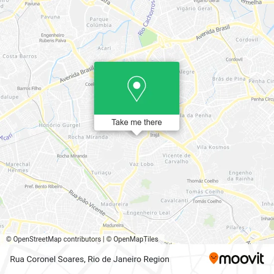
See Rua Coronel Soares, Irajá, on the map
Public Transit to Rua Coronel Soares in Irajá
Wondering how to get to Rua Coronel Soares in Irajá? Moovit helps you find the best way to get to Rua Coronel Soares with step-by-step directions from the nearest public transit station.
Moovit provides free maps and live directions to help you navigate through your city. View schedules, routes, timetables, and find out how long does it take to get to Rua Coronel Soares in real time.
Looking for the nearest stop or station to Rua Coronel Soares? Check out this list of stops closest to your destination: Rua Guiraréia; Avenida Monsenhor Félix; Avenida Monsenhor Félix; Rua Jucari; Irajá; Avenida Pastor Martin Luther King Junior; Rocha Miranda.
Bus: 42, 561, 568, 711, 774, SV 774, 785, 560L, 568L, 712, 296, 688, 940.Metro: L2.Train: RAMAL BELFORD ROXO.
Want to see if there’s another route that gets you there at an earlier time? Moovit helps you find alternative routes or times. Get directions from and directions to Rua Coronel Soares easily from the Moovit App or Website.
We make riding to Rua Coronel Soares easy, which is why over 1.5 million users, including users in Irajá, trust Moovit as the best app for public transit. You don’t need to download an individual bus app or train app, Moovit is your all-in-one transit app that helps you find the best bus time or train time available.
For information on prices of bus, metro and train, costs and ride fares to Rua Coronel Soares, please check the Moovit app.
Use the app to navigate to popular places including to the airport, hospital, stadium, grocery store, mall, coffee shop, school, college, and university.
Rua Coronel Soares Address: Irajá Rio de Janeiro-RJ street in Irajá
- Condominio Residencial Esplendor,
- Colégio Percepção (Colégio Percepção - Irajá),
- Colegio Percepção,
- Centro Espirita Sao Lazaro e Sao Francisco de Assis,
- Tropical Festas,
- Tropical Kids Festas,
- Boate Luxuria Lounge Iraja,
- Sherazzade Hotel,
- Rua Guiraréia 270,
- Mansao Santorini,
- Em Rosa Bettiato Zattera,
- Escola Municipal Rosa Bettiato Záttera,
- Tropical Festas e Eventos,
- Choperia Tropical,
- Avenida Monsenhor Félix 255,
- Posto Rio Vouga (Shell),
- Rua Carolina Amado,
- Hotel Sherazzade,
- Fundação Dionísio Lins,
- Centro de Saúde Clementino Fraga
Places Near Rua Coronel Soares (Irajá)
- Hospital Federal Cardoso Fontes, Jacarepaguá,
- Shopping RioSul, Botafogo,
- Avenida Venezuela 134, Saúde,
- Shopping Downtown, Barra Da Tijuca,
- Feira Livre da Gloria, Glória,
- Rodoviária Novo Rio (Rodoviária do Rio de Janeiro), Santo Cristo,
- Shopping Nova América, Del Castilho,
- Rio De Janeiro,
- Avenida Rio Branco, Centro,
- Rua Licínio Cardoso, São Francisco Xavier,
- Niterói, Niterói,
- Feirão De Malhas, Duque De Caxias,
- Praia do Arpoador, Ipanema,
- Hospital Federal Do Andaraí, Andaraí,
- Hospital Municipal Ronaldo Gazolla, Acari,
- Shopping Rio Sul, Botafogo,
- Norte Shopping, Cachambi,
- Hospital Pedro Ernesto, Vila Isabel,
- Museu Do Amanhã, Centro,
- Rua Ulysses Guimarães 16, Cidade Nova
How to get to popular places in Rio de Janeiro Region with public transit
Get around Irajá by public transit!
Traveling around Irajá has never been so easy. See step by step directions as you travel to any attraction, street or major public transit station. View bus and train schedules, arrival times, service alerts and detailed routes on a map, so you know exactly how to get to anywhere in Irajá.
When traveling to any destination around Irajá use Moovit's Live Directions with Get Off Notifications to know exactly where and how far to walk, how long to wait for your line, and how many stops are left. Moovit will alert you when it's time to get off — no need to constantly re-check whether yours is the next stop.
Wondering how to use public transit in Irajá or how to pay for public transit in Irajá? Moovit public transit app can help you navigate your way with public transit easily, and at minimum cost. It includes public transit fees, ticket prices, and costs. Looking for a map of Irajá public transit lines? Moovit public transit app shows all public transit maps in Irajá with all Bus, Train, Metro, Light Rail, Ferry, Cable Car, Gondola and Funicular routes and stops on an interactive map.
Rio de Janeiro Region has 8 transit type(s), including: Bus, Train, Metro, Light Rail, Ferry, Cable Car, Gondola and Funicular, operated by several transit agencies, including TrensRJ, Metrô Rio, VLT Carioca, Barcas Rio, BRT MOBI-Rio, Auto Viação Alpha, Auto Viação Tijuca, Gire Transportes, Transurb, Viação Nossa Senhora das Graças, Consórcio INTERSUL, Braso Lisboa (Municipal), Caprichosa Auto Ônibus, Auto Viação Três Amigos and Rodoviária Âncora Matias