Directions to Rua Gil Gafrée (Manguinhos) with public transportation
The following transit lines have routes that pass near Rua Gil Gafrée
 Bus: 312, 313, 979, SN 312, 488L.
- Metro: L2.
- Train: RAMAL SARACURUNA, RAMAL BELFORD ROXO.
How to get to Rua Gil Gafrée by bus?
Click on the bus route to see step by step directions with maps, line arrival times and updated time schedules.
From Caxias D'Or, Duque De Caxias
41 minFrom Aeroporto Santos Dumont, Centro
40 minFrom Rua dos Inválidos 212, Centro
39 minFrom Gafrée E Guinle, Maracanã
29 minFrom Ilha do Governador, Jardim Carioca
44 minFrom Rua Riachuelo 350, Centro
41 minFrom Centro, Centro
40 minFrom Ilha Plaza Shopping, Jardim Carioca
36 minFrom Avenida Almirante Silvio de Noronha 365, Centro
51 minFrom Engenho De Dentro, Engenho De Dentro
27 min
How to get to Rua Gil Gafrée by train?
Click on the train route to see step by step directions with maps, line arrival times and updated time schedules.
How to get to Rua Gil Gafrée by metro?
Click on the metro route to see step by step directions with maps, line arrival times and updated time schedules.
Bus stops near Rua Gil Gafrée in Manguinhos
Train stations near Rua Gil Gafrée in Manguinhos
Metro station near Rua Gil Gafrée in Manguinhos
- Maria Da Graça, 31 min walk,VIEW
Bus lines to Rua Gil Gafrée in Manguinhos
- 312, Olaria - Candelária (Brs 4 - Via São Cristóvão),VIEW
- SN 312, Penha - Candelária (Via Ibiapina / Itararé / Rodoviária),VIEW
- 313, Penha - Tiradentes (Brs 4 - Via São Cristóvão),VIEW
- 488L, Caxias - Usina (Brs I - Via Uerj / Vila Isabel),VIEW
- 600C, Wona - Central (Brs I - Via Penha),VIEW
- 621, Penha - Saens Peña (Brs 6),VIEW
- 622, Penha - Saens Peña (Circular),VIEW
- 630, Iapi da Penha - Saens Peña (Brs 6 - Via Bonsucesso / Benfica),VIEW
- 663, Méier - Fundão (Via Av. Brasil),VIEW
- 696, Praia do Dendê - Méier (Via Av. Brasil),VIEW
- SN 696, Praia do Dendê - Meier (Via Praia do Rosa / Bancários),VIEW
- 979, Terminal Madureira - Terminal Fundão (via Rua Goiás),VIEW
- 265, Marechal Hermes - Castelo (Brs 4 - Via Norte Shopping),VIEW
- SN 265, Marechal Hermes - Castelo (BRS 4 - via Terminal Gentileza),VIEW
- SP 265, Marechal Hermes - Terminal Gentileza (Via Norte Shopping),VIEW
- 296, Irajá - Castelo (Brs 4 - Via Norte Shopping),VIEW
- 298, Acari - Castelo (Brs 4 - Via Norte Shopping),VIEW
- SN 298, Acari - Castelo (Brs 4 - Via Norte Shopping / Terminal Gentileza),VIEW
- 311, Engenheiro Leal - Candelária (Brs 4 - Via Del Castilho / São Cristóvão),VIEW
- 371, Praça Seca - Praça da República (Brs 5 - Via Norte Shopping),VIEW
What are the closest stations to Rua Gil Gafrée?
The closest stations to Rua Gil Gafrée are:
- Avenida Dos Democráticos, 542-626 is 161 meters away, 3 min walk.
- Ccaa Maria Da Graça | Metrô Maria Da Graça is 569 meters away, 8 min walk.
- Estação De Trem De Manguinhos is 681 meters away, 9 min walk.
- Fiocruz is 684 meters away, 9 min walk.
- Portaria Leopoldo Bulhões is 707 meters away, 10 min walk.
- Jacarezinho is 1690 meters away, 22 min walk.
- Manguinhos is 1714 meters away, 22 min walk.
- Maria Da Graça is 2440 meters away, 31 min walk.
Which bus lines stop near Rua Gil Gafrée?
These bus lines stop near Rua Gil Gafrée: 312, 313, 979.
Which metro line stops near Rua Gil Gafrée?
L2 (Pavuna)
Which train line stops near Rua Gil Gafrée?
RAMAL SARACURUNA (Central Do Brasil)
What’s the nearest train station to Rua Gil Gafrée in Manguinhos?
The nearest train stations to Rua Gil Gafrée in Manguinhos are Jacarezinho and Manguinhos. The closest one is a 22 min walk away.
What’s the nearest bus station to Rua Gil Gafrée in Manguinhos?
The nearest bus station to Rua Gil Gafrée in Manguinhos is Avenida Dos Democráticos, 542-626. It’s a 3 min walk away.
What time is the first metro to Rua Gil Gafrée in Manguinhos?
The L2 is the first metro that goes to Rua Gil Gafrée in Manguinhos. It stops nearby at 5:23 AM.
What time is the last metro to Rua Gil Gafrée in Manguinhos?
The L2 is the last metro that goes to Rua Gil Gafrée in Manguinhos. It stops nearby at 12:28 AM.
What time is the first train to Rua Gil Gafrée in Manguinhos?
The RAMAL SARACURUNA is the first train that goes to Rua Gil Gafrée in Manguinhos. It stops nearby at 4:55 AM.
What time is the last train to Rua Gil Gafrée in Manguinhos?
The RAMAL SARACURUNA is the last train that goes to Rua Gil Gafrée in Manguinhos. It stops nearby at 10:52 PM.
What time is the first bus to Rua Gil Gafrée in Manguinhos?
The SN 634 is the first bus that goes to Rua Gil Gafrée in Manguinhos. It stops nearby at 3:05 AM.
What time is the last bus to Rua Gil Gafrée in Manguinhos?
The SN 634 is the last bus that goes to Rua Gil Gafrée in Manguinhos. It stops nearby at 3:28 AM.
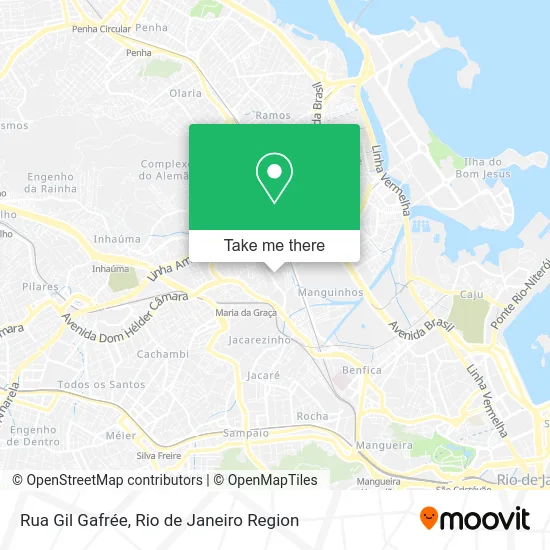
See Rua Gil Gafrée, Manguinhos, on the map
Public Transit to Rua Gil Gafrée in Manguinhos
Wondering how to get to Rua Gil Gafrée in Manguinhos? Moovit helps you find the best way to get to Rua Gil Gafrée with step-by-step directions from the nearest public transit station.
Moovit provides free maps and live directions to help you navigate through your city. View schedules, routes, timetables, and find out how long does it take to get to Rua Gil Gafrée in real time.
Looking for the nearest stop or station to Rua Gil Gafrée? Check out this list of stops closest to your destination: Avenida Dos Democráticos; Ccaa Maria Da Graça | Metrô Maria Da Graça; Estação De Trem De Manguinhos; Fiocruz; Portaria Leopoldo Bulhões; Jacarezinho; Manguinhos; Maria Da Graça.
Bus: 312, 313, 979, SN 312, 488L, 600C, 265, SN 265, SP 265, 296, 298, 350, 486L, 489L, 634.Metro: L2.Train: RAMAL SARACURUNA, RAMAL BELFORD ROXO.
Want to see if there’s another route that gets you there at an earlier time? Moovit helps you find alternative routes or times. Get directions from and directions to Rua Gil Gafrée easily from the Moovit App or Website.
We make riding to Rua Gil Gafrée easy, which is why over 1.5 million users, including users in Manguinhos, trust Moovit as the best app for public transit. You don’t need to download an individual bus app or train app, Moovit is your all-in-one transit app that helps you find the best bus time or train time available.
For information on prices of bus, train and metro, costs and ride fares to Rua Gil Gafrée, please check the Moovit app.
Use the app to navigate to popular places including to the airport, hospital, stadium, grocery store, mall, coffee shop, school, college, and university.
Rua Gil Gafrée Address: Manguinhos Rio de Janeiro-RJ street in Manguinhos
- salao de festa universal inhaúma,
- Posto de Gasolina Rede K5,
- Travessa Sao Pedro Acesso Cam Democraticos 3,
- Avenida dos Democráticos 646,
- Rua Capitão Bragança 82,
- Equipe Guilhotina Fight - Mestre Alexandre Pequeno,
- cras caio fernando abreu,
- Rua Hesperia, 35,
- Rede Economia de Supermercados,
- Pagode de Maria da Graça,
- AEFA - Associacao Espirita Francisco De Assis,
- Rede economia,
- Associação De Moradores Da Vila Turismo,
- Colégio Estadual Prof. Clóvis Monteiro,
- Quadra - C. E. Prof. Clóvis Monteiro,
- Ferragens Duas Patrias de Bonsucesso,
- Rua Lourenço Ribeiro 31,
- Edi Joaquim Venâncio - Manguinhos,
- Zona 169 Seção 7,
- Avenida dos Democráticos / Rua Pedro de Aquino
Places Near Rua Gil Gafrée (Manguinhos)
- Shopping Downtown, Barra Da Tijuca,
- Rua Licínio Cardoso, São Francisco Xavier,
- Praia do Arpoador, Ipanema,
- Hospital Municipal Ronaldo Gazolla, Acari,
- Niterói, Niterói,
- Hospital Federal Cardoso Fontes, Jacarepaguá,
- Hospital Pedro Ernesto, Vila Isabel,
- Rua Ulysses Guimarães 16, Cidade Nova,
- Avenida Rio Branco, Centro,
- Feira Livre da Gloria, Glória,
- Norte Shopping, Cachambi,
- Rio De Janeiro,
- Feirão De Malhas, Duque De Caxias,
- Rodoviária Novo Rio (Rodoviária do Rio de Janeiro), Santo Cristo,
- Avenida Venezuela 134, Saúde,
- Hospital Federal Do Andaraí, Andaraí,
- Shopping Rio Sul, Botafogo,
- Shopping Nova América, Del Castilho,
- Shopping RioSul, Botafogo,
- Museu Do Amanhã, Centro
How to get to popular places in Rio de Janeiro Region with public transit
Get around Manguinhos by public transit!
Traveling around Manguinhos has never been so easy. See step by step directions as you travel to any attraction, street or major public transit station. View bus and train schedules, arrival times, service alerts and detailed routes on a map, so you know exactly how to get to anywhere in Manguinhos.
When traveling to any destination around Manguinhos use Moovit's Live Directions with Get Off Notifications to know exactly where and how far to walk, how long to wait for your line, and how many stops are left. Moovit will alert you when it's time to get off — no need to constantly re-check whether yours is the next stop.
Wondering how to use public transit in Manguinhos or how to pay for public transit in Manguinhos? Moovit public transit app can help you navigate your way with public transit easily, and at minimum cost. It includes public transit fees, ticket prices, and costs. Looking for a map of Manguinhos public transit lines? Moovit public transit app shows all public transit maps in Manguinhos with all Bus, Train, Metro, Light Rail, Ferry, Cable Car, Gondola and Funicular routes and stops on an interactive map.
Rio de Janeiro Region has 8 transit type(s), including: Bus, Train, Metro, Light Rail, Ferry, Cable Car, Gondola and Funicular, operated by several transit agencies, including TrensRJ, Metrô Rio, VLT Carioca, Barcas Rio, BRT MOBI-Rio, Auto Viação Alpha, Auto Viação Tijuca, Gire Transportes, Transurb, Viação Nossa Senhora das Graças, Consórcio INTERSUL, Braso Lisboa (Municipal), Caprichosa Auto Ônibus, Auto Viação Três Amigos and Rodoviária Âncora Matias