How to get to Rua Ininga by bus?
Click on the bus route to see step by step directions with maps, line arrival times and updated time schedules.
From Rua Castro Alves, Méier
53 minFrom Shopping Grande Rio, São João De Meriti
44 minFrom Rua São Januario, Vasco Da Gama
36 minFrom Rua São Januario 153, Imperial De São Cristóvão
41 minFrom Praça Seca, Praça Seca
49 minFrom Avenida Governador Leonel de Moura Brizola, Duque De Caxias
48 minFrom Ilha do Governador, Jardim Carioca
60 minFrom rua senador alencar, Imperial De São Cristóvão
38 minFrom Avenida Marechal Rondon, São Francisco Xavier
52 minFrom Praça Seca / BRT Transcarioca, Praça Seca
42 min
How to get to Rua Ininga by train?
Click on the train route to see step by step directions with maps, line arrival times and updated time schedules.
Bus stops near Rua Ininga in Brás De Pina
Train station near Rua Ininga in Brás De Pina
- Parada De Lucas, 5 min walk,VIEW
Bus lines to Rua Ininga in Brás De Pina
- 494L, Caxias,VIEW
- 335, Cordovil (Rápido),VIEW
- 905, Bonsucesso,VIEW
- 906, Caju,VIEW
- 940, Ramos,VIEW
- 485L, Caxias - Pilares (Via Itararé),VIEW
- 486L, Bar dos Cavaleiros - Largo da Cancela (Via Praça das Nações),VIEW
- 488L, Caxias - Usina (Brs I - Via Uerj / Vila Isabel),VIEW
- 489L, Caxias - Saens Peña (Via Praça das Nações),VIEW
- 492L, Caxias - Engenho da Rainha (Via Itaóca),VIEW
- 495L, Caxias - Penha,VIEW
- 600C, Wona - Central (Brs I - Via Penha),VIEW
What are the closest stations to Rua Ininga?
The closest stations to Rua Ininga are:
- Avenida Antenor Navarro, 138-240 is 137 meters away, 2 min walk.
- Avenida Antenor Navarro, 159 is 137 meters away, 2 min walk.
- Avenida Arapogi, 95 is 303 meters away, 4 min walk.
- Parada De Lucas is 328 meters away, 5 min walk.
- Rua Bento Cardoso, 693-933 is 512 meters away, 7 min walk.
Which bus lines stop near Rua Ininga?
These bus lines stop near Rua Ininga: 335, 488L, 494L, 495L.
Which train line stops near Rua Ininga?
RAMAL SARACURUNA (Gramacho)
What’s the nearest train station to Rua Ininga in Brás De Pina?
The nearest train station to Rua Ininga in Brás De Pina is Parada De Lucas. It’s a 5 min walk away.
What’s the nearest bus station to Rua Ininga in Brás De Pina?
The nearest bus stations to Rua Ininga in Brás De Pina are Avenida Antenor Navarro, 138-240 and Avenida Antenor Navarro, 159. The closest one is a 2 min walk away.
What time is the first train to Rua Ininga in Brás De Pina?
The RAMAL SARACURUNA is the first train that goes to Rua Ininga in Brás De Pina. It stops nearby at 4:39 AM.
What time is the last train to Rua Ininga in Brás De Pina?
The RAMAL SARACURUNA is the last train that goes to Rua Ininga in Brás De Pina. It stops nearby at 11:06 PM.
What time is the first bus to Rua Ininga in Brás De Pina?
The 905 is the first bus that goes to Rua Ininga in Brás De Pina. It stops nearby at 4:14 AM.
What time is the last bus to Rua Ininga in Brás De Pina?
The 600C is the last bus that goes to Rua Ininga in Brás De Pina. It stops nearby at 2:37 AM.
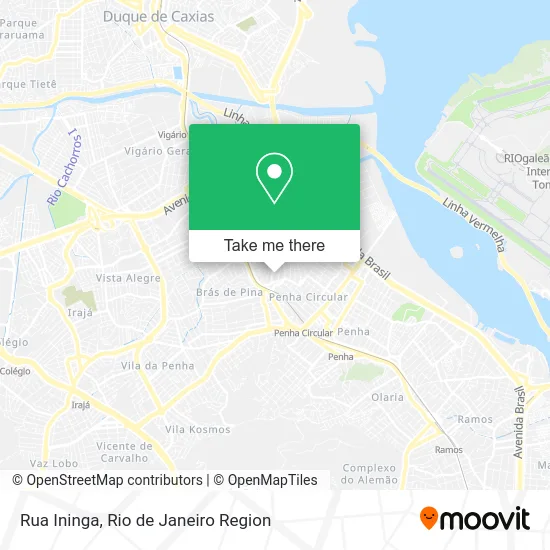
See Rua Ininga, Brás De Pina, on the map
Public Transit to Rua Ininga in Brás De Pina
Wondering how to get to Rua Ininga in Brás De Pina? Moovit helps you find the best way to get to Rua Ininga with step-by-step directions from the nearest public transit station.
Moovit provides free maps and live directions to help you navigate through your city. View schedules, routes, timetables, and find out how long does it take to get to Rua Ininga in real time.
Looking for the nearest stop or station to Rua Ininga? Check out this list of stops closest to your destination: Avenida Antenor Navarro; Avenida Antenor Navarro; Avenida Arapogi; Parada De Lucas; Rua Bento Cardoso.
Bus: 335, 488L, 494L, 495L, 905, 906, 940, 485L, 486L, 489L, 492L.Train: RAMAL SARACURUNA.
Want to see if there’s another route that gets you there at an earlier time? Moovit helps you find alternative routes or times. Get directions from and directions to Rua Ininga easily from the Moovit App or Website.
We make riding to Rua Ininga easy, which is why over 1.5 million users, including users in Brás De Pina, trust Moovit as the best app for public transit. You don’t need to download an individual bus app or train app, Moovit is your all-in-one transit app that helps you find the best bus time or train time available.
For information on prices of bus and train, costs and ride fares to Rua Ininga, please check the Moovit app.
Use the app to navigate to popular places including to the airport, hospital, stadium, grocery store, mall, coffee shop, school, college, and university.
Rua Ininga Address: R. Ininga - Bráz De Pina, Rio de Janeiro - RJ, Brasil street in Brás De Pina
- Bom Desconto Bras De Pina,
- Prainha Arraial do Cabo,
- Escola Municipal São Paulo,
- Rua Coirana, 154,
- Feira De Sábado Brás De Pina,
- SuperVia - Estação Braz de Pina,
- Avenida Antenor Navarro,
- Avenida Antenor Navarro Próximo ao 159,
- Padaria Guanabara,
- Feira da rua Iricumé,
- Rua Puriata 225,
- Rua Iricume 197,
- Bráz De Pina,
- Avenida Arapogi,
- Rua Caraipé 76,
- Rua Enes Filho 797,
- Rua Piriá 60,
- Paróquia Santa Cecília,
- Rua Canta 26,
- Venice Cachos
Places Near Rua Ininga (Brás De Pina)
- Museu Do Amanhã, Centro,
- Feira Livre da Gloria, Glória,
- Shopping Rio Sul, Botafogo,
- Shopping Nova América, Del Castilho,
- Hospital Federal Do Andaraí, Andaraí,
- Hospital Federal Cardoso Fontes, Jacarepaguá,
- Niterói, Niterói,
- Rua Licínio Cardoso, São Francisco Xavier,
- Shopping RioSul, Botafogo,
- Hospital Municipal Ronaldo Gazolla, Acari,
- Rodoviária Novo Rio (Rodoviária do Rio de Janeiro), Santo Cristo,
- Rio De Janeiro,
- Rua Ulysses Guimarães 16, Cidade Nova,
- Avenida Rio Branco, Centro,
- Shopping Downtown, Barra Da Tijuca,
- Hospital Pedro Ernesto, Vila Isabel,
- Praia do Arpoador, Ipanema,
- Avenida Venezuela 134, Saúde,
- Feirão De Malhas, Duque De Caxias,
- Norte Shopping, Cachambi
How to get to popular places in Rio de Janeiro Region with public transit
Get around Brás De Pina by public transit!
Traveling around Brás De Pina has never been so easy. See step by step directions as you travel to any attraction, street or major public transit station. View bus and train schedules, arrival times, service alerts and detailed routes on a map, so you know exactly how to get to anywhere in Brás De Pina.
When traveling to any destination around Brás De Pina use Moovit's Live Directions with Get Off Notifications to know exactly where and how far to walk, how long to wait for your line, and how many stops are left. Moovit will alert you when it's time to get off — no need to constantly re-check whether yours is the next stop.
Wondering how to use public transit in Brás De Pina or how to pay for public transit in Brás De Pina? Moovit public transit app can help you navigate your way with public transit easily, and at minimum cost. It includes public transit fees, ticket prices, and costs. Looking for a map of Brás De Pina public transit lines? Moovit public transit app shows all public transit maps in Brás De Pina with all Bus, Train, Metro, Light Rail, Ferry, Cable Car, Gondola and Funicular routes and stops on an interactive map.
Rio de Janeiro Region has 8 transit type(s), including: Bus, Train, Metro, Light Rail, Ferry, Cable Car, Gondola and Funicular, operated by several transit agencies, including TrensRJ, Metrô Rio, VLT Carioca, Barcas Rio, BRT MOBI-Rio, Auto Viação Alpha, Auto Viação Tijuca, Gire Transportes, Transurb, Viação Nossa Senhora das Graças, Consórcio INTERSUL, Braso Lisboa (Municipal), Caprichosa Auto Ônibus, Auto Viação Três Amigos and Rodoviária Âncora Matias