How to get to Rua Lamarāo by bus?
Click on the bus route to see step by step directions with maps, line arrival times and updated time schedules.
From Hospital Estadual Adão Pereira Nunes, Duque De Caxias
41 minFrom Pilar, Duque De Caxias
49 minFrom Outlet Premium Rio de Janeiro, Duque De Caxias
44 minFrom Chácaras Rio-Petrópolis, Duque De Caxias
30 minFrom Santa Cruz Da Serra, Duque De Caxias
36 minFrom Jardim Primavera, Duque De Caxias
37 minFrom Ponto Final TREL - PETRÓPOLIS X PIABETÁ, Petrópolis
57 minFrom Campos Elíseos, Duque De Caxias
45 minFrom Refinaria Duque de Caxias (REDUC), Duque De Caxias
36 minFrom Caxias- Lote xv, Duque De Caxias
43 min
Bus stops near Rua Lamarāo in Duque De Caxias
Bus lines to Rua Lamarāo in Duque De Caxias
- 558I, Caxias,VIEW
- 01, Caxias (Via Maternidade),VIEW
- 31, Amapá,VIEW
- 154N, Xerém,VIEW
- 486C, Central,VIEW
- 637T, Leblon (via Seletiva),VIEW
- 765I, Xerém (Via Pedágio),VIEW
- 2417T, Barra da Tijuca,VIEW
- POLO XERÉM - SANTA CRUZ DA SERRA, Santa Cruz Da Serra (Parador),VIEW
- 417T, Barra da Tijuca,VIEW
- 445I, Xerém (Saída De Belford Roxo),VIEW
- 554I, Caxias,VIEW
- TZ02, Aviário ↔ Xerém,VIEW
What are the closest stations to Rua Lamarāo?
The closest stations to Rua Lamarāo are:
- Alameda Santa Alice, 36 is 184 meters away, 3 min walk.
- Alameda Santa Alice, 21 is 200 meters away, 3 min walk.
- Rua Pastor Manoel Avelino De Souza, 6-26 is 560 meters away, 8 min walk.
- Rua Pastor Manoel Avelino De Souza, 27-29 is 578 meters away, 8 min walk.
- Rua Pastor Manoel Avelino De Souza, 37-47 is 697 meters away, 9 min walk.
Which bus lines stop near Rua Lamarāo?
These bus lines stop near Rua Lamarāo: 01, 154N, 765I.
What’s the nearest bus station to Rua Lamarāo in Duque De Caxias?
The nearest bus stations to Rua Lamarāo in Duque De Caxias are Alameda Santa Alice, 36 and Alameda Santa Alice, 21. The closest one is a 3 min walk away.
What time is the first bus to Rua Lamarāo in Duque De Caxias?
The 445I is the first bus that goes to Rua Lamarāo in Duque De Caxias. It stops nearby at 3:28 AM.
What time is the last bus to Rua Lamarāo in Duque De Caxias?
The 445I is the last bus that goes to Rua Lamarāo in Duque De Caxias. It stops nearby at 2:07 AM.
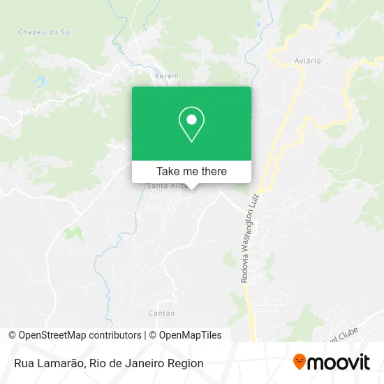
See Rua Lamarāo, Duque De Caxias, on the map
Public Transit to Rua Lamarāo in Duque De Caxias
Wondering how to get to Rua Lamarāo in Duque De Caxias? Moovit helps you find the best way to get to Rua Lamarāo with step-by-step directions from the nearest public transit station.
Moovit provides free maps and live directions to help you navigate through your city. View schedules, routes, timetables, and find out how long does it take to get to Rua Lamarāo in real time.
Looking for the nearest stop or station to Rua Lamarāo? Check out this list of stops closest to your destination: Alameda Santa Alice; Alameda Santa Alice; Rua Pastor Manoel Avelino De Souza; Rua Pastor Manoel Avelino De Souza; Rua Pastor Manoel Avelino De Souza.
Bus: 01, 154N, 765I, 558I, 31, 486C, 637T, 2417T, POLO XERÉM - SANTA CRUZ DA SERRA, 417T, 445I, 554I, TZ02.
Want to see if there’s another route that gets you there at an earlier time? Moovit helps you find alternative routes or times. Get directions from and directions to Rua Lamarāo easily from the Moovit App or Website.
We make riding to Rua Lamarāo easy, which is why over 1.5 million users, including users in Duque De Caxias, trust Moovit as the best app for public transit. You don’t need to download an individual bus app or train app, Moovit is your all-in-one transit app that helps you find the best bus time or train time available.
For information on prices of bus, costs and ride fares to Rua Lamarāo, please check the Moovit app.
Use the app to navigate to popular places including to the airport, hospital, stadium, grocery store, mall, coffee shop, school, college, and university.
Rua Lamarāo Address: Rua Lamarāo - Mantiquira, Duque de Caxias - RJ, Brasil street in Duque De Caxias
- Resenha Lanches F.C.,
- Odonto Center Xerém,
- Rua 27 de Novembro 15,
- Jrfischer Informática,
- Otica in Casa,
- Vila Santa Alice,
- Fábio da Silva Stumpf Sociedade Individual de Advocacia,
- Hera Intermediacoes Financeiras Ltda,
- Carne de Sol Com Aipim,
- Chininha Lanches,
- Lions Clube Ama Xerem,
- Gilmar,
- Ama Xerém,
- Andréa da Silva dos Reis,
- Padaria Princesa Real,
- Espaço Rayza de Beleza,
- Farmacia Saúde da Vila,
- Clínica Radiológica Pedro II,
- Carsil Lubrificantes,
- Supermercado Celma
Places Near Rua Lamarāo (Duque De Caxias)
- Hospital Federal Do Andaraí, Andaraí,
- Shopping Rio Sul, Botafogo,
- Museu Do Amanhã, Centro,
- Avenida Rio Branco, Centro,
- Shopping Nova América, Del Castilho,
- Niterói, Niterói,
- Hospital Federal Cardoso Fontes, Jacarepaguá,
- Avenida Venezuela 134, Saúde,
- Hospital Pedro Ernesto, Vila Isabel,
- Hospital Municipal Ronaldo Gazolla, Acari,
- Shopping Downtown, Barra Da Tijuca,
- Rodoviária Novo Rio (Rodoviária do Rio de Janeiro), Santo Cristo,
- Praia do Arpoador, Ipanema,
- Rio De Janeiro,
- Rua Licínio Cardoso, São Francisco Xavier,
- Norte Shopping, Cachambi,
- Shopping RioSul, Botafogo,
- Feirão De Malhas, Duque De Caxias,
- Feira Livre da Gloria, Glória,
- Rua Ulysses Guimarães 16, Cidade Nova
How to get to popular places in Rio de Janeiro Region with public transit
Get around Duque De Caxias by public transit!
Traveling around Duque De Caxias has never been so easy. See step by step directions as you travel to any attraction, street or major public transit station. View bus and train schedules, arrival times, service alerts and detailed routes on a map, so you know exactly how to get to anywhere in Duque De Caxias.
When traveling to any destination around Duque De Caxias use Moovit's Live Directions with Get Off Notifications to know exactly where and how far to walk, how long to wait for your line, and how many stops are left. Moovit will alert you when it's time to get off — no need to constantly re-check whether yours is the next stop.
Wondering how to use public transit in Duque De Caxias or how to pay for public transit in Duque De Caxias? Moovit public transit app can help you navigate your way with public transit easily, and at minimum cost. It includes public transit fees, ticket prices, and costs. Looking for a map of Duque De Caxias public transit lines? Moovit public transit app shows all public transit maps in Duque De Caxias with all Bus, Train, Metro, Light Rail, Ferry, Cable Car, Gondola and Funicular routes and stops on an interactive map.
Rio de Janeiro Region has 8 transit type(s), including: Bus, Train, Metro, Light Rail, Ferry, Cable Car, Gondola and Funicular, operated by several transit agencies, including TrensRJ, Metrô Rio, VLT Carioca, Barcas Rio, BRT MOBI-Rio, Auto Viação Alpha, Auto Viação Tijuca, Gire Transportes, Transurb, Viação Nossa Senhora das Graças, Consórcio INTERSUL, Braso Lisboa (Municipal), Caprichosa Auto Ônibus, Auto Viação Três Amigos and Rodoviária Âncora Matias