Directions to Rua Mem de Sá (Niterói) with public transportation
The following transit lines have routes that pass near Rua Mem de Sá
 Bus: 2740D (EXECUTIVO), 30, 770D, 771D, OC1.
- Ferry: PRAÇA ARARIBÓIA - PRAÇA XV, CHARITAS - PRAÇA XV.
How to get to Rua Mem de Sá by bus?
Click on the bus route to see step by step directions with maps, line arrival times and updated time schedules.
From Praça Da Cruz Vermelha, Centro
38 minFrom Rua Beatriz Larragoiti Lucas 121, Cidade Nova
37 minFrom Franklin Roosevelt, Centro
41 minFrom Praça Zé Garoto, São Gonçalo
54 minFrom Rua Sacadura Cabral 120, Saúde
49 minFrom General Polidoro, Botafogo
53 minFrom Rua Dom Marcos Barbosa, Cidade Nova
37 minFrom Rua Senador Dantas, 117, Centro
42 minFrom Cinelândia, Centro
38 minFrom Copacabana Palace, Copacabana
58 min
How to get to Rua Mem de Sá by ferry?
Click on the ferry route to see step by step directions with maps, line arrival times and updated time schedules.
Bus stops near Rua Mem de Sá in Niterói
- Rua Presidente Backer, 3 min walk,VIEW
- Rua Gavião Peixoto 194, 3 min walk,VIEW
- R. Pres. Backer 195 - Icaraí Niterói - Rj 24220-041 Brasil, 3 min walk,VIEW
- Condomínio Do Edifício Gardenia - Rua Mem De Sá 128 - Icaraí Niterói - Rj 24220-261 Brasil, 5 min walk,VIEW
- Hospital São Lucas / Teatro Eduardo Kraichete, 5 min walk,VIEW
- Caio Martins, 5 min walk,VIEW
Ferry stations near Rua Mem de Sá in Niterói
Bus lines to Rua Mem de Sá in Niterói
- 61, Venda Da Cruz,VIEW
- 2905D (EXECUTIVO), Castelo,VIEW
- 31, Beltrão,VIEW
- 62, Charitas,VIEW
- 30, Centro (Terminal),VIEW
- 1910D (EXECUTIVO), Itaipu (Via Presidente Vargas),VIEW
- OC1, Oc1 Piratininga,VIEW
- OC2, Oc2 Terminal,VIEW
- OC3A, Oc3a Itaipu (Via Eng.Do Mato),VIEW
- 36, 36 Sapê,VIEW
- 37, 37 Parque Colina,VIEW
- 38A, 38a Terminal,VIEW
- 44, 44 Ititioca,VIEW
- 48, 48 Rio Do Ouro,VIEW
- 48SP, 48sp Serviço Parcial- Ida,VIEW
- 53, 53 Santa Rosa,VIEW
- 770D, Rua Acre,VIEW
- 771D, Rio Do Ouro,VIEW
- 570D, Glória,VIEW
- 703D, -Vila Isabel,VIEW
What are the closest stations to Rua Mem de Sá?
The closest stations to Rua Mem de Sá are:
- Rua Presidente Backer is 104 meters away, 3 min walk.
- Rua Gavião Peixoto 194 is 111 meters away, 3 min walk.
- R. Pres. Backer 195 - Icaraí Niterói - Rj 24220-041 Brasil is 122 meters away, 3 min walk.
- Condomínio Do Edifício Gardenia - Rua Mem De Sá 128 - Icaraí Niterói - Rj 24220-261 Brasil is 281 meters away, 5 min walk.
- Hospital São Lucas / Teatro Eduardo Kraichete is 293 meters away, 5 min walk.
- Caio Martins is 313 meters away, 5 min walk.
- Avenida Prefeito Silvio Picanço 1400 is 2987 meters away, 39 min walk.
- Praça Araribóia ⛴ is 3907 meters away, 50 min walk.
Which bus lines stop near Rua Mem de Sá?
These bus lines stop near Rua Mem de Sá: 2740D (EXECUTIVO), 30, 770D, 771D, OC1, OC2.
Which ferry line stops near Rua Mem de Sá?
PRAÇA ARARIBÓIA - PRAÇA XV (Praça Araribóia)
What’s the nearest bus station to Rua Mem de Sá in Niterói?
The nearest bus stations to Rua Mem de Sá in Niterói are Rua Presidente Backer, Rua Gavião Peixoto 194 and R. Pres. Backer 195 - Icaraí Niterói - Rj 24220-041 Brasil. The closest one is a 3 min walk away.
What time is the first bus to Rua Mem de Sá in Niterói?
The 61 is the first bus that goes to Rua Mem de Sá in Niterói. It stops nearby at 3:06 AM.
What time is the last bus to Rua Mem de Sá in Niterói?
The OC3A is the last bus that goes to Rua Mem de Sá in Niterói. It stops nearby at 3:11 AM.
What time is the first ferry to Rua Mem de Sá in Niterói?
The PRAÇA ARARIBÓIA - PRAÇA XV is the first ferry that goes to Rua Mem de Sá in Niterói. It stops nearby at 5:40 AM.
What time is the last ferry to Rua Mem de Sá in Niterói?
The PRAÇA ARARIBÓIA - PRAÇA XV is the last ferry that goes to Rua Mem de Sá in Niterói. It stops nearby at 11:50 PM.
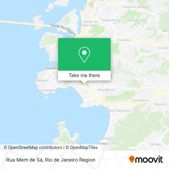
See Rua Mem de Sá, Niterói, on the map
Public Transit to Rua Mem de Sá in Niterói
Wondering how to get to Rua Mem de Sá in Niterói? Moovit helps you find the best way to get to Rua Mem de Sá with step-by-step directions from the nearest public transit station.
Moovit provides free maps and live directions to help you navigate through your city. View schedules, routes, timetables, and find out how long does it take to get to Rua Mem de Sá in real time.
Looking for the nearest stop or station to Rua Mem de Sá? Check out this list of stops closest to your destination: Rua Presidente Backer; Rua Gavião Peixoto 194; R. Pres. Backer 195 - Icaraí Niterói - Rj 24220-041 Brasil; Condomínio Do Edifício Gardenia - Rua Mem De Sá 128 - Icaraí Niterói - Rj 24220-261 Brasil; Hospital São Lucas / Teatro Eduardo Kraichete; Caio Martins; Avenida Prefeito Silvio Picanço 1400; Praça Araribóia ⛴.
Bus: 2740D (EXECUTIVO), 30, 770D, 771D, OC1, OC2, 31, 62, 1910D (EXECUTIVO), 61, 2905D (EXECUTIVO), 570D, 703D, 709D, 750D, 35, 40, 03, 48B.Ferry: PRAÇA ARARIBÓIA - PRAÇA XV, CHARITAS - PRAÇA XV.
Want to see if there’s another route that gets you there at an earlier time? Moovit helps you find alternative routes or times. Get directions from and directions to Rua Mem de Sá easily from the Moovit App or Website.
We make riding to Rua Mem de Sá easy, which is why over 1.5 million users, including users in Niterói, trust Moovit as the best app for public transit. You don’t need to download an individual bus app or train app, Moovit is your all-in-one transit app that helps you find the best bus time or train time available.
For information on prices of bus and ferry, costs and ride fares to Rua Mem de Sá, please check the Moovit app.
Use the app to navigate to popular places including to the airport, hospital, stadium, grocery store, mall, coffee shop, school, college, and university.
Rua Mem de Sá Address: Rua Mem de Sá, 182 - Icaraí, Niterói - RJ, Brasil street in Niterói
- Rua Lopes Trovão 189,
- Pet Home-Pet Shop,
- Crv Imagem Icaraí,
- Núcleo de Yoga Flor de Lótus,
- Dra Patricia Acioly - Dermatologista,
- Otorrinos Reunidos,
- Telex Soluções Auditivas,
- Rua Lopes Trovão / Rua Mem de Sá,
- Esmalteria Nóbrega,
- Rua Lopes Trovão / Rua Gavião Peixoto,
- Diagnosticos Médicos Especializados (DME),
- Escola Municipal Júlia Cortines,
- Blan,
- Padaria Santa Marta,
- Center IV,
- 248,
- Casa do Irmão Juramim,
- Curty E Silva Roupas, Presentes, Utilidades E Acessorios,
- Rua Mem de Sá / Rua Presidente Backer,
- Rua Presidente Backer / Rua Mem de Sá
Places Near Rua Mem de Sá (Niterói)
- Shopping RioSul, Botafogo,
- Avenida Rio Branco, Centro,
- Hospital Federal Do Andaraí, Andaraí,
- Feira Livre da Gloria, Glória,
- Praia do Arpoador, Ipanema,
- Rio De Janeiro,
- Shopping Downtown, Barra Da Tijuca,
- Shopping Rio Sul, Botafogo,
- Shopping Nova América, Del Castilho,
- Avenida Venezuela 134, Saúde,
- Rua Ulysses Guimarães 16, Cidade Nova,
- Norte Shopping, Cachambi,
- Hospital Municipal Ronaldo Gazolla, Acari,
- Hospital Federal Cardoso Fontes, Jacarepaguá,
- Hospital Pedro Ernesto, Vila Isabel,
- Rua Licínio Cardoso, São Francisco Xavier,
- Feirão De Malhas, Duque De Caxias,
- Niterói, Niterói,
- Museu Do Amanhã, Centro,
- Rodoviária Novo Rio (Rodoviária do Rio de Janeiro), Santo Cristo
How to get to popular places in Rio de Janeiro Region with public transit
Get around Niterói by public transit!
Traveling around Niterói has never been so easy. See step by step directions as you travel to any attraction, street or major public transit station. View bus and train schedules, arrival times, service alerts and detailed routes on a map, so you know exactly how to get to anywhere in Niterói.
When traveling to any destination around Niterói use Moovit's Live Directions with Get Off Notifications to know exactly where and how far to walk, how long to wait for your line, and how many stops are left. Moovit will alert you when it's time to get off — no need to constantly re-check whether yours is the next stop.
Wondering how to use public transit in Niterói or how to pay for public transit in Niterói? Moovit public transit app can help you navigate your way with public transit easily, and at minimum cost. It includes public transit fees, ticket prices, and costs. Looking for a map of Niterói public transit lines? Moovit public transit app shows all public transit maps in Niterói with all Bus, Train, Metro, Light Rail, Ferry, Cable Car, Gondola and Funicular routes and stops on an interactive map.
Rio de Janeiro Region has 8 transit type(s), including: Bus, Train, Metro, Light Rail, Ferry, Cable Car, Gondola and Funicular, operated by several transit agencies, including TrensRJ, Metrô Rio, VLT Carioca, Barcas Rio, BRT MOBI-Rio, Auto Viação Alpha, Auto Viação Tijuca, Gire Transportes, Transurb, Viação Nossa Senhora das Graças, Consórcio INTERSUL, Braso Lisboa (Municipal), Caprichosa Auto Ônibus, Auto Viação Três Amigos and Rodoviária Âncora Matias