How to get to Rua Moacir Barbosa Soares by bus?
Click on the bus route to see step by step directions with maps, line arrival times and updated time schedules.
From Rua Sylvio da Rocha Pollis, Barra Da Tijuca
60 minFrom Avenida Armando Lombardi, Barra Da Tijuca
40 minFrom BRT - Estação Barra Shopping, Barra Da Tijuca
27 minFrom Hospital Estadual Carlos Chagas, Marechal Hermes
55 minFrom Rua Aristides Caire, Méier
43 minFrom Banco Bradesco - Agência 2795, Cachambi
41 minFrom Avenida Ministro Edgard Romero, Madureira
53 minFrom BRT - Estação Afrânio Costa, Barra Da Tijuca
35 minFrom Avenida Ayrton Senna, Barra Da Tijuca
34 minFrom Hospital Naval Marcílio Dias, Lins De Vasconcelos
49 min
Bus stops near Rua Moacir Barbosa Soares in Gardênia Azul
- Av. Ten. Cel. Muniz De Aragão | Condomínio Nova Barra, 6 min walk,VIEW
- Av. Ten. Cel. Muniz De Aragão | Rua Guilherme Moreira, 7 min walk,VIEW
- Estr. Engenho D'Água | Caminhos Da Barra, 8 min walk,VIEW
- Praça Da Gardênia Azul - (Linhas 353 E Booster 863), 11 min walk,VIEW
- Apartamentos - Cidade De Deus (1), 13 min walk,VIEW
Funicular station near Rua Moacir Barbosa Soares in Gardênia Azul
- José Roiz De Aragão, 46 min walk,VIEW
Bus lines to Rua Moacir Barbosa Soares in Gardênia Azul
- 829, Gardênia Azul ↔ Freguesia,VIEW
- 932, Tanque,VIEW
- 352, Riocentro - Candelária (Brs 5 - Via Linha Amarela),VIEW
- 368, Riocentro - Candelária (Brs 5 - Via Maracanã),VIEW
- SN 368, Riocentro - Candelária (BRS 5 - via Maracanã),VIEW
- 861, Rio das Pedras - Curicica (Via Gardênia Azul / Largo do Remi),VIEW
- SN 861, Rio das Pedras - Curicica (Via Gardênia Azul / Largo do Remi),VIEW
- 863, Rio das Pedras - Barra da Tijuca (Via Alvorada - Circular),VIEW
- SV 863, Rio das Pedras - Barra da Tijuca (via Floresta),VIEW
- 880, Rio das Pedras - Alvorada,VIEW
- SN 880, Rio das Pedras - Alvorada,VIEW
- 961, Rio das Pedras - Recreio (Expresso - via Ilha Pura / Av. Alfredo Baltazar),VIEW
- 987, Gardênia Azul - Pechincha,VIEW
- 2110, Gardênia Azul / Jardim Clarice - Castelo (Brs 5 - Via Anil),VIEW
- 361, Gardênia Azul (Rio Das Pedras),VIEW
- 862, Rio Das Pedras ↔ Barrashopping (Via Floresta),VIEW
- 353, Gardênia Azul,VIEW
- SN 353, Gardênia Azul ,VIEW
- 550, Gávea,VIEW
- SN 550, Cidade de Deus (Feira Livre),VIEW
What are the closest stations to Rua Moacir Barbosa Soares?
The closest stations to Rua Moacir Barbosa Soares are:
- Av. Ten. Cel. Muniz De Aragão | Condomínio Nova Barra is 410 meters away, 6 min walk.
- Av. Ten. Cel. Muniz De Aragão | Rua Guilherme Moreira is 492 meters away, 7 min walk.
- Estr. Engenho D'Água | Caminhos Da Barra is 548 meters away, 8 min walk.
- Praça Da Gardênia Azul - (Linhas 353 E Booster 863) is 870 meters away, 11 min walk.
- Apartamentos - Cidade De Deus (1) is 954 meters away, 13 min walk.
- José Roiz De Aragão is 3582 meters away, 46 min walk.
Which bus lines stop near Rua Moacir Barbosa Soares?
These bus lines stop near Rua Moacir Barbosa Soares: 692, 861, 862, 863, 880.
What’s the nearest bus station to Rua Moacir Barbosa Soares in Gardênia Azul?
The nearest bus station to Rua Moacir Barbosa Soares in Gardênia Azul is Av. Ten. Cel. Muniz De Aragão | Condomínio Nova Barra. It’s a 6 min walk away.
What time is the first bus to Rua Moacir Barbosa Soares in Gardênia Azul?
The SN 600 is the first bus that goes to Rua Moacir Barbosa Soares in Gardênia Azul. It stops nearby at 3:00 AM.
What time is the last bus to Rua Moacir Barbosa Soares in Gardênia Azul?
The 550 is the last bus that goes to Rua Moacir Barbosa Soares in Gardênia Azul. It stops nearby at 4:06 AM.
What time is the first funicular to Rua Moacir Barbosa Soares in Gardênia Azul?
The IGREJA DA PENNA is the first funicular that goes to Rua Moacir Barbosa Soares in Gardênia Azul. It stops nearby at 8:00 AM.
What time is the last funicular to Rua Moacir Barbosa Soares in Gardênia Azul?
The IGREJA DA PENNA is the last funicular that goes to Rua Moacir Barbosa Soares in Gardênia Azul. It stops nearby at 5:00 PM.
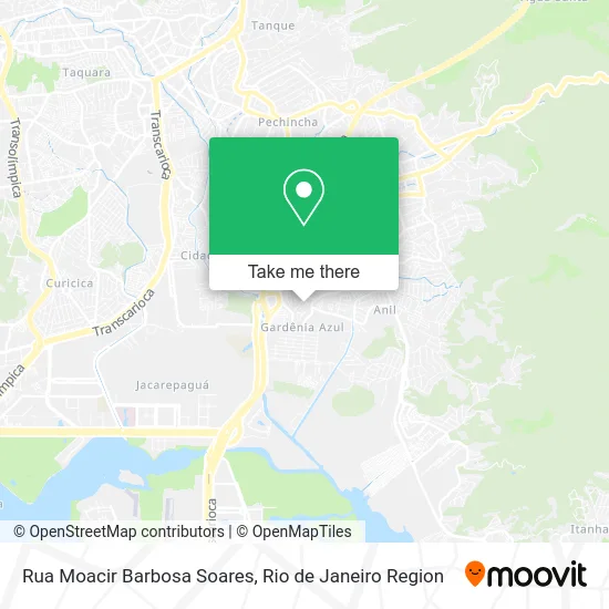
See Rua Moacir Barbosa Soares, Gardênia Azul, on the map
Public Transit to Rua Moacir Barbosa Soares in Gardênia Azul
Wondering how to get to Rua Moacir Barbosa Soares in Gardênia Azul? Moovit helps you find the best way to get to Rua Moacir Barbosa Soares with step-by-step directions from the nearest public transit station.
Moovit provides free maps and live directions to help you navigate through your city. View schedules, routes, timetables, and find out how long does it take to get to Rua Moacir Barbosa Soares in real time.
Looking for the nearest stop or station to Rua Moacir Barbosa Soares? Check out this list of stops closest to your destination: Av. Ten. Cel. Muniz De Aragão | Condomínio Nova Barra; Av. Ten. Cel. Muniz De Aragão | Rua Guilherme Moreira; Estr. Engenho D'Água | Caminhos Da Barra; Praça Da Gardênia Azul - (Linhas 353 E Booster 863); Apartamentos - Cidade De Deus (1); José Roiz De Aragão.
Bus: 692, 861, 862, 863, 880, 829, 932, 352, 368, SN 368, SN 861, 361, 353, SN 353.Funicular: IGREJA DA PENNA.
Want to see if there’s another route that gets you there at an earlier time? Moovit helps you find alternative routes or times. Get directions from and directions to Rua Moacir Barbosa Soares easily from the Moovit App or Website.
We make riding to Rua Moacir Barbosa Soares easy, which is why over 1.5 million users, including users in Gardênia Azul, trust Moovit as the best app for public transit. You don’t need to download an individual bus app or train app, Moovit is your all-in-one transit app that helps you find the best bus time or train time available.
For information on prices of bus, costs and ride fares to Rua Moacir Barbosa Soares, please check the Moovit app.
Use the app to navigate to popular places including to the airport, hospital, stadium, grocery store, mall, coffee shop, school, college, and university.
Rua Moacir Barbosa Soares Address: Gardênia Azul Rio de Janeiro-RJ street in Gardênia Azul
- Rua Ricardo Seabra, 239,
- Condomínio Nova Barra,
- Estrada do Engenho d'Água / Avenida Tenente Coronel Muniz de Aragão,
- Praça Mercedes Batista Santos / Praça Mercedes Baptista dos Santos,
- Drogaria Pacheco,
- Escola Municipal Azerbaijao,
- Momentos Noivas,
- Omozaze Artigos Religiosos,
- Condomínio Caminhos da Barra Mais,
- Desedata Prestacao de Servicos,
- Adonai,
- Beco Do Saci,
- Leonardo Assis,
- Avenida Tenente Coronel Muniz de Aragão Próximo ao 1528,
- Garden,
- Omozaze,
- Sonho Meu Festas & Cia,
- Borracharia Paulo Show,
- Casa do Gesso,
- Porto Rio Gnv
Places Near Rua Moacir Barbosa Soares (Gardênia Azul)
- Rua Ulysses Guimarães 16, Cidade Nova,
- Hospital Pedro Ernesto, Vila Isabel,
- Shopping Nova América, Del Castilho,
- Museu Do Amanhã, Centro,
- Avenida Rio Branco, Centro,
- Norte Shopping, Cachambi,
- Rodoviária Novo Rio (Rodoviária do Rio de Janeiro), Santo Cristo,
- Niterói, Niterói,
- Hospital Federal Cardoso Fontes, Jacarepaguá,
- Avenida Venezuela 134, Saúde,
- Shopping Downtown, Barra Da Tijuca,
- Rua Licínio Cardoso, São Francisco Xavier,
- Hospital Municipal Ronaldo Gazolla, Acari,
- Rio De Janeiro,
- Feira Livre da Gloria, Glória,
- Hospital Federal Do Andaraí, Andaraí,
- Feirão De Malhas, Duque De Caxias,
- Shopping Rio Sul, Botafogo,
- Praia do Arpoador, Ipanema,
- Shopping RioSul, Botafogo
How to get to popular places in Rio de Janeiro Region with public transit
Get around Gardênia Azul by public transit!
Traveling around Gardênia Azul has never been so easy. See step by step directions as you travel to any attraction, street or major public transit station. View bus and train schedules, arrival times, service alerts and detailed routes on a map, so you know exactly how to get to anywhere in Gardênia Azul.
When traveling to any destination around Gardênia Azul use Moovit's Live Directions with Get Off Notifications to know exactly where and how far to walk, how long to wait for your line, and how many stops are left. Moovit will alert you when it's time to get off — no need to constantly re-check whether yours is the next stop.
Wondering how to use public transit in Gardênia Azul or how to pay for public transit in Gardênia Azul? Moovit public transit app can help you navigate your way with public transit easily, and at minimum cost. It includes public transit fees, ticket prices, and costs. Looking for a map of Gardênia Azul public transit lines? Moovit public transit app shows all public transit maps in Gardênia Azul with all Bus, Train, Metro, Light Rail, Ferry, Cable Car, Gondola and Funicular routes and stops on an interactive map.
Rio de Janeiro Region has 8 transit type(s), including: Bus, Train, Metro, Light Rail, Ferry, Cable Car, Gondola and Funicular, operated by several transit agencies, including TrensRJ, Metrô Rio, VLT Carioca, Barcas Rio, BRT MOBI-Rio, Auto Viação Alpha, Auto Viação Tijuca, Gire Transportes, Transurb, Viação Nossa Senhora das Graças, Consórcio INTERSUL, Braso Lisboa (Municipal), Caprichosa Auto Ônibus, Auto Viação Três Amigos and Rodoviária Âncora Matias