Directions to Rua Rodolfo de Souza (Vila Isabel) with public transportation
The following transit lines have routes that pass near Rua Rodolfo de Souza
 Bus: 232, 390, 435, 456, 623.
- Metro: L2.
- Train: RAMAL BELFORD ROXO, RAMAL SANTA CRUZ, RAMAL SARACURUNA, RAMAL DEODORO, RAMAL JAPERI.
How to get to Rua Rodolfo de Souza by bus?
Click on the bus route to see step by step directions with maps, line arrival times and updated time schedules.
From Urca, Urca
52 minFrom Rua da Quitanda, Centro
33 minFrom Estrada de Jacarepaguá, Freguesia (Jacarepaguá)
35 minFrom Praia Da Urca, Urca
50 minFrom Largo Do Bicão, Vila Da Penha
65 minFrom Hospital Balbino, Olaria
53 minFrom Praia Vermelha, Urca
53 minFrom Tribunal De Justiça, Centro
36 minFrom Avenida Epitácio Pessoa, Lagoa
46 minFrom Rua Maria José, Madureira
47 min
How to get to Rua Rodolfo de Souza by train?
Click on the train route to see step by step directions with maps, line arrival times and updated time schedules.
How to get to Rua Rodolfo de Souza by metro?
Click on the metro route to see step by step directions with maps, line arrival times and updated time schedules.
Bus stops near Rua Rodolfo de Souza in Vila Isabel
Metro station near Rua Rodolfo de Souza in Vila Isabel
- Maracanã, 10 min walk,VIEW
Train station near Rua Rodolfo de Souza in Vila Isabel
- Engenho Novo, 17 min walk,VIEW
Bus lines to Rua Rodolfo de Souza in Vila Isabel
- 456, Norte Shopping,VIEW
- 623, Saens Peña (Circular),VIEW
- 627, Inhaúma - Saens Peña (Brs 6 - Via Méier),VIEW
- 630, Iapi da Penha - Saens Peña (Brs 6 - Via Bonsucesso / Benfica),VIEW
- 435, Gávea,VIEW
- 600, Saens Peña (Ⓜ️ S. Fco. Xavier),VIEW
- SN 600, Taquara (Boiúna),VIEW
- 625, Saens Peña,VIEW
- 638, Saens Peña,VIEW
- 639, Jardim América,VIEW
- SN 639, Jardim América,VIEW
- 134B, Vila Isabel (Rápido),VIEW
- 488L, Usina,VIEW
What are the closest stations to Rua Rodolfo de Souza?
The closest stations to Rua Rodolfo de Souza are:
- Rua Barão De São Francisco, 459 is 333 meters away, 5 min walk.
- Rua Mendes Taváres, 40 is 466 meters away, 6 min walk.
- BRS 2 6 7 - Barão De São Francisco is 502 meters away, 7 min walk.
- Praça Barão De Drummond is 612 meters away, 8 min walk.
- Maracanã is 689 meters away, 10 min walk.
- Engenho Novo is 1265 meters away, 17 min walk.
Which bus lines stop near Rua Rodolfo de Souza?
These bus lines stop near Rua Rodolfo de Souza: 232, 390, 435, 456, 623, 630.
Which metro line stops near Rua Rodolfo de Souza?
L2 (Pavuna)
Which train lines stop near Rua Rodolfo de Souza?
These train lines stop near Rua Rodolfo de Souza: RAMAL BELFORD ROXO, RAMAL SANTA CRUZ, RAMAL SARACURUNA.
What’s the nearest metro station to Rua Rodolfo de Souza in Vila Isabel?
The nearest metro station to Rua Rodolfo de Souza in Vila Isabel is Maracanã. It’s a 10 min walk away.
What’s the nearest train station to Rua Rodolfo de Souza in Vila Isabel?
The nearest train station to Rua Rodolfo de Souza in Vila Isabel is Engenho Novo. It’s a 17 min walk away.
What’s the nearest bus station to Rua Rodolfo de Souza in Vila Isabel?
The nearest bus station to Rua Rodolfo de Souza in Vila Isabel is Rua Barão De São Francisco, 459. It’s a 5 min walk away.
What time is the first metro to Rua Rodolfo de Souza in Vila Isabel?
The L2 is the first metro that goes to Rua Rodolfo de Souza in Vila Isabel. It stops nearby at 5:23 AM.
What time is the last metro to Rua Rodolfo de Souza in Vila Isabel?
The L2 is the last metro that goes to Rua Rodolfo de Souza in Vila Isabel. It stops nearby at 12:27 AM.
What time is the first train to Rua Rodolfo de Souza in Vila Isabel?
The RAMAL DEODORO is the first train that goes to Rua Rodolfo de Souza in Vila Isabel. It stops nearby at 4:16 AM.
What time is the last train to Rua Rodolfo de Souza in Vila Isabel?
The RAMAL SANTA CRUZ is the last train that goes to Rua Rodolfo de Souza in Vila Isabel. It stops nearby at 11:51 PM.
What time is the first bus to Rua Rodolfo de Souza in Vila Isabel?
The SN 353 is the first bus that goes to Rua Rodolfo de Souza in Vila Isabel. It stops nearby at 3:05 AM.
What time is the last bus to Rua Rodolfo de Souza in Vila Isabel?
The SN 600 is the last bus that goes to Rua Rodolfo de Souza in Vila Isabel. It stops nearby at 3:45 AM.
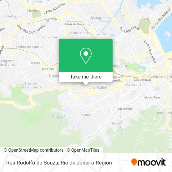
See Rua Rodolfo de Souza, Vila Isabel, on the map
Public Transit to Rua Rodolfo de Souza in Vila Isabel
Wondering how to get to Rua Rodolfo de Souza in Vila Isabel? Moovit helps you find the best way to get to Rua Rodolfo de Souza with step-by-step directions from the nearest public transit station.
Moovit provides free maps and live directions to help you navigate through your city. View schedules, routes, timetables, and find out how long does it take to get to Rua Rodolfo de Souza in real time.
Looking for the nearest stop or station to Rua Rodolfo de Souza? Check out this list of stops closest to your destination: Rua Barão De São Francisco; Rua Mendes Taváres; BRS 2 6 7 - Barão De São Francisco; Praça Barão De Drummond; Maracanã; Engenho Novo.
Bus: 232, 390, 435, 456, 623, 630, 627, 600, SN 600, 625, 638, 134B, 488L.Metro: L2.Train: RAMAL BELFORD ROXO, RAMAL SANTA CRUZ, RAMAL SARACURUNA, RAMAL DEODORO, RAMAL JAPERI.
Want to see if there’s another route that gets you there at an earlier time? Moovit helps you find alternative routes or times. Get directions from and directions to Rua Rodolfo de Souza easily from the Moovit App or Website.
We make riding to Rua Rodolfo de Souza easy, which is why over 1.5 million users, including users in Vila Isabel, trust Moovit as the best app for public transit. You don’t need to download an individual bus app or train app, Moovit is your all-in-one transit app that helps you find the best bus time or train time available.
For information on prices of bus, metro and train, costs and ride fares to Rua Rodolfo de Souza, please check the Moovit app.
Use the app to navigate to popular places including to the airport, hospital, stadium, grocery store, mall, coffee shop, school, college, and university.
Rua Rodolfo de Souza Address: Vila Isabel Rio de Janeiro-RJ street in Vila Isabel
- Rede Economia vila Isabel,
- Creche Casa Dinda,
- Alpha Care,
- Barbearia do Pataoo,
- Sut - Solucao Universal Em Tecnologia,
- Linha 368 - Riocentro / Castelo,
- Marataizes,
- Mozar Derossi Noronha,
- Gabriel,
- Momento Carioca Industria e Comercio,
- Rua Tôrres Homem 1264A,
- Creche Municipal Germinal Da Vila,
- Samuel,
- Barbearia Rogerio e Jack,
- Serralheria e Subempreiteira Rei Davi,
- Gisele Santos Hair,
- Projeto Amar,
- Leo Cobalto,
- Centro Municipal De Saúde Maria Augusta Estrella,
- Benfica club
Places Near Rua Rodolfo de Souza (Vila Isabel)
- Niterói, Niterói,
- Praia do Arpoador, Ipanema,
- Hospital Federal Do Andaraí, Andaraí,
- Feira Livre da Gloria, Glória,
- Hospital Municipal Ronaldo Gazolla, Acari,
- Shopping Nova América, Del Castilho,
- Museu Do Amanhã, Centro,
- Rio De Janeiro,
- Hospital Pedro Ernesto, Vila Isabel,
- Rua Licínio Cardoso, São Francisco Xavier,
- Rua Ulysses Guimarães 16, Cidade Nova,
- Norte Shopping, Cachambi,
- Rodoviária Novo Rio (Rodoviária do Rio de Janeiro), Santo Cristo,
- Shopping RioSul, Botafogo,
- Shopping Downtown, Barra Da Tijuca,
- Hospital Federal Cardoso Fontes, Jacarepaguá,
- Feirão De Malhas, Duque De Caxias,
- Shopping Rio Sul, Botafogo,
- Avenida Venezuela 134, Saúde,
- Avenida Rio Branco, Centro
How to get to popular places in Rio de Janeiro Region with public transit
Get around Vila Isabel by public transit!
Traveling around Vila Isabel has never been so easy. See step by step directions as you travel to any attraction, street or major public transit station. View bus and train schedules, arrival times, service alerts and detailed routes on a map, so you know exactly how to get to anywhere in Vila Isabel.
When traveling to any destination around Vila Isabel use Moovit's Live Directions with Get Off Notifications to know exactly where and how far to walk, how long to wait for your line, and how many stops are left. Moovit will alert you when it's time to get off — no need to constantly re-check whether yours is the next stop.
Wondering how to use public transit in Vila Isabel or how to pay for public transit in Vila Isabel? Moovit public transit app can help you navigate your way with public transit easily, and at minimum cost. It includes public transit fees, ticket prices, and costs. Looking for a map of Vila Isabel public transit lines? Moovit public transit app shows all public transit maps in Vila Isabel with all Bus, Train, Metro, Light Rail, Ferry, Cable Car, Gondola and Funicular routes and stops on an interactive map.
Rio de Janeiro Region has 8 transit type(s), including: Bus, Train, Metro, Light Rail, Ferry, Cable Car, Gondola and Funicular, operated by several transit agencies, including TrensRJ, Metrô Rio, VLT Carioca, Barcas Rio, BRT MOBI-Rio, Auto Viação Alpha, Auto Viação Tijuca, Gire Transportes, Transurb, Viação Nossa Senhora das Graças, Consórcio INTERSUL, Braso Lisboa (Municipal), Caprichosa Auto Ônibus, Auto Viação Três Amigos and Rodoviária Âncora Matias
Public transit lines with stations closest to Rua Rodolfo de Souza in Vila Isabel
Metro lines with stations closest to Rua Rodolfo de Souza in Vila Isabel
Train lines with stations closest to Rua Rodolfo de Souza in Vila Isabel
Bus lines with stations closest to Rua Rodolfo de Souza in Vila Isabel
BRS 2 6 7 - Barão De São Francisco
- 435Grajaú - Gávea (Brs 2 - Via Túnel Santa Bárbara / Túnel Velho)
- 600Taquara - Saens Peña (Brs 7 - Via Cidade de Deus / Vila Isabel)
- SN 600Taquara - Saens Peña (Brs 7 - Via Cidade de Deus / Vila Isabel)
- 625Olaria - Saens Peña (Brs 6 - Via Maria da Graça / Vila Isabel)
- 638Marechal Hermes - Saens Peña (Brs 6 - Via Madureira / Méier / Vila Isabel)