Directions to Rua Santa Luzia (Centro) with public transportation
The following transit lines have routes that pass near Rua Santa Luzia
 Bus: 167, 202, 2100D (EXECUTIVO), 238, 265.
- Metro: L1, L4, L2.
- Train: RAMAL BELFORD ROXO, RAMAL DEODORO, RAMAL SANTA CRUZ, RAMAL SARACURUNA.
- Ferry: ILHA DO GOVERNADOR - PRAÇA XV.
How to get to Rua Santa Luzia by bus?
Click on the bus route to see step by step directions with maps, line arrival times and updated time schedules.
From Praça Saens Peña, Tijuca
26 minFrom Higienópolis, Higienópolis
27 minFrom Hospital Universitário Clementino Fraga Filho, Cidade Universitária (Fundão)
34 minFrom Avenida Roberto Silveira, Niterói
30 minFrom Leblon, Leblon
35 minFrom Hospital Federal da Lagoa, Lagoa
28 minFrom Rua Barão de Mesquita, Tijuca
28 minFrom Cidade da Polícia (CIDPOL), Maria Da Graça
32 minFrom Rua Bruno Lobo 50, Cidade Universitária (Fundão)
36 minFrom Avenida Ataulfo de Paiva, Leblon
34 min
How to get to Rua Santa Luzia by train?
Click on the train route to see step by step directions with maps, line arrival times and updated time schedules.
How to get to Rua Santa Luzia by metro?
Click on the metro route to see step by step directions with maps, line arrival times and updated time schedules.
Bus stops near Rua Santa Luzia in Centro
- Terminal Castelo - Rua Santa Luzia, 1 min walk,VIEW
- Av. Pres. Antônio Carlos 126 - Centro Rio De Janeiro, 3 min walk,VIEW
- Terminal Castelo - Avenida Churchill (Lado B), 3 min walk,VIEW
- Terminal Castelo - Avenida Churchill (Lado A), 4 min walk,VIEW
- BRS 1 / 2 / 3 / 4 / 5 / I - Tribunal Regional Do Trabalho (Pista Lateral), 4 min walk,VIEW
- Avenida Marechal Câmara 1606, 5 min walk,VIEW
- BRS 1 2 3 4 - Franklin Rooselvelt, 5 min walk,VIEW
- Avenida Franklin Roosevelt (Pista Esquerda), 5 min walk,VIEW
- Avenida Franklin Roosevelt (Pista Direita), 5 min walk,VIEW
- Ministério Da Fazenda (Pista Central), 6 min walk,VIEW
- Ponto Final - Castelo, 6 min walk,VIEW
- Praça Do Expedicionário Centro Rio De Janeiro - Rio De Janeiro 20020 Brasil, 7 min walk,VIEW
- Av. General Justo | Aeroporto Santos Dumont ✈, 12 min walk,VIEW
- Avenida General Justo 375, 14 min walk,VIEW
Light Rail stations near Rua Santa Luzia in Centro
- Antônio Carlos, 6 min walk,VIEW
Metro station near Rua Santa Luzia in Centro
- Cinelândia, 8 min walk,VIEW
Ferry station near Rua Santa Luzia in Centro
- Praça XV, 10 min walk,VIEW
Bus lines to Rua Santa Luzia in Centro
- 202, Rio Comprido - Castelo (BRS 1 - via Catumbi / Central),VIEW
- 265, Marechal Hermes - Castelo (Brs 4 - Via Norte Shopping),VIEW
- SN 265, Marechal Hermes - Castelo (BRS 4 - via Terminal Gentileza),VIEW
- 349, Rocha Miranda - Castelo (Brs 4 - Via Vista Alegre / Av. Pres. Vargas),VIEW
- 362, Honório - Castelo (Brs 4),VIEW
- SR 362, Honório - Castelo (Rápido),VIEW
- 378, Marechal Hermes - Castelo (Brs 4),VIEW
- SR 378, Marechal Hermes - Castelo (Rápido),VIEW
- 2721D, Alcântara,VIEW
- 321, Bancários - Castelo (Brs 4 - Via Linha Vermelha),VIEW
- 323, Bananal - Castelo (Brs 4 - via Linha Vermelha),VIEW
- 325, Ribeira - Castelo (Brs 4 - Via Jardim Guanabara / Linha Vermelha),VIEW
- 327, Ribeira - Castelo (Brs 4 - via Linha Vermelha),VIEW
- 350, Irajá - Castelo (Brs 4 - Via Praça das Nações),VIEW
- 2305, Jardim América - Castelo (Brs 4 - Rápido),VIEW
- 232, Castelo,VIEW
- SN 232, Lins,VIEW
- 238, Água Santa,VIEW
- SN 238, Água Santa,VIEW
- 292, Engenho Da Rainha,VIEW
What are the closest stations to Rua Santa Luzia?
The closest stations to Rua Santa Luzia are:
- Terminal Castelo - Rua Santa Luzia is 70 meters away, 1 min walk.
- Av. Pres. Antônio Carlos 126 - Centro Rio De Janeiro is 195 meters away, 3 min walk.
- Terminal Castelo - Avenida Churchill (Lado B) is 226 meters away, 3 min walk.
- Terminal Castelo - Avenida Churchill (Lado A) is 263 meters away, 4 min walk.
- BRS 1 / 2 / 3 / 4 / 5 / I - Tribunal Regional Do Trabalho (Pista Lateral) is 292 meters away, 4 min walk.
- Avenida Marechal Câmara 1606 is 326 meters away, 5 min walk.
- BRS 1 2 3 4 - Franklin Rooselvelt is 333 meters away, 5 min walk.
- Avenida Franklin Roosevelt (Pista Esquerda) is 353 meters away, 5 min walk.
- Avenida Franklin Roosevelt (Pista Direita) is 364 meters away, 5 min walk.
- Ministério Da Fazenda (Pista Central) is 402 meters away, 6 min walk.
- Ponto Final - Castelo is 442 meters away, 6 min walk.
- Antônio Carlos is 457 meters away, 6 min walk.
- Praça Do Expedicionário Centro Rio De Janeiro - Rio De Janeiro 20020 Brasil is 506 meters away, 7 min walk.
- Cinelândia is 592 meters away, 8 min walk.
- Praça XV is 734 meters away, 10 min walk.
- Av. General Justo | Aeroporto Santos Dumont ✈ is 879 meters away, 12 min walk.
- Avenida General Justo 375 is 1020 meters away, 14 min walk.
Which bus lines stop near Rua Santa Luzia?
These bus lines stop near Rua Santa Luzia: 167, 202, 2100D (EXECUTIVO), 238, 265, 321, 323, 637T, SR 362.
Which metro lines stop near Rua Santa Luzia?
These metro lines stop near Rua Santa Luzia: L1, L4, L2.
Which train lines stop near Rua Santa Luzia?
These train lines stop near Rua Santa Luzia: RAMAL BELFORD ROXO, RAMAL DEODORO, RAMAL SANTA CRUZ, RAMAL SARACURUNA.
What’s the nearest light rail station to Rua Santa Luzia in Centro?
The nearest light rail station to Rua Santa Luzia in Centro is Antônio Carlos. It’s a 6 min walk away.
What’s the nearest metro station to Rua Santa Luzia in Centro?
The nearest metro station to Rua Santa Luzia in Centro is Cinelândia. It’s a 8 min walk away.
What’s the nearest bus station to Rua Santa Luzia in Centro?
The nearest bus station to Rua Santa Luzia in Centro is Terminal Castelo - Rua Santa Luzia. It’s a 1 min walk away.
What’s the nearest ferry station to Rua Santa Luzia in Centro?
The nearest ferry station to Rua Santa Luzia in Centro is Praça XV. It’s a 10 min walk away.
What time is the first light rail to Rua Santa Luzia in Centro?
The L1 is the first light rail that goes to Rua Santa Luzia in Centro. It stops nearby at 5:00 AM.
What time is the last light rail to Rua Santa Luzia in Centro?
The L1 is the last light rail that goes to Rua Santa Luzia in Centro. It stops nearby at 11:30 PM.
What time is the first metro to Rua Santa Luzia in Centro?
The L2 is the first metro that goes to Rua Santa Luzia in Centro. It stops nearby at 5:08 AM.
What time is the last metro to Rua Santa Luzia in Centro?
The L2 is the last metro that goes to Rua Santa Luzia in Centro. It stops nearby at 12:42 AM.
What time is the first bus to Rua Santa Luzia in Centro?
The SN 265 is the first bus that goes to Rua Santa Luzia in Centro. It stops nearby at 3:00 AM.
What time is the last bus to Rua Santa Luzia in Centro?
The 378 is the last bus that goes to Rua Santa Luzia in Centro. It stops nearby at 3:39 AM.
What time is the first ferry to Rua Santa Luzia in Centro?
The ILHA DO GOVERNADOR - PRAÇA XV is the first ferry that goes to Rua Santa Luzia in Centro. It stops nearby at 7:45 AM.
What time is the last ferry to Rua Santa Luzia in Centro?
The ILHA DO GOVERNADOR - PRAÇA XV is the last ferry that goes to Rua Santa Luzia in Centro. It stops nearby at 6:30 PM.
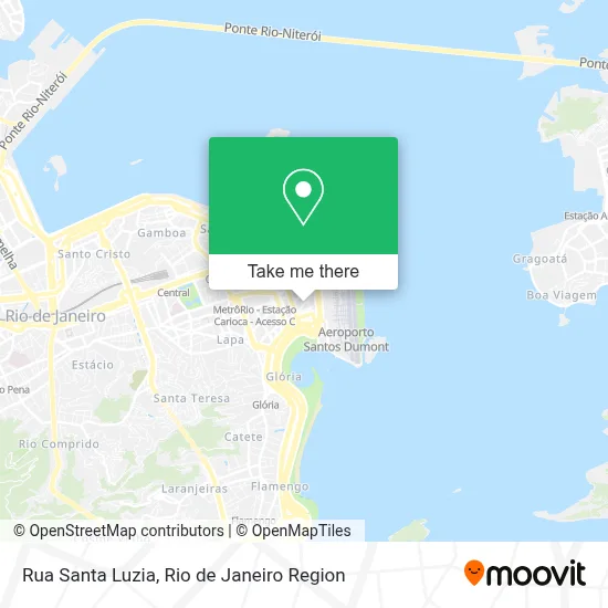
See Rua Santa Luzia, Centro, on the map
Public Transit to Rua Santa Luzia in Centro
Wondering how to get to Rua Santa Luzia in Centro? Moovit helps you find the best way to get to Rua Santa Luzia with step-by-step directions from the nearest public transit station.
Moovit provides free maps and live directions to help you navigate through your city. View schedules, routes, timetables, and find out how long does it take to get to Rua Santa Luzia in real time.
Looking for the nearest stop or station to Rua Santa Luzia? Check out this list of stops closest to your destination: Terminal Castelo - Rua Santa Luzia; Av. Pres. Antônio Carlos 126 - Centro Rio De Janeiro; Terminal Castelo - Avenida Churchill (Lado B); Terminal Castelo - Avenida Churchill (Lado A); BRS 1 / 2 / 3 / 4 / 5 / I - Tribunal Regional Do Trabalho (Pista Lateral); Avenida Marechal Câmara 1606; BRS 1 2 3 4 - Franklin Rooselvelt; Avenida Franklin Roosevelt (Pista Esquerda); Avenida Franklin Roosevelt (Pista Direita); Ministério Da Fazenda (Pista Central); Ponto Final - Castelo; Antônio Carlos; Praça Do Expedicionário Centro Rio De Janeiro - Rio De Janeiro 20020 Brasil; Cinelândia; Praça XV; Av. General Justo | Aeroporto Santos Dumont ✈; Avenida General Justo 375.
Bus: 167, 202, 2100D (EXECUTIVO), 238, 265, 321, 323, 637T, SR 362, SN 265, 349, 362, 2721D, 325, 327, 350, 232, SN 232, SN 238, 292.Metro: L1, L4, L2.Train: RAMAL BELFORD ROXO, RAMAL DEODORO, RAMAL SANTA CRUZ, RAMAL SARACURUNA.Ferry: ILHA DO GOVERNADOR - PRAÇA XV.
Want to see if there’s another route that gets you there at an earlier time? Moovit helps you find alternative routes or times. Get directions from and directions to Rua Santa Luzia easily from the Moovit App or Website.
We make riding to Rua Santa Luzia easy, which is why over 1.5 million users, including users in Centro, trust Moovit as the best app for public transit. You don’t need to download an individual bus app or train app, Moovit is your all-in-one transit app that helps you find the best bus time or train time available.
For information on prices of bus, metro and train, costs and ride fares to Rua Santa Luzia, please check the Moovit app.
Use the app to navigate to popular places including to the airport, hospital, stadium, grocery store, mall, coffee shop, school, college, and university.
Rua Santa Luzia Address: Centro Rio de Janeiro-RJ street in Centro
- Estacionamento Rotativo,
- Santa Casa de Misericórdia do Rio de Janeiro-Hospital Geral,
- Santa Casa da Misericórdia,
- Estacionamento Rotativo Santa Luzia,
- Novotel RJ Santos Dumont Rio de Janeiro,
- Ptmv Terminal Santa Luzia - Plataforma C,
- Rua Santa Luzia 206,
- Avenida Churchill Próximo ao 157,
- Clasp Clube de Assistencia dos Servidores Publicos Federais,
- Avenida Churchill, 129,
- Rua Santa Luzia / Rua Santa Casa de Misericórdia,
- Avenida Marechal Câmara / Rua Santa Luzia,
- Clube de Xadrez Guanabara,
- Beco da Música,
- Defensoria Pública do Estado do Rio de Janeiro ,
- Instituto de Dermatologia Prof. Rubem David Azulay - Santa Casa da Misericórdia do Rio de Janeiro,
- Avenida Marechal Câmara / Avenida Churchill,
- Dermatologia Azulay,
- Ministério Público do Estado do Rio de Janeiro (MP-RJ),
- ibis Rio de Janeiro Santos Dumont
Places Near Rua Santa Luzia (Centro)
- Shopping Nova América, Del Castilho,
- Feirão De Malhas, Duque De Caxias,
- Shopping RioSul, Botafogo,
- Norte Shopping, Cachambi,
- Feira Livre da Gloria, Glória,
- Hospital Federal Cardoso Fontes, Jacarepaguá,
- Hospital Pedro Ernesto, Vila Isabel,
- Rua Licínio Cardoso, São Francisco Xavier,
- Rua Ulysses Guimarães 16, Cidade Nova,
- Praia do Arpoador, Ipanema,
- Hospital Municipal Ronaldo Gazolla, Acari,
- Niterói, Niterói,
- Rodoviária Novo Rio (Rodoviária do Rio de Janeiro), Santo Cristo,
- Museu Do Amanhã, Centro,
- Avenida Venezuela 134, Saúde,
- Avenida Rio Branco, Centro,
- Hospital Federal Do Andaraí, Andaraí,
- Rio De Janeiro,
- Shopping Downtown, Barra Da Tijuca,
- Shopping Rio Sul, Botafogo
How to get to popular places in Rio de Janeiro Region with public transit
Get around Centro by public transit!
Traveling around Centro has never been so easy. See step by step directions as you travel to any attraction, street or major public transit station. View bus and train schedules, arrival times, service alerts and detailed routes on a map, so you know exactly how to get to anywhere in Centro.
When traveling to any destination around Centro use Moovit's Live Directions with Get Off Notifications to know exactly where and how far to walk, how long to wait for your line, and how many stops are left. Moovit will alert you when it's time to get off — no need to constantly re-check whether yours is the next stop.
Wondering how to use public transit in Centro or how to pay for public transit in Centro? Moovit public transit app can help you navigate your way with public transit easily, and at minimum cost. It includes public transit fees, ticket prices, and costs. Looking for a map of Centro public transit lines? Moovit public transit app shows all public transit maps in Centro with all Bus, Train, Metro, Light Rail, Ferry, Cable Car, Gondola and Funicular routes and stops on an interactive map.
Rio de Janeiro Region has 8 transit type(s), including: Bus, Train, Metro, Light Rail, Ferry, Cable Car, Gondola and Funicular, operated by several transit agencies, including TrensRJ, Metrô Rio, VLT Carioca, Barcas Rio, BRT MOBI-Rio, Auto Viação Alpha, Auto Viação Tijuca, Gire Transportes, Transurb, Viação Nossa Senhora das Graças, Consórcio INTERSUL, Braso Lisboa (Municipal), Caprichosa Auto Ônibus, Auto Viação Três Amigos and Rodoviária Âncora Matias