Directions to Ruby Chelsea Nyc (Manhattan) with public transportation
The following transit lines have routes that pass near Ruby Chelsea Nyc
 Bus: BXM4, M11, M20, M7, Q32.
- Train: EMPIRE SERVICE, PORT WASHINGTON BRANCH, YEL, ACELA, ADIRONDACK.
- Subway: 1, 2, C, E, A.
How to get to Ruby Chelsea Nyc by bus?
Click on the bus route to see step by step directions with maps, line arrival times and updated time schedules.
From Metro North Station, Yankee Stadium, Bronx
74 minFrom One Battery Park Plaza, Manhattan
45 minFrom Middle Village, NY, Queens
56 minFrom Rucker Park, Manhattan
76 minFrom Statue of Liberty Ferry, Manhattan
47 minFrom Costco, Manhattan
77 minFrom Hobby Lobby, Queens
67 minFrom MetLife Stadium, East Rutherford
53 minFrom Walmart, Secaucus
53 min
How to get to Ruby Chelsea Nyc by train?
Click on the train route to see step by step directions with maps, line arrival times and updated time schedules.
How to get to Ruby Chelsea Nyc by subway?
Click on the subway route to see step by step directions with maps, line arrival times and updated time schedules.
Subway stations near Ruby Chelsea Nyc in Manhattan
Bus stops near Ruby Chelsea Nyc in Manhattan
Train station near Ruby Chelsea Nyc in Manhattan
- 34 St-Penn Station, 4 min walk,VIEW
Bus lines to Ruby Chelsea Nyc in Manhattan
- M20, Lincoln Center 66 St Via 8 Av,VIEW
- M7, 14 St Via Columbus Via 7 Av,VIEW
- FLIXBUS N2470, Atlanta - DC - NYC,VIEW
- FLIXBUS N2471, NYC Chinatown - Atlanta,VIEW
- FLIXBUS 2601, NYC - Washington DC,VIEW
- FLIXBUS N2601, NYC - Richmond - Virginia Beach,VIEW
- FLIXBUS 2602, NYC - Philadelphia,VIEW
- FLIXBUS 2605, NYC - Richmond,VIEW
- FLIXBUS N2605, Boston - NYC - Richmond,VIEW
- FLIXBUS 2610, NYC - Boston,VIEW
- FLIXBUS N2610, NYC - Boston,VIEW
- FLIXBUS N2615, NYC - Boston - Portland - Bangor,VIEW
- FLIXBUS 2616, NYC - Providence,VIEW
- FLIXBUS N2640, NYC - Pittsburgh - Chicago,VIEW
- FLIXBUS N2641, NYC - Cleveland - Chicago,VIEW
- FLIXBUS 2642, NYC - Pittsburgh,VIEW
- FLIXBUS N2642, NYC - Cincinnati - Chicago,VIEW
- FLIXBUS 2650, New York - Reading,VIEW
- FLIXBUS 2651, New York - Allentown - Philadelphia,VIEW
- FLIXBUS 2654, New York - DC - Pittsburgh,VIEW
What are the closest stations to Ruby Chelsea Nyc?
The closest stations to Ruby Chelsea Nyc are:
- 34 St-Penn Station is 79 yards away, 1 min walk.
- 8 Av/W 28 St is 109 yards away, 2 min walk.
- 28 St is 183 yards away, 3 min walk.
- 7 Av/W 28 St is 231 yards away, 3 min walk.
- New York Midtown (31st St & 8th Ave) is 379 yards away, 5 min walk.
- W 26th St & 7th Ave is 418 yards away, 5 min walk.
- 9 Av/W 28 St is 472 yards away, 6 min walk.
- W 32 St/7 Av is 639 yards away, 8 min walk.
Which bus lines stop near Ruby Chelsea Nyc?
These bus lines stop near Ruby Chelsea Nyc: BXM4, M11, M20, M7, Q32, QM24, X37.
Which train lines stop near Ruby Chelsea Nyc?
These train lines stop near Ruby Chelsea Nyc: EMPIRE SERVICE, PORT WASHINGTON BRANCH, YEL.
Which subway lines stop near Ruby Chelsea Nyc?
These subway lines stop near Ruby Chelsea Nyc: 1, 2, C, E.
What’s the nearest subway station to Ruby Chelsea Nyc in Manhattan?
The nearest subway station to Ruby Chelsea Nyc in Manhattan is 34 St-Penn Station. It’s a 1 min walk away.
What’s the nearest train station to Ruby Chelsea Nyc in Manhattan?
The nearest train station to Ruby Chelsea Nyc in Manhattan is 34 St-Penn Station. It’s a 4 min walk away.
What’s the nearest bus station to Ruby Chelsea Nyc in Manhattan?
The nearest bus station to Ruby Chelsea Nyc in Manhattan is 8 Av/W 28 St. It’s a 2 min walk away.
What time is the first subway to Ruby Chelsea Nyc in Manhattan?
The E is the first subway that goes to Ruby Chelsea Nyc in Manhattan. It stops nearby at 3:00 AM.
What time is the last subway to Ruby Chelsea Nyc in Manhattan?
The 2 is the last subway that goes to Ruby Chelsea Nyc in Manhattan. It stops nearby at 3:58 AM.
What time is the first train to Ruby Chelsea Nyc in Manhattan?
The PORT JEFFERSON BRANCH is the first train that goes to Ruby Chelsea Nyc in Manhattan. It stops nearby at 3:01 AM.
What time is the last train to Ruby Chelsea Nyc in Manhattan?
The RONKONKOMA BRANCH is the last train that goes to Ruby Chelsea Nyc in Manhattan. It stops nearby at 3:15 AM.
What time is the first bus to Ruby Chelsea Nyc in Manhattan?
The FLIXBUS N2605 is the first bus that goes to Ruby Chelsea Nyc in Manhattan. It stops nearby at 3:00 AM.
What time is the last bus to Ruby Chelsea Nyc in Manhattan?
The FLIXBUS N2640 is the last bus that goes to Ruby Chelsea Nyc in Manhattan. It stops nearby at 4:30 PM.
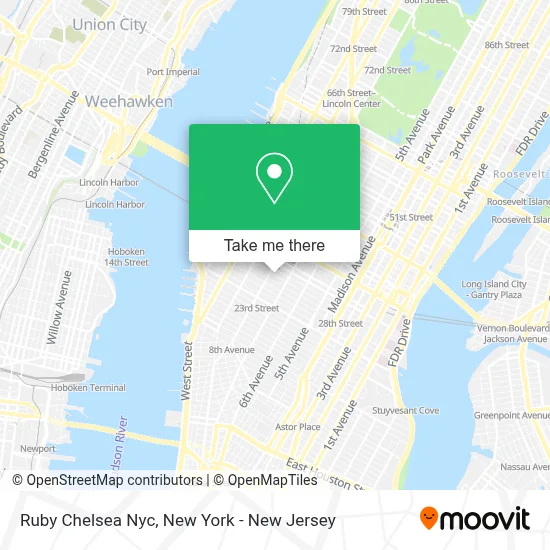
See Ruby Chelsea Nyc, Manhattan, on the map
Public Transit to Ruby Chelsea Nyc in Manhattan
Wondering how to get to Ruby Chelsea Nyc in Manhattan? Moovit helps you find the best way to get to Ruby Chelsea Nyc with step-by-step directions from the nearest public transit station.
Moovit provides free maps and live directions to help you navigate through your city. View schedules, routes, timetables, and find out how long does it take to get to Ruby Chelsea Nyc in real time.
Looking for the nearest stop or station to Ruby Chelsea Nyc? Check out this list of stops closest to your destination: 34 St-Penn Station; 8 Av/W 28 St; 28 St; 7 Av/W 28 St; New York Midtown (31st St & 8th Ave); W 26th St & 7th Ave; 9 Av/W 28 St; W 32 St/7 Av.
Bus: BXM4, M11, M20, M7, Q32, QM24, X37, FLIXBUS N2470, FLIXBUS N2471, FLIXBUS 2601, FLIXBUS N2601, FLIXBUS 2602.Train: EMPIRE SERVICE, PORT WASHINGTON BRANCH, YEL, ACELA, ADIRONDACK, BERKSHIRE FLYER, CARDINAL, CAROLINIAN.Subway: 1, 2, C, E, A.
Want to see if there’s another route that gets you there at an earlier time? Moovit helps you find alternative routes or times. Get directions from and directions to Ruby Chelsea Nyc easily from the Moovit App or Website.
We make riding to Ruby Chelsea Nyc easy, which is why over 1.5 million users, including users in Manhattan, trust Moovit as the best app for public transit. You don’t need to download an individual bus app or train app, Moovit is your all-in-one transit app that helps you find the best bus time or train time available.
For information on prices of subway, bus and train, costs and ride fares to Ruby Chelsea Nyc, please check the Moovit app.
Use the app to navigate to popular places including to the airport, hospital, stadium, grocery store, mall, coffee shop, school, college, and university.
Ruby Chelsea Nyc Address: 243 W 28th St street in Manhattan
- Local Locker Storage,
- Rumi Event Space,
- High School of Fashion Industries,
- Empire United Fencing,
- Funniest Family Moments,
- Mg Imaging,
- Amazon Locker - Alumni Hall,
- Holiday Inn Express New York City - Chelsea,
- Ahrc Traumatic Brain Injury,
- Atm 7eleven-Fcti,
- 34 St 8 Ave,
- Holiday Inn Express New York City Chelsea an IHG Hotel,
- Indeed Thoughts,
- Keyme Locksmiths,
- Holiday Inn Express-NYC Madison Square Garden,
- Josh Wood Productions,
- Siddha Yoga Meditation Center,
- Lites on West Soho,
- Metroclick Touch Screen Digital Signage Company,
- Alvita Care
Places Near Ruby Chelsea Nyc (Manhattan)
- 66 John Street, Manhattan,
- 111 Centre New York City Supreme Court, Manhattan,
- Katz's Deli, Manhattan,
- SoHo, Manhattan,
- Pier 83, Manhattan,
- Rockefeller Center, Manhattan,
- Hudson Yards, Manhattan,
- 26 Federal Plaza, Manhattan,
- Queens Center Mall, Queens,
- Times Square, Manhattan,
- 376 Hudson Street, Manhattan,
- Bellevue Hospital, Manhattan,
- Chinatown, Manhattan,
- 3 Stone St, Manhattan,
- 911 Memorial, Manhattan,
- Mountainside Hospital, Glen Ridge,
- 1 Police Plaza, Manhattan,
- Wall Street, Manhattan,
- qqqq, Manhattan,
- San Gennaro Feast, Manhattan
How to get to popular places in New York - New Jersey with public transit
Get around Manhattan by public transit!
Traveling around Manhattan has never been so easy. See step by step directions as you travel to any attraction, street or major public transit station. View bus and train schedules, arrival times, service alerts and detailed routes on a map, so you know exactly how to get to anywhere in Manhattan.
When traveling to any destination around Manhattan use Moovit's Live Directions with Get Off Notifications to know exactly where and how far to walk, how long to wait for your line, and how many stops are left. Moovit will alert you when it's time to get off — no need to constantly re-check whether yours is the next stop.
Wondering how to use public transit in Manhattan or how to pay for public transit in Manhattan? Moovit public transit app can help you navigate your way with public transit easily, and at minimum cost. It includes public transit fees, ticket prices, and costs. Looking for a map of Manhattan public transit lines? Moovit public transit app shows all public transit maps in Manhattan with all Bus, Train, Subway, Light Rail, Ferry and Cable Car routes and stops on an interactive map.
New York - New Jersey has 6 transit type(s), including: Bus, Train, Subway, Light Rail, Ferry and Cable Car, operated by several transit agencies, including MTA Subway, Metro-North Railroad, LIRR, PATH, MTA New York City Transit - Express routes, MTA Bus, NJ Transit, NYC Ferry, NICE bus, Bee-Line Bus, NJ Transit Rail, Norwalk Transit District, Hartford Line, River Valley Transit and HART