How to get to Rue Berger by bus?
Click on the bus route to see step by step directions with maps, line arrival times and updated time schedules.
From Bois de Boulogne, Paris
75 minFrom Pavillon d'Armenonville, Paris
69 minFrom Cirque Pinder, Paris
48 minFrom Hôpital Marie Lannelongue, Le Plessis-Robinson
85 minFrom Crématorium du Mont-Valérien, Arrondissement de Nanterre
109 minFrom Basilique Saint-Denis, Saint-Denis
85 minFrom Crematorium du Mont Valérien, Nanterre
99 minFrom Paris Expo Porte de Versailles, Paris
53 minFrom Rosny 2, Rosny-Sous-Bois
94 minFrom Crematorium de Clamart, Clamart
88 min
How to get to Rue Berger by metro?
Click on the metro route to see step by step directions with maps, line arrival times and updated time schedules.
Bus stops near Rue Berger in Paris
Metro station near Rue Berger in Paris
- Châtelet, 4 min walk,VIEW
RER station near Rue Berger in Paris
- Châtelet - Les Halles, 8 min walk,VIEW
Bus lines to Rue Berger in Paris
- 74, Berges de Seine,VIEW
- 85, Châtelet,VIEW
- N15, Gabriel Péri - Métro,VIEW
- N16, Pont de Levallois - Bécon,VIEW
- 29, Porte de Montempoivre,VIEW
- 67, Palais Royal - Musée du Louvre,VIEW
- 21, Stade Charléty - Porte de Gentilly,VIEW
- 69, Champs de Mars,VIEW
- 72, Parc de Saint-Cloud,VIEW
- N11, Pont de Neuilly - Métro,VIEW
- N24, Porte Maillot - Grande Armée,VIEW
- 38, Porte de la Chapelle,VIEW
- N12, Romainville - Carnot,VIEW
- N13, Bobigny - Pablo Picasso,VIEW
- N14, Mairie de Saint-Ouen - République,VIEW
- N23, Porte Des Lilas,VIEW
What are the closest stations to Rue Berger?
The closest stations to Rue Berger are:
- Bourse de Commerce is 136 meters away, 2 min walk.
- Etienne Marcel - Montmartre is 220 meters away, 3 min walk.
- Rivoli - Pont Neuf is 247 meters away, 4 min walk.
- Châtelet is 297 meters away, 4 min walk.
- Les Halles - Centre Georges Pompidou is 390 meters away, 6 min walk.
- Châtelet - Les Halles is 583 meters away, 8 min walk.
Which bus lines stop near Rue Berger?
These bus lines stop near Rue Berger: 38, 39, 58, 70, 72, 76.
Which metro lines stop near Rue Berger?
These metro lines stop near Rue Berger: 1, 11, 14, 4.
Which RER lines stop near Rue Berger?
These RER lines stop near Rue Berger: A, B.
What’s the nearest metro station to Rue Berger in Paris?
The nearest metro station to Rue Berger in Paris is Châtelet. It’s a 4 min walk away.
What’s the nearest bus station to Rue Berger in Paris?
The nearest bus station to Rue Berger in Paris is Bourse de Commerce. It’s a 2 min walk away.
What’s the nearest RER station to Rue Berger in Paris?
The nearest RER station to Rue Berger in Paris is Châtelet - Les Halles. It’s a 8 min walk away.
What time is the first metro to Rue Berger in Paris?
The 14 is the first metro that goes to Rue Berger in Paris. It stops nearby at 5:30 AM.
What time is the last metro to Rue Berger in Paris?
The 11 is the last metro that goes to Rue Berger in Paris. It stops nearby at 1:15 AM.
What time is the first bus to Rue Berger in Paris?
The N16 is the first bus that goes to Rue Berger in Paris. It stops nearby at 3:06 AM.
What time is the last bus to Rue Berger in Paris?
The N16 is the last bus that goes to Rue Berger in Paris. It stops nearby at 3:34 AM.
What time is the first RER to Rue Berger in Paris?
The D is the first RER that goes to Rue Berger in Paris. It stops nearby at 5:17 AM.
What time is the last RER to Rue Berger in Paris?
The A is the last RER that goes to Rue Berger in Paris. It stops nearby at 1:02 AM.
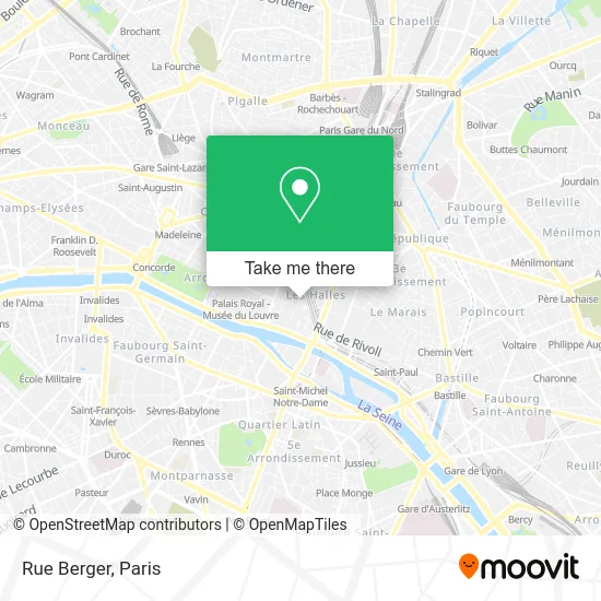
See Rue Berger, Paris, on the map
Public Transit to Rue Berger in Paris
Wondering how to get to Rue Berger in Paris? Moovit helps you find the best way to get to Rue Berger with step-by-step directions from the nearest public transit station.
Moovit provides free maps and live directions to help you navigate through your city. View schedules, routes, timetables, and find out how long does it take to get to Rue Berger in real time.
Looking for the nearest stop or station to Rue Berger? Check out this list of stops closest to your destination: Bourse de Commerce; Etienne Marcel - Montmartre; Rivoli - Pont Neuf; Châtelet; Les Halles - Centre Georges Pompidou; Châtelet - Les Halles.
Bus: 38, 39, 58, 70, 72, 76, 74, 85, N15, N16, 29, 67, 21, 69, N11, N24.Metro: 1, 11, 14, 4, 7.RER: A, B, D.
Want to see if there’s another route that gets you there at an earlier time? Moovit helps you find alternative routes or times. Get directions from and directions to Rue Berger easily from the Moovit App or Website.
We make riding to Rue Berger easy, which is why over 1.5 million users, including users in Paris, trust Moovit as the best app for public transit. You don’t need to download an individual bus app or train app, Moovit is your all-in-one transit app that helps you find the best bus time or train time available.
For information on prices of metro, bus, RER and light rail, costs and ride fares to Rue Berger, please check the Moovit app.
Use the app to navigate to popular places including to the airport, hospital, stadium, grocery store, mall, coffee shop, school, college, and university.
Rue Berger Address: Rue Berger, 75001 Paris, France street in Paris
- Porte du Pont Neuf,
- 1 Porte Pont Neuf,
- Muji,
- 23 Rue Berger,
- Au Chien Qui Fume,
- Hippopotamus,
- DARTY Les Halles,
- Indiana Café – Les Halles,
- 15 Rue de Rivoli,
- Place Carrée,
- Le Molière,
- Devred,
- Le Sous Bock,
- Le Paradis du Fruit,
- Photobooth,
- Gymnase Suzanne Berlioux,
- Starbucks,
- Camaieu @ Les Halles,
- Agence Ratp,
- Rue de l'Arbre Sec
Places Near Rue Berger (Paris)
- Créteil Soleil, Creteil,
- Hopital Lariboisière, Paris,
- Gare Routière Flixbus, Paris,
- 29 Rue Manin, Paris,
- Théâtre Mogador, Paris,
- Hôpital Beaujon, Clichy,
- Hôpital Cochin, Paris,
- Hôpital Henri Mondor, Creteil,
- Atelier Des Lumieres, Paris,
- Marché Saint-Pierre, Paris,
- Institut Curie, Paris,
- Hopital Foch, Suresnes,
- Centre Hospitalier des 15/20, Paris,
- Hôpital Saint-Joseph, Paris,
- Galeries Lafayette, Paris,
- Hôpital Pitié Salpêtrière, Paris,
- Fondation Louis Vuitton, Paris,
- Hôpital de la Pitié-Salpêtrière, Paris,
- Hôpital Necker, Paris,
- Galeries Lafayette Haussmann, Paris
How to get to popular places in Paris with public transit
Get around Paris by public transit!
Traveling around Paris has never been so easy. See step by step directions as you travel to any attraction, street or major public transit station. View bus and train schedules, arrival times, service alerts and detailed routes on a map, so you know exactly how to get to anywhere in Paris.
When traveling to any destination around Paris use Moovit's Live Directions with Get Off Notifications to know exactly where and how far to walk, how long to wait for your line, and how many stops are left. Moovit will alert you when it's time to get off — no need to constantly re-check whether yours is the next stop.
Wondering how to use public transit in Paris or how to pay for public transit in Paris? Moovit public transit app can help you navigate your way with public transit easily, and at minimum cost. It includes public transit fees, ticket prices, and costs. Looking for a map of Paris public transit lines? Moovit public transit app shows all public transit maps in Paris with all Bus, Train, Metro, Light Rail, RER, Funicular and Gondola routes and stops on an interactive map.
Paris has 7 transit type(s), including: Bus, Train, Metro, Light Rail, RER, Funicular and Gondola, operated by several transit agencies, including RATP, RER, RER Bus de remplacement, Train, Train Bus de remplacement, Tramway Bus de remplacement, TER, ADP, Magical Shuttle, Argenteuil - Boucles de Seine, Autocars Dominique, Bièvre, Brie et 2 Morin, Le Bus - C.C. du Clermontois and Cœur d’Essonne