How to get to Rue Pierre Nicole by bus?
Click on the bus route to see step by step directions with maps, line arrival times and updated time schedules.
From Saint-Cloud, Saint-Cloud
97 minFrom Meudon-la-Forêt, Meudon
81 minFrom Mairie du 19e arrondissement, Paris
49 minFrom Mairie du 19ème, Paris
50 minFrom Saint-Denis, Saint-Denis
88 minFrom Paris La Défense Arena, Nanterre
94 minFrom Havas Village, Puteaux
71 minFrom Parc zoologique de Paris, Paris
68 minFrom Paris la Défense Arena, Arrondissement de Nanterre
94 minFrom Basilique du Sacré-Cœur, Paris
51 min
How to get to Rue Pierre Nicole by train?
Click on the train route to see step by step directions with maps, line arrival times and updated time schedules.
How to get to Rue Pierre Nicole by metro?
Click on the metro route to see step by step directions with maps, line arrival times and updated time schedules.
From Mairie du 19e arrondissement, Paris
47 minFrom Mairie du 19ème, Paris
48 minFrom Saint-Denis, Saint-Denis
45 minFrom Paris La Défense Arena, Nanterre
56 minFrom Havas Village, Puteaux
60 minFrom Parc zoologique de Paris, Paris
48 minFrom Paris la Défense Arena, Arrondissement de Nanterre
56 minFrom Basilique du Sacré-Cœur, Paris
46 min
Bus stops near Rue Pierre Nicole in Paris
RER station near Rue Pierre Nicole in Paris
- Luxembourg, 7 min walk,VIEW
Bus lines to Rue Pierre Nicole in Paris
- 83, Porte D'Ivry,VIEW
- 91, Gare de Lyon - Diderot,VIEW
- N02, Gare Montparnasse,VIEW
- N01, Gare de L'Est,VIEW
- 38, Porte D'Orléans,VIEW
- 82, Hôpital Américain,VIEW
- N14, Mairie de Saint-Ouen - République,VIEW
- N21, Châtelet,VIEW
- N123, Gare D'Arpajon,VIEW
- N122, Châtelet,VIEW
- 21, Stade Charléty - Porte de Gentilly,VIEW
- 24, Ecole Vétérinaire de Maisons-Alfort,VIEW
- 27, Gare Saint-Lazare,VIEW
What are the closest stations to Rue Pierre Nicole?
The closest stations to Rue Pierre Nicole are:
- Vavin is 173 meters away, 3 min walk.
- Port Royal - Saint-Jacques is 237 meters away, 4 min walk.
- Port Royal is 248 meters away, 4 min walk.
- Val de Grâce is 280 meters away, 4 min walk.
- Feuillantines is 468 meters away, 6 min walk.
- Raspail is 478 meters away, 7 min walk.
- Luxembourg is 501 meters away, 7 min walk.
Which train line stops near Rue Pierre Nicole?
N (Rambouillet/ Mantes-la-Jolie/ Dreux)
Which RER line stops near Rue Pierre Nicole?
B (Saint Rémy les Chèvreuses/ Massy Palaiseau/ Robinson)
Which metro lines stop near Rue Pierre Nicole?
These metro lines stop near Rue Pierre Nicole: 4, 6.
Which bus lines stop near Rue Pierre Nicole?
These bus lines stop near Rue Pierre Nicole: 24, 27, 38, 75, 83.
What’s the nearest metro station to Rue Pierre Nicole in Paris?
The nearest metro station to Rue Pierre Nicole in Paris is Vavin. It’s a 3 min walk away.
What’s the nearest bus station to Rue Pierre Nicole in Paris?
The nearest bus stations to Rue Pierre Nicole in Paris are Port Royal - Saint-Jacques, Port Royal and Val de Grâce. The closest one is a 4 min walk away.
What’s the nearest RER station to Rue Pierre Nicole in Paris?
The nearest RER station to Rue Pierre Nicole in Paris is Luxembourg. It’s a 7 min walk away.
What time is the first metro to Rue Pierre Nicole in Paris?
The 6 is the first metro that goes to Rue Pierre Nicole in Paris. It stops nearby at 5:37 AM.
What time is the last metro to Rue Pierre Nicole in Paris?
The 4 is the last metro that goes to Rue Pierre Nicole in Paris. It stops nearby at 1:05 AM.
What time is the first bus to Rue Pierre Nicole in Paris?
The N122 is the first bus that goes to Rue Pierre Nicole in Paris. It stops nearby at 3:21 AM.
What time is the last bus to Rue Pierre Nicole in Paris?
The N123 is the last bus that goes to Rue Pierre Nicole in Paris. It stops nearby at 3:59 AM.
What time is the first RER to Rue Pierre Nicole in Paris?
The B is the first RER that goes to Rue Pierre Nicole in Paris. It stops nearby at 5:20 AM.
What time is the last RER to Rue Pierre Nicole in Paris?
The B is the last RER that goes to Rue Pierre Nicole in Paris. It stops nearby at 12:56 AM.
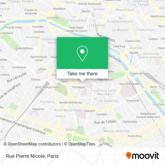
See Rue Pierre Nicole, Paris, on the map
Public Transit to Rue Pierre Nicole in Paris
Wondering how to get to Rue Pierre Nicole in Paris? Moovit helps you find the best way to get to Rue Pierre Nicole with step-by-step directions from the nearest public transit station.
Moovit provides free maps and live directions to help you navigate through your city. View schedules, routes, timetables, and find out how long does it take to get to Rue Pierre Nicole in real time.
Looking for the nearest stop or station to Rue Pierre Nicole? Check out this list of stops closest to your destination: Vavin; Port Royal - Saint-Jacques; Port Royal; Val de Grâce; Feuillantines; Raspail; Luxembourg.
Train: N.RER: B.Metro: 4, 6.Bus: 24, 27, 38, 75, 83, 91, N02, N01.
Want to see if there’s another route that gets you there at an earlier time? Moovit helps you find alternative routes or times. Get directions from and directions to Rue Pierre Nicole easily from the Moovit App or Website.
We make riding to Rue Pierre Nicole easy, which is why over 1.5 million users, including users in Paris, trust Moovit as the best app for public transit. You don’t need to download an individual bus app or train app, Moovit is your all-in-one transit app that helps you find the best bus time or train time available.
For information on prices of metro, bus, RER and train, costs and ride fares to Rue Pierre Nicole, please check the Moovit app.
Use the app to navigate to popular places including to the airport, hospital, stadium, grocery store, mall, coffee shop, school, college, and university.
Rue Pierre Nicole Address: Rue Pierre Nicole, 75005 Paris, France street in Paris
- Collège Privé Sévigné,
- Lycée Sévigné,
- Paris International Seventh-Day Adventist Church (PISDAC),
- Centre Catholique du Lycée Lavoisier,
- Forever Living Products,
- Rue Henri Barbusse,
- Solera Paris,
- Place Alphonse Laveran,
- Gymnase du Centre Jean Sarrailh,
- Rue Fustel de Coulanges,
- Restaurant Universitaire Bullier,
- 147 Boulevard Saint-Michel,
- 3 Rue du Faubourg Saint-Jacques,
- Ecole d'application du Val de Grâce,
- Crous Paris,
- 88 Boulevard de Port-Royal,
- Schola Cantorum,
- Mutuelle Saint-Christophe,
- L'académie de La bière,
- Crous De Paris
Places Near Rue Pierre Nicole (Paris)
- Hopital Lariboisière, Paris,
- Hôpital Henri Mondor, Creteil,
- Hôpital Necker, Paris,
- Hôpital Cochin, Paris,
- Galeries Lafayette, Paris,
- Centre Hospitalier des 15/20, Paris,
- Institut Curie, Paris,
- Hôpital de la Pitié-Salpêtrière, Paris,
- Marché Saint-Pierre, Paris,
- Théâtre Mogador, Paris,
- Hôpital Pitié Salpêtrière, Paris,
- Galeries Lafayette Haussmann, Paris,
- Hôpital Beaujon, Clichy,
- Fondation Louis Vuitton, Paris,
- Gare Routière Flixbus, Paris,
- Atelier Des Lumieres, Paris,
- Créteil Soleil, Creteil,
- Hôpital Saint-Joseph, Paris,
- Hopital Foch, Suresnes,
- 29 Rue Manin, Paris
How to get to popular places in Paris with public transit
Get around Paris by public transit!
Traveling around Paris has never been so easy. See step by step directions as you travel to any attraction, street or major public transit station. View bus and train schedules, arrival times, service alerts and detailed routes on a map, so you know exactly how to get to anywhere in Paris.
When traveling to any destination around Paris use Moovit's Live Directions with Get Off Notifications to know exactly where and how far to walk, how long to wait for your line, and how many stops are left. Moovit will alert you when it's time to get off — no need to constantly re-check whether yours is the next stop.
Wondering how to use public transit in Paris or how to pay for public transit in Paris? Moovit public transit app can help you navigate your way with public transit easily, and at minimum cost. It includes public transit fees, ticket prices, and costs. Looking for a map of Paris public transit lines? Moovit public transit app shows all public transit maps in Paris with all Bus, Train, Metro, Light Rail, RER, Funicular and Gondola routes and stops on an interactive map.
Paris has 7 transit type(s), including: Bus, Train, Metro, Light Rail, RER, Funicular and Gondola, operated by several transit agencies, including RATP, RER, RER Bus de remplacement, Train, Train Bus de remplacement, Tramway Bus de remplacement, TER, ADP, Magical Shuttle, Argenteuil - Boucles de Seine, Autocars Dominique, Bièvre, Brie et 2 Morin, Le Bus - C.C. du Clermontois and Cœur d’Essonne