How to get to Rue de Berne by bus?
Click on the bus route to see step by step directions with maps, line arrival times and updated time schedules.
From Consulat d'Algerie, Bobigny
125 minFrom Aéroport du Bourget, Le Bourget
90 minFrom Parc Floral de Paris, Paris
95 minFrom Parc Montsouris, Paris
56 minFrom Cirque du Soleil - Amaluna, Paris
68 minFrom hôpital D' Argenteuil, Argenteuil
89 minFrom Vitry-sur Seine, Vitry-Sur-Seine
87 minFrom Leroy Merlin Vitry-Sur-Seine, Vitry-Sur-Seine
85 minFrom Le Bourget, Le Bourget
103 minFrom Jardin des Serres d'Auteuil, Paris
58 min
How to get to Rue de Berne by train?
Click on the train route to see step by step directions with maps, line arrival times and updated time schedules.
How to get to Rue de Berne by metro?
Click on the metro route to see step by step directions with maps, line arrival times and updated time schedules.
Bus stops near Rue de Berne in Paris
Bus lines to Rue de Berne in Paris
- 80, Porte de Versailles,VIEW
- 95, Porte de Vanves - Place Simard,VIEW
- N15, Villejuif - Louis Aragon,VIEW
- N51, Gare Saint-Lazare,VIEW
- 30, Pigalle,VIEW
- 21, Stade Charléty - Porte de Gentilly,VIEW
- N02, Gare Montparnasse,VIEW
- 66, Opéra,VIEW
- 28, Porte de Clichy,VIEW
- 94, Pont de Levallois - Bécon - Métro,VIEW
- N16, Pont de Levallois - Bécon,VIEW
- N52, Gare Saint-Lazare,VIEW
What are the closest stations to Rue de Berne?
The closest stations to Rue de Berne are:
- Place de Clichy is 169 meters away, 3 min walk.
- Bucarest is 192 meters away, 3 min walk.
- Rome - Batignolles is 234 meters away, 4 min walk.
- Europe is 304 meters away, 5 min walk.
Which train lines stop near Rue de Berne?
These train lines stop near Rue de Berne: J, L.
Which metro lines stop near Rue de Berne?
These metro lines stop near Rue de Berne: 13, 14, 2, 3.
Which bus lines stop near Rue de Berne?
These bus lines stop near Rue de Berne: 21, 27, 29, 30, 66, 80, 93, 95.
What’s the nearest metro station to Rue de Berne in Paris?
The nearest metro station to Rue de Berne in Paris is Place de Clichy. It’s a 3 min walk away.
What’s the nearest bus station to Rue de Berne in Paris?
The nearest bus station to Rue de Berne in Paris is Bucarest. It’s a 3 min walk away.
What time is the first metro to Rue de Berne in Paris?
The 2 is the first metro that goes to Rue de Berne in Paris. It stops nearby at 5:32 AM.
What time is the last metro to Rue de Berne in Paris?
The 3 is the last metro that goes to Rue de Berne in Paris. It stops nearby at 1:06 AM.
What time is the first bus to Rue de Berne in Paris?
The N52 is the first bus that goes to Rue de Berne in Paris. It stops nearby at 3:01 AM.
What time is the last bus to Rue de Berne in Paris?
The N51 is the last bus that goes to Rue de Berne in Paris. It stops nearby at 3:54 AM.
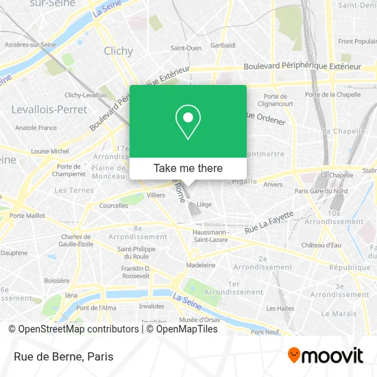
See Rue de Berne, Paris, on the map
Public Transit to Rue de Berne in Paris
Wondering how to get to Rue de Berne in Paris? Moovit helps you find the best way to get to Rue de Berne with step-by-step directions from the nearest public transit station.
Moovit provides free maps and live directions to help you navigate through your city. View schedules, routes, timetables, and find out how long does it take to get to Rue de Berne in real time.
Looking for the nearest stop or station to Rue de Berne? Check out this list of stops closest to your destination: Place de Clichy; Bucarest; Rome - Batignolles; Europe.
Train: J, L.Metro: 13, 14, 2, 3.Bus: 21, 27, 29, 30, 66, 80, 93, 95, N15, N51, N02.
Want to see if there’s another route that gets you there at an earlier time? Moovit helps you find alternative routes or times. Get directions from and directions to Rue de Berne easily from the Moovit App or Website.
We make riding to Rue de Berne easy, which is why over 1.5 million users, including users in Paris, trust Moovit as the best app for public transit. You don’t need to download an individual bus app or train app, Moovit is your all-in-one transit app that helps you find the best bus time or train time available.
For information on prices of metro, bus, RER, train and light rail, costs and ride fares to Rue de Berne, please check the Moovit app.
Use the app to navigate to popular places including to the airport, hospital, stadium, grocery store, mall, coffee shop, school, college, and university.
Rue de Berne Address: Rue de Berne, 75008 Paris, France street in Paris
- Hotel Cervantes by Happyculture Paris,
- 11 rue de berne,
- Best Western Premier Kapital Opera,
- Hotel Astoria Astotel Paris,
- 42 Rue de Moscou,
- Cours Clapeyron,
- 10 Rue Clapeyron,
- Hotel Elysees Opera,
- Place de Dublin,
- Hotel Berne Opera,
- Guy Hoquet,
- 3-11 Rue de Turin,
- Rue de Rome,
- La Trattoria,
- 86 Rue Cardinet,
- 16 Rue de Bucarest,
- Le Lutetia,
- Clinique Turin,
- Arrêt Rome-Batignolles,
- Marché biologique des Batignolles
Places Near Rue de Berne (Paris)
- Hôpital Pitié Salpêtrière, Paris,
- Hôpital Henri Mondor, Creteil,
- Gare Routière Flixbus, Paris,
- Hopital Foch, Suresnes,
- Théâtre Mogador, Paris,
- Hôpital Cochin, Paris,
- Hôpital Beaujon, Clichy,
- Hôpital de la Pitié-Salpêtrière, Paris,
- Hôpital Necker, Paris,
- Fondation Louis Vuitton, Paris,
- Marché Saint-Pierre, Paris,
- 29 Rue Manin, Paris,
- Hopital Lariboisière, Paris,
- Institut Curie, Paris,
- Créteil Soleil, Creteil,
- Centre Hospitalier des 15/20, Paris,
- Hôpital Saint-Joseph, Paris,
- Galeries Lafayette, Paris,
- Galeries Lafayette Haussmann, Paris,
- Atelier Des Lumieres, Paris
How to get to popular places in Paris with public transit
Get around Paris by public transit!
Traveling around Paris has never been so easy. See step by step directions as you travel to any attraction, street or major public transit station. View bus and train schedules, arrival times, service alerts and detailed routes on a map, so you know exactly how to get to anywhere in Paris.
When traveling to any destination around Paris use Moovit's Live Directions with Get Off Notifications to know exactly where and how far to walk, how long to wait for your line, and how many stops are left. Moovit will alert you when it's time to get off — no need to constantly re-check whether yours is the next stop.
Wondering how to use public transit in Paris or how to pay for public transit in Paris? Moovit public transit app can help you navigate your way with public transit easily, and at minimum cost. It includes public transit fees, ticket prices, and costs. Looking for a map of Paris public transit lines? Moovit public transit app shows all public transit maps in Paris with all Bus, Train, Metro, Light Rail, RER, Funicular and Gondola routes and stops on an interactive map.
Paris has 7 transit type(s), including: Bus, Train, Metro, Light Rail, RER, Funicular and Gondola, operated by several transit agencies, including RATP, RER, RER Bus de remplacement, Train, Train Bus de remplacement, Tramway Bus de remplacement, TER, ADP, Magical Shuttle, Argenteuil - Boucles de Seine, Autocars Dominique, Bièvre, Brie et 2 Morin, Le Bus - C.C. du Clermontois and Cœur d’Essonne