Directions to Ruggeri's Redemption Center (Boston) with public transportation
The following transit lines have routes that pass near Ruggeri's Redemption Center
 Bus: 31, 32, GREYHOUND US0255S, GREYHOUND US0256S, 21.
- Train: VERMONTER, VALLEY FLYER.
How to get to Ruggeri's Redemption Center by bus?
Click on the bus route to see step by step directions with maps, line arrival times and updated time schedules.
How to get to Ruggeri's Redemption Center by train?
Click on the train route to see step by step directions with maps, line arrival times and updated time schedules.
Bus stops near Ruggeri's Redemption Center in Boston
Train station near Ruggeri's Redemption Center in Boston
- Greenfield Amtrak Station, 20 min walk,VIEW
Bus lines to Ruggeri's Redemption Center in Boston
- 21, Jwo Transit Center,VIEW
- 23, Jwo Transit Center,VIEW
- 24, Greenfield Community College,VIEW
- GREYHOUND US0255S, New York - Springfield - White River JCT,VIEW
- GREYHOUND US0256S, Boston - Fitchburg - New York,VIEW
- 20, GreenLink,VIEW
- 31, Northampton,VIEW
- 32, Orange,VIEW
- 41, Charlemont,VIEW
- PG, Pelham-Greenfield,VIEW
What are the closest stations to Ruggeri's Redemption Center?
The closest stations to Ruggeri's Redemption Center are:
- Federal St at Greenfield Savings Bank is 147 yards away, 3 min walk.
- Main St at Cafe is 355 yards away, 5 min walk.
- Greenfield John Olver Transit Ctr is 459 yards away, 6 min walk.
- Greenfield Amtrak Station is 1696 yards away, 20 min walk.
Which bus lines stop near Ruggeri's Redemption Center?
These bus lines stop near Ruggeri's Redemption Center: 31, 32, GREYHOUND US0255S, GREYHOUND US0256S.
Which train line stops near Ruggeri's Redemption Center?
VERMONTER (St Albans)
What’s the nearest train station to Ruggeri's Redemption Center in Boston?
The nearest train station to Ruggeri's Redemption Center in Boston is Greenfield Amtrak Station. It’s a 20 min walk away.
What’s the nearest bus station to Ruggeri's Redemption Center in Boston?
The nearest bus station to Ruggeri's Redemption Center in Boston is Federal St at Greenfield Savings Bank. It’s a 3 min walk away.
What time is the first train to Ruggeri's Redemption Center in Boston?
The VALLEY FLYER is the first train that goes to Ruggeri's Redemption Center in Boston. It stops nearby at 6:05 AM.
What time is the last train to Ruggeri's Redemption Center in Boston?
The VALLEY FLYER is the last train that goes to Ruggeri's Redemption Center in Boston. It stops nearby at 10:33 PM.
What time is the first bus to Ruggeri's Redemption Center in Boston?
The 31 is the first bus that goes to Ruggeri's Redemption Center in Boston. It stops nearby at 5:00 AM.
What time is the last bus to Ruggeri's Redemption Center in Boston?
The 23 is the last bus that goes to Ruggeri's Redemption Center in Boston. It stops nearby at 7:45 PM.
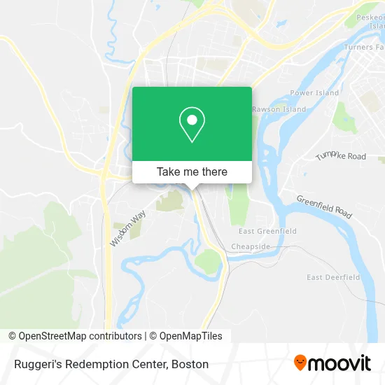
See Ruggeri's Redemption Center, Boston, on the map
Public Transit to Ruggeri's Redemption Center in Boston
Wondering how to get to Ruggeri's Redemption Center in Boston? Moovit helps you find the best way to get to Ruggeri's Redemption Center with step-by-step directions from the nearest public transit station.
Moovit provides free maps and live directions to help you navigate through your city. View schedules, routes, timetables, and find out how long does it take to get to Ruggeri's Redemption Center in real time.
Looking for the nearest stop or station to Ruggeri's Redemption Center? Check out this list of stops closest to your destination: Federal St at Greenfield Savings Bank; Main St at Cafe; Greenfield John Olver Transit Ctr; Greenfield Amtrak Station.
Bus: 31, 32, GREYHOUND US0255S, GREYHOUND US0256S, 21, 23, 24, 20.Train: VERMONTER, VALLEY FLYER.
Want to see if there’s another route that gets you there at an earlier time? Moovit helps you find alternative routes or times. Get directions from and directions to Ruggeri's Redemption Center easily from the Moovit App or Website.
We make riding to Ruggeri's Redemption Center easy, which is why over 1.7 million users, including users in Boston, trust Moovit as the best app for public transit. You don’t need to download an individual bus app or train app, Moovit is your all-in-one transit app that helps you find the best bus time or train time available.
For information on prices of bus and train, costs and ride fares to Ruggeri's Redemption Center, please check the Moovit app.
Use the app to navigate to popular places including to the airport, hospital, stadium, grocery store, mall, coffee shop, school, college, and university.
Ruggeri's Redemption Center Address: 126 Deerfield St street in Boston
- Deerfield Cabinets and Millwork,
- New-Art Plastics,
- Hale Construction,
- NB Productions Dog Training Classes,
- The Arbors at Greenfield Massachusetts,
- Z's Corner,
- Franklin County,
- Greenfield Youth Center,
- Greenfield,
- Frank Gregory Studios,
- John W. Olver Transit Center,
- Awards & Specialties Unlimited,
- Amtrak,
- Olive Street Development,
- Revenex Medical Billing Services,
- NE Medical Practice,
- Greenfield Fire Department,
- Professional Carpenters at Parody Builders,
- Environmental Labs,
- Green River
Places Near Ruggeri's Redemption Center (Boston)
- Leader Bank Pavilion (Leader Bank Pavillion), Boston,
- Seaport District, Boston,
- North End, Boston,
- Mgm Music Hall, Boston,
- Isabella Stewart Gardner Museum, Boston,
- Boston Medical Center, Boston,
- Prudential Center, Boston,
- Museum Of Science, Boston,
- Castle Island, Boston,
- Boston Children's Hospital, Boston,
- Wilbur Theatre, Boston,
- Massachusetts General Hospital, Boston,
- Boston Convention & Exhibition Center, Boston,
- House Of Blues, Boston,
- Quincy Market, Boston,
- Cheers, Boston,
- Td Garden, Boston,
- Wang Theater, Boston,
- Boston Common, Boston,
- Faneuil Hall, Boston
How to get to popular places in Boston with public transit
Get around Boston by public transit!
Traveling around Boston has never been so easy. See step by step directions as you travel to any attraction, street or major public transit station. View bus and train schedules, arrival times, service alerts and detailed routes on a map, so you know exactly how to get to anywhere in Boston.
When traveling to any destination around Boston use Moovit's Live Directions with Get Off Notifications to know exactly where and how far to walk, how long to wait for your line, and how many stops are left. Moovit will alert you when it's time to get off — no need to constantly re-check whether yours is the next stop.
Wondering how to use public transit in Boston or how to pay for public transit in Boston? Moovit public transit app can help you navigate your way with public transit easily, and at minimum cost. It includes public transit fees, ticket prices, and costs. Looking for a map of Boston public transit lines? Moovit public transit app shows all public transit maps in Boston with all Bus, Train, Subway and Ferry routes and stops on an interactive map.
Boston has 4 transit type(s), including: Bus, Train, Subway and Ferry, operated by several transit agencies, including MBTA, Southeastern Regional Transit Authority, MetroWest Regional Transit Authority, Rhode Island Public Transit Authority, WRTA, Lowell Regional Transit Authority, Merrimack Valley Transit, Montachusett Regional Transit Authority, Cape Cod Regional Transit Authority, Brockton Area Transit Authority, Martha's Vineyard Transit Authority, the WAVE - Nantucket Regional Transit Authority, GATRA, Cape Ann Transportation Authority and Massport