Directions to Rumble (Manhattan) with public transportation
The following transit lines have routes that pass near Rumble
 Bus: BXM18, M103, M20, QM11, SIM7.
- Train: BLU, GRE, RED.
- Subway: 1, 2, 4, 5, E.
- Ferry: EDGEWATER - BROOKFIELD PLACE, HOBOKEN / NJ TRANSIT TERMINAL - BROOKFIELD PLACE, PAULUS HOOK - BROOKFIELD PLACE, PORT IMPERIAL - BROOKFIELD PLACE, SOUTH AMBOY - PIER 11/WALL ST..
How to get to Rumble by bus?
Click on the bus route to see step by step directions with maps, line arrival times and updated time schedules.
From The LEGO Store, Manhattan
35 minFrom HI New York Hostel, Manhattan
93 minFrom The Lucerne Hotel, Manhattan
66 minFrom Brooklyn Museum, Manhattan
46 minFrom Astoria, Queens
98 minFrom 92nd Street Y, Manhattan
72 minFrom United Nations, Manhattan
41 minFrom 103rd Street, Manhattan
84 minFrom Guggenheim Museum, Manhattan
43 minFrom North Bergen, NJ, North Bergen
92 min
How to get to Rumble by train?
Click on the train route to see step by step directions with maps, line arrival times and updated time schedules.
How to get to Rumble by subway?
Click on the subway route to see step by step directions with maps, line arrival times and updated time schedules.
From The LEGO Store, Manhattan
33 minFrom HI New York Hostel, Manhattan
38 minFrom The Lucerne Hotel, Manhattan
32 minFrom Brooklyn Museum, Manhattan
44 minFrom Astoria, Queens
44 minFrom 92nd Street Y, Manhattan
37 minFrom United Nations, Manhattan
36 minFrom 103rd Street, Manhattan
43 minFrom Guggenheim Museum, Manhattan
39 min
Train station near Rumble in Manhattan
- World Trade Center, 2 min walk,VIEW
Bus stops near Rumble in Manhattan
Subway stations near Rumble in Manhattan
Ferry station near Rumble in Manhattan
- Brookfield Place/Battery Park City, 6 min walk,VIEW
Bus lines to Rumble in Manhattan
What are the closest stations to Rumble?
The closest stations to Rumble are:
- World Trade Center is 159 yards away, 2 min walk.
- Vesey St/West St is 180 yards away, 3 min walk.
- Park Place is 196 yards away, 3 min walk.
- Vesey St/North End Av is 208 yards away, 3 min walk.
- Wtc Cortlandt is 226 yards away, 3 min walk.
- Vesey St & North End Ave is 244 yards away, 4 min walk.
- Warren St/Greenwich St is 395 yards away, 5 min walk.
- Brookfield Place/Battery Park City is 460 yards away, 6 min walk.
Which bus lines stop near Rumble?
These bus lines stop near Rumble: BXM18, M103, M20, QM11.
Which train lines stop near Rumble?
These train lines stop near Rumble: BLU, GRE, RED.
Which subway lines stop near Rumble?
These subway lines stop near Rumble: 1, 2, 4, 5, E, W.
What’s the nearest subway station to Rumble in Manhattan?
The nearest subway stations to Rumble in Manhattan are Park Place and Wtc Cortlandt. The closest one is a 3 min walk away.
What’s the nearest train station to Rumble in Manhattan?
The nearest train station to Rumble in Manhattan is World Trade Center. It’s a 2 min walk away.
What’s the nearest bus station to Rumble in Manhattan?
The nearest bus stations to Rumble in Manhattan are Vesey St/West St and Vesey St/North End Av. The closest one is a 3 min walk away.
What’s the nearest ferry station to Rumble in Manhattan?
The nearest ferry station to Rumble in Manhattan is Brookfield Place/Battery Park City. It’s a 6 min walk away.
What time is the first subway to Rumble in Manhattan?
The 2 is the first subway that goes to Rumble in Manhattan. It stops nearby at 3:07 AM.
What time is the last subway to Rumble in Manhattan?
The 2 is the last subway that goes to Rumble in Manhattan. It stops nearby at 4:08 AM.
What time is the first train to Rumble in Manhattan?
The RED is the first train that goes to Rumble in Manhattan. It stops nearby at 3:10 AM.
What time is the last train to Rumble in Manhattan?
The RED is the last train that goes to Rumble in Manhattan. It stops nearby at 2:55 AM.
What time is the first bus to Rumble in Manhattan?
The M22 is the first bus that goes to Rumble in Manhattan. It stops nearby at 5:00 AM.
What time is the last bus to Rumble in Manhattan?
The M22 is the last bus that goes to Rumble in Manhattan. It stops nearby at 1:18 AM.
What time is the first ferry to Rumble in Manhattan?
The PAULUS HOOK - BROOKFIELD PLACE is the first ferry that goes to Rumble in Manhattan. It stops nearby at 6:07 AM.
What time is the last ferry to Rumble in Manhattan?
The PAULUS HOOK - BROOKFIELD PLACE is the last ferry that goes to Rumble in Manhattan. It stops nearby at 10:52 PM.
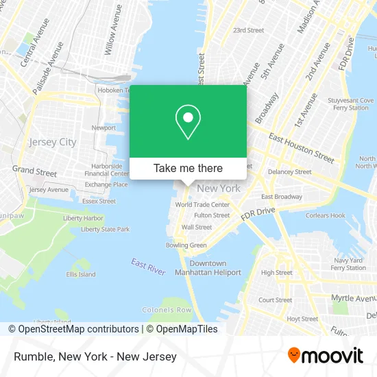
See Rumble, Manhattan, on the map
Public Transit to Rumble in Manhattan
Wondering how to get to Rumble in Manhattan? Moovit helps you find the best way to get to Rumble with step-by-step directions from the nearest public transit station.
Moovit provides free maps and live directions to help you navigate through your city. View schedules, routes, timetables, and find out how long does it take to get to Rumble in real time.
Looking for the nearest stop or station to Rumble? Check out this list of stops closest to your destination: World Trade Center; Vesey St/West St; Park Place; Vesey St/North End Av; Wtc Cortlandt; Vesey St & North End Ave; Warren St/Greenwich St; Brookfield Place/Battery Park City.
Bus: BXM18, M103, M20, QM11, SIM7, SIM9, SIM33.Train: BLU, GRE, RED.Subway: 1, 2, 4, 5, E, W, 3.Ferry: EDGEWATER - BROOKFIELD PLACE, HOBOKEN / NJ TRANSIT TERMINAL - BROOKFIELD PLACE, PAULUS HOOK - BROOKFIELD PLACE, PORT IMPERIAL - BROOKFIELD PLACE, SOUTH AMBOY - PIER 11/WALL ST..
Want to see if there’s another route that gets you there at an earlier time? Moovit helps you find alternative routes or times. Get directions from and directions to Rumble easily from the Moovit App or Website.
We make riding to Rumble easy, which is why over 1.5 million users, including users in Manhattan, trust Moovit as the best app for public transit. You don’t need to download an individual bus app or train app, Moovit is your all-in-one transit app that helps you find the best bus time or train time available.
For information on prices of subway, bus and train, costs and ride fares to Rumble, please check the Moovit app.
Use the app to navigate to popular places including to the airport, hospital, stadium, grocery store, mall, coffee shop, school, college, and university.
Rumble Address: 142 West St street in Manhattan
- Top Cops Protective Services,
- Angel Match,
- Pomélo+Co.,
- Rumble Boxing,
- New York State Of Mind,
- Vesey St & Joe Dimaggio Hwy,
- Hotel James,
- Marshalls Department Store,
- Lip Stained,
- Family Of Light Holistic Center,
- Eurasian Capital, Llc.,
- Amex Tower In New York,
- Local 1070,
- 100 Barclay,
- Adow Capital Management,
- Plandek,
- New York Life Insurance,
- Warby Parker Readery at Brookfield Place,
- Notemyself,
- Good Vibes Every Day
Places Near Rumble (Manhattan)
- 1 Police Plaza, Manhattan,
- Hudson Yards, Manhattan,
- Mountainside Hospital, Glen Ridge,
- qqqq, Manhattan,
- Wall Street, Manhattan,
- 26 Federal Plaza, Manhattan,
- 66 John Street, Manhattan,
- Times Square, Manhattan,
- 376 Hudson Street, Manhattan,
- Pier 83, Manhattan,
- Queens Center Mall, Queens,
- SoHo, Manhattan,
- 3 Stone St, Manhattan,
- Rockefeller Center, Manhattan,
- Chinatown, Manhattan,
- Katz's Deli, Manhattan,
- San Gennaro Feast, Manhattan,
- 911 Memorial, Manhattan,
- Bellevue Hospital, Manhattan,
- 111 Centre New York City Supreme Court, Manhattan
How to get to popular places in New York - New Jersey with public transit
Get around Manhattan by public transit!
Traveling around Manhattan has never been so easy. See step by step directions as you travel to any attraction, street or major public transit station. View bus and train schedules, arrival times, service alerts and detailed routes on a map, so you know exactly how to get to anywhere in Manhattan.
When traveling to any destination around Manhattan use Moovit's Live Directions with Get Off Notifications to know exactly where and how far to walk, how long to wait for your line, and how many stops are left. Moovit will alert you when it's time to get off — no need to constantly re-check whether yours is the next stop.
Wondering how to use public transit in Manhattan or how to pay for public transit in Manhattan? Moovit public transit app can help you navigate your way with public transit easily, and at minimum cost. It includes public transit fees, ticket prices, and costs. Looking for a map of Manhattan public transit lines? Moovit public transit app shows all public transit maps in Manhattan with all Bus, Train, Subway, Light Rail, Ferry and Cable Car routes and stops on an interactive map.
New York - New Jersey has 6 transit type(s), including: Bus, Train, Subway, Light Rail, Ferry and Cable Car, operated by several transit agencies, including MTA Subway, Metro-North Railroad, LIRR, PATH, MTA New York City Transit - Express routes, MTA Bus, NJ Transit, NYC Ferry, NICE bus, Bee-Line Bus, NJ Transit Rail, Norwalk Transit District, Hartford Line, River Valley Transit and HART
Public transit lines with stations closest to Rumble in Manhattan
Subway lines with stations closest to Rumble in Manhattan
Train lines with stations closest to Rumble in Manhattan
Bus lines with stations closest to Rumble in Manhattan
Ferry lines with stations closest to Rumble in Manhattan
Brookfield Place/Battery Park City
- EDGEWATER - BROOKFIELD PLACEEdgewater - Brookfield Place
- HOBOKEN / NJ TRANSIT TERMINAL - BROOKFIELD PLACEHoboken / NJ Transit Terminal - Brookfield Place
- PAULUS HOOK - BROOKFIELD PLACEPaulus Hook - Brookfield Place
- PORT IMPERIAL - BROOKFIELD PLACEPort Imperial - Brookfield Place
- SOUTH AMBOY - PIER 11/WALL ST.South Amboy - Pier 11/Wall St.