Directions to Rumford Chemical Works (Boston) with public transportation
The following transit lines have routes that pass near Rumford Chemical Works
How to get to Rumford Chemical Works by bus?
Click on the bus route to see step by step directions with maps, line arrival times and updated time schedules.
Bus stations near Rumford Chemical Works in Boston
- Pawtucket & Newman (Opposite Kenton), 5 min walk,
- Wilson After Bourne, 8 min walk,
Bus lines to Rumford Chemical Works in Boston
- 78, Kennedy Plaza Via Beverage Hill Ave,
- 35, Kennedy Plaza,
What are the closest stations to Rumford Chemical Works?
The closest stations to Rumford Chemical Works are:
- Pawtucket & Newman (Opposite Kenton) is 355 yards away, 5 min walk.
- Wilson After Bourne is 644 yards away, 8 min walk.
Which bus lines stop near Rumford Chemical Works?
These bus lines stop near Rumford Chemical Works: 35, 78.
What’s the nearest bus stop to Rumford Chemical Works in Boston?
The nearest bus stop to Rumford Chemical Works in Boston is Pawtucket & Newman (Opposite Kenton). It’s a 5 min walk away.
What time is the first bus to Rumford Chemical Works in Boston?
The 78 is the first bus that goes to Rumford Chemical Works in Boston. It stops nearby at 7:16 AM.
What time is the last bus to Rumford Chemical Works in Boston?
The 78 is the last bus that goes to Rumford Chemical Works in Boston. It stops nearby at 7:54 PM.
How much is the bus fare to Rumford Chemical Works?
The bus fare to Rumford Chemical Works costs about $1.50 - $2.00.
See Rumford Chemical Works, Boston, on the map
Public Transit to Rumford Chemical Works in Boston
Wondering how to get to Rumford Chemical Works in Boston, United States? Moovit helps you find the best way to get to Rumford Chemical Works with step-by-step directions from the nearest public transit station.
Moovit provides free maps and live directions to help you navigate through your city. View schedules, routes, timetables, and find out how long does it take to get to Rumford Chemical Works in real time.
Looking for the nearest stop or station to Rumford Chemical Works? Check out this list of stops closest to your destination: Pawtucket & Newman (Opposite Kenton); Wilson After Bourne.
Bus: 35, 78.
Want to see if there’s another route that gets you there at an earlier time? Moovit helps you find alternative routes or times. Get directions from and directions to Rumford Chemical Works easily from the Moovit App or Website.
We make riding to Rumford Chemical Works easy, which is why over 1.5 million users, including users in Boston, trust Moovit as the best app for public transit. You don’t need to download an individual bus app or train app, Moovit is your all-in-one transit app that helps you find the best bus time or train time available.
For information on prices of bus, costs and ride fares to Rumford Chemical Works, please check the Moovit app.
Use the app to navigate to popular places including to the airport, hospital, stadium, grocery store, mall, coffee shop, school, college, and university.
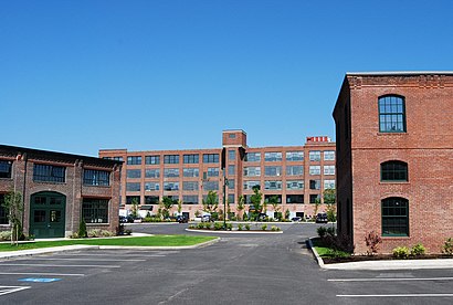
Rumford Chemical Works Address: Rumford, RI 02916 street in Boston
Attractions near Rumford Chemical Works
Summit Office Systems,United States Postal Service,Healthsource Ri,ChargePoint,East Providence Small Engine Repair,J H Lynch & Sons,New England Sealcoating,Law Office of Judy Davis,Element Real Estate,Cordis Counseling,Snap Photography Studio,Rumford Dental,World Insurance Associates,Rumford Center & Lofts,Nicole Navega, Licsw,Best Dog Ever Acup,Eagle Insurance,Cindy Mari Boudoir,Carpenter Cemetery,University Surgical AssociatesHow to get to popular attractions in Boston with public transit
Seaport Blvd, Boston,Rental Car Center - Logan Airport, Boston,House of Blues , Boston,Raising Cane's, Boston,Amesbury, MA, Amesbury,Babson College, Wellesley,Kendall Square, Cambridge,New England Baptist Hospital, Boston,JFK Library, Boston,41 Mall Road, Burlington, MA 01805 Burlington Mall Road, Burlington,Randolph, MA, Randolph,Chelmsford,Holiday Inn Boston Bunker Hill an IHG Hotel Somerville, Somerville,811 Mass Ave,Skywalk Observatory, Boston,Winthrop, Winthrop Town,City Hall Plaza, Boston,Boston Celtics, Boston,Embassy Suites Boston At Logan, Boston,Harvard Club Of Boston, BostonGet around Boston by public transit!
Traveling around Boston has never been so easy. See step by step directions as you travel to any attraction, street or major public transit station. View bus and train schedules, arrival times, service alerts and detailed routes on a map, so you know exactly how to get to anywhere in Boston.
When traveling to any destination around Boston use Moovit's Live Directions with Get Off Notifications to know exactly where and how far to walk, how long to wait for your line, and how many stops are left. Moovit will alert you when it's time to get off — no need to constantly re-check whether yours is the next stop.
Wondering how to use public transit in Boston or how to pay for public transit in Boston? Moovit public transit app can help you navigate your way with public transit easily, and at minimum cost. It includes public transit fees, ticket prices, and costs. Looking for a map of Boston public transit lines? Moovit public transit app shows all public transit maps in Boston with all Bus, Train, Subway and Ferry routes and stops on an interactive map.
Boston has 4 transit type(s), including: Bus, Train, Subway and Ferry, operated by several transit agencies, including MBTA, Southeastern Regional Transit Authority, MetroWest Regional Transit Authority, Rhode Island Public Transit Authority, WRTA, Lowell Regional Transit Authority, Merrimack Valley Transit, Montachusett Regional Transit Authority, Cape Cod Regional Transit Authority, Brockton Area Transit Authority, Martha's Vineyard Transit Authority, the WAVE - Nantucket Regional Transit Authority, GATRA, Cape Ann Transportation Authority, Massport