Directions to Rumpa’S Halal Kitchen. (Queens) with public transportation
The following transit lines have routes that pass near Rumpa’S Halal Kitchen.
 Bus: Q111, Q114, Q51, Q6, QM63.
- Train: LONG BEACH BRANCH, BABYLON BRANCH, WEST HEMPSTEAD BRANCH, FAR ROCKAWAY BRANCH, AIRTRAIN.
- Subway: E, J, Z.
How to get to Rumpa’S Halal Kitchen. by bus?
Click on the bus route to see step by step directions with maps, line arrival times and updated time schedules.
From Northwell - Long Island Jewish Medical Center, Queens
71 minFrom Fresh Meadows, Queens
48 minFrom 30-56 Whitestone Expwy, Queens
66 minFrom Walmart, Valley Stream
51 minFrom Long Island Jewish Hospital, Queens
71 minFrom Belmont Park, Elmont
62 minFrom Middle Village, NY, Queens
63 minFrom Bayside, NY, Queens
69 minFrom Nostrand Ave, Brooklyn, Queens
69 minFrom North Shore Towers, Queens
78 min
How to get to Rumpa’S Halal Kitchen. by train?
Click on the train route to see step by step directions with maps, line arrival times and updated time schedules.
How to get to Rumpa’S Halal Kitchen. by subway?
Click on the subway route to see step by step directions with maps, line arrival times and updated time schedules.
Train stations near Rumpa’S Halal Kitchen. in Queens
Bus stops near Rumpa’S Halal Kitchen. in Queens
Subway station near Rumpa’S Halal Kitchen. in Queens
- Jamaica Center-Parsons/Archer, 20 min walk,VIEW
Bus lines to Rumpa’S Halal Kitchen. in Queens
- QM63, Rosedale,VIEW
- Q6, JFK Cargo Area Via Sutphin Bl Via Rockaway Bl,VIEW
- QM21, Midtown 57 St Via Madison Av,VIEW
- Q51, Limited Cambria Heights,VIEW
- QM65, Laurelton,VIEW
- Q111, Rush Cedarhurst Peninsula Bl Via Brewer Bl Via 147 Av,VIEW
- Q113, Limited Jamaica Parsons-Hillside Via Nassau Exy Via Brewer Bl,VIEW
- Q114, Rush Far Rockaway Seagirt Bl Via Brewer Bl,VIEW
- Q115, Springfield Gardens Via Brewer Bl,VIEW
What are the closest stations to Rumpa’S Halal Kitchen.?
The closest stations to Rumpa’S Halal Kitchen. are:
- St.Albans is 253 yards away, 4 min walk.
- Linden Blvd/Sutphin Blvd is 458 yards away, 6 min walk.
- Sutphin Blvd/Linden Blvd is 467 yards away, 6 min walk.
- Guy R Brewer Blvd/Linden Blvd is 516 yards away, 7 min walk.
- Jamaica Center-Parsons/Archer is 1660 yards away, 20 min walk.
- Locust Manor is 2232 yards away, 27 min walk.
- Jamaica is 2521 yards away, 30 min walk.
Which bus lines stop near Rumpa’S Halal Kitchen.?
These bus lines stop near Rumpa’S Halal Kitchen.: Q111, Q114, Q51, Q6.
Which train line stops near Rumpa’S Halal Kitchen.?
LONG BEACH BRANCH (Long Beach)
Which subway lines stop near Rumpa’S Halal Kitchen.?
These subway lines stop near Rumpa’S Halal Kitchen.: E, J.
What’s the nearest subway station to Rumpa’S Halal Kitchen. in Queens?
The nearest subway station to Rumpa’S Halal Kitchen. in Queens is Jamaica Center-Parsons/Archer. It’s a 20 min walk away.
What’s the nearest train station to Rumpa’S Halal Kitchen. in Queens?
The nearest train station to Rumpa’S Halal Kitchen. in Queens is St.Albans. It’s a 4 min walk away.
What’s the nearest bus station to Rumpa’S Halal Kitchen. in Queens?
The nearest bus stations to Rumpa’S Halal Kitchen. in Queens are Linden Blvd/Sutphin Blvd and Sutphin Blvd/Linden Blvd. The closest one is a 6 min walk away.
What time is the first light rail to Rumpa’S Halal Kitchen. in Queens?
The AIRTRAIN is the first light rail that goes to Rumpa’S Halal Kitchen. in Queens. It stops nearby at 3:00 AM.
What time is the last light rail to Rumpa’S Halal Kitchen. in Queens?
The AIRTRAIN is the last light rail that goes to Rumpa’S Halal Kitchen. in Queens. It stops nearby at 3:06 AM.
What time is the first subway to Rumpa’S Halal Kitchen. in Queens?
The E is the first subway that goes to Rumpa’S Halal Kitchen. in Queens. It stops nearby at 3:06 AM.
What time is the last subway to Rumpa’S Halal Kitchen. in Queens?
The J is the last subway that goes to Rumpa’S Halal Kitchen. in Queens. It stops nearby at 3:49 AM.
What time is the first train to Rumpa’S Halal Kitchen. in Queens?
The BABYLON BRANCH is the first train that goes to Rumpa’S Halal Kitchen. in Queens. It stops nearby at 3:07 AM.
What time is the last train to Rumpa’S Halal Kitchen. in Queens?
The BABYLON BRANCH is the last train that goes to Rumpa’S Halal Kitchen. in Queens. It stops nearby at 3:07 AM.
What time is the first bus to Rumpa’S Halal Kitchen. in Queens?
The Q6 is the first bus that goes to Rumpa’S Halal Kitchen. in Queens. It stops nearby at 3:02 AM.
What time is the last bus to Rumpa’S Halal Kitchen. in Queens?
The Q6 is the last bus that goes to Rumpa’S Halal Kitchen. in Queens. It stops nearby at 3:07 AM.
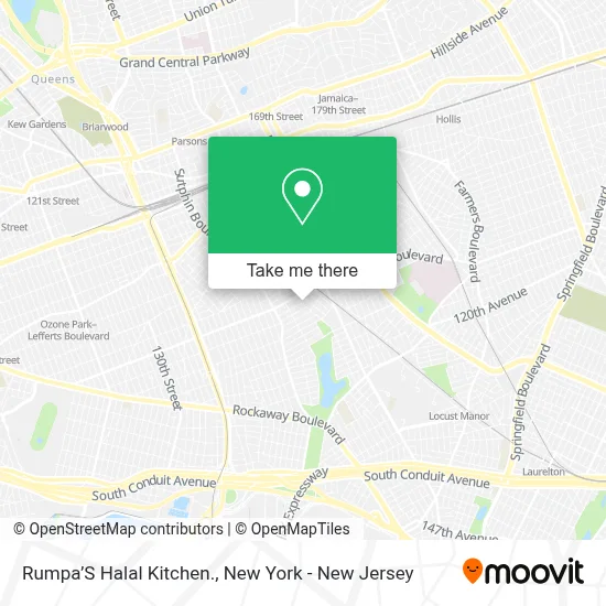
See Rumpa’S Halal Kitchen., Queens, on the map
Public Transit to Rumpa’S Halal Kitchen. in Queens
Wondering how to get to Rumpa’S Halal Kitchen. in Queens? Moovit helps you find the best way to get to Rumpa’S Halal Kitchen. with step-by-step directions from the nearest public transit station.
Moovit provides free maps and live directions to help you navigate through your city. View schedules, routes, timetables, and find out how long does it take to get to Rumpa’S Halal Kitchen. in real time.
Looking for the nearest stop or station to Rumpa’S Halal Kitchen.? Check out this list of stops closest to your destination: St.Albans; Linden Blvd/Sutphin Blvd; Sutphin Blvd/Linden Blvd; Guy R Brewer Blvd/Linden Blvd; Jamaica Center-Parsons/Archer; Locust Manor; Jamaica.
Bus: Q111, Q114, Q51, Q6, QM63, QM21, QM65.Train: LONG BEACH BRANCH, BABYLON BRANCH, WEST HEMPSTEAD BRANCH, FAR ROCKAWAY BRANCH, AIRTRAIN, CITY TERMINAL ZONE, HEMPSTEAD BRANCH, MONTAUK BRANCH, OYSTER BAY BRANCH.Subway: E, J, Z.
Want to see if there’s another route that gets you there at an earlier time? Moovit helps you find alternative routes or times. Get directions from and directions to Rumpa’S Halal Kitchen. easily from the Moovit App or Website.
We make riding to Rumpa’S Halal Kitchen. easy, which is why over 1.5 million users, including users in Queens, trust Moovit as the best app for public transit. You don’t need to download an individual bus app or train app, Moovit is your all-in-one transit app that helps you find the best bus time or train time available.
For information on prices of bus, subway and train, costs and ride fares to Rumpa’S Halal Kitchen., please check the Moovit app.
Use the app to navigate to popular places including to the airport, hospital, stadium, grocery store, mall, coffee shop, school, college, and university.
Rumpa’S Halal Kitchen. Address: 114-37 157th St street in Queens
- The Greater New Hope Deliverance Church,
- Shelter Rock Seventh-Day Adventist Church,
- Produce Plus Corporation,
- Fresh Farm Halal Supermarket,
- Z&P Motor Inc,
- Carousel Early Learning Inc.,
- Gifted Hands Daycare,
- 157 Food Market,
- Parking Lot,
- 155 St 114th,
- Ups Access Point Location,
- Mt.Zion Tabernacle,
- Nyc Building Violation Removal & Expediting,
- Kingdom Hall Of Jehovahs Witnesses,
- Climate Care Solution,
- Augustus Design Digital Graphics,
- The D. Buchanan Collection,
- Casita De Pao Inc Daycare,
- Triple A’S Tire Shop,
- T @ M Motorsport
Places Near Rumpa’S Halal Kitchen. (Queens)
- San Gennaro Feast, Manhattan,
- 26 Federal Plaza, Manhattan,
- Wall Street, Manhattan,
- Times Square, Manhattan,
- Mountainside Hospital, Glen Ridge,
- qqqq, Manhattan,
- Hudson Yards, Manhattan,
- 66 John Street, Manhattan,
- Bellevue Hospital, Manhattan,
- SoHo, Manhattan,
- 1 Police Plaza, Manhattan,
- Katz's Deli, Manhattan,
- Queens Center Mall, Queens,
- 911 Memorial, Manhattan,
- Rockefeller Center, Manhattan,
- 111 Centre New York City Supreme Court, Manhattan,
- Chinatown, Manhattan,
- 3 Stone St, Manhattan,
- Pier 83, Manhattan,
- 376 Hudson Street, Manhattan
How to get to popular places in New York - New Jersey with public transit
Get around Queens by public transit!
Traveling around Queens has never been so easy. See step by step directions as you travel to any attraction, street or major public transit station. View bus and train schedules, arrival times, service alerts and detailed routes on a map, so you know exactly how to get to anywhere in Queens.
When traveling to any destination around Queens use Moovit's Live Directions with Get Off Notifications to know exactly where and how far to walk, how long to wait for your line, and how many stops are left. Moovit will alert you when it's time to get off — no need to constantly re-check whether yours is the next stop.
Wondering how to use public transit in Queens or how to pay for public transit in Queens? Moovit public transit app can help you navigate your way with public transit easily, and at minimum cost. It includes public transit fees, ticket prices, and costs. Looking for a map of Queens public transit lines? Moovit public transit app shows all public transit maps in Queens with all Bus, Train, Subway, Light Rail, Ferry and Cable Car routes and stops on an interactive map.
New York - New Jersey has 6 transit type(s), including: Bus, Train, Subway, Light Rail, Ferry and Cable Car, operated by several transit agencies, including MTA Subway, Metro-North Railroad, LIRR, PATH, MTA New York City Transit - Express routes, MTA Bus, NJ Transit, NYC Ferry, NICE bus, Bee-Line Bus, NJ Transit Rail, Norwalk Transit District, Hartford Line, River Valley Transit and HART