See Rundetårn, København, on the map
Directions to Rundetårn (København) with public transportation
The following transit lines have routes that pass near Rundetårn
 Bus:
Bus: - Train:
- Metro:
How to get to Rundetårn by bus?
Click on the bus route to see step by step directions with maps, line arrival times and updated time schedules.
How to get to Rundetårn by train?
Click on the train route to see step by step directions with maps, line arrival times and updated time schedules.
Bus stations near Rundetårn in København
- Gammel Strand St. Christiansborg (Vindebrogade),7 min walk,
- Nørre Farimagsgade (Frederiksborggade),8 min walk,
- Georg Brandes Plads Parkmuseerne (Øster Voldgade),9 min walk,
- Nørreport St. (Nørre Voldgade),9 min walk,
- Nørreport St. (Metro),9 min walk,
Metro stations near Rundetårn in København
- Marmorkirken St. (Metro),8 min walk,
Train stations near Rundetårn in København
- Nørreport St.,9 min walk,
Bus lines to Rundetårn in København
- 2A,Operaen Holmen,
- 23,Hellerup St.,
- 31,Vanløse Ålekistevej,
- 37,Vesterport St. (Vester Farimagsgade),
- 5C,Københavns Lufthavn,
- 14,Nørreport St.,
- 6A,Emdrup Torv,
- 94N,Rådhuspladsen,
- 184,Nørreport St.,
- 185,Klampenborg St.,
- 350S,Nørreport St.,
- M1,Nørreport St. (Metro),
- M2,Kongens Nytorv St. (Metro),
- 15E,Rævehøjvej Dtu,
- 150S,Nørreport St.,
What are the closest stations to Rundetårn?
The closest stations to Rundetårn are:
- Gammel Strand St. Christiansborg (Vindebrogade) is 481 meters away, 7 min walk.
- Nørre Farimagsgade (Frederiksborggade) is 550 meters away, 8 min walk.
- Marmorkirken St. (Metro) is 610 meters away, 8 min walk.
- Georg Brandes Plads Parkmuseerne (Øster Voldgade) is 628 meters away, 9 min walk.
- Nørreport St. (Nørre Voldgade) is 656 meters away, 9 min walk.
- Nørreport St. (Metro) is 676 meters away, 9 min walk.
- Nørreport St. is 687 meters away, 9 min walk.
Which bus lines stop near Rundetårn?
These bus lines stop near Rundetårn: 184, 31, 350S, 5C, 6A.
Which train lines stop near Rundetårn?
These train lines stop near Rundetårn: A, B, E.
Which metro line stops near Rundetårn?
M1
What’s the nearest metro station to Rundetårn in København?
The nearest metro station to Rundetårn in København is Marmorkirken St. (Metro). It’s a 8 min walk away.
What’s the nearest train station to Rundetårn in København?
The nearest train station to Rundetårn in København is Nørreport St.. It’s a 9 min walk away.
What’s the nearest bus stop to Rundetårn in København?
The nearest bus stop to Rundetårn in København is Gammel Strand St. Christiansborg (Vindebrogade). It’s a 7 min walk away.
What time is the first metro to Rundetårn in København?
The M2 is the first metro that goes to Rundetårn in København. It stops nearby at 3:00 AM.
What time is the last metro to Rundetårn in København?
The M1 is the last metro that goes to Rundetårn in København. It stops nearby at 3:05 AM.
What time is the first train to Rundetårn in København?
The 802 is the first train that goes to Rundetårn in København. It stops nearby at 3:21 AM.
What time is the last train to Rundetårn in København?
The 802 is the last train that goes to Rundetårn in København. It stops nearby at 3:21 AM.
What time is the first bus to Rundetårn in København?
The 5C is the first bus that goes to Rundetårn in København. It stops nearby at 3:01 AM.
What time is the last bus to Rundetårn in København?
The 150S is the last bus that goes to Rundetårn in København. It stops nearby at 3:28 AM.
See Rundetårn, København, on the map
Public Transit to Rundetårn in København
Wondering how to get to Rundetårn in København, Denmark? Moovit helps you find the best way to get to Rundetårn with step-by-step directions from the nearest public transit station.
Moovit provides free maps and live directions to help you navigate through your city. View schedules, routes, timetables, and find out how long does it take to get to Rundetårn in real time.
Looking for the nearest stop or station to Rundetårn? Check out this list of stops closest to your destination: Gammel Strand St. Christiansborg (Vindebrogade); Nørre Farimagsgade (Frederiksborggade); Marmorkirken St. (Metro); Georg Brandes Plads Parkmuseerne (Øster Voldgade); Nørreport St. (Nørre Voldgade); Nørreport St. (Metro); Nørreport St..
Bus:Train:Metro:
Want to see if there’s another route that gets you there at an earlier time? Moovit helps you find alternative routes or times. Get directions from and directions to Rundetårn easily from the Moovit App or Website.
We make riding to Rundetårn easy, which is why over 1.5 million users, including users in København, trust Moovit as the best app for public transit. You don’t need to download an individual bus app or train app, Moovit is your all-in-one transit app that helps you find the best bus time or train time available.
For information on prices of train, bus and metro, costs and ride fares to Rundetårn, please check the Moovit app.
Use the app to navigate to popular places including to the airport, hospital, stadium, grocery store, mall, coffee shop, school, college, and university.
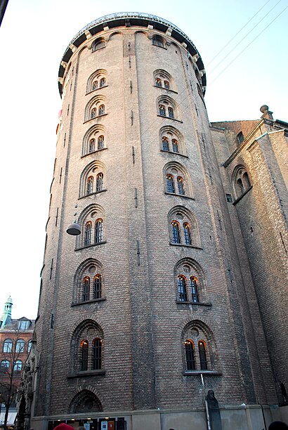
Rundetårn Address: Landemærket street in København
Attractions near Rundetårn
Købmagergade 52A,Rundetårn,Købmagergade,Suhmsgade 4,Københavns Hovedbibliotek,Asics,Restaurant Kultorvet,Huks Fluks,Hauser Plads,Niels Brock Copenhagen Business College,Como,Store Kannikestræde 16,Kultorvet,Lille Kannikestræde 3,Gråbrødretorv,Krystalgade,Arket,Gråbrødretorv 7,Vedelsby, Knud,Bredgade 8 ApsHow to get to popular attractions in København with public transit
Virum, Lyngby-Taarbæk,Molslinien, Max Mols, Odsherred,Løkken Strand, Hjørring,Tryg Forsikring Kantinen, Ballerup,COWI A/S, Lyngby-Taarbæk,Islev st., København,Comwell Kolding, Kolding,Munkebjerg Hotel & Casino, Vejle,Rudkøbing, Langeland,LEGO System A/S, Billund,Vejle Transportcenter, Vejle,Billund, Billund,Jernbanebo, Nyborg,Novo Nordisk/ Hagedornsvej, Gentofte,Hornbæk, Helsingør,Ry, Skanderborg,Matematisk Kantine, Aarhus Universitet, Århus,Greve Station, Greve,Kerteminde, Kerteminde,Sæby, FrederikshavnGet around København by public transit!
Traveling around København has never been so easy. See step by step directions as you travel to any attraction, street or major public transit station. View bus and train schedules, arrival times, service alerts and detailed routes on a map, so you know exactly how to get to anywhere in København.
When traveling to any destination around København use Moovit's Live Directions with Get Off Notifications to know exactly where and how far to walk, how long to wait for your line, and how many stops are left. Moovit will alert you when it's time to get off — no need to constantly re-check whether yours is the next stop.
Wondering how to use public transit in København or how to pay for public transit in København? Moovit public transit app can help you navigate your way with public transit easily, and at minimum cost. It includes public transit fees, ticket prices, and costs. Looking for a map of København public transit lines? Moovit public transit app shows all public transit maps in København with all train, bus or metro routes and stops on an interactive map.
København has 3 transit type(s), including: train, bus or metro, operated by several transit agencies, including Metroselskabet, DSB S-tog, Lokaltog A/S, DSB S-tog, Midttrafik, Odense Letbane, DSB, NT, GoCollective, Midttrafik, Skånetrafiken, Metroselskabet, Movia, NT and Midttrafik