Directions to Rundown Marketplace (Hartford) with public transportation
The following transit lines have routes that pass near Rundown Marketplace
How to get to Rundown Marketplace by bus?
Click on the bus route to see step by step directions with maps, line arrival times and updated time schedules.
How to get to Rundown Marketplace by train?
Click on the train route to see step by step directions with maps, line arrival times and updated time schedules.
Bus stops near Rundown Marketplace in Hartford
Train station near Rundown Marketplace in Hartford
- Hartford Union Station, 45 min walk,VIEW
Bus lines to Rundown Marketplace in Hartford
- 32, 32 - Windsor Ave-Downtown Hartford,VIEW
- 36, 36 - Day Hill Rd-Griffin Cntr,VIEW
- 38, 38c - Weston St-Ctransit,VIEW
- 40, 40 - North Main St-Downtown Hartford,VIEW
- 42, 42/46 - Barbour St-Tower Ave-Coventry St,VIEW
- 44, 44 - Garden St-Downtown Hartford,VIEW
- 46, 46 - Vine St-Downtown Hartford,VIEW
- 50, 50a - Blue Hills Ave-Copaco-Cigna,VIEW
- 52, 52w - Blue Hills Ave-Wedgewood Dr,VIEW
- 54, 54x - Hartford Via I-91,VIEW
- 56, 56f - Bloomfield Ave-Bloomfield Ctr-Federation Home,VIEW
- 58, 58 - Albany Av-Bishops Corner,VIEW
- 60, 60 - Farmington Av-West Hartford Ctr,VIEW
- 62, 62 - Farmington Av-North Main St-Bishops Corner,VIEW
- 64, 64 - Farmington Av-Downtown Hartford,VIEW
- 66, 66 - Farmington Av-Downtown Hartford,VIEW
- 72, 72a - Asylum Av-Bishops Corner-Cigna-Metlife,VIEW
- 74, 74 - Granby St-St Francis Hosp-Copaco-Wedgewood Dr,VIEW
- 76, 76 - Ashley St-Downtown Hartford,VIEW
- 87, 87g - East River Dr-Goodwin College,VIEW
What are the closest stations to Rundown Marketplace?
The closest stations to Rundown Marketplace are:
- Main St @ Pratt St is 126 yards away, 2 min walk.
- Main St @ Asylum St is 167 yards away, 3 min walk.
- Church St @ Main St is 259 yards away, 4 min walk.
- Asylum St @ Trumbull St is 282 yards away, 4 min walk.
- Central Row @ Main St is 303 yards away, 4 min walk.
- Main St @ 750 Main St is 326 yards away, 5 min walk.
- Pearl St @ Lewis St is 383 yards away, 5 min walk.
- Market St @ Talcott St is 406 yards away, 5 min walk.
- Hartford Union Station is 3817 yards away, 45 min walk.
Which bus lines stop near Rundown Marketplace?
These bus lines stop near Rundown Marketplace: 928, DASH, FLIXBUS 2610, GREYHOUND US0230, GREYHOUND US0235, GREYHOUND US0255S.
Which train lines stop near Rundown Marketplace?
These train lines stop near Rundown Marketplace: AMTRAK HARTFORD LINE, HARTFORD LINE, VALLEY FLYER, VERMONTER.
What’s the nearest bus station to Rundown Marketplace in Hartford?
The nearest bus station to Rundown Marketplace in Hartford is Main St @ Pratt St. It’s a 2 min walk away.
What time is the first train to Rundown Marketplace in Hartford?
The NORTHEAST REGIONAL is the first train that goes to Rundown Marketplace in Hartford. It stops nearby at 4:51 AM.
What time is the last train to Rundown Marketplace in Hartford?
The NORTHEAST REGIONAL is the last train that goes to Rundown Marketplace in Hartford. It stops nearby at 11:59 PM.
What time is the first bus to Rundown Marketplace in Hartford?
The 40 is the first bus that goes to Rundown Marketplace in Hartford. It stops nearby at 3:58 AM.
What time is the last bus to Rundown Marketplace in Hartford?
The 37 is the last bus that goes to Rundown Marketplace in Hartford. It stops nearby at 1:40 AM.
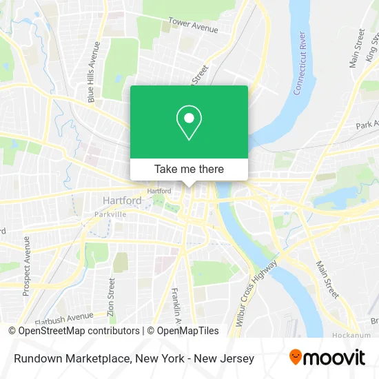
See Rundown Marketplace, Hartford, on the map
Public Transit to Rundown Marketplace in Hartford
Wondering how to get to Rundown Marketplace in Hartford? Moovit helps you find the best way to get to Rundown Marketplace with step-by-step directions from the nearest public transit station.
Moovit provides free maps and live directions to help you navigate through your city. View schedules, routes, timetables, and find out how long does it take to get to Rundown Marketplace in real time.
Looking for the nearest stop or station to Rundown Marketplace? Check out this list of stops closest to your destination: Main St @ Pratt St; Main St @ Asylum St; Church St @ Main St; Asylum St @ Trumbull St; Central Row @ Main St; Main St @ 750 Main St; Pearl St @ Lewis St; Market St @ Talcott St; Hartford Union Station.
Bus: 928, DASH, FLIXBUS 2610, GREYHOUND US0230, GREYHOUND US0235, GREYHOUND US0255S, 32, 36, 38, 40, 42, 72, 74, 76, 87, CB, 101, 102, 125, 128, AH, PPB, 30, 34, 80.Train: AMTRAK HARTFORD LINE, HARTFORD LINE, VALLEY FLYER, VERMONTER, NORTHEAST REGIONAL.
Want to see if there’s another route that gets you there at an earlier time? Moovit helps you find alternative routes or times. Get directions from and directions to Rundown Marketplace easily from the Moovit App or Website.
We make riding to Rundown Marketplace easy, which is why over 1.5 million users, including users in Hartford, trust Moovit as the best app for public transit. You don’t need to download an individual bus app or train app, Moovit is your all-in-one transit app that helps you find the best bus time or train time available.
For information on prices of train and bus, costs and ride fares to Rundown Marketplace, please check the Moovit app.
Use the app to navigate to popular places including to the airport, hospital, stadium, grocery store, mall, coffee shop, school, college, and university.
Rundown Marketplace Address: 44 Pratt St Hartford, CT 06103 street in Hartford
- Mister Trash,
- Beth Hadley,
- Rundown,
- Psychic Readings by Delilah,
- Hartford Flavor C,
- Hartford Flavor Cocktail Parlour,
- The Society Apartments on Pratt Street,
- Opticians Unlimited,
- Theo's Of Hartford,
- Terramia Restaurant and Bar,
- El Poeta De Los Sandwiches,
- Gentle Bull Shop,
- Ct Gop,
- Hartford Offices,
- Ofa,
- Edward F Hennessey Attorney,
- Raw,
- Ultimate Staffing,
- Simon J Brighenti Attorney,
- Whittlesey
Places Near Rundown Marketplace (Hartford)
- Katz's Deli, Manhattan,
- Wall Street, Manhattan,
- San Gennaro Feast, Manhattan,
- 911 Memorial, Manhattan,
- 1 Police Plaza, Manhattan,
- 66 John Street, Manhattan,
- Queens Center Mall, Queens,
- Times Square, Manhattan,
- 3 Stone St, Manhattan,
- Pier 83, Manhattan,
- 376 Hudson Street, Manhattan,
- 26 Federal Plaza, Manhattan,
- 111 Centre New York City Supreme Court, Manhattan,
- Mountainside Hospital, Glen Ridge,
- Chinatown, Manhattan,
- Hudson Yards, Manhattan,
- SoHo, Manhattan,
- qqqq, Manhattan,
- Bellevue Hospital, Manhattan,
- Rockefeller Center, Manhattan
How to get to popular places in New York - New Jersey with public transit
Get around Hartford by public transit!
Traveling around Hartford has never been so easy. See step by step directions as you travel to any attraction, street or major public transit station. View bus and train schedules, arrival times, service alerts and detailed routes on a map, so you know exactly how to get to anywhere in Hartford.
When traveling to any destination around Hartford use Moovit's Live Directions with Get Off Notifications to know exactly where and how far to walk, how long to wait for your line, and how many stops are left. Moovit will alert you when it's time to get off — no need to constantly re-check whether yours is the next stop.
Wondering how to use public transit in Hartford or how to pay for public transit in Hartford? Moovit public transit app can help you navigate your way with public transit easily, and at minimum cost. It includes public transit fees, ticket prices, and costs. Looking for a map of Hartford public transit lines? Moovit public transit app shows all public transit maps in Hartford with all Bus, Train, Subway, Light Rail, Ferry and Cable Car routes and stops on an interactive map.
New York - New Jersey has 6 transit type(s), including: Bus, Train, Subway, Light Rail, Ferry and Cable Car, operated by several transit agencies, including MTA Subway, Metro-North Railroad, LIRR, PATH, MTA New York City Transit - Express routes, MTA Bus, NJ Transit, NYC Ferry, NICE bus, Bee-Line Bus, NJ Transit Rail, Norwalk Transit District, Hartford Line, River Valley Transit and HART