How to get to Running Track by bus?
Click on the bus route to see step by step directions with maps, line arrival times and updated time schedules.
From Vetal Tekdi, Pune & Velhe
85 minFrom Icc Trade Tower, Pune & Velhe
54 minFrom Baner, Pune & Velhe
58 minFrom Xrbia Hinjewadi, Paud
67 minFrom Ganesh Temple, Pune & Velhe
58 minFrom KEM HOSPITAL, Pune & Velhe
53 minFrom Bird Valley, Pune & Velhe
58 minFrom Prof. Ramkrishna More Arts,commerce & Science college akurdi, Pune & Velhe
48 minFrom Sailani Baba Dargah, Wadgaon
66 minFrom Symbiosis Institute Of Management Studies (Sims), Pune & Velhe
69 min
Bus stops near Running Track in Paud
Bus lines to Running Track in Paud
- 327, Alandi Darshan - Hinjawadi Maan Phase 3,VIEW
- 327A, Bhosari Gaon - Hinjawadi Maan Phase 3,VIEW
- 43, Nigdi Bhakti Shakti Terminal - Katraj,VIEW
- 44, Akurdi Railway Station - Katraj,VIEW
- 74, Chinchwadgaon - Paud Shashkiya Vishramgruha,VIEW
- 115, Hinjawadi Maan Phase 3 - Pune Station,VIEW
- 306, Dange Chowk - Hinjawadi Megapolis Phase 3,VIEW
- 313, Chinchwadgaon - Chandkhed,VIEW
- 316, Chinchwadgaon - Katarkhadak,VIEW
- 320, Chinchwadgaon - Hinjawadi Maan Phase 3,VIEW
- 372, Nigdi Bhakti Shakti Terminal - Hinjawadi Megapolis Phase 3,VIEW
- 306A, Dange Chowk - Hinjawadi Hills Society Dattawadi,VIEW
- 355A, Radha Chowk (Mhalunge Phata) - Chikhali Nageshwar Vidyalaya,VIEW
- 383A, Dange Chowk - Hinjawadi Maan Phase 3,VIEW
- 313B, Chinchwadgaon - Kasarsai Karkhana,VIEW
- 355B, Balewadi Depot - Chikhali Nageshwar Vidyalaya,VIEW
- 383D, Dange Chowk - Chandkhed,VIEW
- 372M, Nigdi Bhakti Shakti Terminal - Hinjawadi Megapolis Phase 3 (Ladies Sp),VIEW
- 50N, Nigdi Bhakti Shakti Terminal - Sinhgad Paytha,VIEW
What are the closest stations to Running Track?
The closest stations to Running Track are:
- Arya Medical Samrat Chowk Wakad is 324 meters away, 5 min walk.
- Kala Khadak Vasahat is 1427 meters away, 19 min walk.
Which bus lines stop near Running Track?
These bus lines stop near Running Track: 100, 276, 306A, 317, 35, 35A, 43.
Which train line stops near Running Track?
99810 (Lonavala)
What’s the nearest bus station to Running Track in Paud?
The nearest bus station to Running Track in Paud is Arya Medical Samrat Chowk Wakad. It’s a 5 min walk away.
What time is the first bus to Running Track in Paud?
The 383D is the first bus that goes to Running Track in Paud. It stops nearby at 5:28 AM.
What time is the last bus to Running Track in Paud?
The 115 is the last bus that goes to Running Track in Paud. It stops nearby at 12:31 AM.
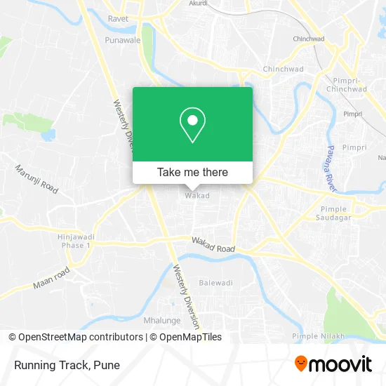
See Running Track, Paud, on the map
Public Transit to Running Track in Paud
Wondering how to get to Running Track in Paud? Moovit helps you find the best way to get to Running Track with step-by-step directions from the nearest public transit station.
Moovit provides free maps and live directions to help you navigate through your city. View schedules, routes, timetables, and find out how long does it take to get to Running Track in real time.
Looking for the nearest stop or station to Running Track? Check out this list of stops closest to your destination: Arya Medical Samrat Chowk Wakad; Kala Khadak Vasahat.
Bus: 100, 276, 306A, 317, 35, 35A, 43, 327, 327A, 44, 74, 115, 306.Train: 99810.
Want to see if there’s another route that gets you there at an earlier time? Moovit helps you find alternative routes or times. Get directions from and directions to Running Track easily from the Moovit App or Website.
We make riding to Running Track easy, which is why over 1.5 million users, including users in Paud, trust Moovit as the best app for public transit. You don’t need to download an individual bus app or train app, Moovit is your all-in-one transit app that helps you find the best bus time or train time available.
For information on prices of bus and train, costs and ride fares to Running Track, please check the Moovit app.
Use the app to navigate to popular places including to the airport, hospital, stadium, grocery store, mall, coffee shop, school, college, and university.
Running Track Address: Wakad, Pimpri Chinchwad, Maharashtra street in Paud
- Goldcrest Salon,
- Hanumant Mote,
- Swapnil Provision And General Stores,
- Bhumkar Dairy Farm,
- Orion Hospital-ER,
- Carl Zeiss,
- Dr. Sachin Shivnitwar Clinic,
- Pramek Solns,
- Nakshatra Superspeciality Eye Hospi,
- Be Beautiful Ladies Salon & Academy,
- Go Square, Wakad,
- Swami Samarth Farmer Weekly Market-Wakad Pune,
- Hotel Aarti,
- SK Optical,
- 173 West Oaks,
- Suburban Diagnostic,
- Edenn Tower Cooperative Housing Society,
- Whirlpool Service Center Centre Wak,
- Banglore Iyengar Bakery,
- Vision Eye Optics
Places Near Running Track (Paud)
- Pune Okayama Friendship Garden, Pune & Velhe,
- BAPS Shri Swaminarayan Mandir, Pune & Velhe,
- Tulshibaug, Pune & Velhe,
- Chaturshringi Temple, Pune & Velhe,
- Symbiosis Lavale Bus Stop, Pune & Velhe,
- ISKCON Nvcc Temple, Pune & Velhe,
- Laxmi Road, Pune & Velhe,
- Pvr Icon - Pavilion Mall, Pune & Velhe,
- ISKCON Pune, Pune & Velhe,
- Vishwakarma Institute Of Technology (Vit), Pune & Velhe,
- Fc Road, Pune & Velhe,
- Dagadusheth Halwai Ganapati Temple, Pune & Velhe,
- M G Road, Pune & Velhe,
- Cognizant Deccan Campus (CDC), Paud,
- Dagdusheth Halwai Ganpati Mandir, Pune & Velhe,
- Senapati Bapat Road, Pune & Velhe,
- Sarasbaug, Pune & Velhe,
- Swaminarayan Mandir, Pune & Velhe,
- Ion Digital Zone, Pune & Velhe,
- Westend Mall, Pune & Velhe
How to get to popular places in Pune with public transit
Get around Paud by public transit!
Traveling around Paud has never been so easy. See step by step directions as you travel to any attraction, street or major public transit station. View bus and train schedules, arrival times, service alerts and detailed routes on a map, so you know exactly how to get to anywhere in Paud.
When traveling to any destination around Paud use Moovit's Live Directions with Get Off Notifications to know exactly where and how far to walk, how long to wait for your line, and how many stops are left. Moovit will alert you when it's time to get off — no need to constantly re-check whether yours is the next stop.
Wondering how to use public transit in Paud or how to pay for public transit in Paud? Moovit public transit app can help you navigate your way with public transit easily, and at minimum cost. It includes public transit fees, ticket prices, and costs. Looking for a map of Paud public transit lines? Moovit public transit app shows all public transit maps in Paud with all Bus, Train and Metro routes and stops on an interactive map.
Pune has 3 transit type(s), including: Bus, Train and Metro, operated by several transit agencies, including Pune Metro (Maha Metro), PMPML, PMPML Night Bus Service (Ratrani) and Central Railways (Indian Railways)