Rupert Station station - Friday schedule
| Line | Direction | Time |
|---|---|---|
| MILLENNIUM LINE | To VCC-Clark | 5:28 AM |
| MILLENNIUM LINE | To VCC-Clark | 5:34 AM |
| MILLENNIUM LINE | Lafarge Lake-Douglas | 5:35 AM |
| MILLENNIUM LINE | To VCC-Clark | 5:40 AM |
| MILLENNIUM LINE | Lafarge Lake-Douglas | 5:42 AM |
| MILLENNIUM LINE | To VCC-Clark | 5:46 AM |
| MILLENNIUM LINE | Lafarge Lake-Douglas | 5:48 AM |
| MILLENNIUM LINE | To VCC-Clark | 5:52 AM |
| MILLENNIUM LINE | Lafarge Lake-Douglas | 5:54 AM |
| MILLENNIUM LINE | To VCC-Clark | 5:57 AM |
| MILLENNIUM LINE | Lafarge Lake-Douglas | 6:00 AM |
| MILLENNIUM LINE | To VCC-Clark | 6:01 AM |
| MILLENNIUM LINE | To VCC-Clark | 6:04 AM |
| MILLENNIUM LINE | Lafarge Lake-Douglas | 6:06 AM |
| MILLENNIUM LINE | To VCC-Clark | 6:07 AM |
| MILLENNIUM LINE | To VCC-Clark | 6:10 AM |
| MILLENNIUM LINE | To VCC-Clark | 6:13 AM |
| MILLENNIUM LINE | Lafarge Lake-Douglas | 6:13 AM |
| MILLENNIUM LINE | Lafarge Lake-Douglas | 6:16 AM |
| MILLENNIUM LINE | To VCC-Clark | 6:17 AM |
| MILLENNIUM LINE | Lafarge Lake-Douglas | 6:19 AM |
| MILLENNIUM LINE | To VCC-Clark | 6:20 AM |
| MILLENNIUM LINE | Lafarge Lake-Douglas | 6:22 AM |
| MILLENNIUM LINE | To VCC-Clark | 6:23 AM |
| MILLENNIUM LINE | Lafarge Lake-Douglas | 6:25 AM |
Directions to Rupert Station (Vancouver) with public transportation
The following transit lines have routes that pass near Rupert Station
How to get to Rupert Station by bus?
Click on the bus route to see step by step directions with maps, line arrival times and updated time schedules.
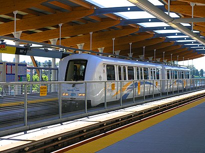
How to get to Rupert Station by SkyTrain?
Click on the SkyTrain route to see step by step directions with maps, line arrival times and updated time schedules.
Bus stations near Rupert Station in Vancouver
- Rupert Station @ Bay 1, 1 min walk,
- Westbound E Broadway @ Rupert St, 3 min walk,
Skytrain stations near Rupert Station in Vancouver
- Gilmore Station, 3 min walk,
- 29th Avenue Station, 27 min walk,
Bus lines to Rupert Station in Vancouver
- 27, Joyce Station,
- 9, Alma,
- 99, To Boundary B-Line,
- N9, Downtown,
What are the closest stations to Rupert Station?
The closest stations to Rupert Station are:
- Rupert Station @ Bay 1 is 15 meters away, 1 min walk.
- Westbound E Broadway @ Rupert St is 182 meters away, 3 min walk.
- Gilmore Station is 202 meters away, 3 min walk.
- 29th Avenue Station is 2031 meters away, 27 min walk.
Which bus lines stop near Rupert Station?
These bus lines stop near Rupert Station: 27, 9, 99.
Which SkyTrain line stops near Rupert Station?
MILLENNIUM LINE
What’s the nearest SkyTrain station to Rupert Station in Vancouver?
The nearest SkyTrain station to Rupert Station in Vancouver is Gilmore Station. It’s a 3 min walk away.
What’s the nearest bus stop to Rupert Station in Vancouver?
The nearest bus stop to Rupert Station in Vancouver is Rupert Station @ Bay 1. It’s a 1 min walk away.
What time is the first SkyTrain to Rupert Station in Vancouver?
The MILLENNIUM LINE is the first SkyTrain that goes to Rupert Station in Vancouver. It stops nearby at 5:24 AM.
What time is the last SkyTrain to Rupert Station in Vancouver?
The MILLENNIUM LINE is the last SkyTrain that goes to Rupert Station in Vancouver. It stops nearby at 1:38 AM.
What time is the first bus to Rupert Station in Vancouver?
The N9 is the first bus that goes to Rupert Station in Vancouver. It stops nearby at 3:06 AM.
What time is the last bus to Rupert Station in Vancouver?
The 99 is the last bus that goes to Rupert Station in Vancouver. It stops nearby at 3:24 AM.
See Rupert Station, Vancouver, on the map
Public transit to Rupert Station station in Vancouver
Looking for directions to Rupert Station in Vancouver, Canada?
Download the Moovit App to find the current schedule and step-by-step directions for SkyTrain or Bus routes that pass through Rupert Station.
Looking for the nearest stops closest to Rupert Station ? Check out this list of closest stops to your destination: Rupert Station @ Bay 1; Westbound E Broadway @ Rupert St; Gilmore Station; 29th Avenue Station.
Bus: 27, 9, 99, N9.SkyTrain: MILLENNIUM LINE, EXPO LINE.
We make riding on public transit to Rupert Station easy, which is why over 1.5 million users, including users in Vancouver trust Moovit as the best app for public transit.
Use the app to navigate to popular places including to the airport, hospital, stadium, grocery store, mall, coffee shop, school, college, and university.
The station has the following entrances: Rupert St
The first line to this station is MILLENNIUM LINE, at 5:28 AM, and the last line is MILLENNIUM LINE at 1:34 AM.
2698 Rupert St, Vancouver, BC, Canada
This station serves TransLink’s lines
Popular routes from Rupert Station, Vancouver
Popular public transit stations in Vancouver
Eastbound Marine Dr Offramp @ Lions Gate Bridge,Main Street-Science World Station @ Bay 1,Northbound Ingleton Ave @ Sunset St,Southbound Granville St @ W 33 Ave,Southbound Marine Way @ Market Crossing,Keith Rd @ Horseshoe Bay Ferry Terminal,Eastbound North Fraser Way @ 5000 Block,Eastbound W 4th Ave @ Fir St,Eastbound Kingsway @ St. Catherines St,Eastbound W Broadway @ Alder St,Eastbound SE Marine Dr @ Victoria Dr,Richmond-Brighouse Station,Townsite at Terminal Ave N,Westbound W 49 Ave @ Larch St,Lafarge Lake-Douglas Station @ Bay 3,Mill Bay - Mill Bay Shopping Centre,Northbound Garden City Rd @ Alderbridge Way,Northbound 208 St @ 80 Ave,Lougheed Hwy @ Boundary Loop,Holdom StationGet around Southwest British Columbia by public transit!
Traveling around Southwest British Columbia has never been so easy. See step by step directions as you travel to any attraction, street or major public transit station. View bus and train schedules, arrival times, service alerts and detailed routes on a map, so you know exactly how to get to anywhere in Southwest British Columbia.
When traveling to any destination around Southwest British Columbia use Moovit's Live Directions with Get Off Notifications to know exactly where and how far to walk, how long to wait for your line, and how many stops are left. Moovit will alert you when it's time to get off — no need to constantly re-check whether yours is the next stop.
Wondering how to use public transit in Southwest British Columbia or how to pay for public transit in Southwest British Columbia? Moovit public transit app can help you navigate your way with public transit easily, and at minimum cost. It includes public transit fees, ticket prices, and costs. Looking for a map of Southwest British Columbia public transit lines? Moovit public transit app shows all public transit maps in Southwest British Columbia with all Bus, Train, SkyTrain and Ferry routes and stops on an interactive map.
Southwest British Columbia has 4 transit type(s), including: Bus, Train, SkyTrain and Ferry, operated by several transit agencies, including TransLink, False Creek Ferries, BC Ferries, Aquabus, BC Transit - Central Fraser Valley Transit System, BCTransit, BC Transit - Comox Valley Transit System, BC Transit - Aggasiz-Harrison and Hope Transit System, BC Transit - Chilliwack Transit System, BC Transit - Squamish, BC Transit - Whistler Transit System, BC Transit - Cowichan Valley Regional Transit System, BC Transit - Campbell River Transit System, BC Transit - Powell River Regional Transit System, BC Transit - Sunshine Coast Transit System