How to get to Russell Lantz Carpentry Service by bus?
Click on the bus route to see step by step directions with maps, line arrival times and updated time schedules.
From Charlton Memorial Hospital, Fall River
91 minFrom Amazon Fulfillment Bos7, Fall River
110 minFrom Bedford Industrial Park, New Bedford
156 minFrom Walmart Fall River Supercenter, Fall River
86 minFrom RMV New Bedford, New Bedford
156 minFrom B.M.C. Durfee High School, Fall River
72 minFrom Bristol Community College, Fall River
73 minFrom Lizzy Borden House, Fall River
62 min
Bus stop near Russell Lantz Carpentry Service in Boston
- Park & Ride (Fish Road - Tiverton), 37 min walk,VIEW
Bus lines to Russell Lantz Carpentry Service in Boston
What are the closest stations to Russell Lantz Carpentry Service?
The closest stations to Russell Lantz Carpentry Service are:
- Park & Ride (Fish Road - Tiverton) is 3141 yards away, 37 min walk.
Which bus lines stop near Russell Lantz Carpentry Service?
These bus lines stop near Russell Lantz Carpentry Service: 101, 24L.
What time is the first bus to Russell Lantz Carpentry Service in Boston?
The 24L is the first bus that goes to Russell Lantz Carpentry Service in Boston. It stops nearby at 6:24 AM.
What time is the last bus to Russell Lantz Carpentry Service in Boston?
The 24L is the last bus that goes to Russell Lantz Carpentry Service in Boston. It stops nearby at 7:26 PM.
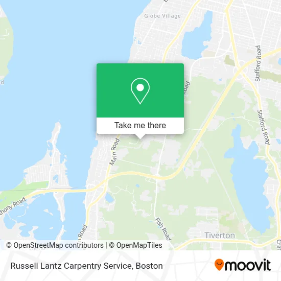
See Russell Lantz Carpentry Service, Boston, on the map
Public Transit to Russell Lantz Carpentry Service in Boston
Wondering how to get to Russell Lantz Carpentry Service in Boston? Moovit helps you find the best way to get to Russell Lantz Carpentry Service with step-by-step directions from the nearest public transit station.
Moovit provides free maps and live directions to help you navigate through your city. View schedules, routes, timetables, and find out how long does it take to get to Russell Lantz Carpentry Service in real time.
Looking for the nearest stop or station to Russell Lantz Carpentry Service? Check out this list of stops closest to your destination: Park & Ride (Fish Road - Tiverton).
Bus: 101, 24L, 61X.
Want to see if there’s another route that gets you there at an earlier time? Moovit helps you find alternative routes or times. Get directions from and directions to Russell Lantz Carpentry Service easily from the Moovit App or Website.
We make riding to Russell Lantz Carpentry Service easy, which is why over 1.7 million users, including users in Boston, trust Moovit as the best app for public transit. You don’t need to download an individual bus app or train app, Moovit is your all-in-one transit app that helps you find the best bus time or train time available.
For information on prices of bus, costs and ride fares to Russell Lantz Carpentry Service, please check the Moovit app.
Use the app to navigate to popular places including to the airport, hospital, stadium, grocery store, mall, coffee shop, school, college, and university.
Russell Lantz Carpentry Service Address: 191 Hayden Ave street in Boston
- Moses Hunt Lot,
- Liferaft and Survival Equipment (Life Raft & Survival Equipment - Lrse),
- Cvs,
- Mercedes Benz,
- Mercedes-Benz of Tiverton,
- Viti VOLVO Cars Tiverton,
- Northeast Millwork Corp,
- St Angelo Hardwoods,
- Dunkin',
- Tom's,
- Deacon Benjamin Hambly Lot,
- Hadad David A DMD,
- Isaac Sherman Lot,
- LAL Construction Co Inc,
- American Dream,
- Edward Bailey Lot,
- Teacher's Pet Pre-K,
- Leo's Greenhouse,
- U-Haul,
- William Sherman Lot
Places Near Russell Lantz Carpentry Service (Boston)
- Boston Children's Hospital, Boston,
- Prudential Center, Boston,
- North End, Boston,
- Leader Bank Pavilion (Leader Bank Pavillion), Boston,
- Seaport District, Boston,
- Wilbur Theatre, Boston,
- Massachusetts General Hospital, Boston,
- Boston Convention & Exhibition Center, Boston,
- Mgm Music Hall, Boston,
- House Of Blues, Boston,
- Isabella Stewart Gardner Museum, Boston,
- Museum Of Science, Boston,
- Td Garden, Boston,
- Boston Medical Center, Boston,
- Wang Theater, Boston,
- Cheers, Boston,
- Faneuil Hall, Boston,
- Boston Common, Boston,
- Castle Island, Boston,
- Quincy Market, Boston
How to get to popular places in Boston with public transit
Get around Boston by public transit!
Traveling around Boston has never been so easy. See step by step directions as you travel to any attraction, street or major public transit station. View bus and train schedules, arrival times, service alerts and detailed routes on a map, so you know exactly how to get to anywhere in Boston.
When traveling to any destination around Boston use Moovit's Live Directions with Get Off Notifications to know exactly where and how far to walk, how long to wait for your line, and how many stops are left. Moovit will alert you when it's time to get off — no need to constantly re-check whether yours is the next stop.
Wondering how to use public transit in Boston or how to pay for public transit in Boston? Moovit public transit app can help you navigate your way with public transit easily, and at minimum cost. It includes public transit fees, ticket prices, and costs. Looking for a map of Boston public transit lines? Moovit public transit app shows all public transit maps in Boston with all Bus, Train, Subway and Ferry routes and stops on an interactive map.
Boston has 4 transit type(s), including: Bus, Train, Subway and Ferry, operated by several transit agencies, including MBTA, Southeastern Regional Transit Authority, MetroWest Regional Transit Authority, Rhode Island Public Transit Authority, WRTA, Lowell Regional Transit Authority, Merrimack Valley Transit, Montachusett Regional Transit Authority, Cape Cod Regional Transit Authority, Brockton Area Transit Authority, Martha's Vineyard Transit Authority, the WAVE - Nantucket Regional Transit Authority, GATRA, Cape Ann Transportation Authority and Massport