See Rutland Downtown Historic District on the map
Directions to Rutland Downtown Historic District with public transportation
The following transit lines have routes that pass near Rutland Downtown Historic District
 Bus:
Bus:
How to get to Rutland Downtown Historic District by bus?
Click on the bus route to see step by step directions with maps, line arrival times and updated time schedules.
Bus stations near Rutland Downtown Historic District
- Library,2 min walk,
- Wales St. & Center St.,2 min walk,
- Wales St. & Washington St.,3 min walk,
- Price Chopper / Merchants Row,5 min walk,
Bus lines to Rutland Downtown Historic District
- SOUTH EXTENSION,Rutland Multi-Modal Transit Center,
- HOSPITAL,Rutland Multi-Modal Transit Center,
- NORTH,Rutland Multi-Modal Transit Center,
- WEST,West St. & Cramton Ave.,
What are the closest stations to Rutland Downtown Historic District?
The closest stations to Rutland Downtown Historic District are:
- Library is 101 yards away, 2 min walk.
- Wales St. & Center St. is 124 yards away, 2 min walk.
- Wales St. & Washington St. is 221 yards away, 3 min walk.
- Price Chopper / Merchants Row is 395 yards away, 5 min walk.
Which bus lines stop near Rutland Downtown Historic District?
These bus lines stop near Rutland Downtown Historic District: DIAMOND EXPRESS, FAIR HAVEN, LUDLOW, MANCHESTER.
What’s the nearest bus stop to Rutland Downtown Historic District?
The nearest bus stops to Rutland Downtown Historic District are Library and Wales St. & Center St.. The closest one is a 2 min walk away.
See Rutland Downtown Historic District on the map
Public Transportation to Rutland Downtown Historic District
Wondering how to get to Rutland Downtown Historic District, United States? Moovit helps you find the best way to get to Rutland Downtown Historic District with step-by-step directions from the nearest public transit station.
Moovit provides free maps and live directions to help you navigate through your city. View schedules, routes, timetables, and find out how long does it take to get to Rutland Downtown Historic District in real time.
Looking for the nearest stop or station to Rutland Downtown Historic District? Check out this list of stops closest to your destination: Library; Wales St. & Center St.; Wales St. & Washington St.; Price Chopper / Merchants Row.
Bus:
Want to see if there’s another route that gets you there at an earlier time? Moovit helps you find alternative routes or times. Get directions from and directions to Rutland Downtown Historic District easily from the Moovit App or Website.
We make riding to Rutland Downtown Historic District easy, which is why over 1.5 million users, including users in Rutland, trust Moovit as the best app for public transit. You don’t need to download an individual bus app or train app, Moovit is your all-in-one transit app that helps you find the best bus time or train time available.
For information on prices of bus, costs and ride fares to Rutland Downtown Historic District, please check the Moovit app.
Use the app to navigate to popular places including to the airport, hospital, stadium, grocery store, mall, coffee shop, school, college, and university.
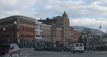
Rutland Downtown Historic District Address: Center Street street in Rutland
Attractions near Rutland Downtown Historic District
Rutland County Courthouse,Advent Christian Church,Rutland Courthouse Historic District,Rutland Free Library,Roots,Lawrence Recreation Center,Rutland Historical Society Museum,Grace Congregational United Church Of Christ,Paramount Theater,Rutland Water Fountain,Rutland City Hall,Rutland Police Department,Longfellow School,Rutland City School District Office,Marble Valley Regional Transit Center,Trinity Episcopal Church,Rutland Historical Society Building,Immaculate Heart Of Mary Roman Catholic Church,Price Chopper,First Baptist ChurchHow to get to popular attractions in Rutland with public transit
Richford, VT,UVM McAuley Hall, Chittenden,Brandon, VT, Rutland,Northfield, VT,Waterbury Park & Ride,NEFCU ATM @ Essex Cinemas, Chittenden,Newport, VT, Orleans,White River Junction Train Station (WRJ) - Amtrak, Windsor,Shelburne, VT, Chittenden,Rutland, VT, Rutland,Alburgh, VT, Grand Isle,MVU,Price Chopper,Killington Ski Resort, Rutland,Dunkin' Donuts, Chittenden,Chinatown,White River Junction, VT, Windsor,Milton Park & Ride (Exit 17), Chittenden,Brattleboro, VT, Windham,Dirt Chic Resale Clothing, ChittendenGet around Rutland by public transit!
Traveling around Rutland has never been so easy. See step by step directions as you travel to any attraction, street or major public transit station. View bus and train schedules, arrival times, service alerts and detailed routes on a map, so you know exactly how to get to anywhere in Rutland.
When traveling to any destination around Rutland use Moovit's Live Directions with Get Off Notifications to know exactly where and how far to walk, how long to wait for your line, and how many stops are left. Moovit will alert you when it's time to get off — no need to constantly re-check whether yours is the next stop.
Wondering how to use public transit in Rutland or how to pay for public transit in Rutland? Moovit public transit app can help you navigate your way with public transit easily, and at minimum cost. It includes public transit fees, ticket prices, and costs. Looking for a map of Rutland public transit lines? Moovit public transit app shows all public transit maps in Rutland with all bus routes and stops on an interactive map.
Rutland has 1 transit type(s), including: bus, operated by several transit agencies, including Green Mountain Transit, Wilmington MOOver, Advance Transit, Vermont Translines, Rockingham MOOver, The Bus (Marble Valley Regional Transit District), Green Mountain Express, Rural Community Transportation, Addison County Transit Resources, Stagecoach Transportation Services, Amtrak, Greyhound-us and FlixBus-us