Directions to Rv&Truck World (Cambridge) with public transportation
The following transit lines have routes that pass near Rv&Truck World
 Bus: 77, 87, 96, RED LINE SHUTTLE, RED LINE SHUTTLE.
- Train: FITCHBURG, RED LINE.
- Subway: RED LINE, GREEN LINE B, GREEN LINE C, GREEN LINE E.
How to get to Rv&Truck World by bus?
Click on the bus route to see step by step directions with maps, line arrival times and updated time schedules.
From MBTA Suffolk Downs Station, Boston
84 minFrom Uscis Biometrics Office, Revere
74 minFrom One Beacon Street, Boston
44 minFrom Comfort Inn & Suites Logan International Airport, Revere
75 minFrom Rino's Place, Boston
95 minFrom Tatte Bakery & Cafe, Boston
45 minFrom Colonial Theatre, Boston
48 minFrom Lemuel Shattuck Hospital, Boston
84 minFrom 7F Everett Street, Revere
74 minFrom Canopy-Boston, Boston
45 min
How to get to Rv&Truck World by train?
Click on the train route to see step by step directions with maps, line arrival times and updated time schedules.
How to get to Rv&Truck World by subway?
Click on the subway route to see step by step directions with maps, line arrival times and updated time schedules.
From MBTA Suffolk Downs Station, Boston
44 minFrom Uscis Biometrics Office, Revere
57 minFrom One Beacon Street, Boston
22 minFrom Comfort Inn & Suites Logan International Airport, Revere
59 minFrom Rino's Place, Boston
47 minFrom Tatte Bakery & Cafe, Boston
23 minFrom Colonial Theatre, Boston
24 minFrom Lemuel Shattuck Hospital, Boston
56 minFrom 7F Everett Street, Revere
56 minFrom Canopy-Boston, Boston
30 min
Bus stops near Rv&Truck World in Cambridge
Train station near Rv&Truck World in Cambridge
- Porter, 17 min walk,VIEW
Subway station near Rv&Truck World in Cambridge
- Ball Square Station, 19 min walk,VIEW
Bus lines to Rv&Truck World in Cambridge
What are the closest stations to Rv&Truck World?
The closest stations to Rv&Truck World are:
- Porter - Massachusetts Avenue @ Mount Vernon St is 433 yards away, 6 min walk.
- Elm St @ Mossland St is 439 yards away, 6 min walk.
- Massachusetts Ave @ Walden St is 495 yards away, 6 min walk.
- Massachusetts Ave @ Porter Red Line Sta is 519 yards away, 7 min walk.
- Somerville Ave @ Massachusetts Ave is 587 yards away, 8 min walk.
- Porter is 1445 yards away, 17 min walk.
- Ball Square Station is 1594 yards away, 19 min walk.
Which bus lines stop near Rv&Truck World?
These bus lines stop near Rv&Truck World: 77, 87, 96.
Which train line stops near Rv&Truck World?
FITCHBURG (#409 | Wachusett)
Which subway line stops near Rv&Truck World?
RED LINE (Alewife)
What’s the nearest subway station to Rv&Truck World in Cambridge?
The nearest subway station to Rv&Truck World in Cambridge is Ball Square Station. It’s a 19 min walk away.
What’s the nearest train station to Rv&Truck World in Cambridge?
The nearest train station to Rv&Truck World in Cambridge is Porter. It’s a 17 min walk away.
What’s the nearest bus station to Rv&Truck World in Cambridge?
The nearest bus stations to Rv&Truck World in Cambridge are Porter - Massachusetts Avenue @ Mount Vernon St, Elm St @ Mossland St and Massachusetts Ave @ Walden St. The closest one is a 6 min walk away.
What time is the first subway to Rv&Truck World in Cambridge?
The GREEN LINE E is the first subway that goes to Rv&Truck World in Cambridge. It stops nearby at 4:53 AM.
What time is the last subway to Rv&Truck World in Cambridge?
The GREEN LINE E is the last subway that goes to Rv&Truck World in Cambridge. It stops nearby at 2:39 AM.
What time is the first train to Rv&Truck World in Cambridge?
The FITCHBURG is the first train that goes to Rv&Truck World in Cambridge. It stops nearby at 5:47 AM.
What time is the last train to Rv&Truck World in Cambridge?
The FITCHBURG is the last train that goes to Rv&Truck World in Cambridge. It stops nearby at 12:17 AM.
What time is the first bus to Rv&Truck World in Cambridge?
The 77 is the first bus that goes to Rv&Truck World in Cambridge. It stops nearby at 5:03 AM.
What time is the last bus to Rv&Truck World in Cambridge?
The 87 is the last bus that goes to Rv&Truck World in Cambridge. It stops nearby at 1:31 AM.
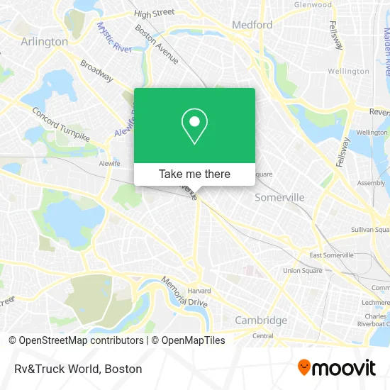
See Rv&Truck World, Cambridge, on the map
Public Transit to Rv&Truck World in Cambridge
Wondering how to get to Rv&Truck World in Cambridge? Moovit helps you find the best way to get to Rv&Truck World with step-by-step directions from the nearest public transit station.
Moovit provides free maps and live directions to help you navigate through your city. View schedules, routes, timetables, and find out how long does it take to get to Rv&Truck World in real time.
Looking for the nearest stop or station to Rv&Truck World? Check out this list of stops closest to your destination: Porter - Massachusetts Avenue @ Mount Vernon St; Elm St @ Mossland St; Massachusetts Ave @ Walden St; Massachusetts Ave @ Porter Red Line Sta; Somerville Ave @ Massachusetts Ave; Porter; Ball Square Station.
Bus: 77, 87, 96, RED LINE SHUTTLE, RED LINE SHUTTLE, RED LINE SHUTTLE, 83, RED LINE SHUTTLE.Train: FITCHBURG, RED LINE.Subway: RED LINE, GREEN LINE B, GREEN LINE C, GREEN LINE E.
Want to see if there’s another route that gets you there at an earlier time? Moovit helps you find alternative routes or times. Get directions from and directions to Rv&Truck World easily from the Moovit App or Website.
We make riding to Rv&Truck World easy, which is why over 1.7 million users, including users in Cambridge, trust Moovit as the best app for public transit. You don’t need to download an individual bus app or train app, Moovit is your all-in-one transit app that helps you find the best bus time or train time available.
For information on prices of subway, bus and train, costs and ride fares to Rv&Truck World, please check the Moovit app.
Use the app to navigate to popular places including to the airport, hospital, stadium, grocery store, mall, coffee shop, school, college, and university.
Rv&Truck World Address: 1920 Massachusetts Ave street in Cambridge
- Curry House,
- Pigeon park,
- Porter Square Hotel,
- Porter Square Hotel Cambridge,
- New Age Astrology Reading,
- Wantea,
- Margeaux Supper Parlor,
- Transcendental Meditation: Cambridge, Ma,
- Mount Olivet Lodge,
- Cambridge Masonic Temple (Cambridge Masonic Hall Association),
- MBTA Porter Square Station,
- Duckduckgoofs,
- Bitcoin Pizza - Porter Square,
- Porter Square,
- Storage Squad,
- MBTA-Porter Square,
- Henry Bear's Park,
- Phinista Cafe,
- USAlliance Federal Credit Union,
- CVS/pharmacy
Places Near Rv&Truck World (Cambridge)
- Boston Convention & Exhibition Center, Boston,
- Wilbur Theatre, Boston,
- House Of Blues, Boston,
- North End, Boston,
- Isabella Stewart Gardner Museum, Boston,
- Mgm Music Hall, Boston,
- Boston Medical Center, Boston,
- Castle Island, Boston,
- Td Garden, Boston,
- Quincy Market, Boston,
- Leader Bank Pavilion (Leader Bank Pavillion), Boston,
- Museum Of Science, Boston,
- Prudential Center, Boston,
- Boston Children's Hospital, Boston,
- Faneuil Hall, Boston,
- Massachusetts General Hospital, Boston,
- Wang Theater, Boston,
- Seaport District, Boston,
- Boston Common, Boston,
- Cheers, Boston
How to get to popular places in Boston with public transit
Get around Cambridge by public transit!
Traveling around Cambridge has never been so easy. See step by step directions as you travel to any attraction, street or major public transit station. View bus and train schedules, arrival times, service alerts and detailed routes on a map, so you know exactly how to get to anywhere in Cambridge.
When traveling to any destination around Cambridge use Moovit's Live Directions with Get Off Notifications to know exactly where and how far to walk, how long to wait for your line, and how many stops are left. Moovit will alert you when it's time to get off — no need to constantly re-check whether yours is the next stop.
Wondering how to use public transit in Cambridge or how to pay for public transit in Cambridge? Moovit public transit app can help you navigate your way with public transit easily, and at minimum cost. It includes public transit fees, ticket prices, and costs. Looking for a map of Cambridge public transit lines? Moovit public transit app shows all public transit maps in Cambridge with all Bus, Train, Subway and Ferry routes and stops on an interactive map.
Boston has 4 transit type(s), including: Bus, Train, Subway and Ferry, operated by several transit agencies, including MBTA, Southeastern Regional Transit Authority, MetroWest Regional Transit Authority, Rhode Island Public Transit Authority, WRTA, Lowell Regional Transit Authority, Merrimack Valley Transit, Montachusett Regional Transit Authority, Cape Cod Regional Transit Authority, Brockton Area Transit Authority, Martha's Vineyard Transit Authority, the WAVE - Nantucket Regional Transit Authority, GATRA, Cape Ann Transportation Authority and Massport