Directions to Rxo (Manhattan) with public transportation
The following transit lines have routes that pass near Rxo
 Bus: 119, 28, M20, Q32, QM24.
- Train: 2, EMPIRE SERVICE, PORT WASHINGTON BRANCH, RONKONKOMA BRANCH, YEL.
- Subway: 1, 2, 7, A, E.
How to get to Rxo by bus?
Click on the bus route to see step by step directions with maps, line arrival times and updated time schedules.
From Middle Village, NY, Queens
49 minFrom Yankee Stadium, Bronx
68 minFrom Metropolitan Hospital, Manhattan
35 minFrom Rikers Island, Bronx
82 minFrom 32-20 northern blvd, Queens
43 minFrom Consulado Ecuatoriano en Queens, Queens
67 minFrom Marriott Downtown, Manhattan
47 minFrom 125th St & Park Ave, Manhattan
46 minFrom NJ 440, Jersey City
75 min
How to get to Rxo by train?
Click on the train route to see step by step directions with maps, line arrival times and updated time schedules.
How to get to Rxo by subway?
Click on the subway route to see step by step directions with maps, line arrival times and updated time schedules.
Bus stops near Rxo in Manhattan
Subway stations near Rxo in Manhattan
Bus lines to Rxo in Manhattan
- M20, Lincoln Center 66 St Via 8 Av,VIEW
- M34A-SBS, Select Bus Pa Bus Trm Via 34 St Via 8 Av,VIEW
- GREENWICH, Midtown / W 39th Street - Midtown / W 39th Street,VIEW
- 34TH ST, 34th St,VIEW
- M34-SBS, Select Bus East Side Fdr Dr Crosstown,VIEW
- SIM23, Annadale Via Arden Av,VIEW
- SIM24, Midtown Via 34 St Via Madison Av,VIEW
- M7, 14 St Via Columbus Via 7 Av,VIEW
- GREYHOUND US0305, New York Port Authority,VIEW
- Q32, Penn Station,VIEW
What are the closest stations to Rxo?
The closest stations to Rxo are:
- 8 Av/W 37 St is 35 yards away, 1 min walk.
- 34 St-Penn Station is 114 yards away, 2 min walk.
- W 34th St & 8th Ave (Westbound) is 285 yards away, 4 min walk.
- W 34th St & 7th Ave is 291 yards away, 4 min walk.
- W 34 St/7 Av is 294 yards away, 4 min walk.
- 7 Av/W 37 St is 324 yards away, 4 min walk.
- New York Midtown West is 328 yards away, 4 min walk.
- 7 Av/ W 36 St is 349 yards away, 5 min walk.
- 34 St-Herald Sq is 354 yards away, 5 min walk.
- 33rd Street is 384 yards away, 5 min walk.
- Times Sq-42 St is 453 yards away, 6 min walk.
Which bus lines stop near Rxo?
These bus lines stop near Rxo: 119, 28, M20, Q32, QM24.
Which train lines stop near Rxo?
These train lines stop near Rxo: 2, EMPIRE SERVICE, PORT WASHINGTON BRANCH, RONKONKOMA BRANCH, YEL.
Which subway lines stop near Rxo?
These subway lines stop near Rxo: 1, 2, 7, A, E, M, Q, R.
What’s the nearest subway station to Rxo in Manhattan?
The nearest subway station to Rxo in Manhattan is 34 St-Herald Sq. It’s a 5 min walk away.
What’s the nearest train station to Rxo in Manhattan?
The nearest train station to Rxo in Manhattan is 34 St-Penn Station. It’s a 2 min walk away.
What’s the nearest bus station to Rxo in Manhattan?
The nearest bus station to Rxo in Manhattan is 8 Av/W 37 St. It’s a 1 min walk away.
What time is the first subway to Rxo in Manhattan?
The 2 is the first subway that goes to Rxo in Manhattan. It stops nearby at 3:00 AM.
What time is the last subway to Rxo in Manhattan?
The N is the last subway that goes to Rxo in Manhattan. It stops nearby at 4:01 AM.
What time is the first train to Rxo in Manhattan?
The PORT JEFFERSON BRANCH is the first train that goes to Rxo in Manhattan. It stops nearby at 3:01 AM.
What time is the last train to Rxo in Manhattan?
The ATW is the last train that goes to Rxo in Manhattan. It stops nearby at 3:21 AM.
What time is the first bus to Rxo in Manhattan?
The M7 is the first bus that goes to Rxo in Manhattan. It stops nearby at 3:13 AM.
What time is the last bus to Rxo in Manhattan?
The M7 is the last bus that goes to Rxo in Manhattan. It stops nearby at 3:13 AM.
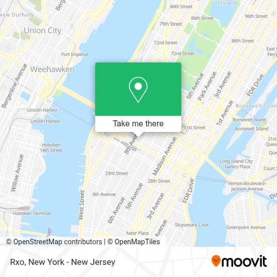
See Rxo, Manhattan, on the map
Public Transit to Rxo in Manhattan
Wondering how to get to Rxo in Manhattan? Moovit helps you find the best way to get to Rxo with step-by-step directions from the nearest public transit station.
Moovit provides free maps and live directions to help you navigate through your city. View schedules, routes, timetables, and find out how long does it take to get to Rxo in real time.
Looking for the nearest stop or station to Rxo? Check out this list of stops closest to your destination: 8 Av/W 37 St; 34 St-Penn Station; W 34th St & 8th Ave (Westbound); W 34th St & 7th Ave; W 34 St/7 Av; 7 Av/W 37 St; New York Midtown West; 7 Av/ W 36 St; 34 St-Herald Sq; 33rd Street; Times Sq-42 St.
Bus: 119, 28, M20, Q32, QM24, M34A-SBS.Train: 2, EMPIRE SERVICE, PORT WASHINGTON BRANCH, RONKONKOMA BRANCH, YEL, ACELA, ADIRONDACK, BERKSHIRE FLYER, CARDINAL, CAROLINIAN, ATW, BLU.Subway: 1, 2, 7, A, E, M, Q, R, B, D, F, FX, C, S, 7X.
Want to see if there’s another route that gets you there at an earlier time? Moovit helps you find alternative routes or times. Get directions from and directions to Rxo easily from the Moovit App or Website.
We make riding to Rxo easy, which is why over 1.5 million users, including users in Manhattan, trust Moovit as the best app for public transit. You don’t need to download an individual bus app or train app, Moovit is your all-in-one transit app that helps you find the best bus time or train time available.
For information on prices of subway, bus and train, costs and ride fares to Rxo, please check the Moovit app.
Use the app to navigate to popular places including to the airport, hospital, stadium, grocery store, mall, coffee shop, school, college, and university.
Rxo Address: 229 W 36th St street in Manhattan
- ALCC American Language,
- West 36th Street, New York City,
- Wework 229 West 36th Street,
- Museo De Ciencias Naturales,
- Linhardt Design,
- Luxe Wholesale,
- Truesecure Apps,
- Goldman Copeland,
- Wuhao Newyork Inc,
- Alexia Admor French Designer Group,
- Belma Fashions Enterprises,
- GCS,
- Amini Llc,
- Henn Na Hotel,
- Red Real Estate,
- Manifest Entertainment,
- Epiphany Manhattan Academy,
- Wingate by Wyndham Manhattan Midtown,
- General Consulate Honduras,
- Certified Public Accountants Firm Of Stewart & Rijal, Pllc
Places Near Rxo (Manhattan)
- Wall Street, Manhattan,
- 911 Memorial, Manhattan,
- qqqq, Manhattan,
- 376 Hudson Street, Manhattan,
- 3 Stone St, Manhattan,
- Hudson Yards, Manhattan,
- 26 Federal Plaza, Manhattan,
- Katz's Deli, Manhattan,
- San Gennaro Feast, Manhattan,
- 1 Police Plaza, Manhattan,
- Queens Center Mall, Queens,
- Times Square, Manhattan,
- Pier 83, Manhattan,
- Rockefeller Center, Manhattan,
- 111 Centre New York City Supreme Court, Manhattan,
- Bellevue Hospital, Manhattan,
- Chinatown, Manhattan,
- Mountainside Hospital, Glen Ridge,
- 66 John Street, Manhattan,
- SoHo, Manhattan
How to get to popular places in New York - New Jersey with public transit
Get around Manhattan by public transit!
Traveling around Manhattan has never been so easy. See step by step directions as you travel to any attraction, street or major public transit station. View bus and train schedules, arrival times, service alerts and detailed routes on a map, so you know exactly how to get to anywhere in Manhattan.
When traveling to any destination around Manhattan use Moovit's Live Directions with Get Off Notifications to know exactly where and how far to walk, how long to wait for your line, and how many stops are left. Moovit will alert you when it's time to get off — no need to constantly re-check whether yours is the next stop.
Wondering how to use public transit in Manhattan or how to pay for public transit in Manhattan? Moovit public transit app can help you navigate your way with public transit easily, and at minimum cost. It includes public transit fees, ticket prices, and costs. Looking for a map of Manhattan public transit lines? Moovit public transit app shows all public transit maps in Manhattan with all Bus, Train, Subway, Light Rail, Ferry and Cable Car routes and stops on an interactive map.
New York - New Jersey has 6 transit type(s), including: Bus, Train, Subway, Light Rail, Ferry and Cable Car, operated by several transit agencies, including MTA Subway, Metro-North Railroad, LIRR, PATH, MTA New York City Transit - Express routes, MTA Bus, NJ Transit, NYC Ferry, NICE bus, Bee-Line Bus, NJ Transit Rail, Norwalk Transit District, Hartford Line, River Valley Transit and HART