How to get to SWTCH by bus?
Click on the bus route to see step by step directions with maps, line arrival times and updated time schedules.
From Shaw Conference Centre Hall A, Edmonton
52 minFrom Hope Mission, Edmonton
45 minFrom 8440 112 Street Northwest, Edmonton
68 minFrom St Albert Farmers' Market, St. Albert
54 minFrom Grenco Industries, Edmonton
77 minFrom Lorne Akins Junior High School, St. Albert
68 minFrom Bonnie Doon, Edmonton
93 minFrom 104 Av & 104 St, Edmonton
48 minFrom Ecf Vapor Emporium Inc Since 2014, Edmonton
72 minFrom La Cite Francophone, Edmonton
89 min
Bus stops near SWTCH in Edmonton
Bus lines to SWTCH in Edmonton
What are the closest stations to SWTCH?
The closest stations to SWTCH are:
- Mayfield Common is 75 meters away, 2 min walk.
- 169 Street & Stony Plain Road is 289 meters away, 5 min walk.
- 165 Street & Stony Plain Road is 720 meters away, 10 min walk.
Which bus lines stop near SWTCH?
These bus lines stop near SWTCH: 007, 052, 054, 914, 921.
What’s the nearest bus station to SWTCH in Edmonton?
The nearest bus station to SWTCH in Edmonton is Mayfield Common. It’s a 2 min walk away.
What time is the first bus to SWTCH in Edmonton?
The 914 is the first bus that goes to SWTCH in Edmonton. It stops nearby at 6:34 AM.
What time is the last bus to SWTCH in Edmonton?
The 921 is the last bus that goes to SWTCH in Edmonton. It stops nearby at 11:23 PM.
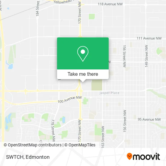
See SWTCH, Edmonton, on the map
Public Transit to SWTCH in Edmonton
Wondering how to get to SWTCH in Edmonton? Moovit helps you find the best way to get to SWTCH with step-by-step directions from the nearest public transit station.
Moovit provides free maps and live directions to help you navigate through your city. View schedules, routes, timetables, and find out how long does it take to get to SWTCH in real time.
Looking for the nearest stop or station to SWTCH? Check out this list of stops closest to your destination: Mayfield Common; 169 Street & Stony Plain Road; 165 Street & Stony Plain Road.
Bus: 007, 052, 054, 914, 921, 925, 908, 912, 924.
Want to see if there’s another route that gets you there at an earlier time? Moovit helps you find alternative routes or times. Get directions from and directions to SWTCH easily from the Moovit App or Website.
We make riding to SWTCH easy, which is why over 1.5 million users, including users in Edmonton, trust Moovit as the best app for public transit. You don’t need to download an individual bus app or train app, Moovit is your all-in-one transit app that helps you find the best bus time or train time available.
For information on prices of bus and light rail, costs and ride fares to SWTCH, please check the Moovit app.
Use the app to navigate to popular places including to the airport, hospital, stadium, grocery store, mall, coffee shop, school, college, and university.
SWTCH Address: 100 Mayfield Cmn NW Edmonton, AB T5P 4B3 street in Edmonton
- F Edmonton Mayfi,
- Riocan Management Inc,
- Fido,
- Mayfield Common Shopping Centre,
- Last Call Mayfield Common,
- FXR Foss Edm,
- Sephora,
- Benefit Cosmetics Browbar,
- BMO Bank of Montreal,
- Tommy Gun's Original Barbershop,
- Men's Room,
- Odd Burger,
- Spirit Halloween,
- Activate,
- save on foods,
- Bath Depot,
- West Edmonton Volkswagen,
- Firestone,
- Matrix Motorsports,
- Crossfire Lube
Places Near SWTCH (Edmonton)
- MacEwan University, Edmonton,
- Grey Nuns Community Hospital, Edmonton,
- Royal Alexandra Hospital, Edmonton,
- Edmonton Valley Zoo, Edmonton,
- Alberta Legislature Building, Edmonton,
- Edmonton VIA Rail Station, Edmonton,
- Borden Park, Edmonton,
- Northgate Centre, Edmonton,
- Rogers Place, Edmonton,
- Canada Place Service Canada Centre, Edmonton,
- University of Alberta, Edmonton,
- Edmonton EXPO Centre, Edmonton,
- Kingsway Mall, Edmonton,
- West Edmonton Mall, Edmonton,
- Whyte Avenue, Edmonton,
- Kaye Edmonton Clinic, Edmonton,
- Londonderry Mall, Edmonton,
- Cross Cancer Institute, Edmonton,
- Fort Edmonton Park, Edmonton,
- Edmonton Commonwealth Stadium, Edmonton
How to get to popular places in Edmonton with public transit
Get around Edmonton by public transit!
Traveling around Edmonton has never been so easy. See step by step directions as you travel to any attraction, street or major public transit station. View bus and train schedules, arrival times, service alerts and detailed routes on a map, so you know exactly how to get to anywhere in Edmonton.
When traveling to any destination around Edmonton use Moovit's Live Directions with Get Off Notifications to know exactly where and how far to walk, how long to wait for your line, and how many stops are left. Moovit will alert you when it's time to get off — no need to constantly re-check whether yours is the next stop.
Wondering how to use public transit in Edmonton or how to pay for public transit in Edmonton? Moovit public transit app can help you navigate your way with public transit easily, and at minimum cost. It includes public transit fees, ticket prices, and costs. Looking for a map of Edmonton public transit lines? Moovit public transit app shows all public transit maps in Edmonton with all Bus and Light Rail routes and stops on an interactive map.
Edmonton has 2 transit type(s), including: Bus and Light Rail, operated by several transit agencies, including ETS LRT, ETS, Strathcona County Transit, St. Albert Transit, Spruce Grove Transit, Fort Saskatchewan Transit, Beaumont Transit and Leduc Transit