How to get to SWTCH by bus?
Click on the bus route to see step by step directions with maps, line arrival times and updated time schedules.
From Bethesda North Marriott Hotel & Conference Center, Montgomery County
56 minFrom Intercounty Connector (ICC)/MD 200, Montgomery County
54 minFrom Walmart, Washington
53 minFrom Allstate Insurance Agent: Azqa Goraya, Prince George's County
66 minFrom Rock Creek Park, Washington
51 minFrom IKEA, Prince George's County
90 minFrom Rock Creek Park, Washington
61 minFrom Silver Spring Civic Building (Silver Spring Civic Center), Montgomery County
28 minFrom Walmart Supercenter Fort Totten - Riggs Rd NE, Washington
53 minFrom St John's College High School, Washington
50 min
How to get to SWTCH by metro?
Click on the metro route to see step by step directions with maps, line arrival times and updated time schedules.
From Bethesda North Marriott Hotel & Conference Center, Montgomery County
86 minFrom Walmart, Washington
57 minFrom Allstate Insurance Agent: Azqa Goraya, Prince George's County
68 minFrom Silver Spring Civic Building (Silver Spring Civic Center), Montgomery County
49 minFrom Walmart Supercenter Fort Totten - Riggs Rd NE, Washington
56 min
Bus stop near SWTCH in Montgomery County
- Arcola Ave & Orebaugh Ave, 5 min walk,VIEW
Metro station near SWTCH in Montgomery County
- Glenmont, 42 min walk,VIEW
Train station near SWTCH in Montgomery County
- Kensington Marc Wb, 61 min walk,VIEW
What are the closest stations to SWTCH?
The closest stations to SWTCH are:
- Arcola Ave & Orebaugh Ave is 357 yards away, 5 min walk.
- Glenmont is 3512 yards away, 42 min walk.
- Kensington Marc Wb is 5095 yards away, 61 min walk.
Which bus lines stop near SWTCH?
These bus lines stop near SWTCH: 31, 9.
Which metro line stops near SWTCH?
RED (Glenmont)
What’s the nearest bus station to SWTCH in Montgomery County?
The nearest bus station to SWTCH in Montgomery County is Arcola Ave & Orebaugh Ave. It’s a 5 min walk away.
What time is the first metro to SWTCH in Montgomery County?
The RED is the first metro that goes to SWTCH in Montgomery County. It stops nearby at 5:00 AM.
What time is the last metro to SWTCH in Montgomery County?
The RED is the last metro that goes to SWTCH in Montgomery County. It stops nearby at 12:37 AM.
What time is the first train to SWTCH in Montgomery County?
The MARC is the first train that goes to SWTCH in Montgomery County. It stops nearby at 5:45 AM.
What time is the last train to SWTCH in Montgomery County?
The MARC is the last train that goes to SWTCH in Montgomery County. It stops nearby at 7:42 PM.
What time is the first bus to SWTCH in Montgomery County?
The 9 is the first bus that goes to SWTCH in Montgomery County. It stops nearby at 4:44 AM.
What time is the last bus to SWTCH in Montgomery County?
The 9 is the last bus that goes to SWTCH in Montgomery County. It stops nearby at 11:04 PM.
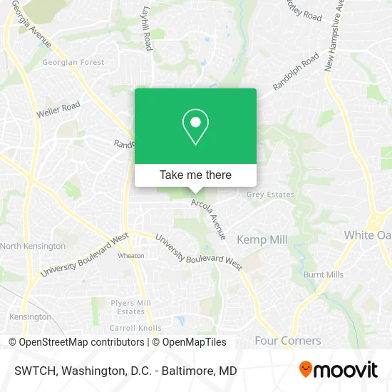
See SWTCH, Montgomery County, on the map
Public Transit to SWTCH in Montgomery County
Wondering how to get to SWTCH in Montgomery County? Moovit helps you find the best way to get to SWTCH with step-by-step directions from the nearest public transit station.
Moovit provides free maps and live directions to help you navigate through your city. View schedules, routes, timetables, and find out how long does it take to get to SWTCH in real time.
Looking for the nearest stop or station to SWTCH? Check out this list of stops closest to your destination: Arcola Ave & Orebaugh Ave; Glenmont; Kensington Marc Wb.
Bus: 31, 9.Train: MARC.Metro: RED.
Want to see if there’s another route that gets you there at an earlier time? Moovit helps you find alternative routes or times. Get directions from and directions to SWTCH easily from the Moovit App or Website.
We make riding to SWTCH easy, which is why over 1.5 million users, including users in Montgomery County, trust Moovit as the best app for public transit. You don’t need to download an individual bus app or train app, Moovit is your all-in-one transit app that helps you find the best bus time or train time available.
For information on prices of bus and metro, costs and ride fares to SWTCH, please check the Moovit app.
Use the app to navigate to popular places including to the airport, hospital, stadium, grocery store, mall, coffee shop, school, college, and university.
SWTCH Address: 11715 Orebaugh Ave Silver Spring, MD 20902 street in Montgomery County
- Shell Recharge,
- Wheaton Regional Park,
- Odessa Shannon Middle School,
- Kids Afterhours,
- MC Magic Cleaning,
- Arcola Elementary,
- Eitan Arusy,
- MCPS Transitions School,
- Washington Postal Credit Union,
- Pine Lake,
- Wheaton Regional Park,
- Wheaton Regional Park Carousel,
- Markman 1957-2005,
- Norma's Hair Design (Simon Hair Design, Walk-Ins or Appointments, Welcome),
- Motor Vehicle Administration - Kemp Mill,
- Suntrust,
- Lclm,
- Brookside Botanical Gardens,
- Alex's Radon Service,
- Brookside Gardens
Places Near SWTCH (Montgomery County)
- Westfield Montgomery Mall, Montgomery County,
- PG Mall, Prince George's County,
- The Anthem, Washington,
- Washington National Cathedral, Washington,
- Rock Creek Tennis Center, Washington,
- Capital One Arena, Washington,
- Basilica of the National Shrine, Washington,
- Warner Theatre, Washington,
- Georgetown, Washington,
- Sibley Memorial Hospital, Washington,
- Marriott Marquis Washington, DC, Washington,
- National Museum of African American History and Culture, Washington,
- M&T Bank Stadium, Baltimore,
- Pennsylvania Ave NW (3rd st and pennsylvania), Washington,
- Museum Of The Bible, Washington,
- Washington DC VA Medical Center, Washington,
- National Zoo, Washington,
- Camden Yards, Baltimore,
- Amazon Hq2, Arlington County,
- National Theatre, Washington
How to get to popular places in Washington, D.C. - Baltimore, MD with public transit
Get around Montgomery County by public transit!
Traveling around Montgomery County has never been so easy. See step by step directions as you travel to any attraction, street or major public transit station. View bus and train schedules, arrival times, service alerts and detailed routes on a map, so you know exactly how to get to anywhere in Montgomery County.
When traveling to any destination around Montgomery County use Moovit's Live Directions with Get Off Notifications to know exactly where and how far to walk, how long to wait for your line, and how many stops are left. Moovit will alert you when it's time to get off — no need to constantly re-check whether yours is the next stop.
Wondering how to use public transit in Montgomery County or how to pay for public transit in Montgomery County? Moovit public transit app can help you navigate your way with public transit easily, and at minimum cost. It includes public transit fees, ticket prices, and costs. Looking for a map of Montgomery County public transit lines? Moovit public transit app shows all public transit maps in Montgomery County with all Bus, Train, Metro, Light Rail and Ferry routes and stops on an interactive map.
Washington, D.C. - Baltimore, MD has 5 transit type(s), including: Bus, Train, Metro, Light Rail and Ferry, operated by several transit agencies, including WMATA, Montgomery County Ride On, Fairfax Connector, TheBus, PRTC, DASH - Alexandria, Arlington Transit (ART), RTA of Central Maryland, MDOT MTA, MDOT MTA Light RailLink, MDOT MTA Commuter Bus, MDOT MTA Local Bus, FXBGO!, Virginia Railway Express (VRE) and MARC