How to get to S. B. Display by bus?
Click on the bus route to see step by step directions with maps, line arrival times and updated time schedules.
From Municipality of Sesto Fiorentino, Sesto Fiorentino
92 minFrom Via di Boldrone 2, Florence
72 minFrom Panche Street, Florence
63 minFrom Sandro Pertini Street, Florence
50 minFrom Ottavio Rinuccini Street, Florence
46 minFrom Florence, Villa Costanza, Scandicci
124 minFrom Villa Costanza, Scandicci
131 minFrom Vergaio, Prato
78 minFrom Torregalli Hospital Scandicci *, Scandicci
87 minFrom Soffiano, Florence
83 min
Bus stops near S. B. Display in Campi Bisenzio
Train station near S. B. Display in Campi Bisenzio
- Calenzano, 63 min walk,VIEW
Bus lines to S. B. Display in Campi Bisenzio
What are the closest stations to S. B. Display?
The closest stations to S. B. Display are:
- Of Paradise is 241 meters away, 4 min walk.
- Magenta is 704 meters away, 10 min walk.
- Barberinese Paradiso is 757 meters away, 10 min walk.
- Tosca Fiesoli is 1129 meters away, 15 min walk.
- Calenzano is 4954 meters away, 63 min walk.
Which bus lines stop near S. B. Display?
These bus lines stop near S. B. Display: 2+, 30.
What’s the nearest bus station to S. B. Display in Campi Bisenzio?
The nearest bus station to S. B. Display in Campi Bisenzio is Of Paradise. It’s a 4 min walk away.
What time is the first train to S. B. Display in Campi Bisenzio?
The R is the first train that goes to S. B. Display in Campi Bisenzio. It stops nearby at 5:41 AM.
What time is the last train to S. B. Display in Campi Bisenzio?
The R is the last train that goes to S. B. Display in Campi Bisenzio. It stops nearby at 12:49 AM.
What time is the first bus to S. B. Display in Campi Bisenzio?
The 30 is the first bus that goes to S. B. Display in Campi Bisenzio. It stops nearby at 5:42 AM.
What time is the last bus to S. B. Display in Campi Bisenzio?
The 30 is the last bus that goes to S. B. Display in Campi Bisenzio. It stops nearby at 1:40 AM.
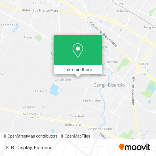
See S. B. Display, Campi Bisenzio, on the map
Public Transit to S. B. Display in Campi Bisenzio
Wondering how to get to S. B. Display in Campi Bisenzio? Moovit helps you find the best way to get to S. B. Display with step-by-step directions from the nearest public transit station.
Moovit provides free maps and live directions to help you navigate through your city. View schedules, routes, timetables, and find out how long does it take to get to S. B. Display in real time.
Looking for the nearest stop or station to S. B. Display? Check out this list of stops closest to your destination: Of Paradise; Magenta; Barberinese Paradiso; Tosca Fiesoli; Calenzano.
Bus: 2+, 30, 75, 86, 35, 206, 87, 94, 212, 303.Train: R, R, R.
Want to see if there’s another route that gets you there at an earlier time? Moovit helps you find alternative routes or times. Get directions from and directions to S. B. Display easily from the Moovit App or Website.
We make riding to S. B. Display easy, which is why over 1.5 million users, including users in Campi Bisenzio, trust Moovit as the best app for public transit. You don’t need to download an individual bus app or train app, Moovit is your all-in-one transit app that helps you find the best bus time or train time available.
For information on prices of bus and light rail, costs and ride fares to S. B. Display, please check the Moovit app.
Use the app to navigate to popular places including to the airport, hospital, stadium, grocery store, mall, coffee shop, school, college, and university.
S. B. Display Address: Via Rocco Benini, 18 50013 Campi Bisenzio street in Campi Bisenzio
- Gruppo Sim Tel,
- Best Leather Goods,
- Unicoop Florence Soccoopa Rl,
- Braconi Constructions,
- Camper Parking Florence,
- Mancinelli Group,
- Sernesi Box Factory,
- Chicca Leather Goods by Yang Xiaochun,
- Verfi di Marini Saverio and C.,
- Millepunti,
- Ucini Giovanni Fernando,
- Giacomo Fantini,
- Nexam,
- E+E,
- Tuscany Leather Goods,
- Nuovo Style,
- Angelo Botta,
- Fratelli Penna Snc Tent Construction for Street Vendors,
- Original Strong,
- Maxel
Places Near S. B. Display (Campi Bisenzio)
- Michelangelo Square, Florence,
- Torregalli Hospital Scandicci *, Scandicci,
- Field of Mars, Florence,
- Visarno Hippodrome, Florence,
- Piero Palagi Hospital Facility-Florence, Florence,
- Asmana, Campi Bisenzio,
- Tobacco Manufacture, Florence,
- Cascine Park, Florence,
- Visarno Arena, Florence,
- IKEA Florence, Sesto Fiorentino,
- I Gigli, Campi Bisenzio,
- OOO, Florence,
- Mandela Forum (Nelson Mandela Forum), Florence,
- Michelangelo Square, Florence,
- Nelson Mandela Forum, Florence,
- Santa Maria Nuova Hospital, Florence,
- Campi Bisenzio, Campi Bisenzio,
- Verdi Theater, Florence,
- Artemio Franchi Municipal Stadium, Florence,
- Santa Maria Novella Station, Florence
How to get to popular places in Florence with public transit
Get around Campi Bisenzio by public transit!
Traveling around Campi Bisenzio has never been so easy. See step by step directions as you travel to any attraction, street or major public transit station. View bus and train schedules, arrival times, service alerts and detailed routes on a map, so you know exactly how to get to anywhere in Campi Bisenzio.
When traveling to any destination around Campi Bisenzio use Moovit's Live Directions with Get Off Notifications to know exactly where and how far to walk, how long to wait for your line, and how many stops are left. Moovit will alert you when it's time to get off — no need to constantly re-check whether yours is the next stop.
Wondering how to use public transit in Campi Bisenzio or how to pay for public transit in Campi Bisenzio? Moovit public transit app can help you navigate your way with public transit easily, and at minimum cost. It includes public transit fees, ticket prices, and costs. Looking for a map of Campi Bisenzio public transit lines? Moovit public transit app shows all public transit maps in Campi Bisenzio with all Bus, Train, Light Rail, Ferry and Funicular routes and stops on an interactive map.
Florence has 5 transit type(s), including: Bus, Train, Light Rail, Ferry and Funicular, operated by several transit agencies, including Florence Urban - Tuscan Bus Lines, GEST, Livorno and Province - Tuscan Bus Lines, Arezzo, Florence and Provinces - Tuscan Bus Lines, Prato and Province - Tuscan Bus Lines, Lucca and Province - Tuscan Bus Lines, Massa, Carrara and Province - Tuscan Bus Lines, Pisa and Province - Tuscan Bus Lines, Grosseto, Siena and Provinces - Tuscan Bus Lines, Arezzo, Siena and Provinces - Tuscan Bus Lines, Florence and Province - Tuscan Bus Lines, Pistoia and Province - Tuscan Bus Lines, Siena and Province - Tuscan Bus Lines, Arezzo and Province - Tuscan Bus Lines and Trenitalia