Directions to S-Line Autoworks (Queens) with public transportation
The following transit lines have routes that pass near S-Line Autoworks
 Bus: Q101, Q32, Q66, Q104.
- Train: BABYLON BRANCH, FAR ROCKAWAY BRANCH, LONG BEACH BRANCH, PORT WASHINGTON BRANCH.
- Subway: M, R, E, F, N.
How to get to S-Line Autoworks by bus?
Click on the bus route to see step by step directions with maps, line arrival times and updated time schedules.
From 1910 monterey avenue, Bronx
90 minFrom Statue of Liberty Ferry, Manhattan
81 minFrom Consulado Mexicano en New York, Manhattan
39 minFrom Macy's Herald Square, Manhattan
62 minFrom Century 21, Manhattan
58 minFrom Citi Field, Queens
47 minFrom JP Morgan Chase Co., Jersey City
89 minFrom Walmart, North Bergen
113 min
How to get to S-Line Autoworks by train?
Click on the train route to see step by step directions with maps, line arrival times and updated time schedules.
How to get to S-Line Autoworks by subway?
Click on the subway route to see step by step directions with maps, line arrival times and updated time schedules.
Bus stops near S-Line Autoworks in Queens
Bus lines to S-Line Autoworks in Queens
What are the closest stations to S-Line Autoworks?
The closest stations to S-Line Autoworks are:
- Steinway St is 105 yards away, 2 min walk.
- Steinway St/34 Av is 135 yards away, 2 min walk.
- 35 Av/Steinway St is 318 yards away, 4 min walk.
- Broadway/Steinway St is 399 yards away, 5 min walk.
- 36 Av is 1234 yards away, 15 min walk.
Which bus lines stop near S-Line Autoworks?
These bus lines stop near S-Line Autoworks: Q101, Q32, Q66.
Which train lines stop near S-Line Autoworks?
These train lines stop near S-Line Autoworks: BABYLON BRANCH, FAR ROCKAWAY BRANCH, LONG BEACH BRANCH, PORT WASHINGTON BRANCH.
Which subway lines stop near S-Line Autoworks?
These subway lines stop near S-Line Autoworks: M, R.
What’s the nearest subway station to S-Line Autoworks in Queens?
The nearest subway station to S-Line Autoworks in Queens is Steinway St. It’s a 2 min walk away.
What’s the nearest bus station to S-Line Autoworks in Queens?
The nearest bus station to S-Line Autoworks in Queens is Steinway St/34 Av. It’s a 2 min walk away.
What time is the first subway to S-Line Autoworks in Queens?
The E is the first subway that goes to S-Line Autoworks in Queens. It stops nearby at 3:00 AM.
What time is the last subway to S-Line Autoworks in Queens?
The F is the last subway that goes to S-Line Autoworks in Queens. It stops nearby at 3:48 AM.
What time is the first bus to S-Line Autoworks in Queens?
The Q101 is the first bus that goes to S-Line Autoworks in Queens. It stops nearby at 3:11 AM.
What time is the last bus to S-Line Autoworks in Queens?
The Q66 is the last bus that goes to S-Line Autoworks in Queens. It stops nearby at 3:16 AM.
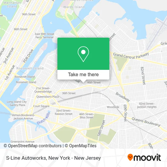
See S-Line Autoworks, Queens, on the map
Public Transit to S-Line Autoworks in Queens
Wondering how to get to S-Line Autoworks in Queens? Moovit helps you find the best way to get to S-Line Autoworks with step-by-step directions from the nearest public transit station.
Moovit provides free maps and live directions to help you navigate through your city. View schedules, routes, timetables, and find out how long does it take to get to S-Line Autoworks in real time.
Looking for the nearest stop or station to S-Line Autoworks? Check out this list of stops closest to your destination: Steinway St; Steinway St/34 Av; 35 Av/Steinway St; Broadway/Steinway St; 36 Av.
Bus: Q101, Q32, Q66, Q104.Train: BABYLON BRANCH, FAR ROCKAWAY BRANCH, LONG BEACH BRANCH, PORT WASHINGTON BRANCH.Subway: M, R, E, F, N, W.
Want to see if there’s another route that gets you there at an earlier time? Moovit helps you find alternative routes or times. Get directions from and directions to S-Line Autoworks easily from the Moovit App or Website.
We make riding to S-Line Autoworks easy, which is why over 1.5 million users, including users in Queens, trust Moovit as the best app for public transit. You don’t need to download an individual bus app or train app, Moovit is your all-in-one transit app that helps you find the best bus time or train time available.
For information on prices of subway, bus and train, costs and ride fares to S-Line Autoworks, please check the Moovit app.
Use the app to navigate to popular places including to the airport, hospital, stadium, grocery store, mall, coffee shop, school, college, and university.
S-Line Autoworks Address: 35-34 42nd St street in Queens
- Bethel International Ministries Church,
- Bubble Sharks,
- Furry Planet Spa,
- Nailsbyvivis,
- Soho Pizza,
- Piccolo Nails,
- Citi Bike,
- Proactive House,Llc,
- Goda Contracting Group,
- Modutank Inc.,
- Metro,
- Hyundai,
- Koeppel Hyundai Service and Parts,
- Ecuadorian Food,
- Koeppel Auto Group,
- Maison De Manee,
- Freakin Rican Restaurant,
- Soft Bubbles Laundromat Dry Cleaner,
- Drinkology Nyc,
- 34th Ave and 43rd
Places Near S-Line Autoworks (Queens)
- 66 John Street, Manhattan,
- Chinatown, Manhattan,
- Hudson Yards, Manhattan,
- 111 Centre New York City Supreme Court, Manhattan,
- 26 Federal Plaza, Manhattan,
- Katz's Deli, Manhattan,
- 376 Hudson Street, Manhattan,
- Times Square, Manhattan,
- 3 Stone St, Manhattan,
- Rockefeller Center, Manhattan,
- Mountainside Hospital, Glen Ridge,
- 1 Police Plaza, Manhattan,
- San Gennaro Feast, Manhattan,
- Queens Center Mall, Queens,
- Wall Street, Manhattan,
- SoHo, Manhattan,
- Bellevue Hospital, Manhattan,
- qqqq, Manhattan,
- 911 Memorial, Manhattan,
- Pier 83, Manhattan
How to get to popular places in New York - New Jersey with public transit
Get around Queens by public transit!
Traveling around Queens has never been so easy. See step by step directions as you travel to any attraction, street or major public transit station. View bus and train schedules, arrival times, service alerts and detailed routes on a map, so you know exactly how to get to anywhere in Queens.
When traveling to any destination around Queens use Moovit's Live Directions with Get Off Notifications to know exactly where and how far to walk, how long to wait for your line, and how many stops are left. Moovit will alert you when it's time to get off — no need to constantly re-check whether yours is the next stop.
Wondering how to use public transit in Queens or how to pay for public transit in Queens? Moovit public transit app can help you navigate your way with public transit easily, and at minimum cost. It includes public transit fees, ticket prices, and costs. Looking for a map of Queens public transit lines? Moovit public transit app shows all public transit maps in Queens with all Bus, Train, Subway, Light Rail, Ferry and Cable Car routes and stops on an interactive map.
New York - New Jersey has 6 transit type(s), including: Bus, Train, Subway, Light Rail, Ferry and Cable Car, operated by several transit agencies, including MTA Subway, Metro-North Railroad, LIRR, PATH, MTA New York City Transit - Express routes, MTA Bus, NJ Transit, NYC Ferry, NICE bus, Bee-Line Bus, NJ Transit Rail, Norwalk Transit District, Hartford Line, River Valley Transit and HART