Directions to S/V Fritha (Boston) with public transportation
The following transit lines have routes that pass near S/V Fritha
 Bus: 211, 9.
- Train: FALL RIVER/NEW BEDFORD.
- Ferry: CUTTYHUNK FERRY, SEASTREAK, SEASTREAK.
How to get to S/V Fritha by bus?
Click on the bus route to see step by step directions with maps, line arrival times and updated time schedules.
From Lizzy Borden House, Fall River
89 minFrom RMV New Bedford, New Bedford
112 minFrom B.M.C. Durfee High School, Fall River
100 minFrom Charlton Memorial Hospital, Fall River
119 minFrom Amazon Fulfillment Bos7, Fall River
134 minFrom Bristol Community College, Fall River
101 minFrom Bedford Industrial Park, New Bedford
115 minFrom Walmart Fall River Supercenter, Fall River
114 minFrom Mass Maritime Academy, Buzzards Bay
145 minFrom Falmouth MA USA, Falmouth
118 min
Bus stop near S/V Fritha in Boston
- Huttleston Ave And Green St, 11 min walk,VIEW
Train station near S/V Fritha in Boston
- New Bedford, 41 min walk,VIEW
Ferry stations near S/V Fritha in Boston
Bus lines to S/V Fritha in Boston
- 211, Fairhaven,VIEW
What are the closest stations to S/V Fritha?
The closest stations to S/V Fritha are:
- Huttleston Ave And Green St is 867 yards away, 11 min walk.
- New Bedford is 3486 yards away, 41 min walk.
- Cuttyhunk Ferry Pier, New Bedford, MA is 4501 yards away, 53 min walk.
- New Bedford, MA is 4604 yards away, 54 min walk.
Which bus lines stop near S/V Fritha?
These bus lines stop near S/V Fritha: 211, 9.
What’s the nearest bus station to S/V Fritha in Boston?
The nearest bus station to S/V Fritha in Boston is Huttleston Ave And Green St. It’s a 11 min walk away.
What time is the first train to S/V Fritha in Boston?
The FALL RIVER/NEW BEDFORD is the first train that goes to S/V Fritha in Boston. It stops nearby at 4:16 AM.
What time is the last train to S/V Fritha in Boston?
The FALL RIVER/NEW BEDFORD is the last train that goes to S/V Fritha in Boston. It stops nearby at 1:38 AM.
What time is the first bus to S/V Fritha in Boston?
The 211 is the first bus that goes to S/V Fritha in Boston. It stops nearby at 6:19 AM.
What time is the last bus to S/V Fritha in Boston?
The 211 is the last bus that goes to S/V Fritha in Boston. It stops nearby at 6:21 PM.
What time is the first ferry to S/V Fritha in Boston?
The SEASTREAK is the first ferry that goes to S/V Fritha in Boston. It stops nearby at 8:20 AM.
What time is the last ferry to S/V Fritha in Boston?
The SEASTREAK is the last ferry that goes to S/V Fritha in Boston. It stops nearby at 8:40 PM.
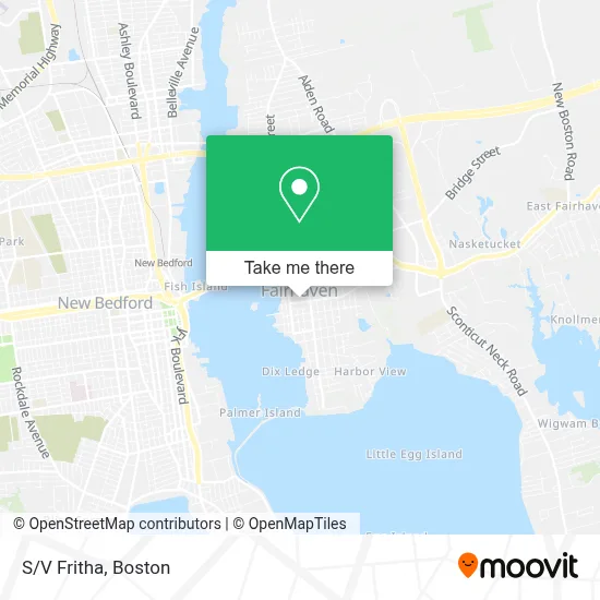
See S/V Fritha, Boston, on the map
Public Transit to S/V Fritha in Boston
Wondering how to get to S/V Fritha in Boston? Moovit helps you find the best way to get to S/V Fritha with step-by-step directions from the nearest public transit station.
Moovit provides free maps and live directions to help you navigate through your city. View schedules, routes, timetables, and find out how long does it take to get to S/V Fritha in real time.
Looking for the nearest stop or station to S/V Fritha? Check out this list of stops closest to your destination: Huttleston Ave And Green St; New Bedford; Cuttyhunk Ferry Pier; New Bedford.
Bus: 211, 9.Train: FALL RIVER/NEW BEDFORD.Ferry: CUTTYHUNK FERRY, SEASTREAK, SEASTREAK.
Want to see if there’s another route that gets you there at an earlier time? Moovit helps you find alternative routes or times. Get directions from and directions to S/V Fritha easily from the Moovit App or Website.
We make riding to S/V Fritha easy, which is why over 1.7 million users, including users in Boston, trust Moovit as the best app for public transit. You don’t need to download an individual bus app or train app, Moovit is your all-in-one transit app that helps you find the best bus time or train time available.
For information on prices of bus, costs and ride fares to S/V Fritha, please check the Moovit app.
Use the app to navigate to popular places including to the airport, hospital, stadium, grocery store, mall, coffee shop, school, college, and university.
S/V Fritha Address: 32 Washington St street in Boston
- Commonwealth Of Dominica International Maritime Registry,
- Dominica Maritime Registry, Inc,
- Ezekiel Sawin House,
- Fairhaven Pharmacy,
- Fhtv Fairhaven Community Television,
- Blue Rhino Propane Exchange,
- The Haircutters,
- Citizens Atm,
- Fleet Propeller Service,
- Gallagher Insurance, Risk Management & Consulting,
- Fairhaven Tattoo And Gallery,
- Shepherd Center For the Performing Arts,
- Pretty Paws Bakery,
- The Nook,
- Sarah Gomes,
- Vintage Soul,
- Euro at Phoenix,
- Fairhaven, Massachusetts,
- Sakura Bon Catering & Co.,
- Abigail Rose
Places Near S/V Fritha (Boston)
- House Of Blues, Boston,
- Boston Common, Boston,
- Quincy Market, Boston,
- Wilbur Theatre, Boston,
- Cheers, Boston,
- Boston Children's Hospital, Boston,
- Faneuil Hall, Boston,
- Prudential Center, Boston,
- Seaport District, Boston,
- Massachusetts General Hospital, Boston,
- North End, Boston,
- Castle Island, Boston,
- Isabella Stewart Gardner Museum, Boston,
- Mgm Music Hall, Boston,
- Leader Bank Pavilion (Leader Bank Pavillion), Boston,
- Boston Convention & Exhibition Center, Boston,
- Museum Of Science, Boston,
- Td Garden, Boston,
- Boston Medical Center, Boston,
- Wang Theater, Boston
How to get to popular places in Boston with public transit
Get around Boston by public transit!
Traveling around Boston has never been so easy. See step by step directions as you travel to any attraction, street or major public transit station. View bus and train schedules, arrival times, service alerts and detailed routes on a map, so you know exactly how to get to anywhere in Boston.
When traveling to any destination around Boston use Moovit's Live Directions with Get Off Notifications to know exactly where and how far to walk, how long to wait for your line, and how many stops are left. Moovit will alert you when it's time to get off — no need to constantly re-check whether yours is the next stop.
Wondering how to use public transit in Boston or how to pay for public transit in Boston? Moovit public transit app can help you navigate your way with public transit easily, and at minimum cost. It includes public transit fees, ticket prices, and costs. Looking for a map of Boston public transit lines? Moovit public transit app shows all public transit maps in Boston with all Bus, Train, Subway and Ferry routes and stops on an interactive map.
Boston has 4 transit type(s), including: Bus, Train, Subway and Ferry, operated by several transit agencies, including MBTA, Southeastern Regional Transit Authority, MetroWest Regional Transit Authority, Rhode Island Public Transit Authority, WRTA, Lowell Regional Transit Authority, Merrimack Valley Transit, Montachusett Regional Transit Authority, Cape Cod Regional Transit Authority, Brockton Area Transit Authority, Martha's Vineyard Transit Authority, the WAVE - Nantucket Regional Transit Authority, GATRA, Cape Ann Transportation Authority and Massport