Directions to Sabor Especial II (Chelsea) with public transportation
The following transit lines have routes that pass near Sabor Especial II
 Bus: 104, 111, 112, 116, SL3.
- Train: NEWBURYPORT/ROCKPORT.
- Subway: BLUE LINE, ORANGE LINE.
How to get to Sabor Especial II by bus?
Click on the bus route to see step by step directions with maps, line arrival times and updated time schedules.
From Dana-Farber Cancer Institute, Boston
76 minFrom Boston Public Library, Boston
59 minFrom Ruggles Station, Boston
78 minFrom Paradise Rock Club & Lounge, Boston
72 minFrom Brighton, Boston
78 minFrom MBTA Kenmore Station, Boston
77 minFrom Brighton District Court, Boston
87 minFrom Nahant Beach, Nahant
82 minFrom Franklin Park, Boston
95 minFrom Jamaica Plain, Boston
100 min
How to get to Sabor Especial II by subway?
Click on the subway route to see step by step directions with maps, line arrival times and updated time schedules.
From Dana-Farber Cancer Institute, Boston
84 minFrom Boston Public Library, Boston
60 minFrom Ruggles Station, Boston
59 minFrom Paradise Rock Club & Lounge, Boston
78 minFrom Brighton, Boston
105 minFrom MBTA Kenmore Station, Boston
67 minFrom Brighton District Court, Boston
107 minFrom Franklin Park, Boston
77 minFrom Jamaica Plain, Boston
72 min
Bus stops near Sabor Especial II in Chelsea
Subway stations near Sabor Especial II in Chelsea
Train station near Sabor Especial II in Chelsea
- Chelsea, 59 min walk,VIEW
Bus lines to Sabor Especial II in Chelsea
What are the closest stations to Sabor Especial II?
The closest stations to Sabor Especial II are:
- Spruce St Opp Mystic Mall is 121 yards away, 2 min walk.
- 45 Spruce St is 290 yards away, 4 min walk.
- Market Basket/Chelsea Station is 524 yards away, 7 min walk.
- Assembly is 4519 yards away, 54 min walk.
- Chelsea is 4751 yards away, 59 min walk.
- Wood Island is 4865 yards away, 58 min walk.
Which bus lines stop near Sabor Especial II?
These bus lines stop near Sabor Especial II: 104, 111, 112, 116, SL3.
Which train line stops near Sabor Especial II?
NEWBURYPORT/ROCKPORT (#148 | North Station)
Which subway line stops near Sabor Especial II?
BLUE LINE (Wonderland)
What’s the nearest bus station to Sabor Especial II in Chelsea?
The nearest bus station to Sabor Especial II in Chelsea is Spruce St Opp Mystic Mall. It’s a 2 min walk away.
What time is the first subway to Sabor Especial II in Chelsea?
The BLUE LINE is the first subway that goes to Sabor Especial II in Chelsea. It stops nearby at 5:10 AM.
What time is the last subway to Sabor Especial II in Chelsea?
The BLUE LINE is the last subway that goes to Sabor Especial II in Chelsea. It stops nearby at 2:01 AM.
What time is the first train to Sabor Especial II in Chelsea?
The NEWBURYPORT/ROCKPORT is the first train that goes to Sabor Especial II in Chelsea. It stops nearby at 5:40 AM.
What time is the last train to Sabor Especial II in Chelsea?
The NEWBURYPORT/ROCKPORT is the last train that goes to Sabor Especial II in Chelsea. It stops nearby at 12:06 AM.
What time is the first bus to Sabor Especial II in Chelsea?
The 104 is the first bus that goes to Sabor Especial II in Chelsea. It stops nearby at 4:37 AM.
What time is the last bus to Sabor Especial II in Chelsea?
The 104 is the last bus that goes to Sabor Especial II in Chelsea. It stops nearby at 1:24 AM.
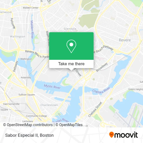
See Sabor Especial II, Chelsea, on the map
Public Transit to Sabor Especial II in Chelsea
Wondering how to get to Sabor Especial II in Chelsea? Moovit helps you find the best way to get to Sabor Especial II with step-by-step directions from the nearest public transit station.
Moovit provides free maps and live directions to help you navigate through your city. View schedules, routes, timetables, and find out how long does it take to get to Sabor Especial II in real time.
Looking for the nearest stop or station to Sabor Especial II? Check out this list of stops closest to your destination: Spruce St Opp Mystic Mall; 45 Spruce St; Market Basket/Chelsea Station; Assembly; Chelsea; Wood Island.
Bus: 104, 111, 112, 116, SL3, 114, LOWER MYSTIC LINK.Train: NEWBURYPORT/ROCKPORT.Subway: BLUE LINE, ORANGE LINE.
Want to see if there’s another route that gets you there at an earlier time? Moovit helps you find alternative routes or times. Get directions from and directions to Sabor Especial II easily from the Moovit App or Website.
We make riding to Sabor Especial II easy, which is why over 1.7 million users, including users in Chelsea, trust Moovit as the best app for public transit. You don’t need to download an individual bus app or train app, Moovit is your all-in-one transit app that helps you find the best bus time or train time available.
For information on prices of bus, subway and train, costs and ride fares to Sabor Especial II, please check the Moovit app.
Use the app to navigate to popular places including to the airport, hospital, stadium, grocery store, mall, coffee shop, school, college, and university.
Sabor Especial II Address: 390 Beacham St street in Chelsea
- Archie & Sons Dismantling,
- DTZ,
- New England Flower Exchange (Boston Flower Exchange),
- Cupp & Cupp Corporation,
- Hampton Inn Boston Logan Airport Chelsea,
- Home,
- 2nd St,
- TSR,
- Craft Massachusetts,
- Fallout 4,
- redbox,
- Excellence's Beauty Salon,
- GNC,
- Arsenal Consulting,
- Masshealth Enrollment Centers,
- Hourihane Cormier & Associates,
- Admirals Hill,
- Mystic Mall,
- Extra Space Storage,
- Drain Cleaning Plumbing
Places Near Sabor Especial II (Chelsea)
- Leader Bank Pavilion (Leader Bank Pavillion), Boston,
- Td Garden, Boston,
- Castle Island, Boston,
- Wilbur Theatre, Boston,
- Quincy Market, Boston,
- Boston Children's Hospital, Boston,
- North End, Boston,
- Boston Convention & Exhibition Center, Boston,
- Boston Common, Boston,
- Prudential Center, Boston,
- House Of Blues, Boston,
- Isabella Stewart Gardner Museum, Boston,
- Massachusetts General Hospital, Boston,
- Seaport District, Boston,
- Wang Theater, Boston,
- Faneuil Hall, Boston,
- Cheers, Boston,
- Museum Of Science, Boston,
- Mgm Music Hall, Boston,
- Boston Medical Center, Boston
How to get to popular places in Boston with public transit
Get around Chelsea by public transit!
Traveling around Chelsea has never been so easy. See step by step directions as you travel to any attraction, street or major public transit station. View bus and train schedules, arrival times, service alerts and detailed routes on a map, so you know exactly how to get to anywhere in Chelsea.
When traveling to any destination around Chelsea use Moovit's Live Directions with Get Off Notifications to know exactly where and how far to walk, how long to wait for your line, and how many stops are left. Moovit will alert you when it's time to get off — no need to constantly re-check whether yours is the next stop.
Wondering how to use public transit in Chelsea or how to pay for public transit in Chelsea? Moovit public transit app can help you navigate your way with public transit easily, and at minimum cost. It includes public transit fees, ticket prices, and costs. Looking for a map of Chelsea public transit lines? Moovit public transit app shows all public transit maps in Chelsea with all Bus, Train, Subway and Ferry routes and stops on an interactive map.
Boston has 4 transit type(s), including: Bus, Train, Subway and Ferry, operated by several transit agencies, including MBTA, Southeastern Regional Transit Authority, MetroWest Regional Transit Authority, Rhode Island Public Transit Authority, WRTA, Lowell Regional Transit Authority, Merrimack Valley Transit, Montachusett Regional Transit Authority, Cape Cod Regional Transit Authority, Brockton Area Transit Authority, Martha's Vineyard Transit Authority, the WAVE - Nantucket Regional Transit Authority, GATRA, Cape Ann Transportation Authority and Massport