Directions to Sacred Wisdom Energy Healing (Peabody) with public transportation
The following transit lines have routes that pass near Sacred Wisdom Energy Healing
 Bus: 435, 455.
- Train: NEWBURYPORT/ROCKPORT.
How to get to Sacred Wisdom Energy Healing by bus?
Click on the bus route to see step by step directions with maps, line arrival times and updated time schedules.
How to get to Sacred Wisdom Energy Healing by train?
Click on the train route to see step by step directions with maps, line arrival times and updated time schedules.
Bus stop near Sacred Wisdom Energy Healing in Peabody
- Washington St @ Main St, 10 min walk,VIEW
Train station near Sacred Wisdom Energy Healing in Peabody
- Beverly, 62 min walk,VIEW
Bus lines to Sacred Wisdom Energy Healing in Peabody
- 435, Central Square Via Malls,VIEW
What are the closest stations to Sacred Wisdom Energy Healing?
The closest stations to Sacred Wisdom Energy Healing are:
- Washington St @ Main St is 780 yards away, 10 min walk.
- Beverly is 5300 yards away, 62 min walk.
Which bus lines stop near Sacred Wisdom Energy Healing?
These bus lines stop near Sacred Wisdom Energy Healing: 435, 455.
Which train line stops near Sacred Wisdom Energy Healing?
NEWBURYPORT/ROCKPORT (#27 | Rockport)
What’s the nearest bus station to Sacred Wisdom Energy Healing in Peabody?
The nearest bus station to Sacred Wisdom Energy Healing in Peabody is Washington St @ Main St. It’s a 10 min walk away.
What time is the first train to Sacred Wisdom Energy Healing in Peabody?
The NEWBURYPORT/ROCKPORT is the first train that goes to Sacred Wisdom Energy Healing in Peabody. It stops nearby at 5:16 AM.
What time is the last train to Sacred Wisdom Energy Healing in Peabody?
The NEWBURYPORT/ROCKPORT is the last train that goes to Sacred Wisdom Energy Healing in Peabody. It stops nearby at 12:31 AM.
What time is the first bus to Sacred Wisdom Energy Healing in Peabody?
The 435 is the first bus that goes to Sacred Wisdom Energy Healing in Peabody. It stops nearby at 6:22 AM.
What time is the last bus to Sacred Wisdom Energy Healing in Peabody?
The 435 is the last bus that goes to Sacred Wisdom Energy Healing in Peabody. It stops nearby at 11:26 PM.
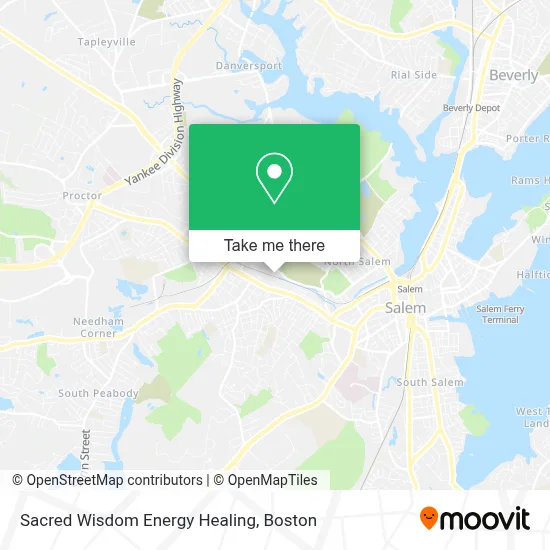
See Sacred Wisdom Energy Healing, Peabody, on the map
Public Transit to Sacred Wisdom Energy Healing in Peabody
Wondering how to get to Sacred Wisdom Energy Healing in Peabody? Moovit helps you find the best way to get to Sacred Wisdom Energy Healing with step-by-step directions from the nearest public transit station.
Moovit provides free maps and live directions to help you navigate through your city. View schedules, routes, timetables, and find out how long does it take to get to Sacred Wisdom Energy Healing in real time.
Looking for the nearest stop or station to Sacred Wisdom Energy Healing? Check out this list of stops closest to your destination: Washington St @ Main St; Beverly.
Bus: 435, 455.Train: NEWBURYPORT/ROCKPORT.
Want to see if there’s another route that gets you there at an earlier time? Moovit helps you find alternative routes or times. Get directions from and directions to Sacred Wisdom Energy Healing easily from the Moovit App or Website.
We make riding to Sacred Wisdom Energy Healing easy, which is why over 1.7 million users, including users in Peabody, trust Moovit as the best app for public transit. You don’t need to download an individual bus app or train app, Moovit is your all-in-one transit app that helps you find the best bus time or train time available.
For information on prices of bus and train, costs and ride fares to Sacred Wisdom Energy Healing, please check the Moovit app.
Use the app to navigate to popular places including to the airport, hospital, stadium, grocery store, mall, coffee shop, school, college, and university.
Sacred Wisdom Energy Healing Address: 26 Howley St street in Peabody
- Arrington Service (Arrington Towing),
- Igreja Evangélica Assembleia de Deus,
- Pierpont Park,
- Marc Pelletier - Premier Solar, LLC,
- Peabody Auto Repair,
- Gorilla Auto Repair,
- Mesin,
- Portuguese American War Veterans Post No 1,
- NLG Enterprises,
- Inn,
- Amazing Love Senior Services,
- Taylor Paul CPA,
- Wilson Kelsey Design,
- Thissell John,
- Jorgo Miraka,
- Emory Construction,
- Thecutsalonbiz,
- Salem Masonic Temple,
- Posner Laurence,
- The Tidewinds Group Peabody
Places Near Sacred Wisdom Energy Healing (Peabody)
- Faneuil Hall, Boston,
- North End, Boston,
- Wang Theater, Boston,
- Quincy Market, Boston,
- Leader Bank Pavilion (Leader Bank Pavillion), Boston,
- Massachusetts General Hospital, Boston,
- Castle Island, Boston,
- Td Garden, Boston,
- Cheers, Boston,
- Museum Of Science, Boston,
- Boston Common, Boston,
- House Of Blues, Boston,
- Seaport District, Boston,
- Isabella Stewart Gardner Museum, Boston,
- Boston Children's Hospital, Boston,
- Boston Convention & Exhibition Center, Boston,
- Boston Medical Center, Boston,
- Mgm Music Hall, Boston,
- Wilbur Theatre, Boston,
- Prudential Center, Boston
How to get to popular places in Boston with public transit
Get around Peabody by public transit!
Traveling around Peabody has never been so easy. See step by step directions as you travel to any attraction, street or major public transit station. View bus and train schedules, arrival times, service alerts and detailed routes on a map, so you know exactly how to get to anywhere in Peabody.
When traveling to any destination around Peabody use Moovit's Live Directions with Get Off Notifications to know exactly where and how far to walk, how long to wait for your line, and how many stops are left. Moovit will alert you when it's time to get off — no need to constantly re-check whether yours is the next stop.
Wondering how to use public transit in Peabody or how to pay for public transit in Peabody? Moovit public transit app can help you navigate your way with public transit easily, and at minimum cost. It includes public transit fees, ticket prices, and costs. Looking for a map of Peabody public transit lines? Moovit public transit app shows all public transit maps in Peabody with all Bus, Train, Subway and Ferry routes and stops on an interactive map.
Boston has 4 transit type(s), including: Bus, Train, Subway and Ferry, operated by several transit agencies, including MBTA, Southeastern Regional Transit Authority, MetroWest Regional Transit Authority, Rhode Island Public Transit Authority, WRTA, Lowell Regional Transit Authority, Merrimack Valley Transit, Montachusett Regional Transit Authority, Cape Cod Regional Transit Authority, Brockton Area Transit Authority, Martha's Vineyard Transit Authority, the WAVE - Nantucket Regional Transit Authority, GATRA, Cape Ann Transportation Authority and Massport