How to get to Sage Cauldron by bus?
Click on the bus route to see step by step directions with maps, line arrival times and updated time schedules.
Bus stops near Sage Cauldron in Boston
What are the closest stations to Sage Cauldron?
The closest stations to Sage Cauldron are:
- Tiogue & Arnold (Opposite Hazel) is 279 yards away, 4 min walk.
- Main Before Holden is 611 yards away, 8 min walk.
Which bus lines stop near Sage Cauldron?
These bus lines stop near Sage Cauldron: 13, 23.
What’s the nearest bus station to Sage Cauldron in Boston?
The nearest bus station to Sage Cauldron in Boston is Tiogue & Arnold (Opposite Hazel). It’s a 4 min walk away.
What time is the first bus to Sage Cauldron in Boston?
The 13 is the first bus that goes to Sage Cauldron in Boston. It stops nearby at 5:31 AM.
What time is the last bus to Sage Cauldron in Boston?
The 13 is the last bus that goes to Sage Cauldron in Boston. It stops nearby at 10:02 PM.
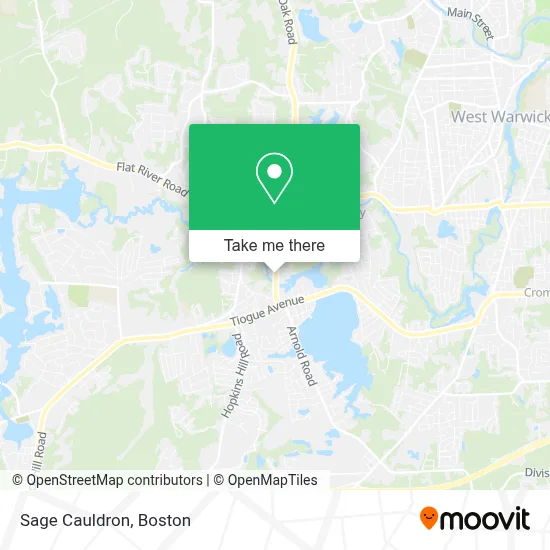
See Sage Cauldron, Boston, on the map
Public Transit to Sage Cauldron in Boston
Wondering how to get to Sage Cauldron in Boston? Moovit helps you find the best way to get to Sage Cauldron with step-by-step directions from the nearest public transit station.
Moovit provides free maps and live directions to help you navigate through your city. View schedules, routes, timetables, and find out how long does it take to get to Sage Cauldron in real time.
Looking for the nearest stop or station to Sage Cauldron? Check out this list of stops closest to your destination: Tiogue & Arnold (Opposite Hazel); Main Before Holden.
Bus: 13, 23.
Want to see if there’s another route that gets you there at an earlier time? Moovit helps you find alternative routes or times. Get directions from and directions to Sage Cauldron easily from the Moovit App or Website.
We make riding to Sage Cauldron easy, which is why over 1.7 million users, including users in Boston, trust Moovit as the best app for public transit. You don’t need to download an individual bus app or train app, Moovit is your all-in-one transit app that helps you find the best bus time or train time available.
For information on prices of bus, costs and ride fares to Sage Cauldron, please check the Moovit app.
Use the app to navigate to popular places including to the airport, hospital, stadium, grocery store, mall, coffee shop, school, college, and university.
Sage Cauldron Address: 67 Sandy Bottom rd, Century Plaza street in Boston
- Endeavors and More,
- Sweatshop Fitness Ri,
- Ellingwood George,
- All Phase Heating & Cooling,
- Rhode Island Genesis Church,
- Helping Hearts,
- Midnight Fuel Oil,
- Coventry BJJ,
- Coventry Nutrition,
- Marvin Webber -Re/Max Central,
- Donna Lima-Johnson,
- Adt,
- Coventry Animal Hospital,
- Acupuncture and Herbal Medicine - Christopher Carlow, D. Ac.,
- Instep Foot & Ankle Specialist,
- Coventry Candle Company,
- Popcorn's Dream Candy Shoppe,
- Law Offices of Nolan, Brunero, Cronin & Ferrara,
- Brunero John S Jr,
- Ocean State Credit Union
Places Near Sage Cauldron (Boston)
- Wilbur Theatre, Boston,
- Boston Convention & Exhibition Center, Boston,
- Castle Island, Boston,
- Cheers, Boston,
- Boston Common, Boston,
- Isabella Stewart Gardner Museum, Boston,
- Museum Of Science, Boston,
- Td Garden, Boston,
- House Of Blues, Boston,
- Boston Medical Center, Boston,
- North End, Boston,
- Quincy Market, Boston,
- Faneuil Hall, Boston,
- Prudential Center, Boston,
- Mgm Music Hall, Boston,
- Seaport District, Boston,
- Boston Children's Hospital, Boston,
- Wang Theater, Boston,
- Massachusetts General Hospital, Boston,
- Leader Bank Pavilion (Leader Bank Pavillion), Boston
How to get to popular places in Boston with public transit
Get around Boston by public transit!
Traveling around Boston has never been so easy. See step by step directions as you travel to any attraction, street or major public transit station. View bus and train schedules, arrival times, service alerts and detailed routes on a map, so you know exactly how to get to anywhere in Boston.
When traveling to any destination around Boston use Moovit's Live Directions with Get Off Notifications to know exactly where and how far to walk, how long to wait for your line, and how many stops are left. Moovit will alert you when it's time to get off — no need to constantly re-check whether yours is the next stop.
Wondering how to use public transit in Boston or how to pay for public transit in Boston? Moovit public transit app can help you navigate your way with public transit easily, and at minimum cost. It includes public transit fees, ticket prices, and costs. Looking for a map of Boston public transit lines? Moovit public transit app shows all public transit maps in Boston with all Bus, Train, Subway and Ferry routes and stops on an interactive map.
Boston has 4 transit type(s), including: Bus, Train, Subway and Ferry, operated by several transit agencies, including MBTA, Southeastern Regional Transit Authority, MetroWest Regional Transit Authority, Rhode Island Public Transit Authority, WRTA, Lowell Regional Transit Authority, Merrimack Valley Transit, Montachusett Regional Transit Authority, Cape Cod Regional Transit Authority, Brockton Area Transit Authority, Martha's Vineyard Transit Authority, the WAVE - Nantucket Regional Transit Authority, GATRA, Cape Ann Transportation Authority and Massport