See Saint-Étienne-De-Crossey on the map
Directions to Saint-Étienne-De-Crossey with public transportation
The following transit lines have routes that pass near Saint-Étienne-De-Crossey
 Bus:
Bus:
How to get to Saint-Étienne-De-Crossey by bus?
Click on the bus route to see step by step directions with maps, line arrival times and updated time schedules.
Bus stations near Saint-Étienne-De-Crossey
- Saint-Étienne-De-Crossey, Village,3 min walk,
- Village,3 min walk,
- Pompiers,8 min walk,
- Couchonniere,10 min walk,
- Les Vachonnes,12 min walk,
Bus lines to Saint-Étienne-De-Crossey
- T41,Chambéry, Gare Routiere,
- D,Eglise - Miribel Les Echelles,
- TAD-D,Chapelle De Merlas - Merlas,
- VO42,Ture - St Aupre,
- PM44,College Plan Menu - Coublevie,
- VO41,Ture - St Aupre,
- VO43,Gare Sud 13 - Voiron,
- PM41,College Plan Menu - Coublevie,
- PM43,Gateliere - St Etienne De Crossey,
What are the closest stations to Saint-Étienne-De-Crossey?
The closest stations to Saint-Étienne-De-Crossey are:
- Saint-Étienne-De-Crossey, Village is 162 meters away, 3 min walk.
- Village is 163 meters away, 3 min walk.
- Pompiers is 604 meters away, 8 min walk.
- Couchonniere is 781 meters away, 10 min walk.
- Les Vachonnes is 897 meters away, 12 min walk.
Which bus lines stop near Saint-Étienne-De-Crossey?
These bus lines stop near Saint-Étienne-De-Crossey: D, T41.
What’s the nearest bus stop to Saint-Étienne-De-Crossey?
The nearest bus stops to Saint-Étienne-De-Crossey are Saint-Étienne-De-Crossey, Village and Village. The closest one is a 3 min walk away.
What time is the first bus to Saint-Étienne-De-Crossey?
The T41 is the first bus that goes to Saint-Étienne-De-Crossey. It stops nearby at 6:25 AM.
What time is the last bus to Saint-Étienne-De-Crossey?
The T41 is the last bus that goes to Saint-Étienne-De-Crossey. It stops nearby at 7:22 PM.
How much is the light rail fare to Saint-Étienne-De-Crossey?
The light rail fare to Saint-Étienne-De-Crossey costs about €1.70.
How much is the bus fare to Saint-Étienne-De-Crossey?
The bus fare to Saint-Étienne-De-Crossey costs about €1.70.
See Saint-Étienne-De-Crossey on the map
Public Transportation to Saint-Étienne-De-Crossey
Wondering how to get to Saint-Étienne-De-Crossey, France? Moovit helps you find the best way to get to Saint-Étienne-De-Crossey with step-by-step directions from the nearest public transit station.
Moovit provides free maps and live directions to help you navigate through your city. View schedules, routes, timetables, and find out how long does it take to get to Saint-Étienne-De-Crossey in real time.
Looking for the nearest stop or station to Saint-Étienne-De-Crossey? Check out this list of stops closest to your destination: Saint-Étienne-De-Crossey, Village; Village; Pompiers; Couchonniere; Les Vachonnes.
Bus:
Want to see if there’s another route that gets you there at an earlier time? Moovit helps you find alternative routes or times. Get directions from and directions to Saint-Étienne-De-Crossey easily from the Moovit App or Website.
We make riding to Saint-Étienne-De-Crossey easy, which is why over 1.5 million users, including users in Saint-Étienne-De-Crossey, trust Moovit as the best app for public transit. You don’t need to download an individual bus app or train app, Moovit is your all-in-one transit app that helps you find the best bus time or train time available.
For information on prices of bus, light rail and train, costs and ride fares to Saint-Étienne-De-Crossey, please check the Moovit app.
Use the app to navigate to popular places including to the airport, hospital, stadium, grocery store, mall, coffee shop, school, college, and university.
Saint-Étienne-De-Crossey Address: Route de Voiron street in Saint-Étienne-De-Crossey
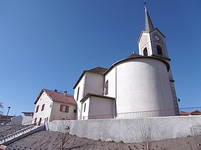
Saint-Étienne-de-Crossey (French pronunciation: [sɛ̃.t‿etjɛn də kʁɔsɛ]) is a commune in the Isère department in southeastern France.Wiki
Attractions near Saint-Étienne-De-Crossey
Boucherie Charc Franck Perrin,Capifrance Bonnabe Jean-Pierre Mandataire Indépendant,Étang Dauphin,Papa Colombel Grace,Lalunet,M Georges Mollier,Petits Pas Pour l'Homme,Pratclotilde,Cap 2S,Couchonnière,Aqua Maintenance Conseil,SOS Bouger San,Lartvoisier,Bricocity,La Vouisienne,Château de Passières,Col De La Croix Bayard,Tolvon,Les Gros,La TivollièreHow to get to popular attractions in Saint-Étienne-De-Crossey with public transit
Bâtiment Stendhal, Gières,Beaurepaire, Beaurepaire,Place Grenette, Grenoble,Grenoble École De Management, Grenoble,Hôpital Sud, Échirolles,Innovallée Montbonnot, Montbonnot-Saint-Martin,Meylan, Meylan,Centre Commercial Carrefour Meylan, Meylan,Lycée Général Et Technologique André Argouges, Grenoble,Sassenage, Sassenage,Casino Challes, Challes-Les-Eaux,Pontcharra, Pontcharra,Mont Saint-Michel, Challes-Les-Eaux,Notre-Dame, Grenoble,Bâtiment Central Esrf, Grenoble,Kfc, Saint-Martin-D'Hères,Le Tacos De Lyon, Échirolles,Lycée Vaucanson, Grenoble,Péage de Chambery Nord, La Motte-Servolex,Lidl, SassenageGet around Saint-Étienne-De-Crossey by public transit!
Traveling around Saint-Étienne-De-Crossey has never been so easy. See step by step directions as you travel to any attraction, street or major public transit station. View bus and train schedules, arrival times, service alerts and detailed routes on a map, so you know exactly how to get to anywhere in Saint-Étienne-De-Crossey.
When traveling to any destination around Saint-Étienne-De-Crossey use Moovit's Live Directions with Get Off Notifications to know exactly where and how far to walk, how long to wait for your line, and how many stops are left. Moovit will alert you when it's time to get off — no need to constantly re-check whether yours is the next stop.
Wondering how to use public transit in Saint-Étienne-De-Crossey or how to pay for public transit in Saint-Étienne-De-Crossey? Moovit public transit app can help you navigate your way with public transit easily, and at minimum cost. It includes public transit fees, ticket prices, and costs. Looking for a map of Saint-Étienne-De-Crossey public transit lines? Moovit public transit app shows all public transit maps in Saint-Étienne-De-Crossey with all bus, light rail or train routes and stops on an interactive map.
Saint-Étienne-De-Crossey has 3 transit type(s), including: bus, light rail or train, operated by several transit agencies, including TAG, TAG, Mobilités M - cars Région, Synchro Bus, Gresi, SNCF VOYAGEURS and capv