Directions to Saint Clement Hall (Boston) with public transportation
The following transit lines have routes that pass near Saint Clement Hall
 Bus: 501, 57, 86, GREEN LINE B SHUTTLE, GREEN LINE B SHUTTLE.
- Train: FRAMINGHAM/WORCESTER.
- Subway: GREEN LINE B.
How to get to Saint Clement Hall by bus?
Click on the bus route to see step by step directions with maps, line arrival times and updated time schedules.
From Hynes Convention Center, Boston
39 minFrom Yankee Lobster, Boston
59 minFrom Thermo Fisher Scientific, Waltham
70 minFrom Boston Marathon Finish Line, Boston
30 minFrom New England Aquarium, Boston
53 minFrom The Westin Waltham Boston, Waltham
70 minFrom Boston Marriott Long Wharf Hotel Boston, Boston
53 minFrom Leader Bank Pavilion (Leader Bank Pavillion), Boston
58 minFrom The Middle East Downstairs, Cambridge
45 minFrom Maverick Station, Boston
73 min
How to get to Saint Clement Hall by train?
Click on the train route to see step by step directions with maps, line arrival times and updated time schedules.
How to get to Saint Clement Hall by subway?
Click on the subway route to see step by step directions with maps, line arrival times and updated time schedules.
From Hynes Convention Center, Boston
48 minFrom Yankee Lobster, Boston
85 minFrom Boston Marathon Finish Line, Boston
45 minFrom New England Aquarium, Boston
63 minFrom Boston Marriott Long Wharf Hotel Boston, Boston
61 minFrom Leader Bank Pavilion (Leader Bank Pavillion), Boston
85 minFrom The Middle East Downstairs, Cambridge
63 minFrom Maverick Station, Boston
64 min
Bus stops near Saint Clement Hall in Boston
Subway station near Saint Clement Hall in Boston
- Boston College, 19 min walk,VIEW
Bus lines to Saint Clement Hall in Boston
- 57, Oak Square,VIEW
- 501, Downtown Via Cambridge St And Copley (Express),VIEW
- 86, Harvard,VIEW
- GREEN LINE B SHUTTLE, Boston College - Babcock Street,VIEW
- GREEN LINE B SHUTTLE, Boston College - Blandford Street,VIEW
- GREEN LINE B SHUTTLE, Boston College - Washington Street,VIEW
- GREEN LINE B SHUTTLE, Boston College - Back Bay (Shuttle),VIEW
- GREEN LINE B SHUTTLE, Boston College - Packard's Corner,VIEW
- SHUTTLE, Boston College - Kenmore (Shuttle),VIEW
- 65, Kenmore,VIEW
- 66, Brighton Center Via Brookline,VIEW
What are the closest stations to Saint Clement Hall?
The closest stations to Saint Clement Hall are:
- Washington St @ Foster St is 196 yards away, 3 min walk.
- Chestnut Hill Ave @ Embassy Rd is 229 yards away, 3 min walk.
- South Street - Commonwealth Ave @ South St is 611 yards away, 8 min walk.
- Chestnut Hill Ave @ Veronica Smith Ctr is 649 yards away, 8 min walk.
- Winship St @ Union St is 831 yards away, 10 min walk.
- Boston College is 1622 yards away, 19 min walk.
Which bus lines stop near Saint Clement Hall?
These bus lines stop near Saint Clement Hall: 501, 57, 86.
Which train line stops near Saint Clement Hall?
FRAMINGHAM/WORCESTER (#521 | Worcester)
Which subway line stops near Saint Clement Hall?
GREEN LINE B (Boston College)
What’s the nearest subway station to Saint Clement Hall in Boston?
The nearest subway station to Saint Clement Hall in Boston is Boston College. It’s a 19 min walk away.
What’s the nearest bus station to Saint Clement Hall in Boston?
The nearest bus stations to Saint Clement Hall in Boston are Washington St @ Foster St and Chestnut Hill Ave @ Embassy Rd. The closest one is a 3 min walk away.
What time is the first subway to Saint Clement Hall in Boston?
The GREEN LINE B is the first subway that goes to Saint Clement Hall in Boston. It stops nearby at 5:01 AM.
What time is the last subway to Saint Clement Hall in Boston?
The GREEN LINE B is the last subway that goes to Saint Clement Hall in Boston. It stops nearby at 2:39 AM.
What time is the first bus to Saint Clement Hall in Boston?
The 57 is the first bus that goes to Saint Clement Hall in Boston. It stops nearby at 4:35 AM.
What time is the last bus to Saint Clement Hall in Boston?
The 57 is the last bus that goes to Saint Clement Hall in Boston. It stops nearby at 2:28 AM.
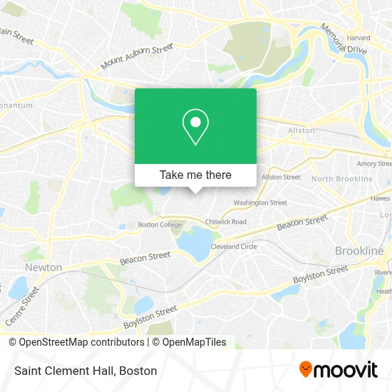
See Saint Clement Hall, Boston, on the map
Public Transit to Saint Clement Hall in Boston
Wondering how to get to Saint Clement Hall in Boston? Moovit helps you find the best way to get to Saint Clement Hall with step-by-step directions from the nearest public transit station.
Moovit provides free maps and live directions to help you navigate through your city. View schedules, routes, timetables, and find out how long does it take to get to Saint Clement Hall in real time.
Looking for the nearest stop or station to Saint Clement Hall? Check out this list of stops closest to your destination: Washington St @ Foster St; Chestnut Hill Ave @ Embassy Rd; South Street - Commonwealth Ave @ South St; Chestnut Hill Ave @ Veronica Smith Ctr; Winship St @ Union St; Boston College.
Bus: 501, 57, 86, GREEN LINE B SHUTTLE, GREEN LINE B SHUTTLE, GREEN LINE B SHUTTLE, GREEN LINE B SHUTTLE, GREEN LINE B SHUTTLE, 65, 66.Train: FRAMINGHAM/WORCESTER.Subway: GREEN LINE B.
Want to see if there’s another route that gets you there at an earlier time? Moovit helps you find alternative routes or times. Get directions from and directions to Saint Clement Hall easily from the Moovit App or Website.
We make riding to Saint Clement Hall easy, which is why over 1.7 million users, including users in Boston, trust Moovit as the best app for public transit. You don’t need to download an individual bus app or train app, Moovit is your all-in-one transit app that helps you find the best bus time or train time available.
For information on prices of bus, subway and train, costs and ride fares to Saint Clement Hall, please check the Moovit app.
Use the app to navigate to popular places including to the airport, hospital, stadium, grocery store, mall, coffee shop, school, college, and university.
Saint Clement Hall Address: 197 Foster St street in Boston
- St. Clement's Hall, Boston College,
- Weston Jesuit Community,
- Faber Jesuit Community,
- Boston College (Brighton Campus),
- Boston Professional Plumbing,
- Lighthouse Art School,
- David Moskovitz,
- Abriel Pest & Termite Control,
- Beijing Taste,
- Sheilas Cleaning SVSC,
- The Magical Forest,
- Christopher Kendig Piano,
- Academy Hill Rd & Rushmore St,
- Lucas Business Locksmith,
- Boston Pizza,
- Loop,
- Dates & Olives,
- Brighton Mobile Locksmith Store,
- Engine 29 Ladder 11 Car 11,
- In House Cafe
Places Near Saint Clement Hall (Boston)
- Faneuil Hall, Boston,
- Boston Medical Center, Boston,
- Museum Of Science, Boston,
- Td Garden, Boston,
- Castle Island, Boston,
- Mgm Music Hall, Boston,
- Prudential Center, Boston,
- Leader Bank Pavilion (Leader Bank Pavillion), Boston,
- Boston Children's Hospital, Boston,
- North End, Boston,
- Seaport District, Boston,
- Quincy Market, Boston,
- Cheers, Boston,
- Wang Theater, Boston,
- Isabella Stewart Gardner Museum, Boston,
- Wilbur Theatre, Boston,
- Massachusetts General Hospital, Boston,
- House Of Blues, Boston,
- Boston Common, Boston,
- Boston Convention & Exhibition Center, Boston
How to get to popular places in Boston with public transit
Get around Boston by public transit!
Traveling around Boston has never been so easy. See step by step directions as you travel to any attraction, street or major public transit station. View bus and train schedules, arrival times, service alerts and detailed routes on a map, so you know exactly how to get to anywhere in Boston.
When traveling to any destination around Boston use Moovit's Live Directions with Get Off Notifications to know exactly where and how far to walk, how long to wait for your line, and how many stops are left. Moovit will alert you when it's time to get off — no need to constantly re-check whether yours is the next stop.
Wondering how to use public transit in Boston or how to pay for public transit in Boston? Moovit public transit app can help you navigate your way with public transit easily, and at minimum cost. It includes public transit fees, ticket prices, and costs. Looking for a map of Boston public transit lines? Moovit public transit app shows all public transit maps in Boston with all Bus, Train, Subway and Ferry routes and stops on an interactive map.
Boston has 4 transit type(s), including: Bus, Train, Subway and Ferry, operated by several transit agencies, including MBTA, Southeastern Regional Transit Authority, MetroWest Regional Transit Authority, Rhode Island Public Transit Authority, WRTA, Lowell Regional Transit Authority, Merrimack Valley Transit, Montachusett Regional Transit Authority, Cape Cod Regional Transit Authority, Brockton Area Transit Authority, Martha's Vineyard Transit Authority, the WAVE - Nantucket Regional Transit Authority, GATRA, Cape Ann Transportation Authority and Massport