See Saint-Galmier, Saint-Etienne, on the map
Directions to Saint-Galmier (Saint-Etienne) with public transportation
The following transit lines have routes that pass near Saint-Galmier
 Train:
 - Light Rail:
Train stations near Saint-Galmier in Saint-Etienne
- Gare De Veauche St Galmier,48 min walk,
What are the closest stations to Saint-Galmier?
The closest stations to Saint-Galmier are:
- Gare De Veauche St Galmier is 3648 meters away, 48 min walk.
Which light rail line stops near Saint-Galmier?
ROANNE - ST-ETIENNE
See Saint-Galmier, Saint-Etienne, on the map
Public Transit to Saint-Galmier in Saint-Etienne
Wondering how to get to Saint-Galmier in Saint-Etienne, France? Moovit helps you find the best way to get to Saint-Galmier with step-by-step directions from the nearest public transit station.
Moovit provides free maps and live directions to help you navigate through your city. View schedules, routes, timetables, and find out how long does it take to get to Saint-Galmier in real time.
Looking for the nearest stop or station to Saint-Galmier? Check out this list of stops closest to your destination: Gare De Veauche St Galmier.
Train:Light Rail:
Want to see if there’s another route that gets you there at an earlier time? Moovit helps you find alternative routes or times. Get directions from and directions to Saint-Galmier easily from the Moovit App or Website.
We make riding to Saint-Galmier easy, which is why over 1.5 million users, including users in Saint-Etienne, trust Moovit as the best app for public transit. You don’t need to download an individual bus app or train app, Moovit is your all-in-one transit app that helps you find the best bus time or train time available.
For information on prices of light rail and bus, costs and ride fares to Saint-Galmier, please check the Moovit app.
Use the app to navigate to popular places including to the airport, hospital, stadium, grocery store, mall, coffee shop, school, college, and university.
Location: Saint-Etienne
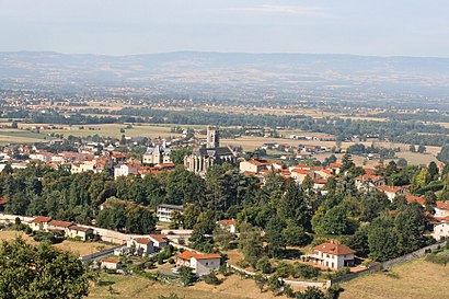
Saint-Galmier (Arpitan: Sant-Garmiér) is a commune in the Loire department in central France. Its residents are called Baldomériens.Wiki
Attractions near Saint-Galmier
Relais Du Silence La Charpiniere,42330,圣加尔米耶,Commune-Fond-Fort,Ville-Fontfort,Сен-Гальмє,سینٹ-گلمیر,42330,Vernay,Le Vernay,Chamboeuf,尚博厄,Шамбеф,Allée du Petit Bois,Le Marandier,La Cressonnière,Champ Vert,Rapeau,4 Lotissement le Belvédère,LFKMHow to get to popular attractions in Saint-Etienne with public transit
Mairie - Hôtel de Ville de Saint-Etienne, Saint-Étienne,Cathédrale Saint-Charles, Saint-Étienne,Parc Montaud, Saint-Étienne,Sncf - Gare De Châteaucreux, Saint-Étienne,Rue Franklin, Saint-Étienne,Groupement de gendarmerie 42, Saint-Étienne,Rue Des Alliés, Saint-Étienne,Lycée Professionnel Benoît Charvet, Saint-Étienne,Planétarium de Saint-Etienne, Saint-Étienne,Liogier, Saint-Étienne,Firminy, Saint-Étienne,Châteaucreux, Saint-Étienne,Quick, Saint-Étienne,Centre Congrès, Saint-Étienne,Montreynaud, Saint-Étienne,Solaure, Saint-Étienne,Salle Omnisports, Saint-Étienne,Peuple Gambetta, Saint-Étienne,Saint-Genest-Lerpt, Saint-Étienne,Marandinière, Saint-ÉtienneGet around Saint-Etienne by public transit!
Traveling around Saint-Etienne has never been so easy. See step by step directions as you travel to any attraction, street or major public transit station. View bus and train schedules, arrival times, service alerts and detailed routes on a map, so you know exactly how to get to anywhere in Saint-Etienne.
When traveling to any destination around Saint-Etienne use Moovit's Live Directions with Get Off Notifications to know exactly where and how far to walk, how long to wait for your line, and how many stops are left. Moovit will alert you when it's time to get off — no need to constantly re-check whether yours is the next stop.
Wondering how to use public transit in Saint-Etienne or how to pay for public transit in Saint-Etienne? Moovit public transit app can help you navigate your way with public transit easily, and at minimum cost. It includes public transit fees, ticket prices, and costs. Looking for a map of Saint-Etienne public transit lines? Moovit public transit app shows all public transit maps in Saint-Etienne with all light rail or bus routes and stops on an interactive map.
Saint-Etienne has 2 transit type(s), including: light rail or bus, operated by several transit agencies, including STAS, STAS and SNCF VOYAGEURS