How to get to Saint Patricks Church by bus?
Click on the bus route to see step by step directions with maps, line arrival times and updated time schedules.
How to get to Saint Patricks Church by train?
Click on the train route to see step by step directions with maps, line arrival times and updated time schedules.
Bus stops near Saint Patricks Church in Lowell
Bus lines to Saint Patricks Church in Lowell
What are the closest stations to Saint Patricks Church?
The closest stations to Saint Patricks Church are:
- Merrimack St & Aiken St is 135 yards away, 2 min walk.
- Broadway St & Suffolk St is 412 yards away, 5 min walk.
- Dutton St & Broadway St is 455 yards away, 6 min walk.
- Dutton St And Broadway St is 463 yards away, 6 min walk.
- Merrimack St & Cardinal O Connell Pkwy is 553 yards away, 7 min walk.
Which bus lines stop near Saint Patricks Church?
These bus lines stop near Saint Patricks Church: 12, 24, 9.
Which train line stops near Saint Patricks Church?
LOWELL (#331 | Lowell)
What’s the nearest bus station to Saint Patricks Church in Lowell?
The nearest bus station to Saint Patricks Church in Lowell is Merrimack St & Aiken St. It’s a 2 min walk away.
What time is the first bus to Saint Patricks Church in Lowell?
The 18 is the first bus that goes to Saint Patricks Church in Lowell. It stops nearby at 5:50 AM.
What time is the last bus to Saint Patricks Church in Lowell?
The 7 is the last bus that goes to Saint Patricks Church in Lowell. It stops nearby at 8:10 PM.
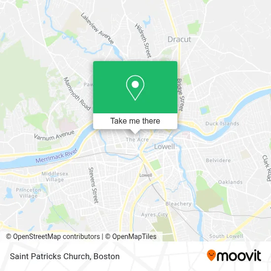
See Saint Patricks Church, Lowell, on the map
Public Transit to Saint Patricks Church in Lowell
Wondering how to get to Saint Patricks Church in Lowell? Moovit helps you find the best way to get to Saint Patricks Church with step-by-step directions from the nearest public transit station.
Moovit provides free maps and live directions to help you navigate through your city. View schedules, routes, timetables, and find out how long does it take to get to Saint Patricks Church in real time.
Looking for the nearest stop or station to Saint Patricks Church? Check out this list of stops closest to your destination: Merrimack St & Aiken St; Broadway St & Suffolk St; Dutton St & Broadway St; Dutton St And Broadway St; Merrimack St & Cardinal O Connell Pkwy.
Bus: 12, 24, 9, 7, 6, 1, 8, 10, 20, 18.Train: LOWELL.
Want to see if there’s another route that gets you there at an earlier time? Moovit helps you find alternative routes or times. Get directions from and directions to Saint Patricks Church easily from the Moovit App or Website.
We make riding to Saint Patricks Church easy, which is why over 1.7 million users, including users in Lowell, trust Moovit as the best app for public transit. You don’t need to download an individual bus app or train app, Moovit is your all-in-one transit app that helps you find the best bus time or train time available.
For information on prices of bus and train, costs and ride fares to Saint Patricks Church, please check the Moovit app.
Use the app to navigate to popular places including to the airport, hospital, stadium, grocery store, mall, coffee shop, school, college, and university.
Saint Patricks Church Address: 282 Suffolk St street in Lowell
- St Patrick School & Education Center,
- Aftershool at the Murkland,
- Holy Trnty Hllenic Orthodox CH,
- Holy Trinity Greek Orthodox Church Lowell,
- Lowe's,
- Raymond Lord Memorial Swimming Pool,
- Accollectables1,
- Install & Replace Garage Door Garage Door,
- Jeanne D'Arc Credit Union ATM,
- FedEx,
- Locksmith Around The Clock,
- Domingo Pichardo Barbe,
- Casey Family Services,
- Hollohan Health & Wellness Center,
- Esperanza Travel & Tours,
- The Hope Chest,
- Locksmith Professionals,
- Cambodia Mutual Assistance Association,
- Franklin Court Community Garden,
- Tonia Jimenez
Places Near Saint Patricks Church (Lowell)
- Castle Island, Boston,
- Isabella Stewart Gardner Museum, Boston,
- Cheers, Boston,
- Seaport District, Boston,
- House Of Blues, Boston,
- Wilbur Theatre, Boston,
- Td Garden, Boston,
- Wang Theater, Boston,
- Boston Children's Hospital, Boston,
- Prudential Center, Boston,
- Faneuil Hall, Boston,
- Museum Of Science, Boston,
- Mgm Music Hall, Boston,
- Leader Bank Pavilion (Leader Bank Pavillion), Boston,
- Massachusetts General Hospital, Boston,
- Boston Convention & Exhibition Center, Boston,
- Boston Common, Boston,
- Boston Medical Center, Boston,
- North End, Boston,
- Quincy Market, Boston
How to get to popular places in Boston with public transit
Get around Lowell by public transit!
Traveling around Lowell has never been so easy. See step by step directions as you travel to any attraction, street or major public transit station. View bus and train schedules, arrival times, service alerts and detailed routes on a map, so you know exactly how to get to anywhere in Lowell.
When traveling to any destination around Lowell use Moovit's Live Directions with Get Off Notifications to know exactly where and how far to walk, how long to wait for your line, and how many stops are left. Moovit will alert you when it's time to get off — no need to constantly re-check whether yours is the next stop.
Wondering how to use public transit in Lowell or how to pay for public transit in Lowell? Moovit public transit app can help you navigate your way with public transit easily, and at minimum cost. It includes public transit fees, ticket prices, and costs. Looking for a map of Lowell public transit lines? Moovit public transit app shows all public transit maps in Lowell with all Bus, Train, Subway and Ferry routes and stops on an interactive map.
Boston has 4 transit type(s), including: Bus, Train, Subway and Ferry, operated by several transit agencies, including MBTA, Southeastern Regional Transit Authority, MetroWest Regional Transit Authority, Rhode Island Public Transit Authority, WRTA, Lowell Regional Transit Authority, Merrimack Valley Transit, Montachusett Regional Transit Authority, Cape Cod Regional Transit Authority, Brockton Area Transit Authority, Martha's Vineyard Transit Authority, the WAVE - Nantucket Regional Transit Authority, GATRA, Cape Ann Transportation Authority and Massport