Saint-Philippe-Du-Roule stop - Thursday schedule
| Line | Direction | Time |
|---|---|---|
| 52 | Parc de Saint-Cloud | 07:09 |
| 52 | Parc de Saint-Cloud | 07:22 |
| 52 | Parc de Saint-Cloud | 07:34 |
| 52 | Parc de Saint-Cloud | 07:47 |
| 52 | Parc de Saint-Cloud | 07:59 |
| 52 | Parc de Saint-Cloud | 08:11 |
| 52 | Parc de Saint-Cloud | 08:23 |
| 52 | Parc de Saint-Cloud | 08:35 |
| 52 | Parc de Saint-Cloud | 08:47 |
| 52 | Parc de Saint-Cloud | 08:59 |
| 52 | Parc de Saint-Cloud | 09:11 |
| 52 | Parc de Saint-Cloud | 09:23 |
| 52 | Parc de Saint-Cloud | 09:35 |
| 52 | Parc de Saint-Cloud | 09:47 |
| 52 | Parc de Saint-Cloud | 09:59 |
| 52 | Parc de Saint-Cloud | 10:09 |
| 52 | Parc de Saint-Cloud | 10:19 |
| 52 | Parc de Saint-Cloud | 10:29 |
| 52 | Parc de Saint-Cloud | 10:39 |
| 52 | Parc de Saint-Cloud | 10:49 |
| 52 | Parc de Saint-Cloud | 10:59 |
| 52 | Parc de Saint-Cloud | 11:12 |
| 52 | Parc de Saint-Cloud | 11:25 |
| 52 | Parc de Saint-Cloud | 11:38 |
| 52 | Parc de Saint-Cloud | 11:51 |
Directions to Saint-Philippe-Du-Roule stop (Paris) with public transit
The following transit lines have routes that pass near Saint-Philippe-Du-Roule
How to get to Saint-Philippe-Du-Roule stop by bus?
Click on the bus route to see step by step directions with maps, line arrival times and updated time schedules.
How to get to Saint-Philippe-Du-Roule stop by train?
Click on the train route to see step by step directions with maps, line arrival times and updated time schedules.
How to get to Saint-Philippe-Du-Roule stop by metro?
Click on the metro route to see step by step directions with maps, line arrival times and updated time schedules.
Bus stops near Saint-Philippe-Du-Roule stop in Paris
- Saint-Philippe-Du-Roule, 1 min walk,
- Haussmann - Courcelles, 4 min walk,
- La Boétie - Percier, 5 min walk,
- Haussmann - Miromesnil, 6 min walk,
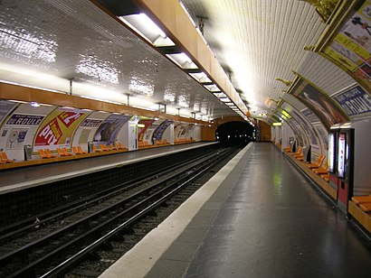
Metro stations near Saint-Philippe-Du-Roule station in Paris
- Saint-Philippe-Du-Roule, 2 min walk,
- Miromesnil, 5 min walk,
- George V, 6 min walk,
Bus lines to Saint-Philippe-Du-Roule stop in Paris
- 52, Opéra - Rue Halevy,
- 28, Porte de Clichy,
- 32, Porte D'Auteuil,
- 80, Porte de Versailles,
- 93, Invalides,
- 22, Porte de Saint-Cloud,
- 43, Gare du Nord,
- N53, Nanterre - Anatole France,
- N02, Gare Montparnasse,
- N01, Barbès - Rochechouart,
- 84, Alsace,
What are the closest stations to Saint-Philippe-Du-Roule?
The closest stations to Saint-Philippe-Du-Roule are:
- Saint-Philippe-Du-Roule is 63 meters away, 1 min walk.
- Haussmann - Courcelles is 259 meters away, 4 min walk.
- La Boétie - Percier is 311 meters away, 5 min walk.
- Miromesnil is 357 meters away, 5 min walk.
- George V is 406 meters away, 6 min walk.
- Haussmann - Miromesnil is 437 meters away, 6 min walk.
Which train line stops near Saint-Philippe-Du-Roule?
J (Ermont - Eaubonne/ Gisors/ Mantes-la-Jolie /Vernon - Giverny)
Which metro line stops near Saint-Philippe-Du-Roule?
9 (Mairie de Montreuil)
Which bus lines stop near Saint-Philippe-Du-Roule?
These bus lines stop near Saint-Philippe-Du-Roule: 22, 32, 52, 80, 93.
What’s the nearest metro station to Saint-Philippe-Du-Roule in Paris?
The nearest metro station to Saint-Philippe-Du-Roule in Paris is Saint-Philippe-Du-Roule. It’s a 2 min walk away.
What’s the nearest bus stop to Saint-Philippe-Du-Roule in Paris?
The nearest bus stop to Saint-Philippe-Du-Roule in Paris is Saint-Philippe-Du-Roule. It’s a 1 min walk away.
What time is the first metro to Saint-Philippe-Du-Roule in Paris?
The 1 is the first metro that goes to Saint-Philippe-Du-Roule in Paris. It stops nearby at 5:14 AM.
What time is the last metro to Saint-Philippe-Du-Roule in Paris?
The 1 is the last metro that goes to Saint-Philippe-Du-Roule in Paris. It stops nearby at 1:19 AM.
What time is the first bus to Saint-Philippe-Du-Roule in Paris?
The N53 is the first bus that goes to Saint-Philippe-Du-Roule in Paris. It stops nearby at 3:00 AM.
What time is the last bus to Saint-Philippe-Du-Roule in Paris?
The N02 is the last bus that goes to Saint-Philippe-Du-Roule in Paris. It stops nearby at 3:46 AM.
See Saint-Philippe-Du-Roule stop, Paris, on the map
Public transit to Saint-Philippe-Du-Roule stop in Paris
Looking for directions to Saint-Philippe-Du-Roule in Paris, France?
Download the Moovit App to find the current schedule and step-by-step directions for Metro, Bus, Train, Light Rail or RER routes that pass through Saint-Philippe-Du-Roule.
Looking for the nearest stops closest to Saint-Philippe-Du-Roule ? Check out this list of closest stops to your destination: Saint-Philippe-Du-Roule; Haussmann - Courcelles; La Boétie - Percier; Miromesnil; George V; Haussmann - Miromesnil.
Train: J.Metro: 9, 13, 1.Bus: 22, 32, 52, 80, 93, 28, 43, N53.
We make riding on public transit to Saint-Philippe-Du-Roule easy, which is why over 1.5 million users, including users in Paris trust Moovit as the best app for public transit.
Use the app to navigate to popular places including to the airport, hospital, stadium, grocery store, mall, coffee shop, school, college, and university.
The first line to this stop is 52, at 07:09, and the last line is 52 at 22:23.
4 Avenue Myron Herrick, Paris, France
This stop serves RATP’s lines
Bus stops near Saint-Philippe-Du-Roule stop
Popular public transit stations in Paris
Get around Paris by public transit!
Traveling around Paris has never been so easy. See step by step directions as you travel to any attraction, street or major public transit station. View bus and train schedules, arrival times, service alerts and detailed routes on a map, so you know exactly how to get to anywhere in Paris.
When traveling to any destination around Paris use Moovit's Live Directions with Get Off Notifications to know exactly where and how far to walk, how long to wait for your line, and how many stops are left. Moovit will alert you when it's time to get off — no need to constantly re-check whether yours is the next stop.
Wondering how to use public transit in Paris or how to pay for public transit in Paris? Moovit public transit app can help you navigate your way with public transit easily, and at minimum cost. It includes public transit fees, ticket prices, and costs. Looking for a map of Paris public transit lines? Moovit public transit app shows all public transit maps in Paris with all Bus, Train, Metro, Light Rail, RER and Funicular routes and stops on an interactive map.
Paris has 6 transit type(s), including: Bus, Train, Metro, Light Rail, RER and Funicular, operated by several transit agencies, including SAVAC, Apolo 7, Seine et Marne Express, Autobus du Fort, Sit'bus, RATP, Train Bus de remplacement, RER Bus de remplacement, Keolis Mobilité Roissy, Seine-Saint-Denis, Réseau Linéad | Lignes urbaines, Train, RER, TER and Tramway