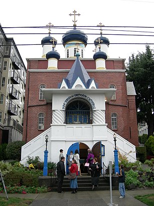
Directions to Saint Spiridon Orthodox Cathedral (Seattle) with public transportation
The following transit lines have routes that pass near Saint Spiridon Orthodox Cathedral
 Bus:
Bus:
How to get to Saint Spiridon Orthodox Cathedral by bus?
Click on the bus route to see step by step directions with maps, line arrival times and updated time schedules.
Bus stations near Saint Spiridon Orthodox Cathedral in Seattle
- Eastlake Ave E & Stewart St,5 min walk,
Bus lines to Saint Spiridon Orthodox Cathedral in Seattle
- 577,Federal Way - Seattle,
- 578,Puyallup - Seattle,
- 590,Tacoma - Seattle,
- 592,Olympia/DuPont - Seattle,
- 594,Lakewood - Seattle,
- 595,Gig Harbor - Seattle,
What are the closest stations to Saint Spiridon Orthodox Cathedral?
The closest stations to Saint Spiridon Orthodox Cathedral are:
- Eastlake Ave E & Stewart St is 348 yards away, 5 min walk.
Which bus lines stop near Saint Spiridon Orthodox Cathedral?
These bus lines stop near Saint Spiridon Orthodox Cathedral: 40, 590, 594, 70, 8.
What’s the nearest bus stop to Saint Spiridon Orthodox Cathedral in Seattle?
The nearest bus stop to Saint Spiridon Orthodox Cathedral in Seattle is Eastlake Ave E & Stewart St. It’s a 5 min walk away.
See Saint Spiridon Orthodox Cathedral, Seattle, on the map
Public Transit to Saint Spiridon Orthodox Cathedral in Seattle
Wondering how to get to Saint Spiridon Orthodox Cathedral in Seattle, United States? Moovit helps you find the best way to get to Saint Spiridon Orthodox Cathedral with step-by-step directions from the nearest public transit station.
Moovit provides free maps and live directions to help you navigate through your city. View schedules, routes, timetables, and find out how long does it take to get to Saint Spiridon Orthodox Cathedral in real time.
Looking for the nearest stop or station to Saint Spiridon Orthodox Cathedral? Check out this list of stops closest to your destination: Eastlake Ave E & Stewart St.
Bus:
Want to see if there’s another route that gets you there at an earlier time? Moovit helps you find alternative routes or times. Get directions from and directions to Saint Spiridon Orthodox Cathedral easily from the Moovit App or Website.
We make riding to Saint Spiridon Orthodox Cathedral easy, which is why over 1.5 million users, including users in Seattle, trust Moovit as the best app for public transit. You don’t need to download an individual bus app or train app, Moovit is your all-in-one transit app that helps you find the best bus time or train time available.
For information on prices of bus and light rail, costs and ride fares to Saint Spiridon Orthodox Cathedral, please check the Moovit app.
Use the app to navigate to popular places including to the airport, hospital, stadium, grocery store, mall, coffee shop, school, college, and university.
Location: Seattle, Seattle - Tacoma, WA
Attractions near Saint Spiridon Orthodox Cathedral
The Edgewater Hotel,Pier 67,Battery Street End,Cam And Mesh Alaskan & Bell,Wireless Mesh Node Elliot & Battery,Art Institute Of Seattle,The Art Institute Of Seattle,Aqua By El Gaucho,Pier 70,Bell Street Marina,Minato Building,Pier 63,Piers 62/63,Virginia Street End,Pier 62,Clipper Vacations,Wireless Mesh Node Elliot & Clay,Cam And Mesh On Alaskan At Port Of Seattle (South),Bellora Condos,Argosy University, SeattleHow to get to popular attractions in Seattle with public transit
The Boeing Co., Everett,Marysville, WA,Southcenter Mall, Tukwila,PCC Community Markets - Issaquah, Issaquah,Tulalip Casino Resort,Walmart Supercenter, Lakewood,Safeway, Seattle,Virginia Mason Hospital, Seattle,Everett, WA, Everett,Tacoma Dome - Transit Center, Tacoma,Olympia-Lacey Amtrak Station (OLW),VA Hospital American Lake Bldg 81, North Fort Lewis,Stadium Thriftway, Tacoma,Point Defiance Park, Tacoma,Loews Hotel 1000, Seattle, Seattle,The Home Depot,Club Silverstone, Tacoma,Space Needle, Seattle,The Landing In Renton, Renton,Walmart Supercenter, PuyallupGet around Seattle by public transit!
Traveling around Seattle has never been so easy. See step by step directions as you travel to any attraction, street or major public transit station. View bus and train schedules, arrival times, service alerts and detailed routes on a map, so you know exactly how to get to anywhere in Seattle.
When traveling to any destination around Seattle use Moovit's Live Directions with Get Off Notifications to know exactly where and how far to walk, how long to wait for your line, and how many stops are left. Moovit will alert you when it's time to get off — no need to constantly re-check whether yours is the next stop.
Wondering how to use public transit in Seattle or how to pay for public transit in Seattle? Moovit public transit app can help you navigate your way with public transit easily, and at minimum cost. It includes public transit fees, ticket prices, and costs. Looking for a map of Seattle public transit lines? Moovit public transit app shows all public transit maps in Seattle with all bus or light rail routes and stops on an interactive map.
Seattle has 2 transit type(s), including: bus or light rail, operated by several transit agencies, including Sound Transit, Seattle Streetcar, Sound Transit, Metro Transit, Metro Transit, Sound Transit, Whatcom Transportation Authority, Mason Transit Authority, Snoqualmie Valley Transportation (SVT), Snoqualmie Valley Transportation, Amtrak, Island Transit, Kitsap Transit, Intercity Transit and Everett Transit