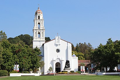
Directions to Saklan Valley School (Moraga) with public transportation
The following transit lines have routes that pass near Saklan Valley School
How to get to Saklan Valley School by bus?
Click on the bus route to see step by step directions with maps, line arrival times and updated time schedules.
Bus stations near Saklan Valley School in Moraga
- Moraga Way/School St, 3 min walk,
- Moraga Way/Viader Dr, 4 min walk,
Bus lines to Saklan Valley School in Moraga
- 6, Lafayette BART via St Marys College,
- 606, Miramonte,
What are the closest stations to Saklan Valley School?
The closest stations to Saklan Valley School are:
- Moraga Way/School St is 226 yards away, 3 min walk.
- Moraga Way/Viader Dr is 299 yards away, 4 min walk.
Which bus line stops near Saklan Valley School?
6
What’s the nearest bus stop to Saklan Valley School in Moraga?
The nearest bus stop to Saklan Valley School in Moraga is Moraga Way/School St. It’s a 3 min walk away.
See Saklan Valley School, Moraga, on the map
Public Transit to Saklan Valley School in Moraga
Wondering how to get to Saklan Valley School in Moraga, United States? Moovit helps you find the best way to get to Saklan Valley School with step-by-step directions from the nearest public transit station.
Moovit provides free maps and live directions to help you navigate through your city. View schedules, routes, timetables, and find out how long does it take to get to Saklan Valley School in real time.
Looking for the nearest stop or station to Saklan Valley School? Check out this list of stops closest to your destination: Moraga Way/School St; Moraga Way/Viader Dr.
Bus: 6, 606.
Want to see if there’s another route that gets you there at an earlier time? Moovit helps you find alternative routes or times. Get directions from and directions to Saklan Valley School easily from the Moovit App or Website.
We make riding to Saklan Valley School easy, which is why over 1.5 million users, including users in Moraga, trust Moovit as the best app for public transit. You don’t need to download an individual bus app or train app, Moovit is your all-in-one transit app that helps you find the best bus time or train time available.
For information on prices of bus and BART, costs and ride fares to Saklan Valley School, please check the Moovit app.
Use the app to navigate to popular places including to the airport, hospital, stadium, grocery store, mall, coffee shop, school, college, and university.
Location: Moraga, San Francisco - San Jose, CA
Attractions near Saklan Valley School
Block Stephen E,TD Fitness,1605 School Street,Willow Spring Church,Moraga Bright Beginnings,Shape Shifters Pilates & Health Studio,Total Clean,Tjm Products Inc,Jeanne Marie Olin Law Offices,James Ash PHD,Databeam Corporation,California Institute For Bio,Uncle Mark's Office,Mark Bellingham Painting,Age Management & Acne Skin Care Clinic,Gabrielson Michael,L & S Sales Co.,Studio E,Direct Sat TV - An Authorized DIRECTV Dealer,Radcliffe & RadcliffeHow to get to popular attractions in Moraga with public transit
Rental Car Center - San Jose Airport, San Jose,Yahoo! Sunnyvale, Sunnyvale,Japantown (日本町), San Jose,Genentech Inc, South San Francisco,Mountain View Caltrain Station,Microsoft SVC,Concord BART Station, Concord,IKEA, East Palo Alto,Sharks Ice at San Jose, San Jose,City of Gilroy, Gilroy,Costco Wholesale, Vallejo,City of Fremont, Fremont,Costco Wholesale, San Jose,Lagunitas Brewing Company, Petaluma,City of Rohnert Park, Rohnert Park,Googleplex - Charlie's Cafe,Fentons Creamery & Restaurant, Oakland,Apple Palo Alto, Palo Alto,City College Of San Francisco, San Francisco,Town & Country Village, Palo AltoGet around San Francisco - San Jose, CA by public transit!
Traveling around San Francisco - San Jose, CA has never been so easy. See step by step directions as you travel to any attraction, street or major public transit station. View bus and train schedules, arrival times, service alerts and detailed routes on a map, so you know exactly how to get to anywhere in San Francisco - San Jose, CA.
When traveling to any destination around San Francisco - San Jose, CA use Moovit's Live Directions with Get Off Notifications to know exactly where and how far to walk, how long to wait for your line, and how many stops are left. Moovit will alert you when it's time to get off — no need to constantly re-check whether yours is the next stop.
Wondering how to use public transit in San Francisco - San Jose, CA or how to pay for public transit in San Francisco - San Jose, CA? Moovit public transit app can help you navigate your way with public transit easily, and at minimum cost. It includes public transit fees, ticket prices, and costs. Looking for a map of San Francisco - San Jose, CA public transit lines? Moovit public transit app shows all public transit maps in San Francisco - San Jose, CA with all Bus, Train, BART, Light Rail, Ferry and Cable Car routes and stops on an interactive map.
San Francisco - San Jose, CA has 6 transit type(s), including: Bus, Train, BART, Light Rail, Ferry and Cable Car, operated by several transit agencies, including BART, Bay Area Rapid Transit, Muni Metro, Caltrain, VTA, Capitol Corridor, Sonoma Marin Area Rail Transit, MUNI, SF Cable Car, AC Transit, Dumbarton Express, Golden Gate Transit, County Connection, SamTrans, SamTrans / City of Menlo Park