Directions to Salem Veterans Services with public transportation
The following transit lines have routes that pass near Salem Veterans Services
 Bus: 450, 455, 451, 456.
- Train: NEWBURYPORT/ROCKPORT.
How to get to Salem Veterans Services by bus?
Click on the bus route to see step by step directions with maps, line arrival times and updated time schedules.
How to get to Salem Veterans Services by train?
Click on the train route to see step by step directions with maps, line arrival times and updated time schedules.
Bus stops near Salem Veterans Services
Train station near Salem Veterans Services
- Beverly, 42 min walk,VIEW
Bus lines to Salem Veterans Services
What are the closest stations to Salem Veterans Services?
The closest stations to Salem Veterans Services are:
- Lafayette St @ Harbor St is 164 yards away, 3 min walk.
- New Derby St Opp Klop Alley is 170 yards away, 3 min walk.
- Washington St @ New Derby St is 289 yards away, 4 min walk.
- Beverly is 3570 yards away, 42 min walk.
Which bus lines stop near Salem Veterans Services?
These bus lines stop near Salem Veterans Services: 450, 455.
Which train line stops near Salem Veterans Services?
NEWBURYPORT/ROCKPORT (#125 | Newburyport)
What’s the nearest bus station to Salem Veterans Services?
The nearest bus stations to Salem Veterans Services are Lafayette St @ Harbor St and New Derby St Opp Klop Alley. The closest one is a 3 min walk away.
What time is the first train to Salem Veterans Services?
The NEWBURYPORT/ROCKPORT is the first train that goes to Salem Veterans Services. It stops nearby at 5:16 AM.
What time is the last train to Salem Veterans Services?
The NEWBURYPORT/ROCKPORT is the last train that goes to Salem Veterans Services. It stops nearby at 12:31 AM.
What time is the first bus to Salem Veterans Services?
The 455 is the first bus that goes to Salem Veterans Services. It stops nearby at 5:01 AM.
What time is the last bus to Salem Veterans Services?
The 450 is the last bus that goes to Salem Veterans Services. It stops nearby at 1:20 AM.
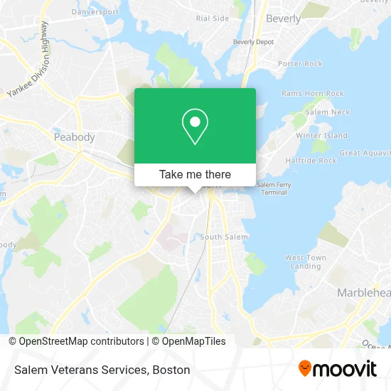
See Salem Veterans Services on the map
Public Transportation to Salem Veterans Services
Wondering how to get to Salem Veterans Services? Moovit helps you find the best way to get to Salem Veterans Services with step-by-step directions from the nearest public transit station.
Moovit provides free maps and live directions to help you navigate through your city. View schedules, routes, timetables, and find out how long does it take to get to Salem Veterans Services in real time.
Looking for the nearest stop or station to Salem Veterans Services? Check out this list of stops closest to your destination: Lafayette St @ Harbor St; New Derby St Opp Klop Alley; Washington St @ New Derby St; Beverly.
Bus: 450, 455, 451, 456.Train: NEWBURYPORT/ROCKPORT.
Want to see if there’s another route that gets you there at an earlier time? Moovit helps you find alternative routes or times. Get directions from and directions to Salem Veterans Services easily from the Moovit App or Website.
We make riding to Salem Veterans Services easy, which is why over 1.7 million users, including users in Salem, trust Moovit as the best app for public transit. You don’t need to download an individual bus app or train app, Moovit is your all-in-one transit app that helps you find the best bus time or train time available.
For information on prices of bus and train, costs and ride fares to Salem Veterans Services, please check the Moovit app.
Use the app to navigate to popular places including to the airport, hospital, stadium, grocery store, mall, coffee shop, school, college, and university.
Salem Veterans Services Address: 5 Broad St street in Salem
- City of Salem,
- JB's Handyman Services,
- Soul Shaker,
- Mosaic Music Instruction,
- Mount Vernon Realty,
- Workplace Giving Alliance,
- Human & Civil Rights,
- Common Group Enterprises,
- Locksmith New Locks Installation,
- Middlesex Mutual Assurance,
- Powell & Mahoney,
- National Life Insurance,
- Preserve Painting,
- Kingdom Hall of Jehovahs Witnesses,
- Capt's Waterfront Grill & Club,
- North Shore Bartending Service,
- Pete's Appliance Repair,
- Church of Jesus Christ of Latter Day Saints,
- Salem, MA,
- Adesso Appliance Repair
Places Near Salem Veterans Services
- Leader Bank Pavilion (Leader Bank Pavillion), Boston,
- Seaport District, Boston,
- North End, Boston,
- Mgm Music Hall, Boston,
- Isabella Stewart Gardner Museum, Boston,
- Boston Medical Center, Boston,
- Prudential Center, Boston,
- Museum Of Science, Boston,
- Castle Island, Boston,
- Boston Children's Hospital, Boston,
- Wilbur Theatre, Boston,
- Massachusetts General Hospital, Boston,
- Boston Convention & Exhibition Center, Boston,
- House Of Blues, Boston,
- Quincy Market, Boston,
- Cheers, Boston,
- Td Garden, Boston,
- Wang Theater, Boston,
- Boston Common, Boston,
- Faneuil Hall, Boston
How to get to popular places in Boston with public transit
Get around Salem by public transit!
Traveling around Salem has never been so easy. See step by step directions as you travel to any attraction, street or major public transit station. View bus and train schedules, arrival times, service alerts and detailed routes on a map, so you know exactly how to get to anywhere in Salem.
When traveling to any destination around Salem use Moovit's Live Directions with Get Off Notifications to know exactly where and how far to walk, how long to wait for your line, and how many stops are left. Moovit will alert you when it's time to get off — no need to constantly re-check whether yours is the next stop.
Wondering how to use public transit in Salem or how to pay for public transit in Salem? Moovit public transit app can help you navigate your way with public transit easily, and at minimum cost. It includes public transit fees, ticket prices, and costs. Looking for a map of Salem public transit lines? Moovit public transit app shows all public transit maps in Salem with all Bus, Train, Subway and Ferry routes and stops on an interactive map.
Boston has 4 transit type(s), including: Bus, Train, Subway and Ferry, operated by several transit agencies, including MBTA, Southeastern Regional Transit Authority, MetroWest Regional Transit Authority, Rhode Island Public Transit Authority, WRTA, Lowell Regional Transit Authority, Merrimack Valley Transit, Montachusett Regional Transit Authority, Cape Cod Regional Transit Authority, Brockton Area Transit Authority, Martha's Vineyard Transit Authority, the WAVE - Nantucket Regional Transit Authority, GATRA, Cape Ann Transportation Authority and Massport