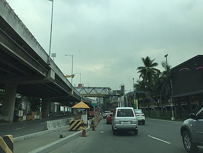
Directions to Sales Road station (Taguig) with public transit
The following transit lines have routes that pass near Sales Road
How to get to Sales Road station by bus?
Click on the bus route to see step by step directions with maps, line arrival times and updated time schedules.
How to get to Sales Road station by train?
Click on the train route to see step by step directions with maps, line arrival times and updated time schedules.
Bus stops near Sales Road in Taguig
- Chino Roces Ave, Makati City, Manila, 1 min walk,
- Lawton Ave, Taguig City, Manila, 9 min walk,
- Sales Road, Pasay City, Manila, 15 min walk,
- South Luzon Expressway, Taguig City, Manila, 20 min walk,
- South Luzon Expressway, Makati City, Manila, 24 min walk,
Train stations near Sales Road in Taguig
- Magellanes Mrt, 20 min walk,
- Edsa Pnr, 20 min walk,
Bus lines to Sales Road station in Taguig
- JEEP, Dbp Ave, Taguig City, Manila, Manila,
- JEEP, Epifanio De Los Santos Avenue, Makati City, Manila,
- JEEP, Pasay Rotonda - Signal Village,
- JEEP, PASAY ROTUNDA - FTI via SIGNAL VILLAGE,
- JEEP, PASAY ROTUNDA - ALABANG (KANAN) via NICHOLS SERVICE RD,
- BUS, Pheonix Sun Business Park, Quezon City, Manila,
- JEEP, Sales Road, Pasay City, Manila,
- BUS, Monumento Sucat via EDSA,
- BUS, Pacita Complex - Navotas Term via EDSA,
- BUS, FTI - Navotas Terminal via EDSA,
- BUS, Malanday - Muntinlupa via Edsa, Monumento,
- BUS, FTI-Monumento via EDSA,
- BUS, FTI - Tungko, SJDM via Lagro, C'wealth Ave EDSA,
- BUS, GMA - Plaza Lawton via Ayala, Carmona, SSH,
- BUS, Navotas Terminal Pacita Complex via EDSA,
- BUS, Alabang - Malanday via EDSA, McArthur,
- BUS, Alabang - Novaliches via EDSA, NLEX,
- BUS, Novaliches Pacita San Pedro via Malinta,
- BUS, Alabang (Starmall) Lagro,
- BUS, Alabang-Novaliches via EDSA, MindanaoAve,
What are the closest stations to Sales Road?
The closest stations to Sales Road are:
- Chino Roces Ave, Makati City, Manila is 27 meters away, 1 min walk.
- Lawton Ave, Taguig City, Manila is 501 meters away, 9 min walk.
- Sales Road, Pasay City, Manila is 1138 meters away, 15 min walk.
- South Luzon Expressway, Taguig City, Manila is 1269 meters away, 20 min walk.
- Magellanes Mrt is 1477 meters away, 20 min walk.
- Edsa Pnr is 1508 meters away, 20 min walk.
- South Luzon Expressway, Makati City, Manila is 1830 meters away, 24 min walk.
Which bus line stops near Sales Road?
JEEP (Epifanio De Los Santos Avenue, Diosdado Macapagal Blvd, Lungsod Ng Pasay→Dbp Ave, Taguig City, Manila, Manila)
Which train line stops near Sales Road?
PNR MC (Biñan PNR)
What’s the nearest train station to Sales Road in Taguig?
The nearest train stations to Sales Road in Taguig are Magellanes Mrt and Edsa Pnr. The closest one is a 20 min walk away.
What’s the nearest bus stop to Sales Road in Taguig?
The nearest bus stop to Sales Road in Taguig is Chino Roces Ave, Makati City, Manila. It’s a 1 min walk away.
What time is the first train to Sales Road in Taguig?
The MRT3 is the first train that goes to Sales Road in Taguig. It stops nearby at 5:19 AM.
What time is the last train to Sales Road in Taguig?
The PNR MC is the last train that goes to Sales Road in Taguig. It stops nearby at 1:04 AM.
What time is the first bus to Sales Road in Taguig?
The BUS is the first bus that goes to Sales Road in Taguig. It stops nearby at 3:10 AM.
What time is the last bus to Sales Road in Taguig?
The BUS is the last bus that goes to Sales Road in Taguig. It stops nearby at 3:16 AM.
See Sales Road, Taguig, on the map
Public Transit to Sales Road in Taguig
How to get to Sales Road in Taguig, Philippines?
It’s easy with Moovit. Type in your street address and Moovit’s route finder will locate the fastest way to get you there! Not sure where to get off on the street? Download the Moovit App to find live directions (including where to get off on Sales Road), see timetables and get the estimated arrival times for your favorite bus or train lines.
Looking for the nearest stop or station to Sales Road? Check out this list of closest stops available to your destination: Chino Roces Ave; Lawton Ave; Sales Road; South Luzon Expressway; Magellanes Mrt; Edsa Pnr; South Luzon Expressway.
Bus: JEEP, BUS.Train: PNR MC, MRT3.
Download the Moovit App to see the current schedule and routes available for Taguig. No need to install a special bus app to check the bus time or a train app to get train time. Moovit is the only all-in-one transit app that helps you get where you need to go.
We make riding on public transit to Sales Road easy, which is why over 1.5 million users, including users in Taguig trust Moovit as the best app for public transit.
Use the app to navigate to popular places including to the airport, hospital, stadium, grocery store, mall, coffee shop, school, college, and university.
Location: Taguig, Manila
Streets near Sales Road, Taguig
Get around Taguig by public transit!
Traveling around Taguig has never been so easy. See step by step directions as you travel to any attraction, street or major public transit station. View bus and train schedules, arrival times, service alerts and detailed routes on a map, so you know exactly how to get to anywhere in Taguig.
When traveling to any destination around Taguig use Moovit's Live Directions with Get Off Notifications to know exactly where and how far to walk, how long to wait for your line, and how many stops are left. Moovit will alert you when it's time to get off — no need to constantly re-check whether yours is the next stop.
Wondering how to use public transit in Taguig or how to pay for public transit in Taguig? Moovit public transit app can help you navigate your way with public transit easily, and at minimum cost. It includes public transit fees, ticket prices, and costs. Looking for a map of Taguig public transit lines? Moovit public transit app shows all public transit maps in Taguig with all Bus and Train routes and stops on an interactive map.
Manila has 2 transit type(s), including: Bus and Train, operated by several transit agencies, including LRTA, LTFRB, MRTC, PNR, P2P, UV Express and BGC Bus