Directions to Salesforce (Boston) with public transportation
The following transit lines have routes that pass near Salesforce
 Bus: 1, 10, 39, BB, 9.
- Train: NEEDHAM, FOXBORO EVENT SERVICE, FRAMINGHAM/WORCESTER, FRANKLIN/FOXBORO, ORANGE LINE.
- Subway: GREEN LINE B, GREEN LINE C, ORANGE LINE, GREEN LINE D, GREEN LINE E.
How to get to Salesforce by bus?
Click on the bus route to see step by step directions with maps, line arrival times and updated time schedules.
From VFW Parkway, Boston
56 minFrom Ac Hotel Cambridge, Cambridge
81 minFrom The Monument, Boston
37 minFrom Qea, Quincy
100 minFrom West Roxbury, Boston
58 minFrom JFK Library, Boston
55 minFrom Hebrew Rehab Center, Boston
47 minFrom Milton Academy, Milton
97 minFrom Arlington, MA, Arlington
88 minFrom Belle Isle Lobster & Seafood, Winthrop Town
87 min
How to get to Salesforce by train?
Click on the train route to see step by step directions with maps, line arrival times and updated time schedules.
How to get to Salesforce by subway?
Click on the subway route to see step by step directions with maps, line arrival times and updated time schedules.
Bus stops near Salesforce in Boston
- Berkeley St @ Columbus Ave, 2 min walk,VIEW
- Boylston St @ Clarendon St, 2 min walk,VIEW
- Boylston St @ Dartmouth St, 3 min walk,VIEW
- Copley - Boylston St @ Dartmouth St, 3 min walk,VIEW
- Copley - Opp 575 Boylston St, 4 min walk,VIEW
- Boston, MA - Copley Square (Corner Of Clarendon St. & St. James Ave. In Front Of Trinity Church), 4 min walk,VIEW
- Saint James Ave @ Dartmouth St, 4 min walk,VIEW
- Stuart St @ Dartmouth St, 6 min walk,VIEW
Subway station near Salesforce in Boston
- Copley, 2 min walk,VIEW
Train station near Salesforce in Boston
- Back Bay - South End, 7 min walk,VIEW
Bus lines to Salesforce in Boston
- 9, Kenmore Via Boston Latin,VIEW
- 10, Arlington Via South Bay Center,VIEW
- 39, Haymarket Via Forest Hills,VIEW
- 55, West Fenway,VIEW
- 57, Haymarket Via Kenmore,VIEW
- GREEN LINE D SHUTTLE, Riverside (Shuttle),VIEW
- ORANGE LINE SHUTTLE, Back Bay Via Copley (Shuttle),VIEW
- GREEN LINE B SHUTTLE, Boston University East - Back Bay,VIEW
- GREEN LINE C SHUTTLE, Saint Mary's Street - Back Bay,VIEW
- GREEN LINE E SHUTTLE, Heath Street - Park Street,VIEW
- GREEN LINE SHUTTLE, Boston University East - Park Street,VIEW
- ORANGE LINE SHUTTLE, Ruggles - Copley,VIEW
- ORANGE LINE SHUTTLE, Copley (Shuttle),VIEW
- ORANGE LINE SHUTTLE, Forest Hills (Shuttle),VIEW
- ACTON/CONCORD COMMUTER, Acton,VIEW
- 501, Downtown Via Cambridge St And Copley (Express),VIEW
- 504, Downtown Via Copley (Express),VIEW
- GREEN LINE B SHUTTLE, Babcock Street (Shuttle),VIEW
- GREEN LINE D SHUTTLE, Riverside (Express Shuttle),VIEW
- GREEN LINE D SHUTTLE, Riverside Via Woodland (Express Shuttle),VIEW
What are the closest stations to Salesforce?
The closest stations to Salesforce are:
- Berkeley St @ Columbus Ave is 124 yards away, 2 min walk.
- Copley is 133 yards away, 2 min walk.
- Boylston St @ Clarendon St is 145 yards away, 2 min walk.
- Boylston St @ Dartmouth St is 183 yards away, 3 min walk.
- Copley - Boylston St @ Dartmouth St is 186 yards away, 3 min walk.
- Copley - Opp 575 Boylston St is 250 yards away, 4 min walk.
- Boston, MA - Copley Square (Corner Of Clarendon St. & St. James Ave. In Front Of Trinity Church) is 268 yards away, 4 min walk.
- Saint James Ave @ Dartmouth St is 271 yards away, 4 min walk.
- Stuart St @ Dartmouth St is 443 yards away, 6 min walk.
- Back Bay - South End is 523 yards away, 7 min walk.
Which bus lines stop near Salesforce?
These bus lines stop near Salesforce: 1, 10, 39, BB.
Which train line stops near Salesforce?
NEEDHAM (#620 | South Station)
Which subway lines stop near Salesforce?
These subway lines stop near Salesforce: GREEN LINE B, GREEN LINE C, ORANGE LINE.
What’s the nearest subway station to Salesforce in Boston?
The nearest subway station to Salesforce in Boston is Copley. It’s a 2 min walk away.
What’s the nearest train station to Salesforce in Boston?
The nearest train station to Salesforce in Boston is Back Bay - South End. It’s a 7 min walk away.
What’s the nearest bus station to Salesforce in Boston?
The nearest bus stations to Salesforce in Boston are Berkeley St @ Columbus Ave and Boylston St @ Clarendon St. The closest one is a 2 min walk away.
What time is the first subway to Salesforce in Boston?
The GREEN LINE D is the first subway that goes to Salesforce in Boston. It stops nearby at 5:05 AM.
What time is the last subway to Salesforce in Boston?
The GREEN LINE E is the last subway that goes to Salesforce in Boston. It stops nearby at 2:16 AM.
What time is the first train to Salesforce in Boston?
The PROVIDENCE/STOUGHTON is the first train that goes to Salesforce in Boston. It stops nearby at 4:25 AM.
What time is the last train to Salesforce in Boston?
The LAKE SHORE LIMITED is the last train that goes to Salesforce in Boston. It stops nearby at 8:26 PM.
What time is the first bus to Salesforce in Boston?
The 57 is the first bus that goes to Salesforce in Boston. It stops nearby at 4:53 AM.
What time is the last bus to Salesforce in Boston?
The 10 is the last bus that goes to Salesforce in Boston. It stops nearby at 1:19 AM.
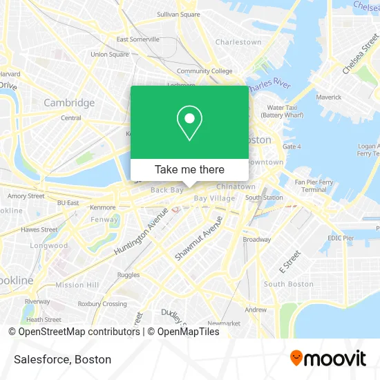
See Salesforce, Boston, on the map
Public Transit to Salesforce in Boston
Wondering how to get to Salesforce in Boston? Moovit helps you find the best way to get to Salesforce with step-by-step directions from the nearest public transit station.
Moovit provides free maps and live directions to help you navigate through your city. View schedules, routes, timetables, and find out how long does it take to get to Salesforce in real time.
Looking for the nearest stop or station to Salesforce? Check out this list of stops closest to your destination: Berkeley St @ Columbus Ave; Copley; Boylston St @ Clarendon St; Boylston St @ Dartmouth St; Copley - Boylston St @ Dartmouth St; Copley - Opp 575 Boylston St; Boston, MA - Copley Square (Corner Of Clarendon St. & St. James Ave. In Front Of Trinity Church); Saint James Ave @ Dartmouth St; Stuart St @ Dartmouth St; Back Bay - South End.
Bus: 1, 10, 39, BB, 9, 55, 57, GREEN LINE D SHUTTLE, GREEN LINE B SHUTTLE, GREEN LINE C SHUTTLE, GREEN LINE E SHUTTLE, GREEN LINE SHUTTLE, ORANGE LINE SHUTTLE, ORANGE LINE SHUTTLE.Train: NEEDHAM, FOXBORO EVENT SERVICE, FRAMINGHAM/WORCESTER, FRANKLIN/FOXBORO, ORANGE LINE.Subway: GREEN LINE B, GREEN LINE C, ORANGE LINE, GREEN LINE D, GREEN LINE E.
Want to see if there’s another route that gets you there at an earlier time? Moovit helps you find alternative routes or times. Get directions from and directions to Salesforce easily from the Moovit App or Website.
We make riding to Salesforce easy, which is why over 1.7 million users, including users in Boston, trust Moovit as the best app for public transit. You don’t need to download an individual bus app or train app, Moovit is your all-in-one transit app that helps you find the best bus time or train time available.
For information on prices of bus, subway and train, costs and ride fares to Salesforce, please check the Moovit app.
Use the app to navigate to popular places including to the airport, hospital, stadium, grocery store, mall, coffee shop, school, college, and university.
Salesforce Address: 500 Boylston St street in Boston
- Craftsmen Standard Flooring,
- Bracebridge Capital (Atv Capital Management),
- Consulado General de España,
- Nordstrom Rack,
- Pearson,
- SoulCycle Back Bay,
- Alicia McPherson Aesthetics,
- Nordstrom Rack Newbury,
- Summit Partners (Summit Partnrs Eurpe Private Eqty FND),
- Trade & Reference Pubhs Div (K-12 Publishers Div),
- Cloudkair,
- Talbots,
- New Balance Hubway,
- Trinity Church Boston,
- FiRE + iCE Boston,
- Victoria's Secret,
- Fire & Ice (Fire Ice Restaurant),
- Georgetown Cupcake,
- H&M,
- TD Bank
Places Near Salesforce (Boston)
- Boston Medical Center, Boston,
- Leader Bank Pavilion (Leader Bank Pavillion), Boston,
- House Of Blues, Boston,
- Mgm Music Hall, Boston,
- Museum Of Science, Boston,
- Castle Island, Boston,
- Boston Convention & Exhibition Center, Boston,
- Isabella Stewart Gardner Museum, Boston,
- Td Garden, Boston,
- Wang Theater, Boston,
- Massachusetts General Hospital, Boston,
- Quincy Market, Boston,
- Boston Common, Boston,
- North End, Boston,
- Wilbur Theatre, Boston,
- Seaport District, Boston,
- Cheers, Boston,
- Faneuil Hall, Boston,
- Boston Children's Hospital, Boston,
- Prudential Center, Boston
How to get to popular places in Boston with public transit
Get around Boston by public transit!
Traveling around Boston has never been so easy. See step by step directions as you travel to any attraction, street or major public transit station. View bus and train schedules, arrival times, service alerts and detailed routes on a map, so you know exactly how to get to anywhere in Boston.
When traveling to any destination around Boston use Moovit's Live Directions with Get Off Notifications to know exactly where and how far to walk, how long to wait for your line, and how many stops are left. Moovit will alert you when it's time to get off — no need to constantly re-check whether yours is the next stop.
Wondering how to use public transit in Boston or how to pay for public transit in Boston? Moovit public transit app can help you navigate your way with public transit easily, and at minimum cost. It includes public transit fees, ticket prices, and costs. Looking for a map of Boston public transit lines? Moovit public transit app shows all public transit maps in Boston with all Bus, Train, Subway and Ferry routes and stops on an interactive map.
Boston has 4 transit type(s), including: Bus, Train, Subway and Ferry, operated by several transit agencies, including MBTA, Southeastern Regional Transit Authority, MetroWest Regional Transit Authority, Rhode Island Public Transit Authority, WRTA, Lowell Regional Transit Authority, Merrimack Valley Transit, Montachusett Regional Transit Authority, Cape Cod Regional Transit Authority, Brockton Area Transit Authority, Martha's Vineyard Transit Authority, the WAVE - Nantucket Regional Transit Authority, GATRA, Cape Ann Transportation Authority and Massport