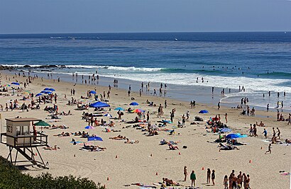
Directions to Salt Creek Beach Park (Dana Point) with public transportation
The following transit lines have routes that pass near Salt Creek Beach Park
How to get to Salt Creek Beach Park by bus?
Click on the bus route to see step by step directions with maps, line arrival times and updated time schedules.
Bus stations near Salt Creek Beach Park in Dana Point
- Pacific Coast-Selva, 7 min walk,
- Pacific Coast-Niguel, 15 min walk,
- Ritz Carlton, 18 min walk,
Bus lines to Salt Creek Beach Park in Dana Point
- 1, Long Beach - Cal State Long Beach,
- DP NORTH, Dana Point - North,
- LNGL, Laguna Niguel Shuttle,
- LCST, Long Coastal - Ritz,
What are the closest stations to Salt Creek Beach Park?
The closest stations to Salt Creek Beach Park are:
- Pacific Coast-Selva is 522 yards away, 7 min walk.
- Pacific Coast-Niguel is 1239 yards away, 15 min walk.
- Ritz Carlton is 1455 yards away, 18 min walk.
Which bus line stops near Salt Creek Beach Park?
1
What’s the nearest bus stop to Salt Creek Beach Park in Dana Point?
The nearest bus stop to Salt Creek Beach Park in Dana Point is Pacific Coast-Selva. It’s a 7 min walk away.
See Salt Creek Beach Park, Dana Point, on the map
Flickr
Public Transit to Salt Creek Beach Park in Dana Point
Wondering how to get to Salt Creek Beach Park in Dana Point, United States? Moovit helps you find the best way to get to Salt Creek Beach Park with step-by-step directions from the nearest public transit station.
Moovit provides free maps and live directions to help you navigate through your city. View schedules, routes, timetables, and find out how long does it take to get to Salt Creek Beach Park in real time.
Looking for the nearest stop or station to Salt Creek Beach Park? Check out this list of stops closest to your destination: Pacific Coast-Selva; Pacific Coast-Niguel; Ritz Carlton.
Bus: 1, DP NORTH, LNGL, LCST.
Want to see if there’s another route that gets you there at an earlier time? Moovit helps you find alternative routes or times. Get directions from and directions to Salt Creek Beach Park easily from the Moovit App or Website.
We make riding to Salt Creek Beach Park easy, which is why over 1.5 million users, including users in Dana Point, trust Moovit as the best app for public transit. You don’t need to download an individual bus app or train app, Moovit is your all-in-one transit app that helps you find the best bus time or train time available.
For information on prices of bus and train, costs and ride fares to Salt Creek Beach Park, please check the Moovit app.
Use the app to navigate to popular places including to the airport, hospital, stadium, grocery store, mall, coffee shop, school, college, and university.
Salt Creek Beach Park Address: Beach View Avenue street in Dana Point
Flickr
Attractions near Salt Creek Beach Park
The Strand,Strand Beach Dr,The Dana Headlands Public Funicular,Suite 200,Le Visage,Speare Eric MD,Mater dei Developments,Rancho las Flores,Dana Point Dermatology Center for Women,Anica Welch - Laguna Sierra Mortgage Group,Vorteil Dermatology & Aesthetic Science,Artistry Salon,21 Ocean Front Ln,95 Strand Beach Dr,High Rated AC Service,Salt Creek Beach Funicular,Salt Creek Beach,5 Strand Beach Dr,Chelsea Pointe,Dana PointHow to get to popular attractions in Dana Point with public transit
Valley View High School, Moreno Valley,Nickelodeon Studios, Hollywood, La,Megabus L.A. Union Station, Downtown, La,Crenshaw High School, Hyde Park, La,La Cienega Blvd & Centinela Ave, Los Angeles,Military Entrance Processing Station (MEPS), El Segundo,Stater Bros. Markets, Colton,Placerita Jr. High School, Santa Clarita,Venice And Fairfax, Mid-City, La,The Trolley At The Grove, Fairfax, La,The Vitamin Shoppe, Pasadena,Toppers Pizza Place, Santa Clarita,South Pasadena Water Tower, South Pasadena,Hillside Memorial Park and Mortuary, Culver City,Fred Kavli Theatre, Thousand Oaks,FOX Television Center, Sawtelle, La,HB Lifeguard Tower 13, Huntington Beach,Clark Magnet High School, Glendale,NBVC (Pleasant Valley Rd. Gate), Port Hueneme,Fillmore, California, FillmoreGet around Los Angeles by public transit!
Traveling around Los Angeles has never been so easy. See step by step directions as you travel to any attraction, street or major public transit station. View bus and train schedules, arrival times, service alerts and detailed routes on a map, so you know exactly how to get to anywhere in Los Angeles.
When traveling to any destination around Los Angeles use Moovit's Live Directions with Get Off Notifications to know exactly where and how far to walk, how long to wait for your line, and how many stops are left. Moovit will alert you when it's time to get off — no need to constantly re-check whether yours is the next stop.
Wondering how to use public transit in Los Angeles or how to pay for public transit in Los Angeles? Moovit public transit app can help you navigate your way with public transit easily, and at minimum cost. It includes public transit fees, ticket prices, and costs. Looking for a map of Los Angeles public transit lines? Moovit public transit app shows all public transit maps in Los Angeles with all Bus, Train, Subway, Light Rail, Ferry and Funicular routes and stops on an interactive map.
Los Angeles has 6 transit type(s), including: Bus, Train, Subway, Light Rail, Ferry and Funicular, operated by several transit agencies, including Metro - Los Angeles, Metrolink Trains, METRO, Long Beach Transit, LADOT, OCTA, Foothill Transit, Big Blue Bus, Riverside Transit Agency, LAX FlyAway, Airporter Shuttle, Playa Vista Shuttle, Amtrak, OMNITRANS, Pasadena Transit