Directions to Salt Lake Photo Company (Boston) with public transportation
The following transit lines have routes that pass near Salt Lake Photo Company
 Bus: 11, 17, 18, 9, CT3.
- Train: GREENBUSH, KINGSTON, FAIRMOUNT, FRANKLIN/FOXBORO, PROVIDENCE/STOUGHTON.
- Subway: RED LINE, ORANGE LINE.
How to get to Salt Lake Photo Company by bus?
Click on the bus route to see step by step directions with maps, line arrival times and updated time schedules.
From Hood Park, Boston
60 minFrom Quincy Center Station, Quincy
98 minFrom Mount Auburn, Cambridge
68 minFrom Malden Catholic High School, Malden
110 minFrom Sarma, Somerville
78 minFrom Quincy, MA, Quincy
94 minFrom Cambridge Health Alliance (CHA), Cambridge
66 minFrom Boda Borg, Malden
84 minFrom Hampton Inn & Suites-Hampton Watertown Boston (Hampton Inn & Suites Watertown Boston), Watertown Town
73 minFrom The Mall At Chestnut Hill, Newton
84 min
How to get to Salt Lake Photo Company by train?
Click on the train route to see step by step directions with maps, line arrival times and updated time schedules.
How to get to Salt Lake Photo Company by subway?
Click on the subway route to see step by step directions with maps, line arrival times and updated time schedules.
Subway stations near Salt Lake Photo Company in Boston
Bus stops near Salt Lake Photo Company in Boston
Train stations near Salt Lake Photo Company in Boston
Bus lines to Salt Lake Photo Company in Boston
What are the closest stations to Salt Lake Photo Company?
The closest stations to Salt Lake Photo Company are:
- Tufts Medical Center is 132 yards away, 2 min walk.
- Dorchester St @ W 8th St is 301 yards away, 4 min walk.
- W 6th St @ E St is 358 yards away, 5 min walk.
- Andrew is 458 yards away, 6 min walk.
- W Broadway @ D St is 838 yards away, 10 min walk.
- Newmarket is 1743 yards away, 21 min walk.
- Jfk/Umass is 2773 yards away, 33 min walk.
Which bus lines stop near Salt Lake Photo Company?
These bus lines stop near Salt Lake Photo Company: 11, 17, 18, 9, CT3.
Which train lines stop near Salt Lake Photo Company?
These train lines stop near Salt Lake Photo Company: GREENBUSH, KINGSTON.
Which subway line stops near Salt Lake Photo Company?
RED LINE (Ashmont/Braintree)
What’s the nearest subway station to Salt Lake Photo Company in Boston?
The nearest subway station to Salt Lake Photo Company in Boston is Tufts Medical Center. It’s a 2 min walk away.
What’s the nearest train station to Salt Lake Photo Company in Boston?
The nearest train station to Salt Lake Photo Company in Boston is Newmarket. It’s a 21 min walk away.
What’s the nearest bus station to Salt Lake Photo Company in Boston?
The nearest bus station to Salt Lake Photo Company in Boston is Dorchester St @ W 8th St. It’s a 4 min walk away.
What time is the first subway to Salt Lake Photo Company in Boston?
The RED LINE is the first subway that goes to Salt Lake Photo Company in Boston. It stops nearby at 5:23 AM.
What time is the last subway to Salt Lake Photo Company in Boston?
The RED LINE is the last subway that goes to Salt Lake Photo Company in Boston. It stops nearby at 1:55 AM.
What time is the first train to Salt Lake Photo Company in Boston?
The FAIRMOUNT is the first train that goes to Salt Lake Photo Company in Boston. It stops nearby at 4:49 AM.
What time is the last train to Salt Lake Photo Company in Boston?
The FAIRMOUNT is the last train that goes to Salt Lake Photo Company in Boston. It stops nearby at 11:55 PM.
What time is the first bus to Salt Lake Photo Company in Boston?
The 10 is the first bus that goes to Salt Lake Photo Company in Boston. It stops nearby at 4:56 AM.
What time is the last bus to Salt Lake Photo Company in Boston?
The 11 is the last bus that goes to Salt Lake Photo Company in Boston. It stops nearby at 1:26 AM.
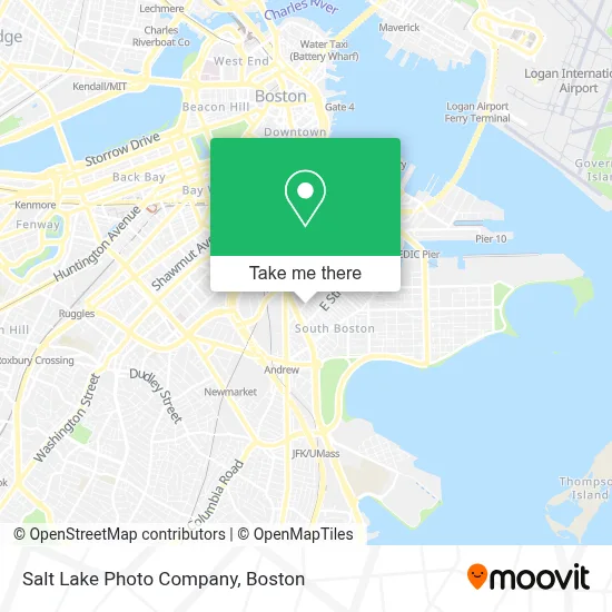
See Salt Lake Photo Company, Boston, on the map
Public Transit to Salt Lake Photo Company in Boston
Wondering how to get to Salt Lake Photo Company in Boston? Moovit helps you find the best way to get to Salt Lake Photo Company with step-by-step directions from the nearest public transit station.
Moovit provides free maps and live directions to help you navigate through your city. View schedules, routes, timetables, and find out how long does it take to get to Salt Lake Photo Company in real time.
Looking for the nearest stop or station to Salt Lake Photo Company? Check out this list of stops closest to your destination: Tufts Medical Center; Dorchester St @ W 8th St; W 6th St @ E St; Andrew; W Broadway @ D St; Newmarket; Jfk/Umass.
Bus: 11, 17, 18, 9, CT3, 10.Train: GREENBUSH, KINGSTON, FAIRMOUNT, FRANKLIN/FOXBORO, PROVIDENCE/STOUGHTON, FALL RIVER/NEW BEDFORD.Subway: RED LINE, ORANGE LINE.
Want to see if there’s another route that gets you there at an earlier time? Moovit helps you find alternative routes or times. Get directions from and directions to Salt Lake Photo Company easily from the Moovit App or Website.
We make riding to Salt Lake Photo Company easy, which is why over 1.7 million users, including users in Boston, trust Moovit as the best app for public transit. You don’t need to download an individual bus app or train app, Moovit is your all-in-one transit app that helps you find the best bus time or train time available.
For information on prices of bus, subway and train, costs and ride fares to Salt Lake Photo Company, please check the Moovit app.
Use the app to navigate to popular places including to the airport, hospital, stadium, grocery store, mall, coffee shop, school, college, and university.
Salt Lake Photo Company Address: 137 D St street in Boston
- D Street Projects,
- 8kun W 8th St,
- Kiley and O'Toole Insurance,
- Dunkin',
- Tufts Medical Center South Boston Behavioral Health,
- 18x9 W 5th St,
- Shy Bird,
- Castle Island Brewing Company,
- Castle Island Brewing,
- Condon James Elementary School,
- Coop's Microcreamery,
- #100,
- Orthodox Church (Holy Trinity Albanian Orthodox Ch),
- Catholic Charities,
- Stadium,
- Pastel Nail Studio,
- Casper Funeral Home (Casper Funeral & Cremation Services),
- Croke Park Whiteys (Croke Park Whitey's),
- Martha Clarke Astrology,
- Brito Family Dental
Places Near Salt Lake Photo Company (Boston)
- Wang Theater, Boston,
- Td Garden, Boston,
- Quincy Market, Boston,
- Prudential Center, Boston,
- Cheers, Boston,
- North End, Boston,
- Boston Common, Boston,
- Faneuil Hall, Boston,
- Boston Children's Hospital, Boston,
- Isabella Stewart Gardner Museum, Boston,
- Leader Bank Pavilion (Leader Bank Pavillion), Boston,
- Boston Convention & Exhibition Center, Boston,
- Boston Medical Center, Boston,
- Massachusetts General Hospital, Boston,
- Wilbur Theatre, Boston,
- Mgm Music Hall, Boston,
- Castle Island, Boston,
- Museum Of Science, Boston,
- House Of Blues, Boston,
- Seaport District, Boston
How to get to popular places in Boston with public transit
Get around Boston by public transit!
Traveling around Boston has never been so easy. See step by step directions as you travel to any attraction, street or major public transit station. View bus and train schedules, arrival times, service alerts and detailed routes on a map, so you know exactly how to get to anywhere in Boston.
When traveling to any destination around Boston use Moovit's Live Directions with Get Off Notifications to know exactly where and how far to walk, how long to wait for your line, and how many stops are left. Moovit will alert you when it's time to get off — no need to constantly re-check whether yours is the next stop.
Wondering how to use public transit in Boston or how to pay for public transit in Boston? Moovit public transit app can help you navigate your way with public transit easily, and at minimum cost. It includes public transit fees, ticket prices, and costs. Looking for a map of Boston public transit lines? Moovit public transit app shows all public transit maps in Boston with all Bus, Train, Subway and Ferry routes and stops on an interactive map.
Boston has 4 transit type(s), including: Bus, Train, Subway and Ferry, operated by several transit agencies, including MBTA, Southeastern Regional Transit Authority, MetroWest Regional Transit Authority, Rhode Island Public Transit Authority, WRTA, Lowell Regional Transit Authority, Merrimack Valley Transit, Montachusett Regional Transit Authority, Cape Cod Regional Transit Authority, Brockton Area Transit Authority, Martha's Vineyard Transit Authority, the WAVE - Nantucket Regional Transit Authority, GATRA, Cape Ann Transportation Authority and Massport